Colorado's Summer Outlook: Warm Signal, But El Niño Is Entering the Picture
El Niño is developing rapidly. Here's what that means for Colorado's summer temperature and precipitation outlook — and why even a good monsoon won't solve the water supply problem we're already in.

Let's be honest about what's in front of us this summer: the warm, dry pattern that defined winter and spring isn't gone, but something significant is changing in the background, and it's worth understanding.
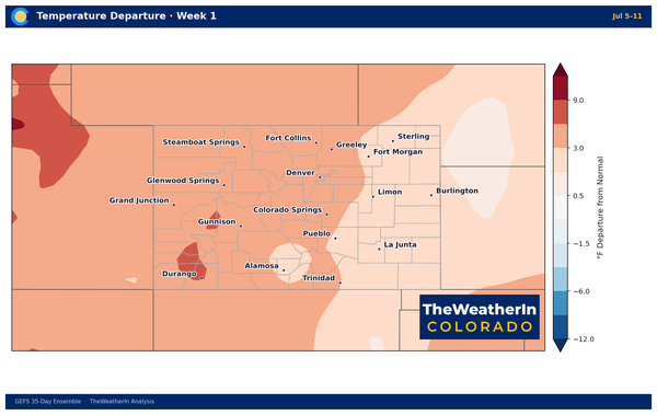
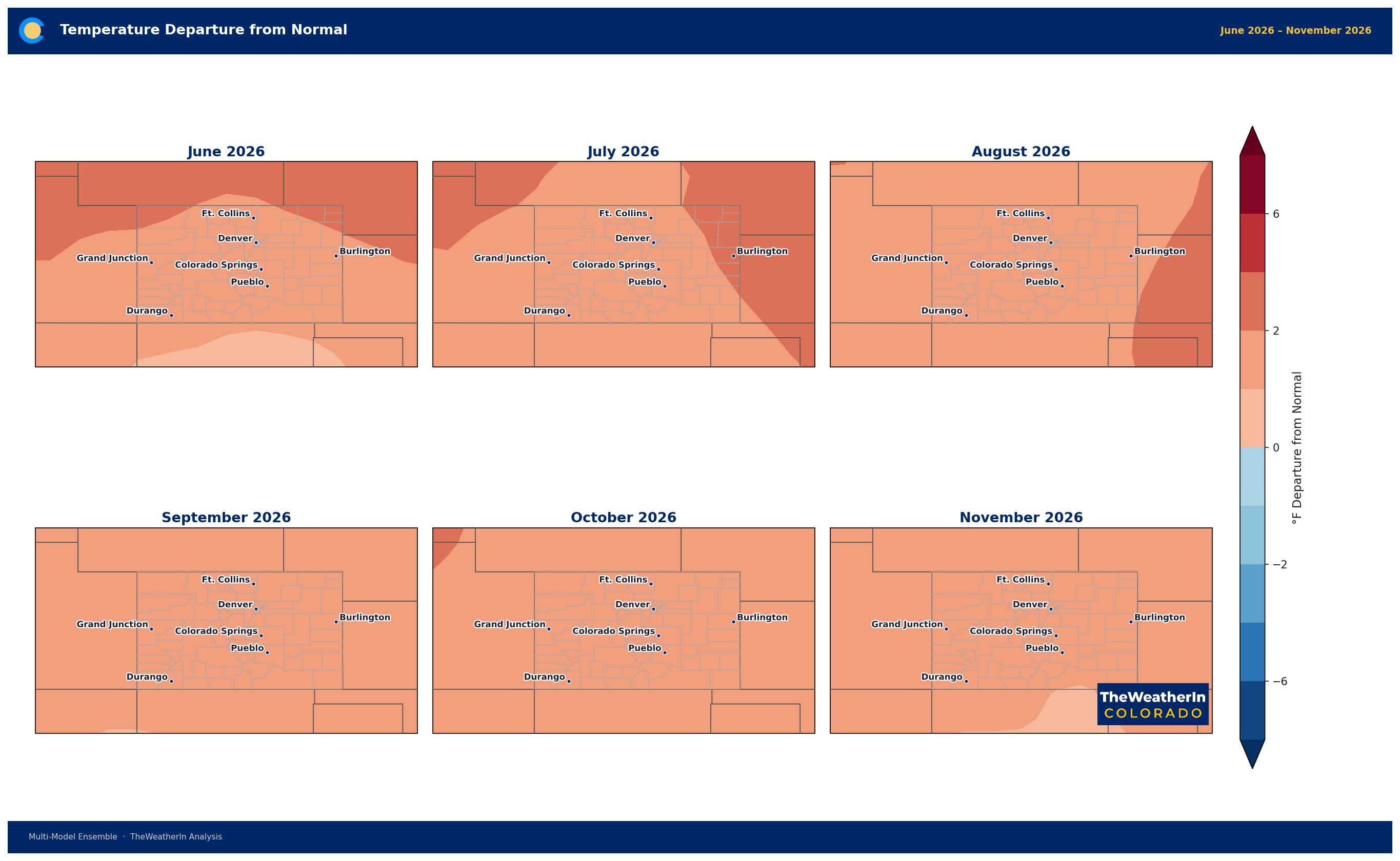
The seasonal forecast data, updated this week, show a consistently above-normal temperature signal for Colorado throughout the summer. June through August, the ensemble is running warm, with 70 to 95 percent of model runs favoring above-normal temperatures statewide. July and August look like the strongest months for that signal, with departures around 1.5 to nearly 2 degrees above the historical average. That's not catastrophic heat in isolation, but it matters when stacked on top of a landscape that's already deeply stressed.
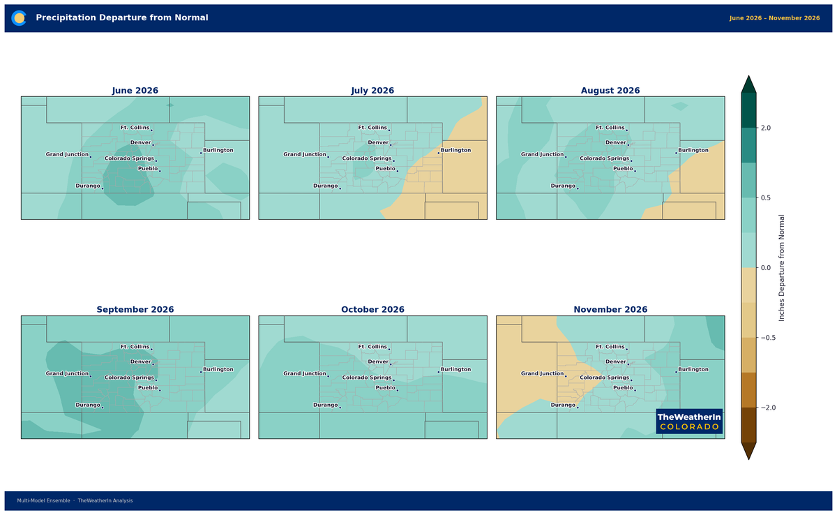
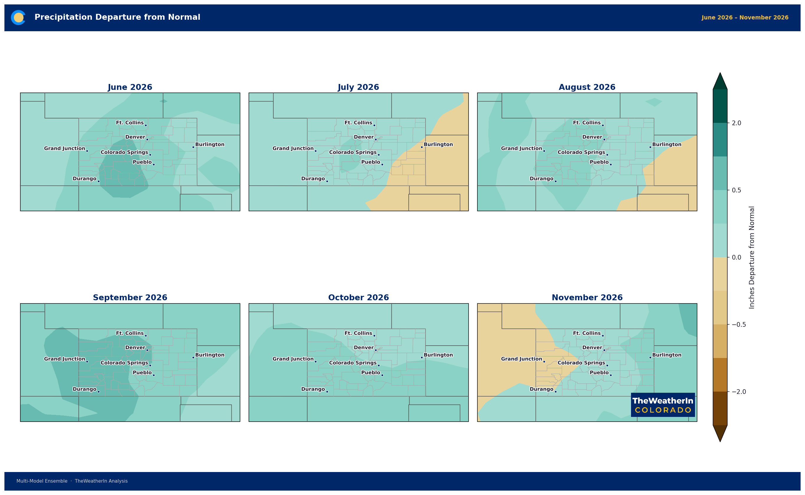
The precipitation signal is more nuanced and, honestly, more interesting than expected given where we've been this spring. The models are leaning slightly above normal for precipitation — especially for late summer and into fall. September stands out, with more than 90 percent of model runs showing above-normal moisture for Colorado. June shows a moderately wetter signal too, while July is the most uncertain month. Let's be careful not to overstate this — these are modest signals, not a dramatic wet flag — but they're not nothing, either.
Here's why that precipitation signal matters: El Niño is developing, and it's developing fast.
Sea surface temperatures in the key equatorial Pacific region are approaching plus 1 degree Celsius above normal. The latest outlooks from the official climate centers are calling for a strong to very strong El Niño event to be fully established by late summer and into fall — a meaningful escalation from where expectations were just a few months ago. To be upfront: El Niño's effects on Colorado are not simple, and we are not trying to imply that one climate signal will resolve everything. In winter, El Niño tends to drive warmth across the northern tier and can produce
complicated patterns for Colorado specifically. But summer is a different story.
El Niño has a documented tendency to enhance the North American Monsoon — the seasonal surge of moisture that flows northward from the Gulf of Mexico and Gulf of California into the Desert Southwest and southern Rockies. That's the
primary driver of Colorado's summer precipitation. If El Niño strengthens the monsoon circulation, we could see a more active late-summer rain pattern, particularly in the southern mountains and Eastern Slope. That possibility is
visible in the data, and it's why the wetter-than-normal signal for late summer and fall deserves more than a passing mention.
But here's the reality check. Even if this summer ends up wetter than average — and there's a real chance of that, especially August through October — it doesn't solve the water supply problem Colorado is heading into. The snowpack failure this winter was the water supply failure. River runoff forecasts for the May through July window are running around 24 percent of median statewide. That's locked in. Summer rain doesn't replenish river volumes the way snowmelt does — it largely serves the land surface, vegetation, and soils — so even a good monsoon season can't replace what was never there.
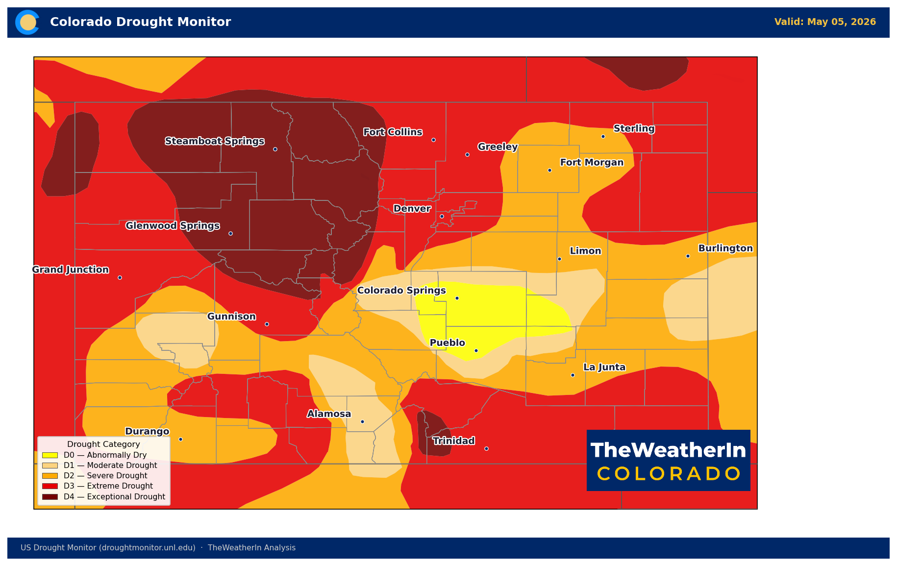
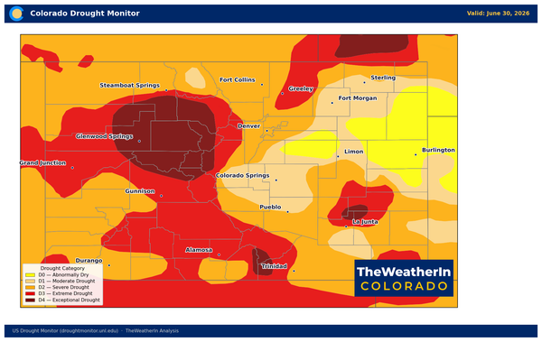
Drought remains severe and widespread. As of May 5th, every county in Colorado is in some level of drought. Nearly 87 percent of the state is in severe drought or worse, and close to 18 percent of the state — concentrated in western Colorado — is in exceptional drought, the highest category. Conditions have stabilized since the worst of the spring intensification, but there's no meaningful improvement on the map yet.
So here's how to frame it: summer looks warm and drier-than-normal in the near term, with drought improving only slowly at best. The developing El Niño gives some genuine hope for a more active monsoon in late summer, which would be meaningful for agriculture, rangeland conditions, and fire weather risk. But hold that hope loosely — no two El Niño years play out the same way, and the underlying drought hole is deep enough that we need a sustained recovery, not a single good month, to change the broader picture. The story this summer is really a two-part story: managing through what the spring left behind, and watching whether fall can begin to turn things around.
TheWeatherInColorado will continue updating the data as the season unfolds and El Niño development accelerates. Insiders have access to all of the seasonal outlook maps here: