Fire Weather Today, Pattern Shift This Weekend — But the Drought Runs Deeper
Red flag conditions are burning across Colorado today, but a cooler, wetter pattern arrives this weekend. The bigger story is what neither can fix.
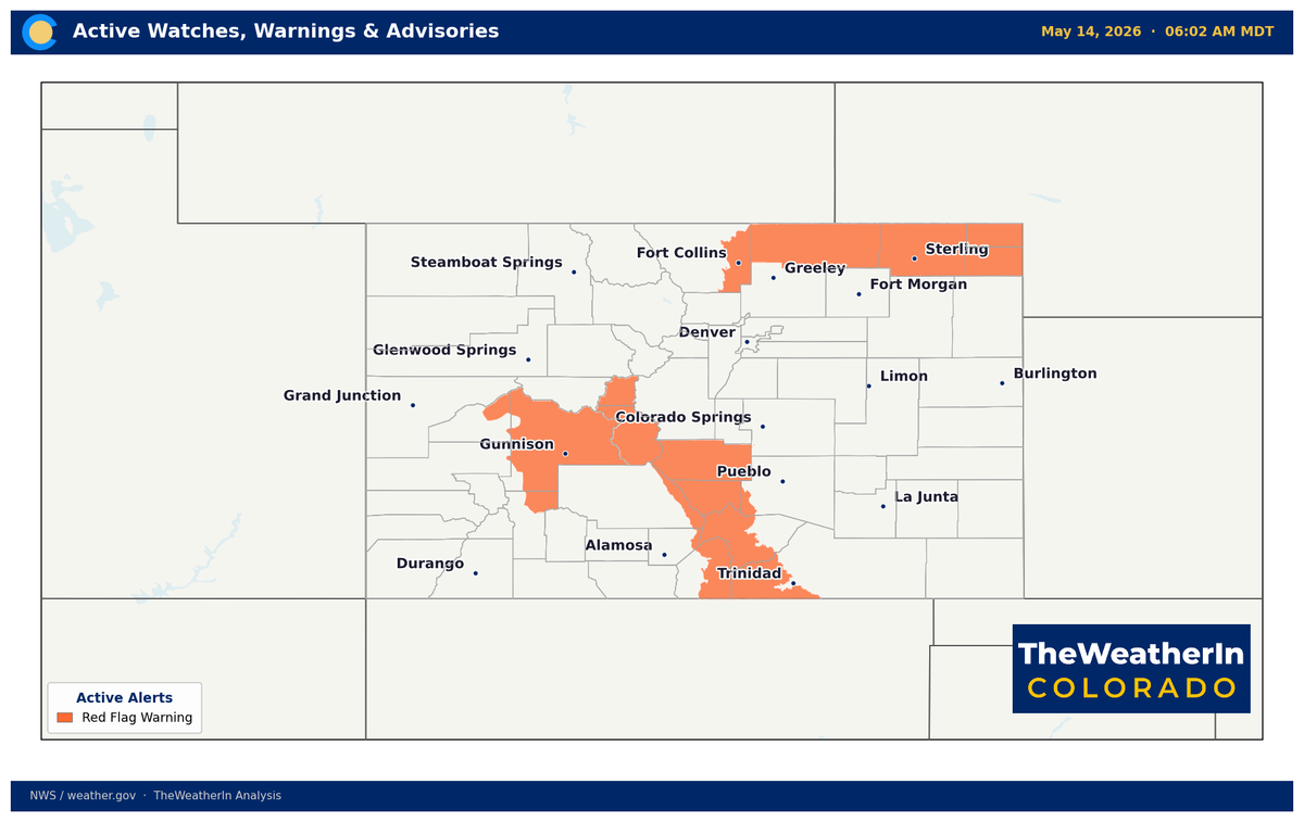
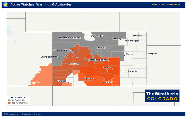
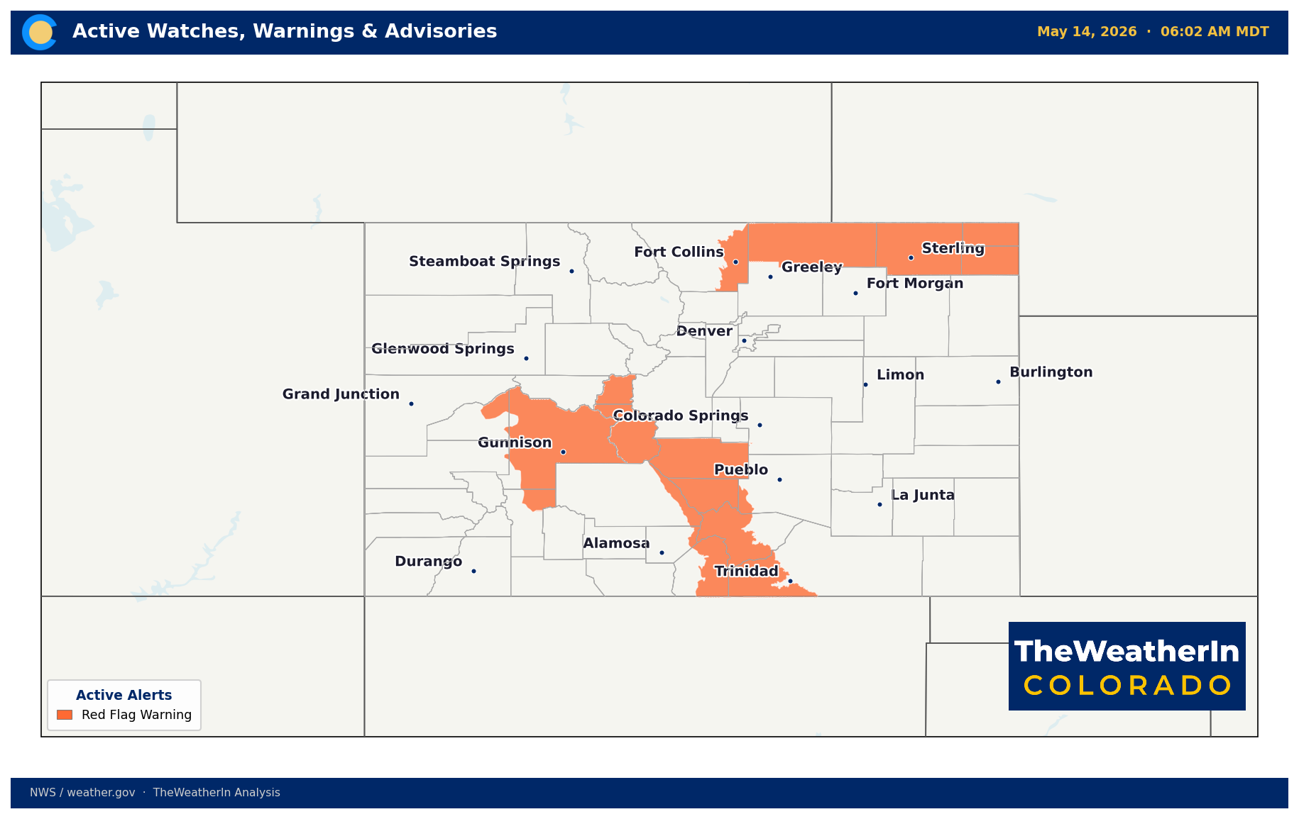
Red Flag Warnings across Colorado this afternoon, but by Sunday, a cooler, wetter pattern moves in — welcome relief for fire weather. The catch: a few days of rain and mountain snow can't touch a drought that has been building since last fall, and it can't replace the snowpack that was hardly there.

Pattern Overview
A warm, dry upper-level ridge has been parked over the region all week, drawing northwest winds down the slopes and squeezing humidity into the single digits across the plains, foothills, and western valleys. That's the same basic setup that has dominated Colorado's weather since late 2025 — a La Niña-driven warm and dry pattern that produced three all-time monthly temperature records (December, February, and March) and the lowest statewide snowpack ever recorded heading into May. The ridge holds through Friday, then gives way.
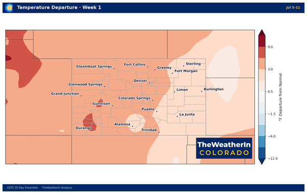
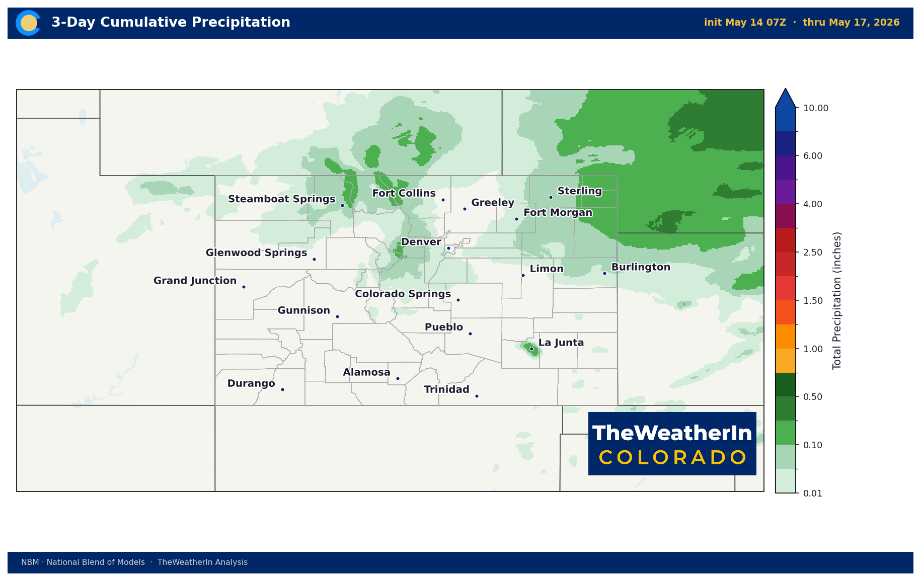
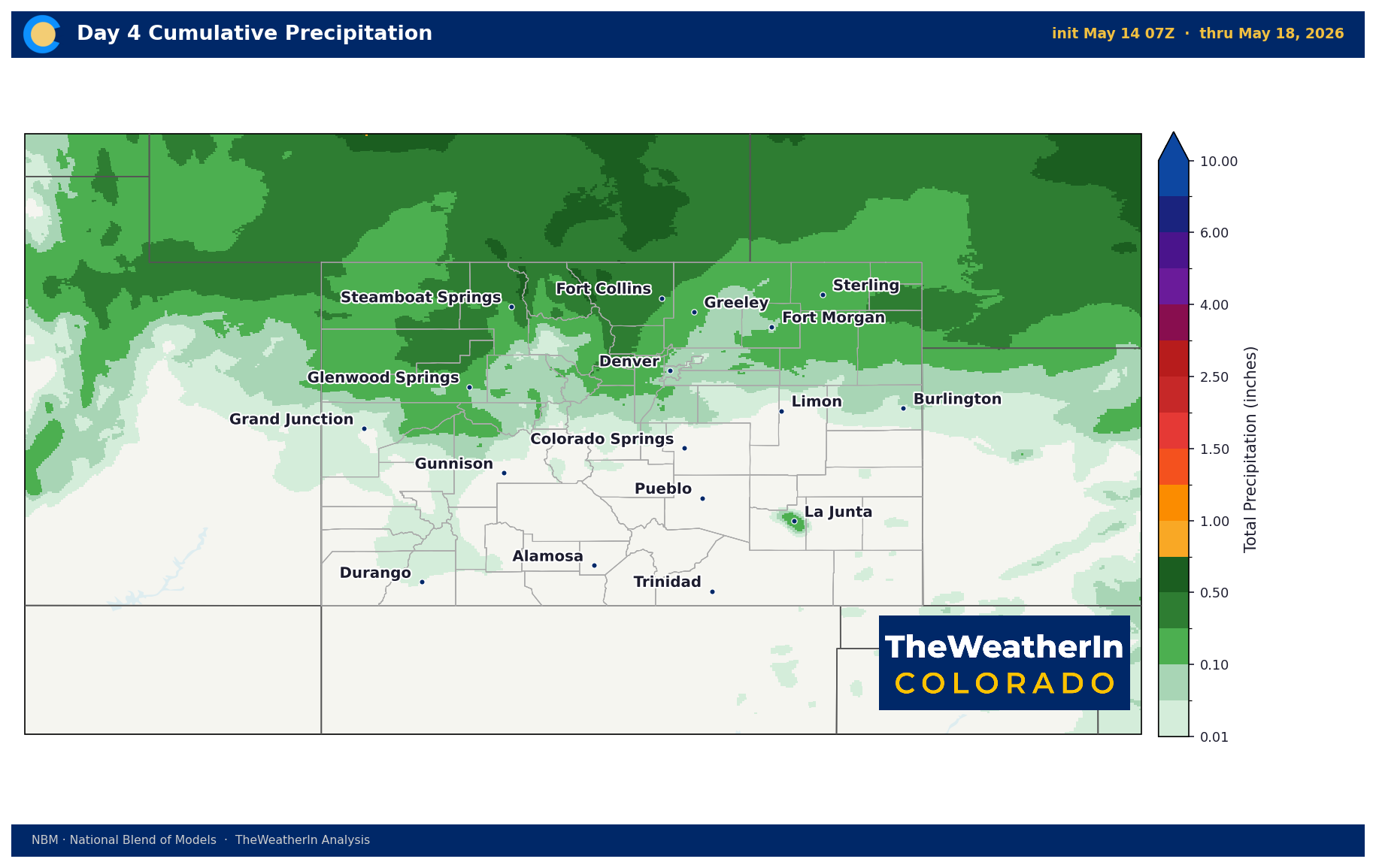
A significant upper-level trough is approaching from the west and will drive a genuine pattern shift this weekend into early next week. Showers and thunderstorms arrive Saturday, with the best organized precipitation — and the best chance at meaningful totals — expected Monday and Tuesday. Above roughly 9,500 to 10,000 feet, precipitation falls as snow. Temperatures will drop 10 to 20 degrees from Friday's near-record warmth to Monday's cooler reality. It's a legitimate pattern change, not just a one-day break.
The larger climate context matters here. La Niña — the primary driver of the warm, dry grip on Colorado this winter and spring — has officially ended. The equatorial Pacific is returning to near-normal sea surface temperatures, and an El Niño is expected to develop rapidly this summer and fall. Historically, that transition loosens the warm, dry lock on southern Colorado. But "historically" does not mean "immediately." The atmosphere takes months to respond, and forecast data through the rest of May does not yet show a decisive shift toward wetter conditions. The ridge breaks this weekend, but the deeper pattern change is still unfolding on a seasonal timescale.
Weeks Ahead: 2–4 Week Outlook
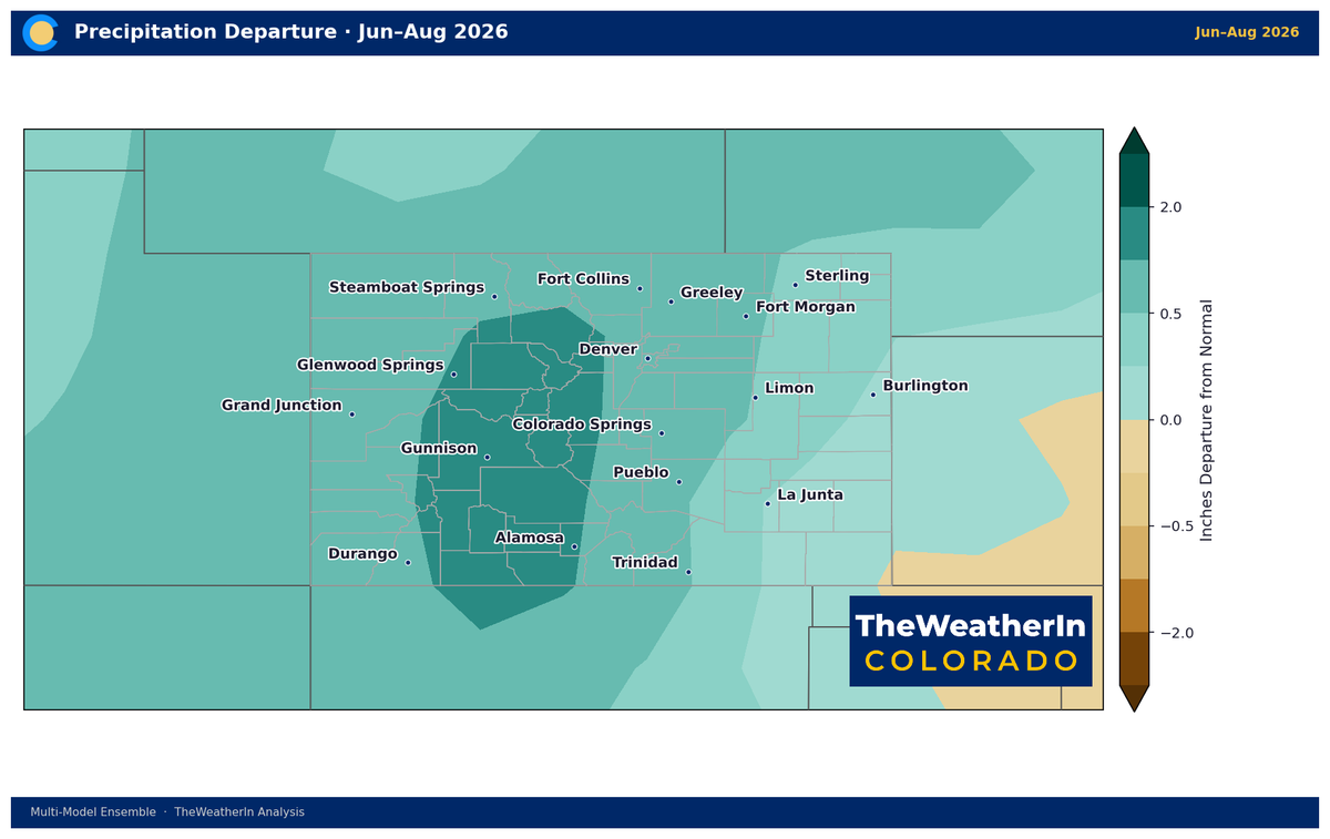
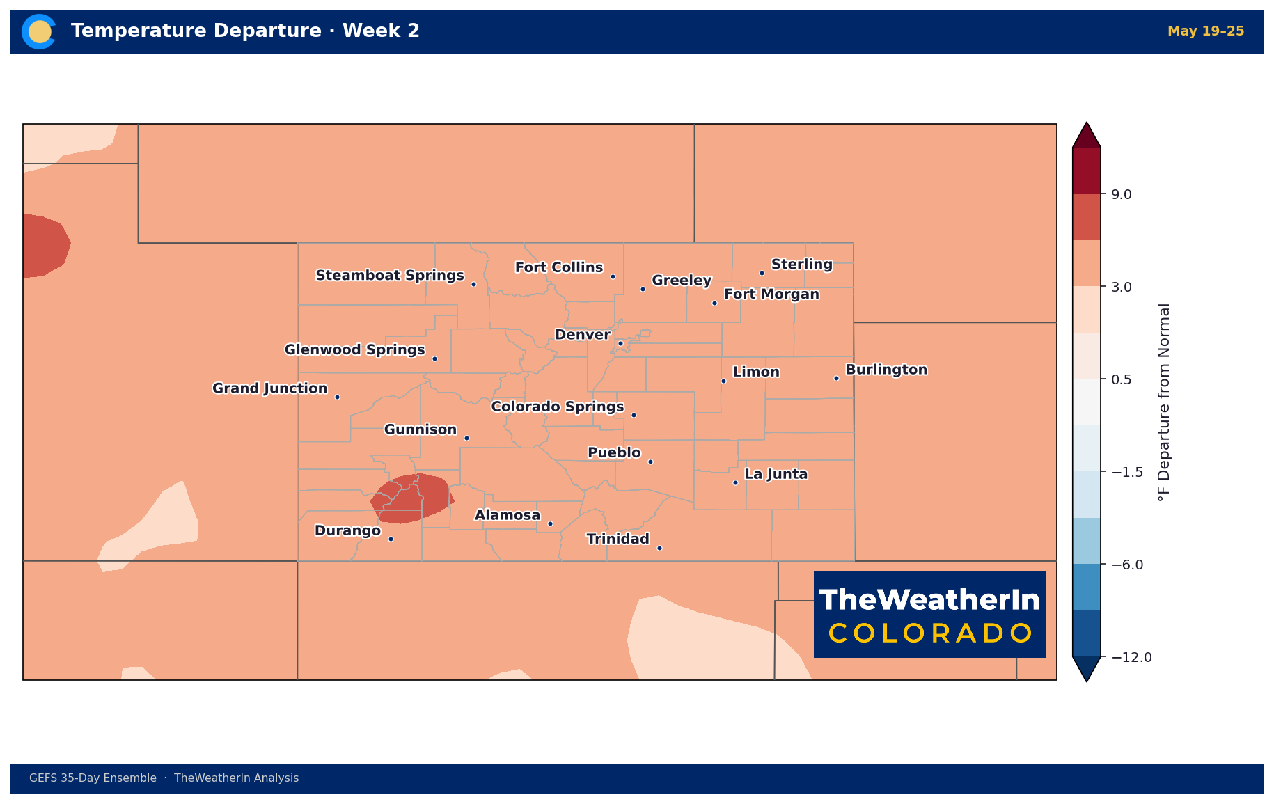
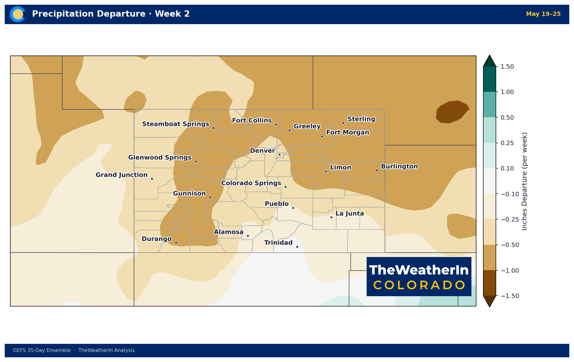
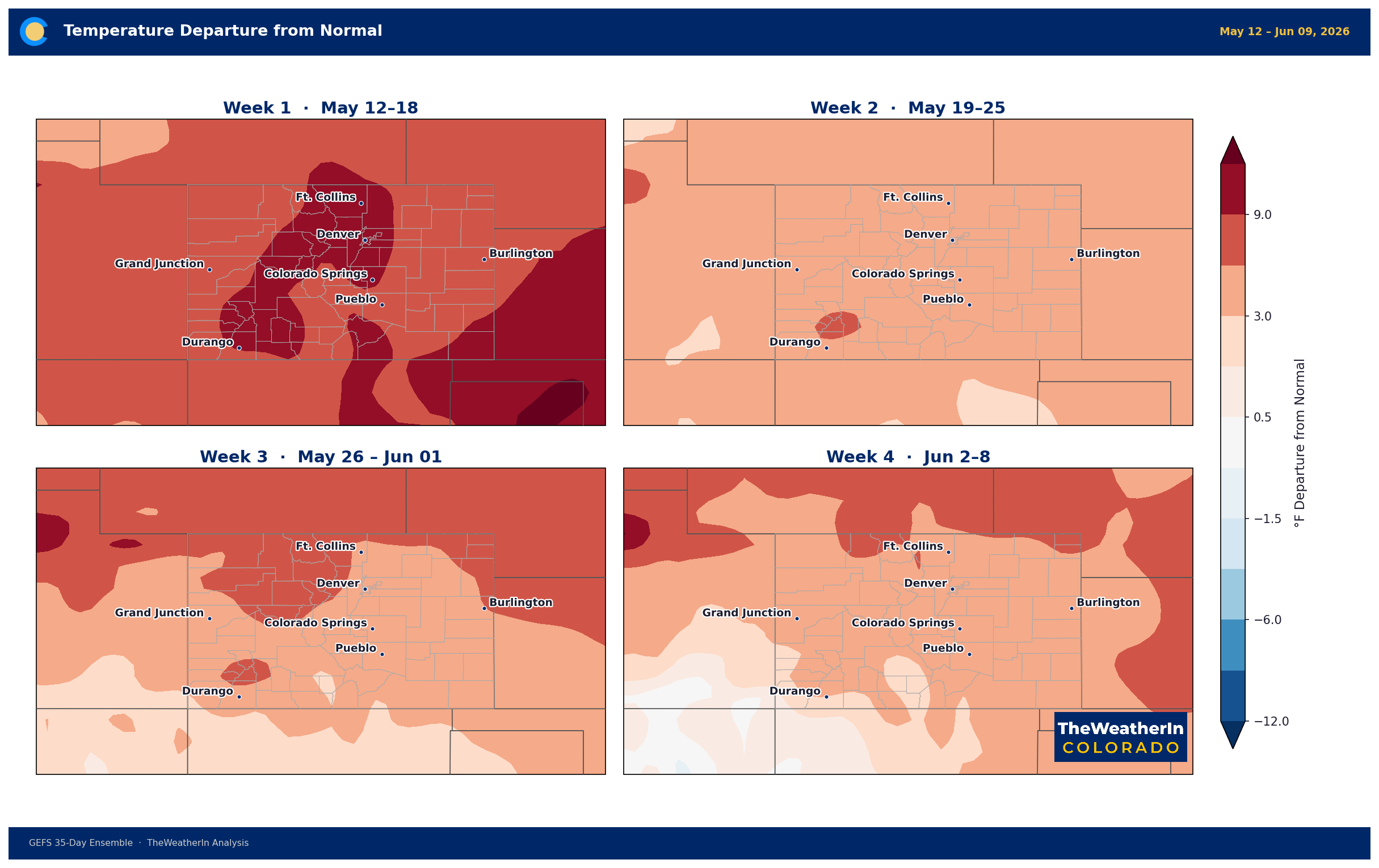
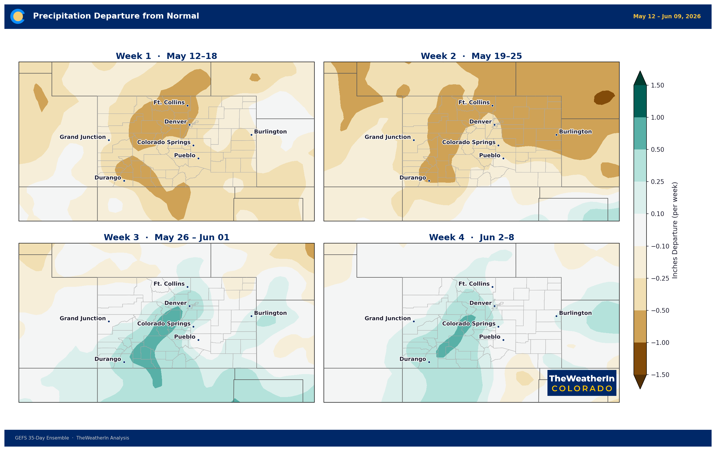
After Monday's cold front clears, forecast data through the rest of May leans toward a gradual return to near- to above-normal temperatures, with precipitation remaining near or below normal statewide — particularly across the south and east. The trough bringing this weekend's precipitation is a meaningful interruption, not a lasting reversal. Some signals in the extended range hint at continued active weather at the end of May, but confidence is low and the broader pattern does not yet support a sustained wet period. The most likely scenario through mid-June is variable: periodic storm systems with warm, dry stretches in between, and no consistent mechanism to erase the soil moisture deficit the state has been building since October.
Regional Breakdown — May 14–20
| Region | Temperature | Precipitation | Highlights |
|---|---|---|---|
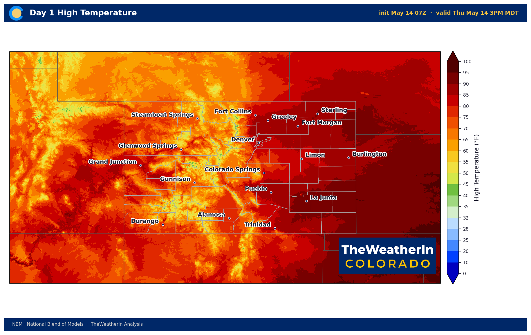
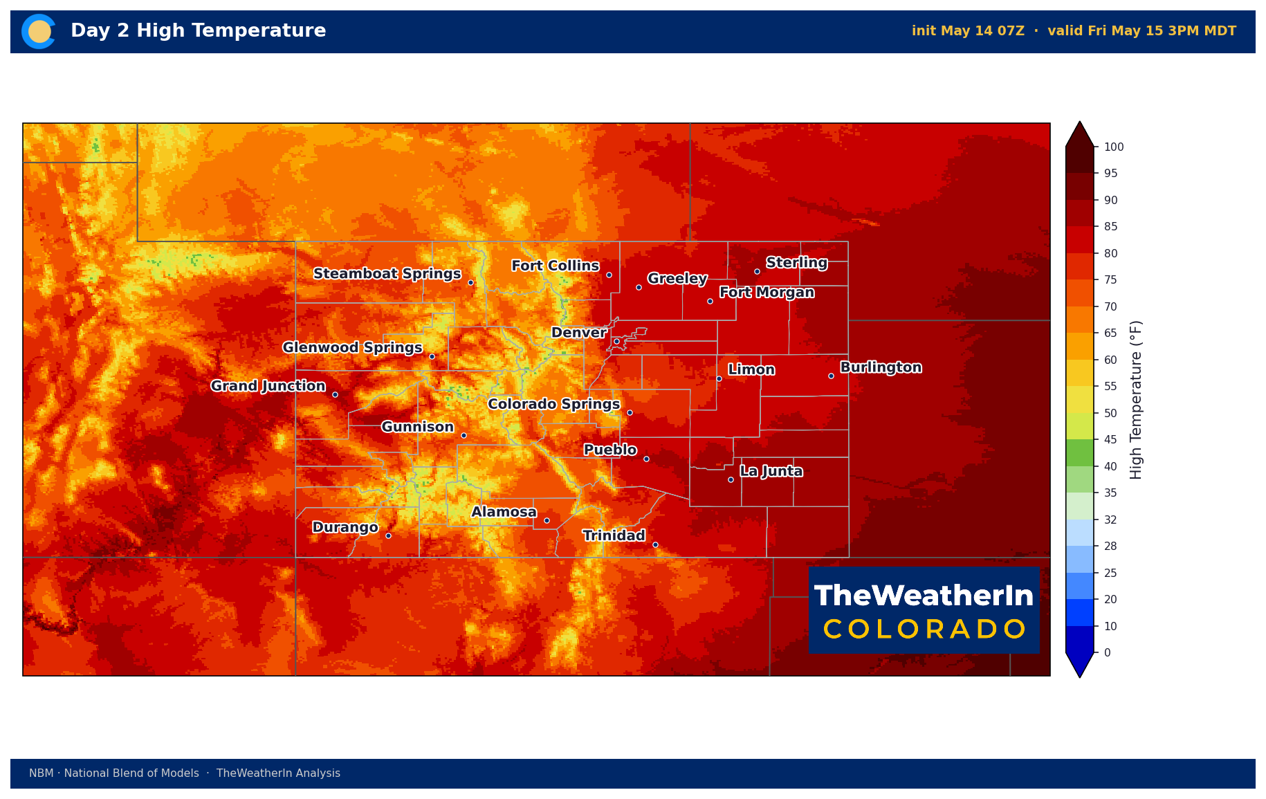
| Front Range / Foothills | Well above normal Thu–Fri; below normal Mon–Tue | Best chances Mon–Tue | Red Flag Warning today; highs 80–87°F Thu–Fri dropping to 50s–60s Mon; snow possible above 9,500 ft Sun–Mon |
| Mountains / High Country | Near to below normal by weekend | Snow above 9,500–10,000 ft Sun–Mon; showers likely Sat–Tue | Best mountain precipitation of the week Mon–Tue; cooler pattern holds through the week |
| Western Slope | Above normal Thu–Fri; 10–20°F below normal Mon | Scattered showers Sat; increasing Sun–Tue; mountain snow possible Mon night | Red Flag Warning today (western divide); gusty winds 25–35 mph Thu–Fri; sharp cooldown arriving Mon |
| Eastern Plains | Hot Thu–Fri (mid-80s to low 90s); 50s–60s Mon–Tue | Best chances Mon–Tue; isolated strong storms possible Thu (Baca Co.) | Critical fire weather today; Baca County: isolated thunderstorms with 45–60 mph outflow winds possible this afternoon; pattern shift Mon brings first meaningful rain since April |
| Southern CO / San Luis Valley | Upper 80s Thu–Fri; low-to-mid 50s Mon–Tue | Scattered showers Sat; increasing Sun–Mon; most widespread precipitation Mon–Tue | Critical fire weather today (upper Arkansas Valley, SE mountains); strong Sunday winds ahead of cold front (gusts 50+ mph possible); coldest air of the pattern arrives Mon |
Drought & Water
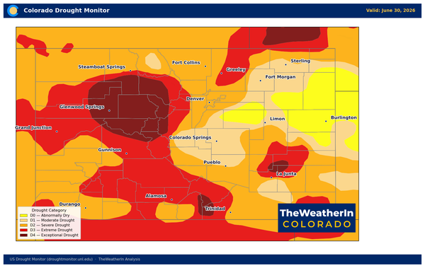
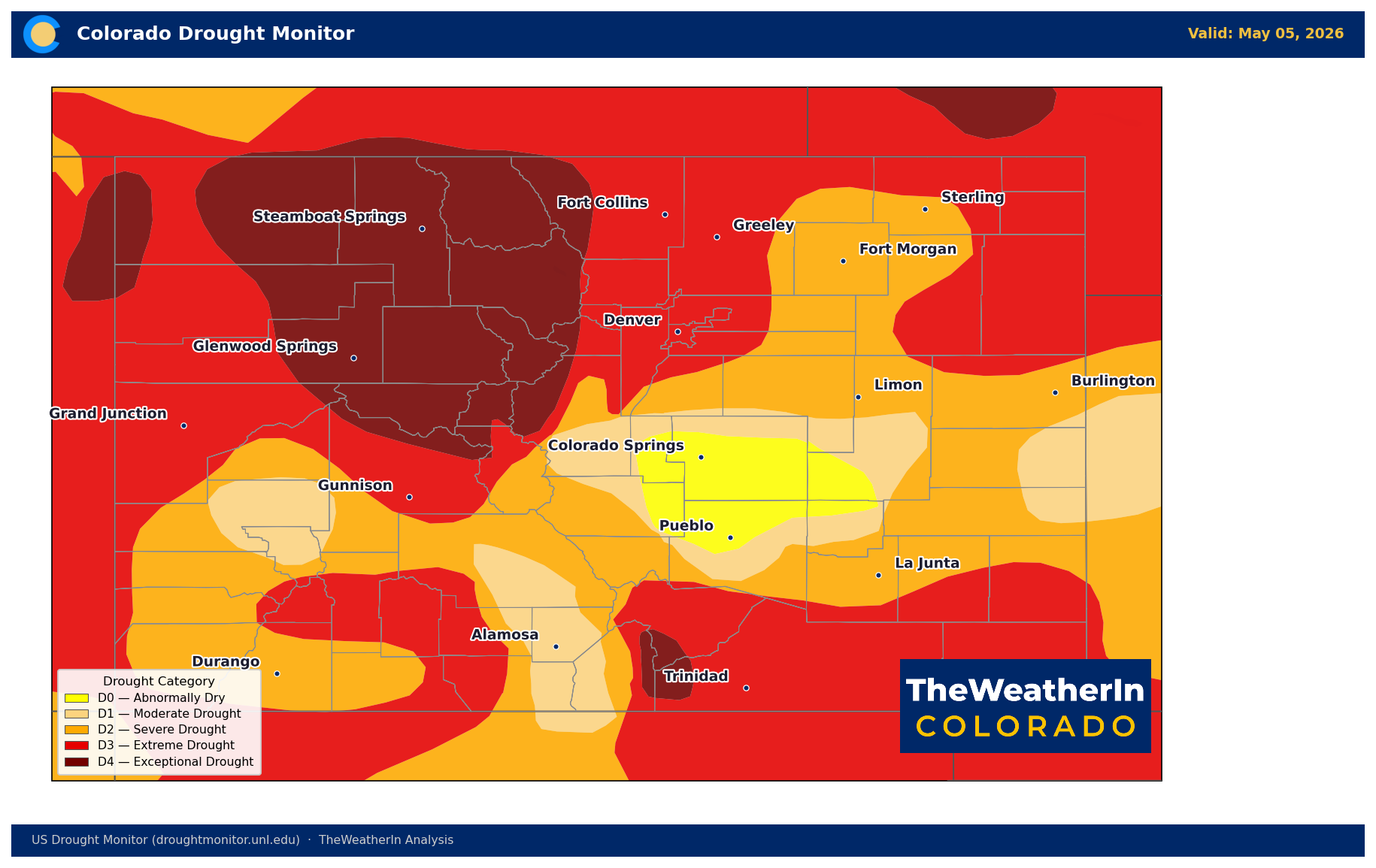
As of the May 5 U.S. Drought Monitor, 100% of Colorado remains in drought — every acre of the state, from the San Juans to the Arikaree. More than 96% is in moderate drought or worse (D1+). Nearly 58% of the state is in extreme or exceptional drought (D3–D4), and close to 18% — roughly the size of the entire Four Corners region — sits in exceptional drought (D4), the most severe category on the scale. The Drought Severity and Coverage Index for Colorado stands at 359, compared to 127 at the start of the year and 140 a year ago. This is not a drought that crept in slowly. As recently as February, only about a quarter of the state was in any drought category. The rapid intensification — driven by record winter warmth, critically low snowpack, and near-record dry conditions on the northern Front Range and southeastern Plains in April — qualifies as a textbook flash drought in parts of southeastern Colorado, where conditions jumped from no drought to extreme drought (D3) in just seven weeks.
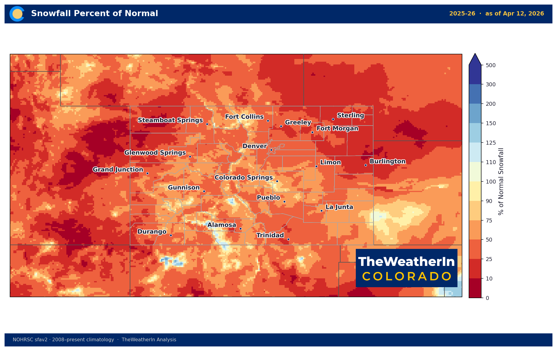
The water supply picture behind that drought map is severe. Statewide snowpack stood at just 20% of median as of May 1 — still the lowest on record for that date, and far below the previous record low. The April 1 snow water equivalent of 1.66 inches was less than one-third of the previous all-time low set in 1977. That snowpack is now largely gone — snowmelt peaked weeks ahead of schedule, and the spring runoff pulse is already receding across most basins. Statewide May–July streamflow is forecast at just 24% of the historical median. Nearly half of all Colorado streamflow forecast points are on track for record or near-record low flows this summer. The Colorado River near the Utah border is forecast at 23% of a normal year — a shortfall of roughly 2.5 million acre-feet. Reservoirs are drawing on 2025 carryover storage with no meaningful mountain replenishment coming.
This weekend's precipitation is a widespread moisture opportunity, and it matters — for fire danger, for topsoil, for rangeland. But it is not drought relief in any meaningful water supply sense. The snowpack window is closed. Late spring rain cannot replace what the mountains never stored. The drought story likely runs through the entire 2026 growing and recreation season, although the monsoon is expected to be active this year.
Agricultural Implications
- Freeze risk Sunday night into Monday: The cold front's passage will bring temperatures close to freezing at elevated and valley locations Sunday night. Frost is possible for frost-sensitive crops and early garden plantings — particularly in the San Luis Valley, mountain parks, and higher-elevation foothills. This follows significant hard freeze damage already documented on West Slope fruit crops in April; producers with vulnerable crops should monitor Sunday night temperatures closely.
- Wind stress today and Sunday: Gusty northwest winds of 30–40 mph are occurring today and Friday across dryland farming areas and rangeland on the plains and foothills, stressing early growth. A second wind event is likely ahead of the cold front Sunday, with gusts potentially exceeding 50 mph in southern Colorado — enough to cause additional mechanical stress on row crops and emerging forage.
- Soil moisture and forage outlook: Statewide soils remain below normal after a warm, dry winter and early spring. Overall, the longer-range pattern — near- to below-normal precipitation favored through much of the rest of May — does not suggest sustained recovery. Livestock producers facing drought-stressed pastures should not expect this event to materially change the summer forage picture, instead await the monsoon and its hopeful moisture. Irrigation water supply remains severely limited statewide, with Eastern Slope and southeastern Colorado users facing the most acute shortages.
The signal to watch into June: whether the developing El Niño pattern can deliver consistent moisture to Colorado's driest regions — or whether the state continues to see periodic storm systems separated by dry, warm stretches that keep evaporative demand high and soils unable to recover. The latest outlook continues to show the wetter trend, just need to cross fingers that the data linked below pans out →