Late Spring Storm Brings Rare Snow Relief — But Drought Isn't Done
Heavy snow is falling across Colorado today, but the bigger story is what comes after: a warm, dry pattern reasserts itself just as drought enters its most critical stretch.

Late Spring Storm Brings Rare Snow Relief — But the Dry Pattern Reasserts Itself by Next Week
A significant late-season storm is sweeping across Colorado today through Wednesday, delivering the kind of heavy, wet snow that May occasionally produces — and that parched soils and stressed water supplies genuinely need right now. But this system is a punctuation mark in a dry story, not the start of a new chapter. Warmer, drier conditions rebuild quickly behind it, and the broader pattern driving Colorado's most severe drought in years remains very much in charge.
Pattern Overview
A deep upper-level trough pushing through the Rockies is wringing out what moisture it can find, producing heavy, wet snow from the northern mountains down to the Front Range foothills and across much of the Eastern Plains. A secondary cold front reinforces the system tonight into Wednesday morning, extending the snow window and deepening the freeze threat. By Thursday, high pressure rebuilds from the west, and temperatures swing into the 60s and 70s across lower elevations — a 40-to-50-degree reversal from Wednesday's lows in under 48 hours.
The storm itself is rooted in a late-season trough pattern — not unusual for early May, though the scale of the temperature swing that follows it is notable. What matters more for the season ahead is the pattern that reasserts itself once this system clears. A persistent ridge of high pressure is forecast to rebuild over the western United States and hold through the middle of the month. That ridge is the same large-scale feature that has dominated the West for much of the past six months, and its return signals that Colorado is not yet done with the warm, dry regime that defined winter and spring 2025–26.
The climate driver behind all of this is gradually shifting. The La Niña pattern that locked in record-breaking warmth and historically low snowpack across Colorado through the cool season has officially ended. Sea surface temperatures in the equatorial Pacific are returning toward neutral, and a weak El Niño is expected to develop by late summer. But that transition is slow-moving. It doesn't flip Colorado's weather overnight, and forecast data through May does not yet show a decisive wet signal emerging for the state. The gradual loosening of La Niña's grip is real — but May is still looking warmer and drier than normal across the southern Rockies.
Weeks Ahead: 2–4 Week Outlook (May 12 – June 2)
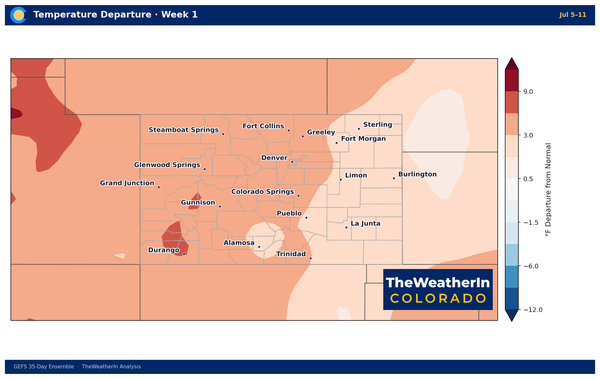
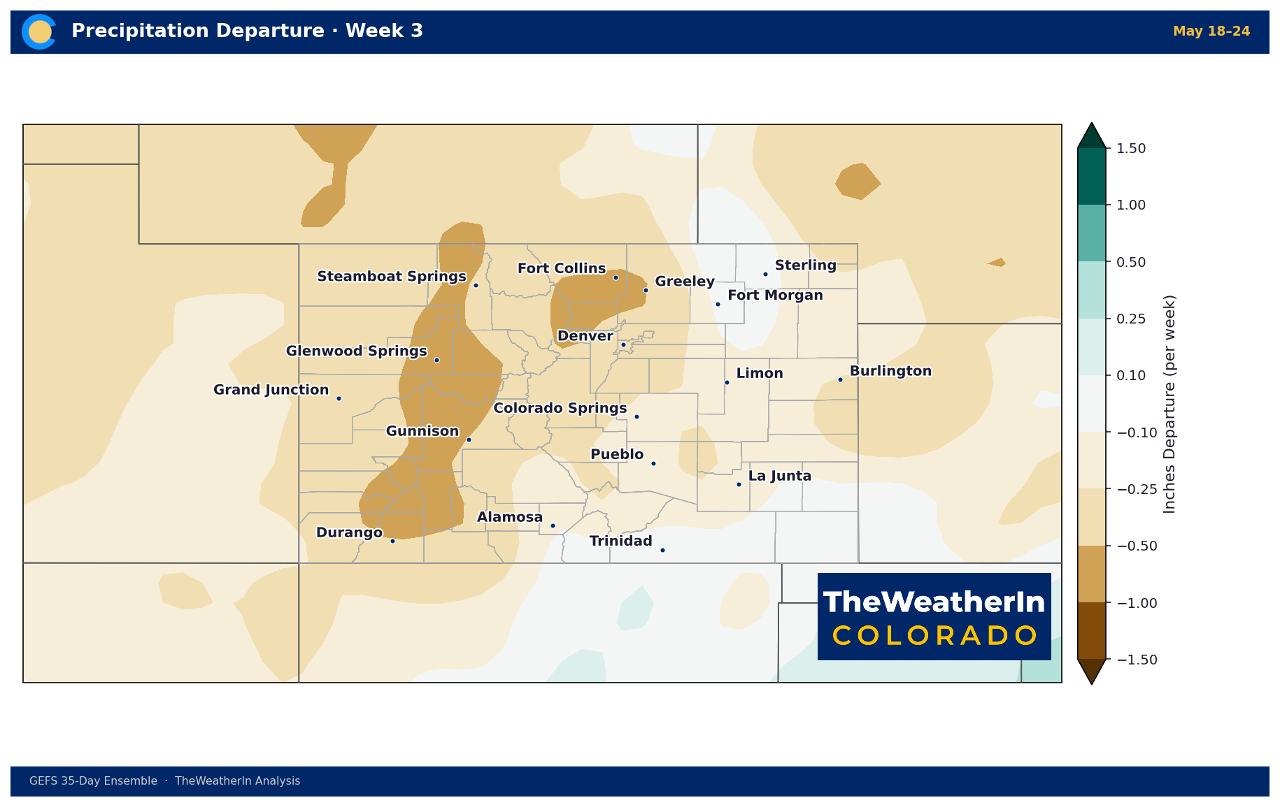
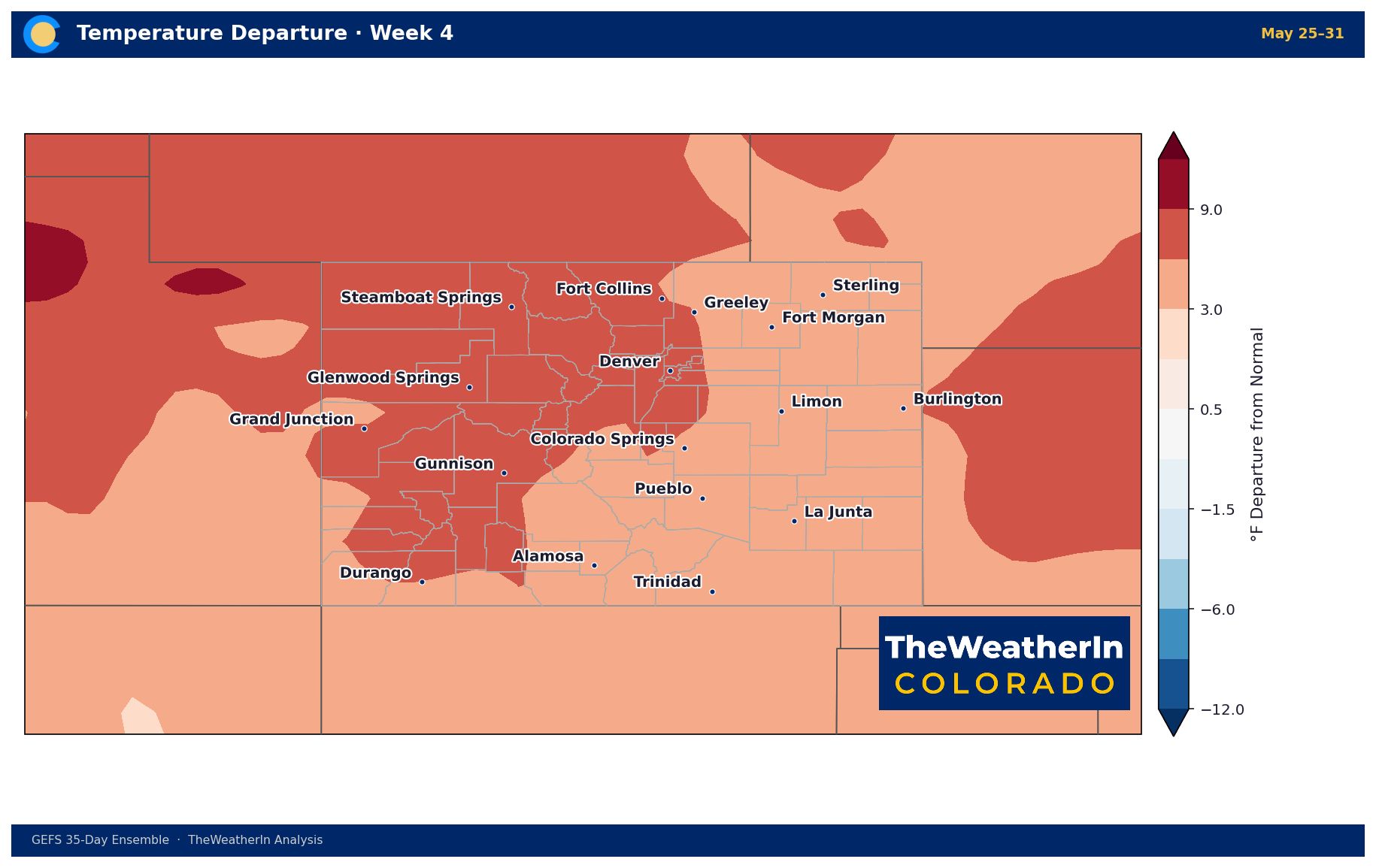
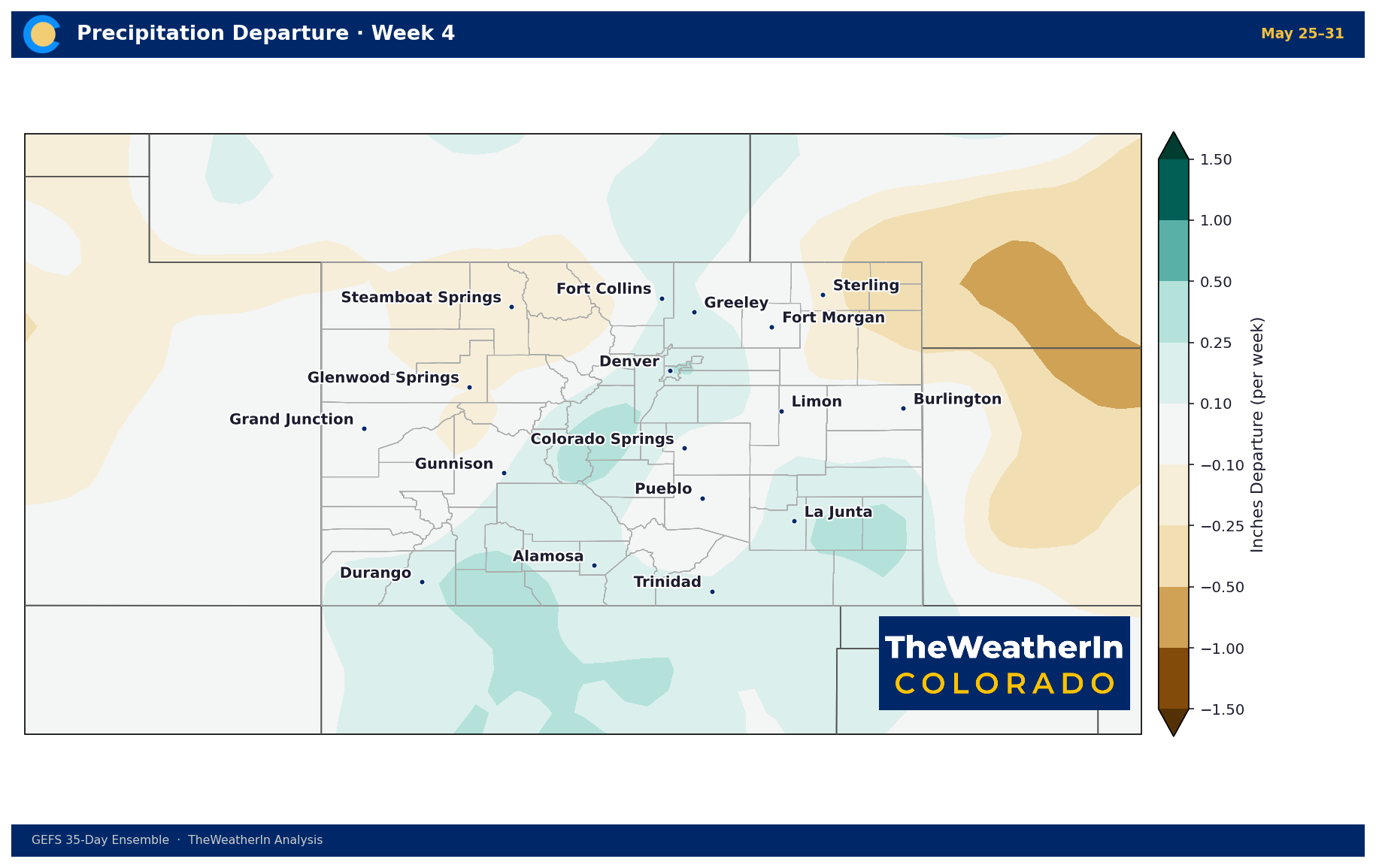
Once this week's storm clears, high pressure reasserts itself quickly and dominates the western U.S. through mid-May. Forecast data for the May 12–18 period favors above-normal temperatures across Colorado, with the most significant heat concentrated across the Southwest and Southern Plains — Colorado should see warmth, but not the most extreme end of what's expected in the region. Precipitation probabilities tilt below normal across the southern Rockies for weeks two through four, consistent with the warm, dry pattern that has prevailed since fall.
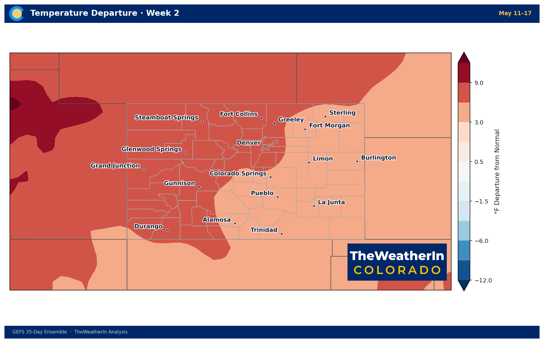
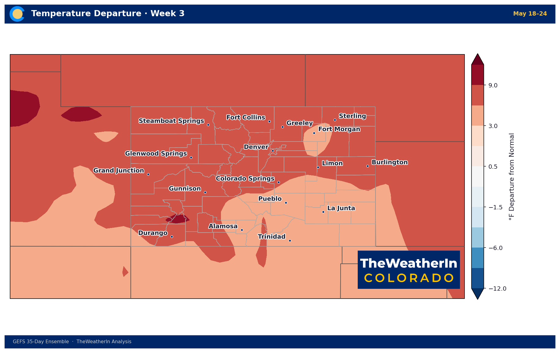
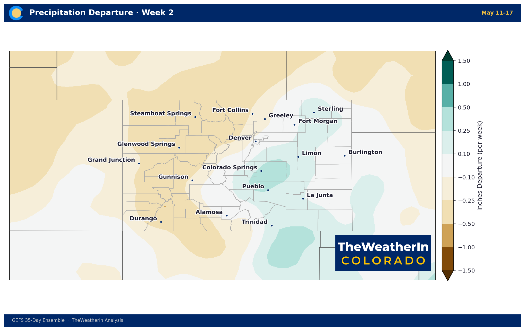
Late-season frost remains possible in high-elevation locations and northern mountain valleys in the first half of the period, especially following the cool air lingering from this week's system. After mid-May, the pattern points toward warmer-than-normal conditions statewide with limited precipitation relief. The transition from La Niña to ENSO-neutral may gradually reduce the intensity of the dry regime, but meaningful pattern change for Colorado is more likely a late-May to June story — and even that signal carries uncertainty.
Regional Breakdown — Week of May 5–12, 2026
| Region | Temperature | Precipitation | Highlights |
|---|---|---|---|
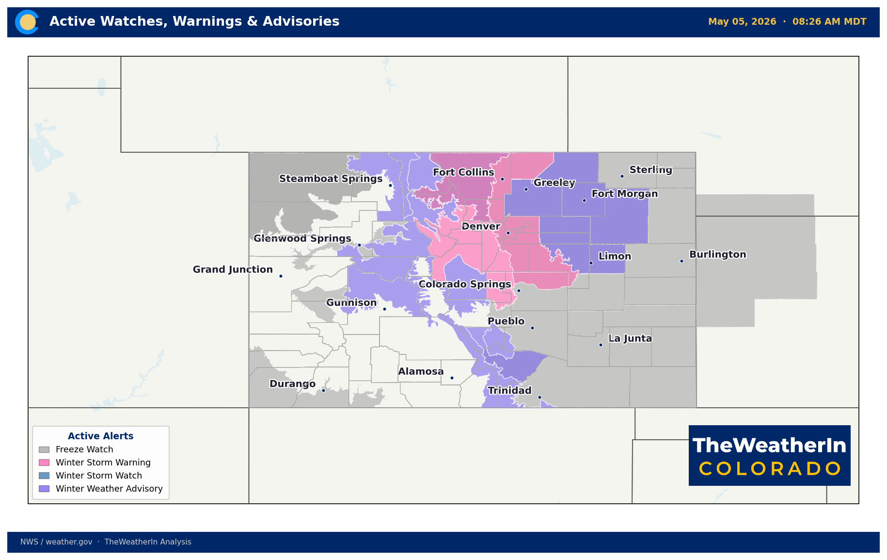
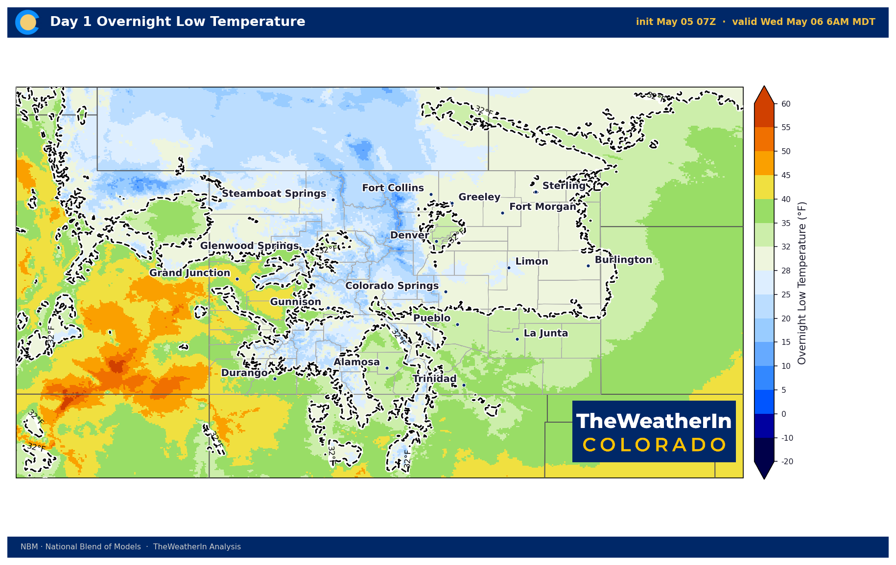
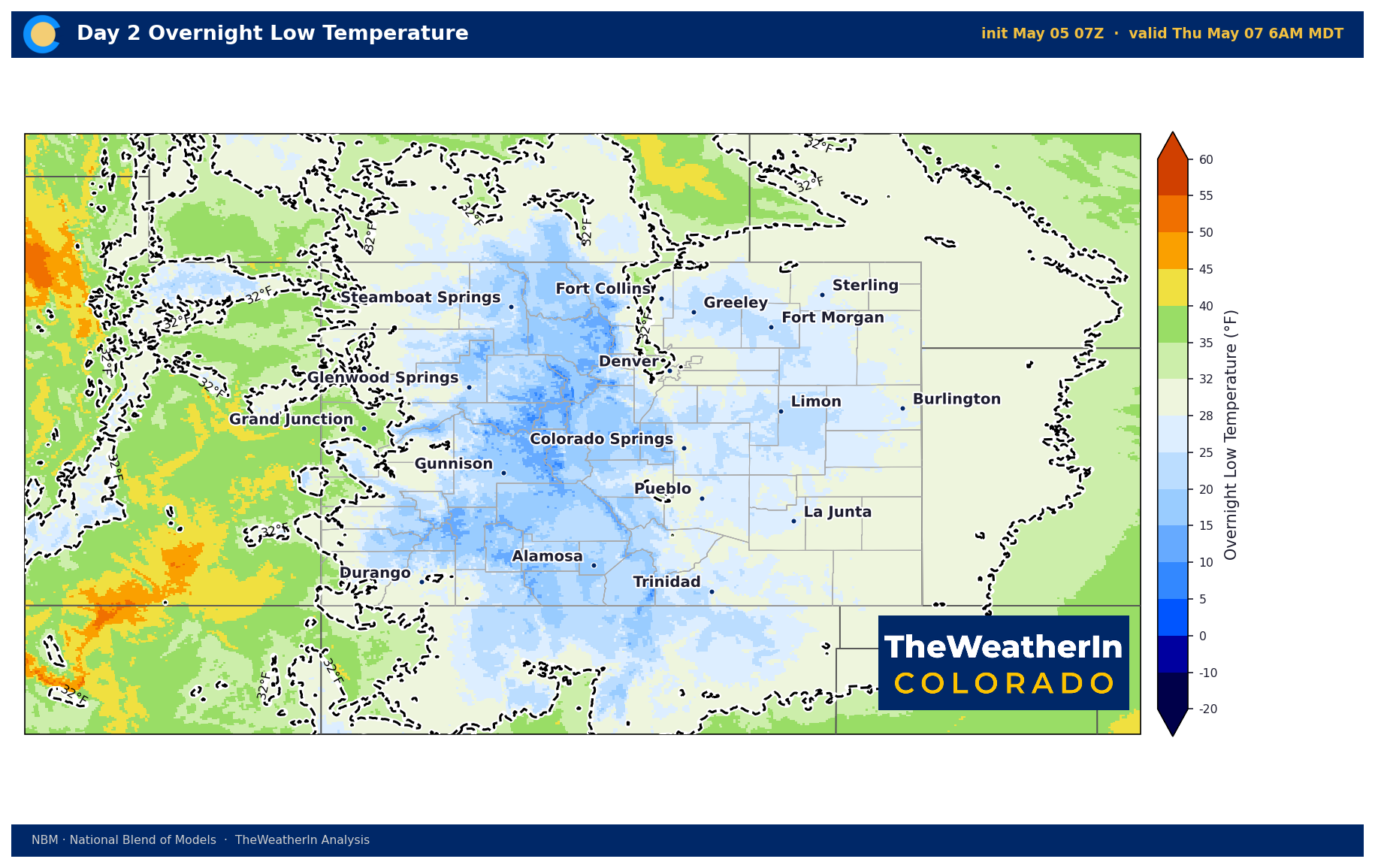
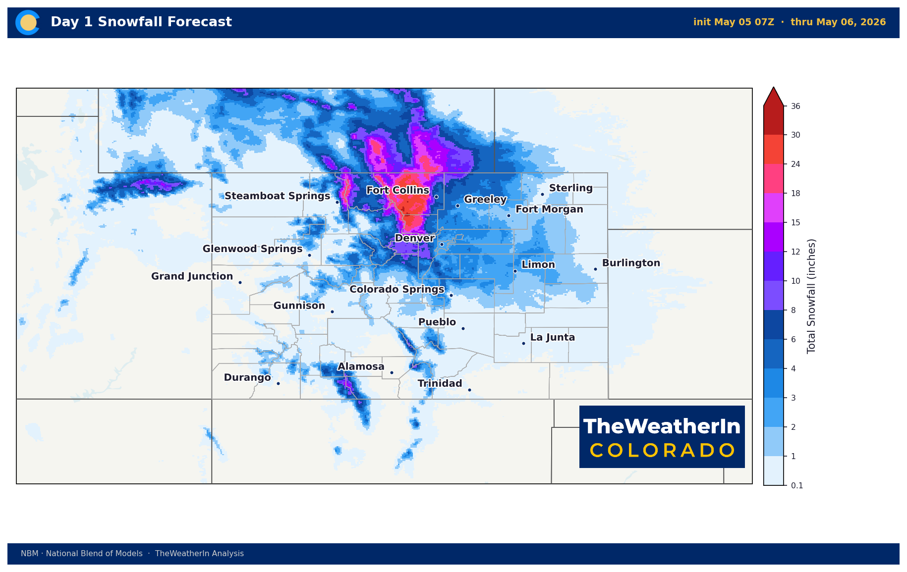
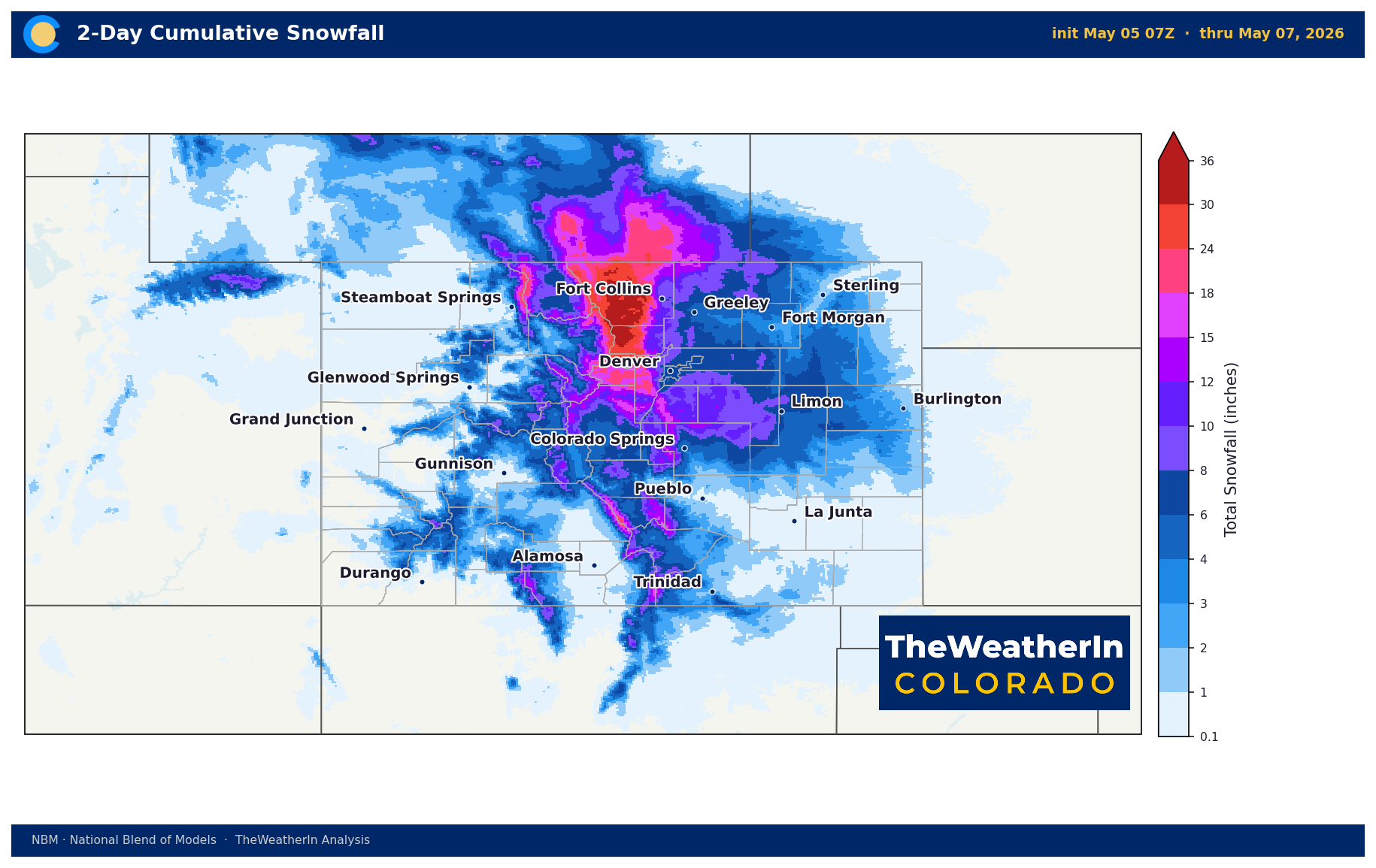
| Front Range / Foothills | Well below normal Tue–Thu; above normal Fri–Sun | 4–12 inches snow (I-25 corridor); 18–24 inches foothills north of I-70 | Winter Storm Warnings through Wednesday afternoon; freeze watches Wed–Thu nights; rapid warmup to 60s–70s by Friday |
| Mountains / High Country | Well below normal through Wednesday; recovering Thursday | 18–36 inches northern ranges (Rabbit Ears, Park Range); lower totals central and southern mountains | Difficult pass travel (Rabbit Ears, Vail) through Wednesday; snow levels ~9,000 ft north; tapering south to north Wednesday afternoon |
| Western Slope | Below normal Tue–Wed; near to above normal Thursday onward | 5–10 inches high passes; rain to snow mix in valley areas overnight | Winter Weather Advisories for high passes; freeze watches northwest valleys (lows mid-20s) Tue–Wed nights; drying and warming begin Thursday |
| Eastern Plains | Below normal Tue–Thu; above normal Fri–Sun | 3–6 inches; locally up to 12 inches near Palmer Divide | Rain transitioning to snow overnight; slushy roads Wednesday; freeze watches Wed–Thu nights; drying by Thursday |
| Southern CO / San Luis Valley | Below normal Tue–Wed; rapid warmup Thu–Sat | Heaviest snow southeast mountains and Teller County (over a foot locally); lighter at San Luis Valley floor | Pikes Peak region peak snow Tuesday night into Wednesday; freeze watches eastern plains and high elevations; dry warmup begins Thursday |
Drought & Water
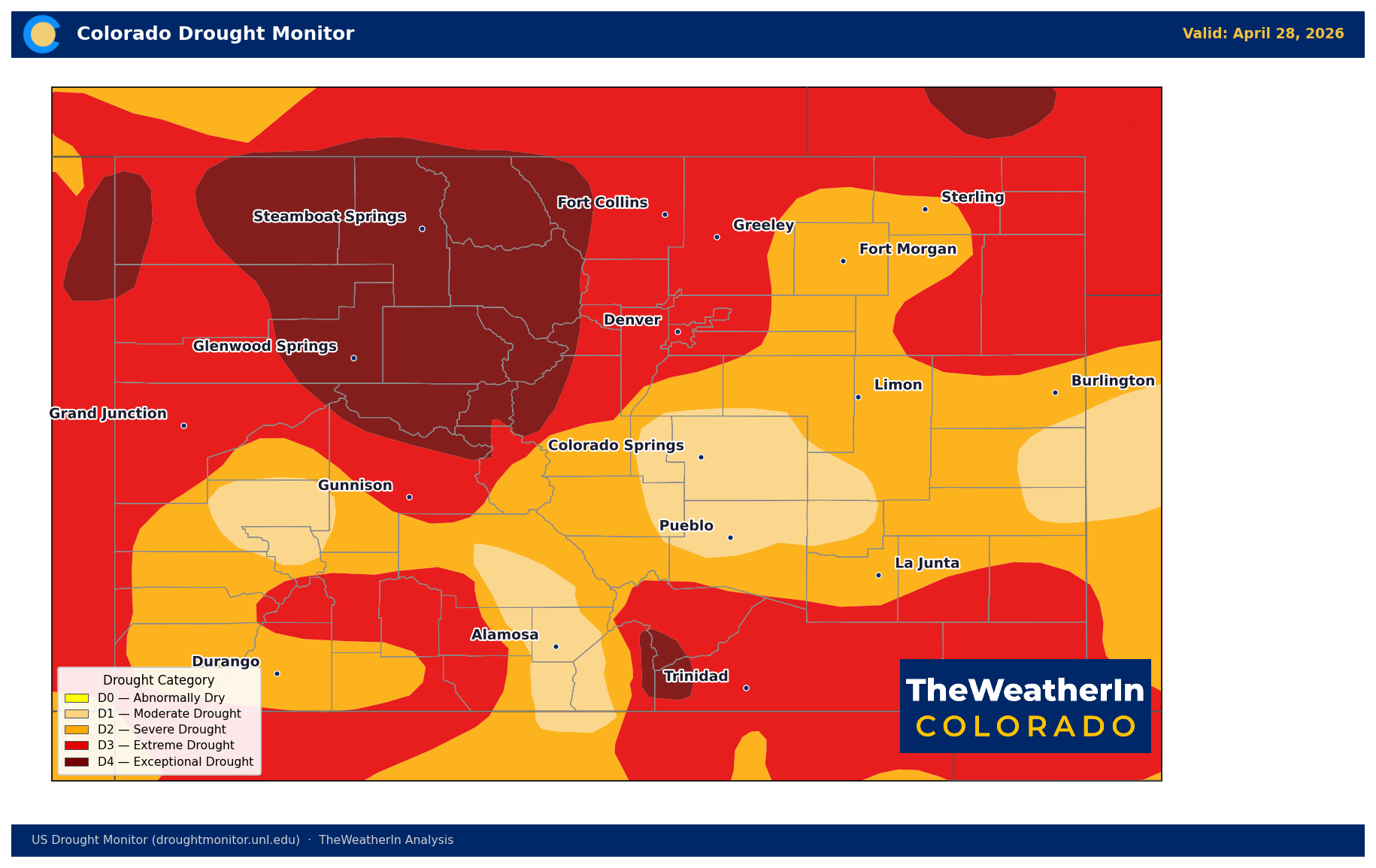
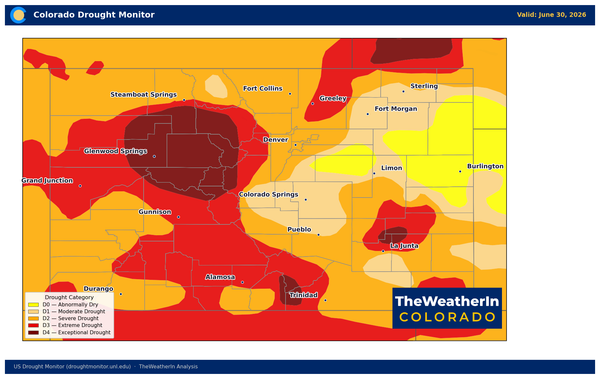
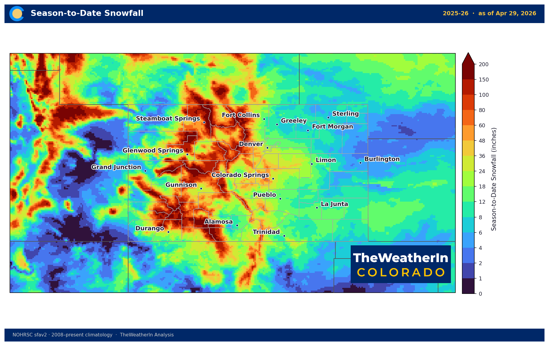
As of April 28, every square mile of Colorado remained at least abnormally dry, with 89.78% of the state in at least moderate drought and 58.54% in severe drought or worse. Exceptional drought — the most intense category — covered 17.69% of the state, concentrated across western Colorado and portions of the southern mountains. The Drought Severity and Coverage Index score of 366 reflects conditions that are, by any historical measure, among the most severe the state has experienced in years.
This week's storm will deliver 1 to 2.5 inches of liquid equivalent precipitation across much of the state — meaningful moisture that will recharge topsoil, suppress fire danger through the week, and provide short-term relief to stressed vegetation and rangelands. What it will not do is materially improve long-term drought status. The water supply deficit built up over a winter of record-low snowpack — statewide April 1 snowpack was 22% of median, the lowest on record — cannot be erased by a single May storm. Southern basin snowpack fell to single-digit percentages before the season ended. That water is simply not coming down the rivers this spring.
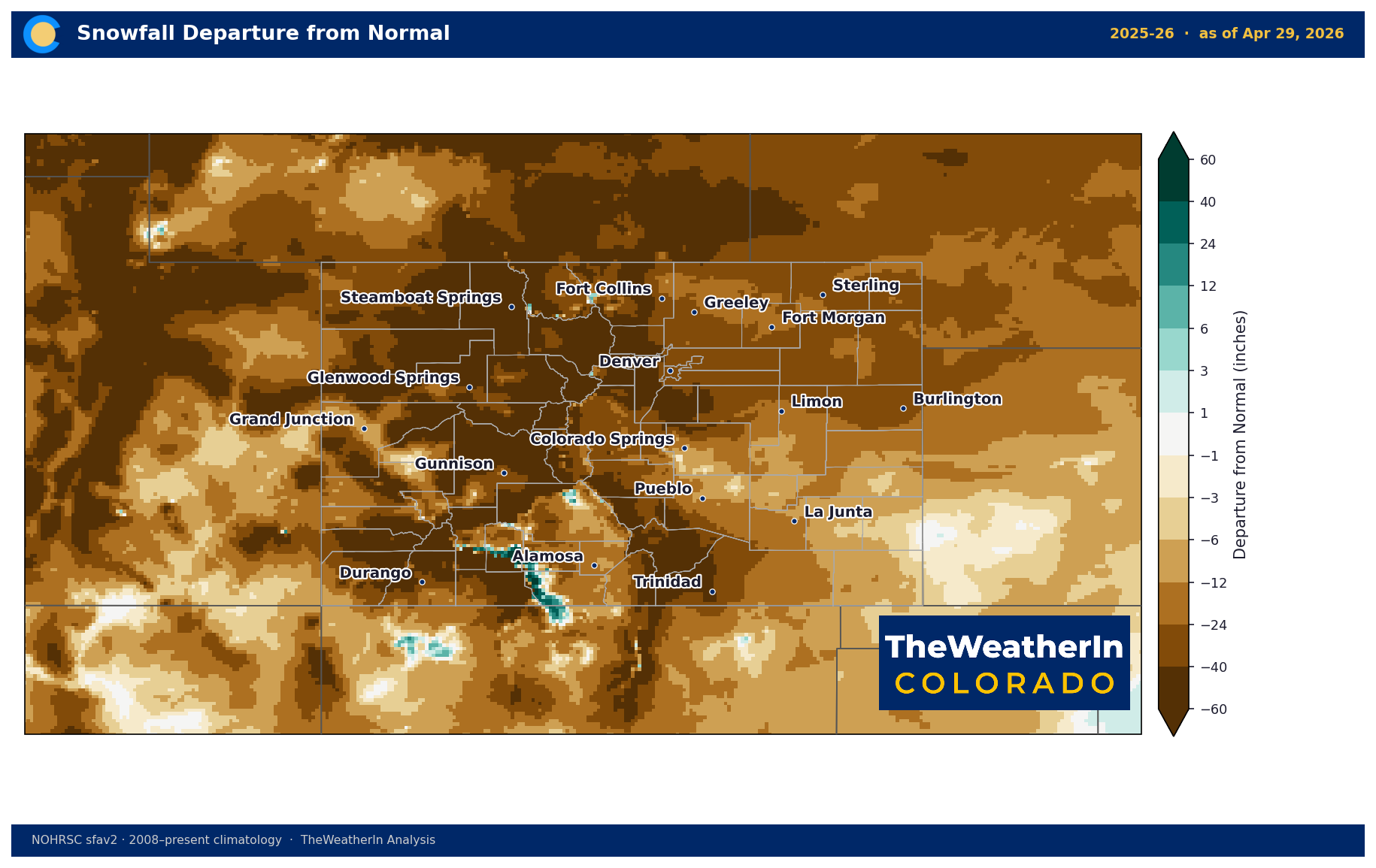
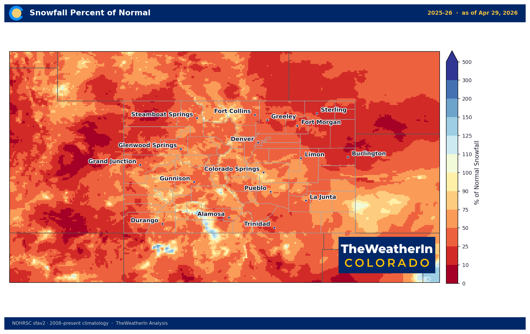
With high pressure expected to rebuild and dominate through much of May, the window for meaningful additional precipitation relief is limited in the near term. Water managers, irrigators, and municipalities operating under tight 2026 supply allocations should plan accordingly. The drought monitor will be updated later this week; modest improvement in D0 and D1 coverage near the storm track is possible, but deeper categories — D3 and D4 across western Colorado and the southern San Luis Valley — are unlikely to move significantly from a single event.
Agricultural Implications
- Freeze risk is the immediate concern. Widespread sub-freezing temperatures are expected Wednesday and Thursday nights across all regions — Front Range, Eastern Plains, mountain valleys, and northwest Western Slope. Early-planted row crops, tree fruit buds, and any tender growth from the warm April are at risk. The rapid swing from winter conditions back to 60s–70s by Thursday–Friday adds additional stress: germinated seed and newly emerged growth that survives the freeze will face immediate warm, dry conditions with no buffer.
- Wet snow loading is a secondary threat through Wednesday. Heavy, wet May snow stresses orchards, young trees, and field crops still in early vegetative stages. Livestock operations near the foothills and mountains should be aware of power outage potential — backup systems for water and feed delivery are worth checking now.
- Soil moisture recharge is real but limited in context. The 1–2.5 inches of liquid precipitation this event delivers is genuine short-term relief for topsoil moisture — ranchers and dryland producers will see some benefit heading into next week. But with the warm, dry pattern rebuilding quickly and below-normal precipitation favored through much of May, that recharge will evaporate faster than normal. Irrigation water supply shortfalls for the 2026 season are already locked in by the snowpack failure; this storm does not change that calculus.
The key signal to watch over the next three to four weeks: whether the western ridge breaks down any earlier than currently forecast data suggests, potentially opening a window for late-May precipitation — particularly for the northern mountains and Western Slope basins, where drought has been most entrenched.