Red Flag Warning Wednesday: Critical Fire Weather Across Colorado
Wind gusts of 30–60 mph and humidity in the single digits Wednesday — one of the more dangerous fire weather setups Colorado has seen this season.
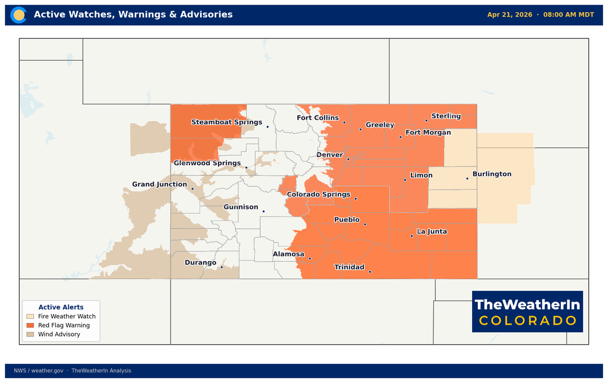
A Red Flag Warning is in effect for much of Colorado on Wednesday, April 22, as an extreme combination of heat, very low humidity, and gusty winds creates dangerous fire conditions across the state. Tuesday is warm and quiet — but conditions deteriorate sharply overnight.

What's Driving It
An upper-level ridge has been sitting directly over Colorado all week, pushing temperatures well above average and squeezing out moisture. As that ridge lifts out, southwest winds strengthen ahead of an approaching storm system — pulling in dry desert air just as temperatures peak. The collision of extreme dryness and strong winds is the fire weather setup.
Wednesday: Red Flag Warning Statewide
Red Flag Warnings are in effect across Colorado from 10 AM Wednesday through midnight, with critical conditions expected across all regions.
| Region | Wind Gusts | Min Humidity |
|---|---|---|
| Front Range / I-25 Corridor / Eastern Plains | 35–45 mph | As low as 4% |
| Southern Colorado / San Luis Valley / Sangre de Cristos | 45–55 mph | Critically low |
| Northwest Colorado (below 7,000 ft) | 45–55 mph | Below 15% |
The Front Range and eastern plains will see the most extreme dryness — relative humidity falling to 4% near the I-25 corridor. For context, typical indoor air in winter runs 30–40%. At 4%, light fuels ignite easily and fire spreads with almost no resistance.
Southern Colorado faces the highest winds. The National Weather Service is monitoring the San Luis Valley and areas near the Sangre de Cristos for a Particularly Dangerous Situation (PDS) designation — issued only when conditions are severe enough that fires can spread faster than suppression resources can respond. Watch for updates Wednesday morning.
Thursday: Elevated Risk Continues in the South
A Fire Weather Watch is in effect for southern Colorado Thursday morning through Thursday evening. The air mass will remain very dry, and there's a 30–40% chance of critical conditions developing again depending on how much wind mixes down from higher levels.
There's also a small but notable chance (10–20%) of a mountain wave developing near Boulder and Golden Thursday, which could produce isolated gusts of 60–70 mph. If that scenario plays out, conditions in the northern foothills would be critical. Forecasters are watching it closely.
Relief Arrives This Weekend
A pattern change arrives by late Friday, with cooler temperatures and increasing moisture. The best precipitation window appears to be Sunday into Sunday night, with mountain snow possible at higher elevations. Some near-critical conditions could linger across parts of the state on Friday before the moisture fully arrives.
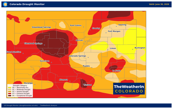
One important caveat: Colorado is in a significant ongoing drought, and dry soils have been limiting moisture recovery ahead of recent storm systems. Even if precipitation totals are reasonable this weekend, drought conditions don't recover from a single event. This week's fire weather serves as a reminder of how little buffer exists right now.
If you manage agricultural land or rangeland, Tuesday and Wednesday are not the days for any outdoor burning. Thursday carries continued risk in the south. Plan accordingly and monitor the latest warnings through the National Weather Service.