An Active Stretch Is Here — But the Bigger Question Is What Comes After
A welcome pattern shift is underway across Colorado, bringing cooler temperatures, mountain snow, and a late-week precipitation system with real potential for drought-stressed parts of Colorado.

A welcome pattern shift is underway across Colorado, bringing cooler temperatures, mountain snow, and a late-week precipitation system with real potential for drought-stressed parts of Colorado — but the window of opportunity is brief, and the longer-range picture beyond early May deserves just as much attention as the next seven days.
Pattern Overview
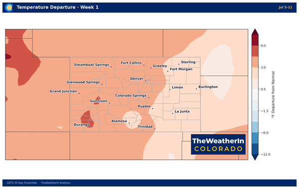
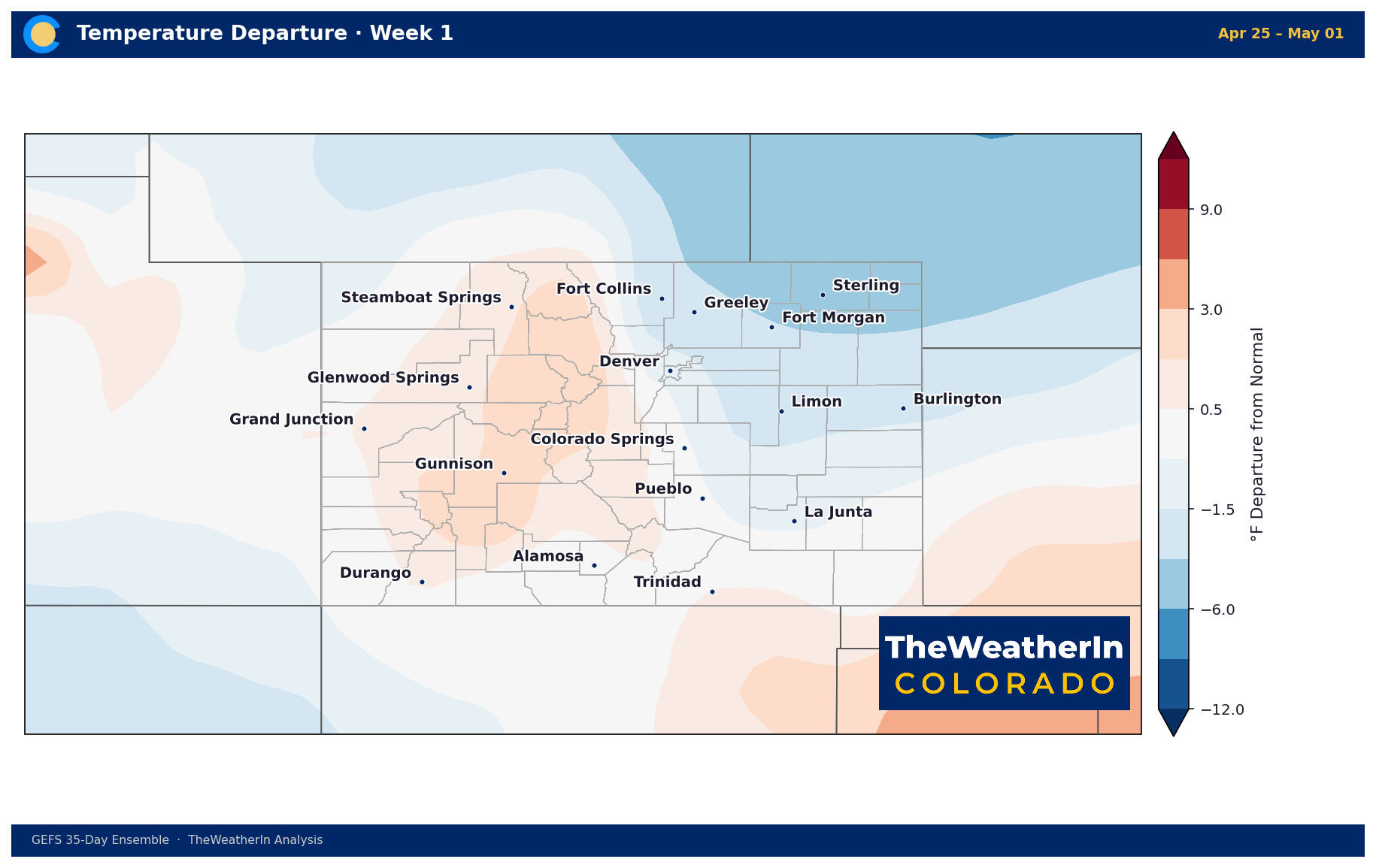
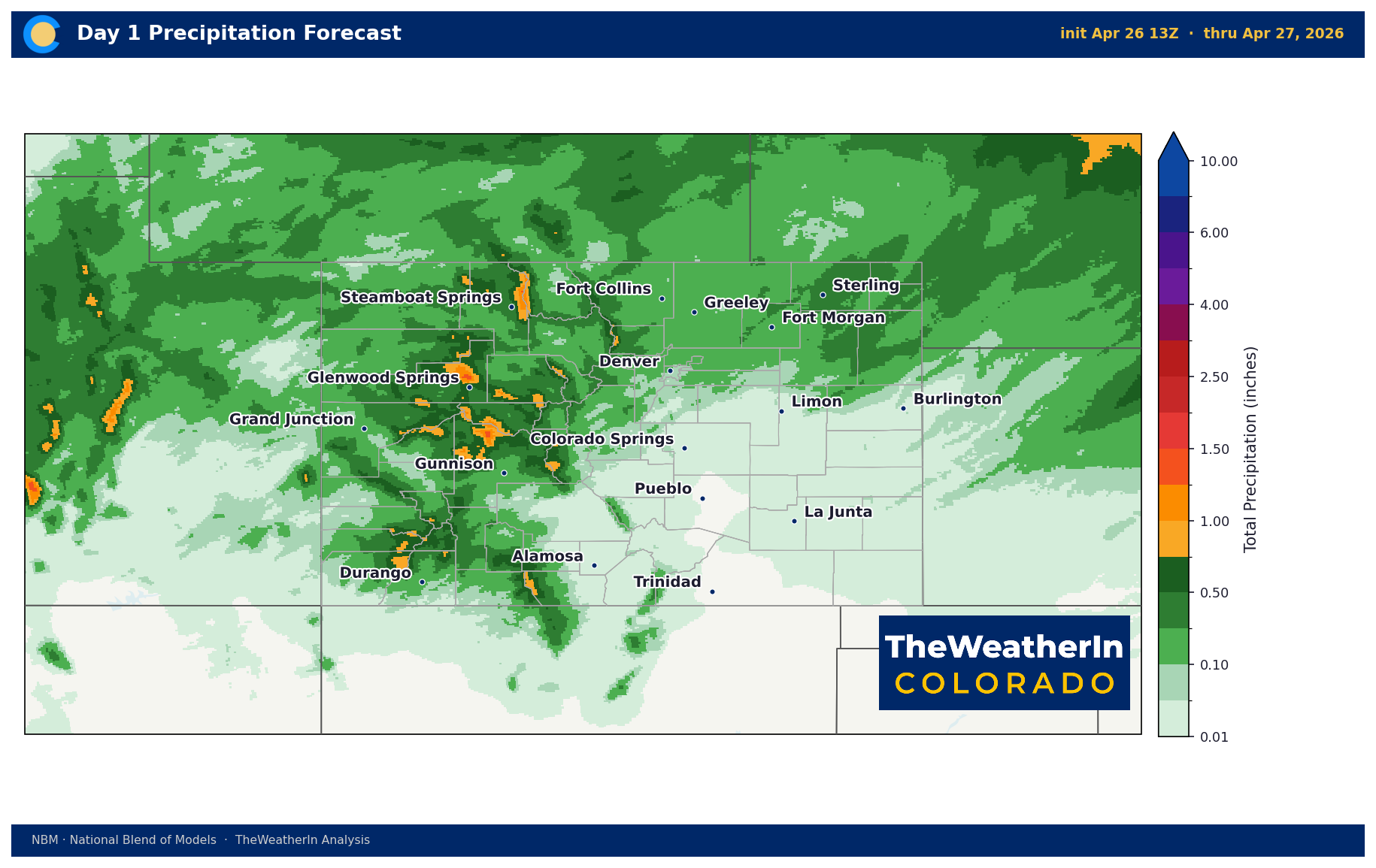
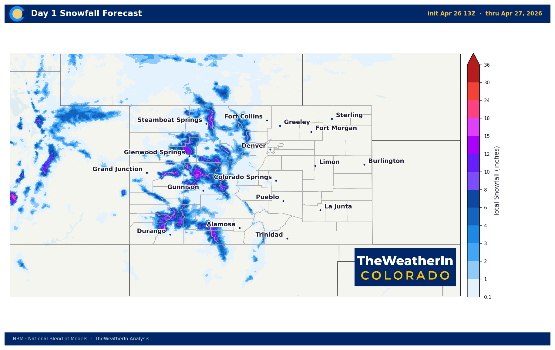
After months of warm, dry conditions rooted in the La Niña pattern that dominated Colorado's 2025–26 winter season, a shift in the upper-level flow has finally arrived. Pacific moisture interacting with an upper-level trough is pushing a cooler, unsettled stretch through early next week — a meaningful contrast to what much of April has delivered. Temperatures will run below normal through Wednesday, with highs in the 50s to low 60s across the lower elevations and mountain snow accumulations of 5 to 12 inches at the higher peaks through Monday.
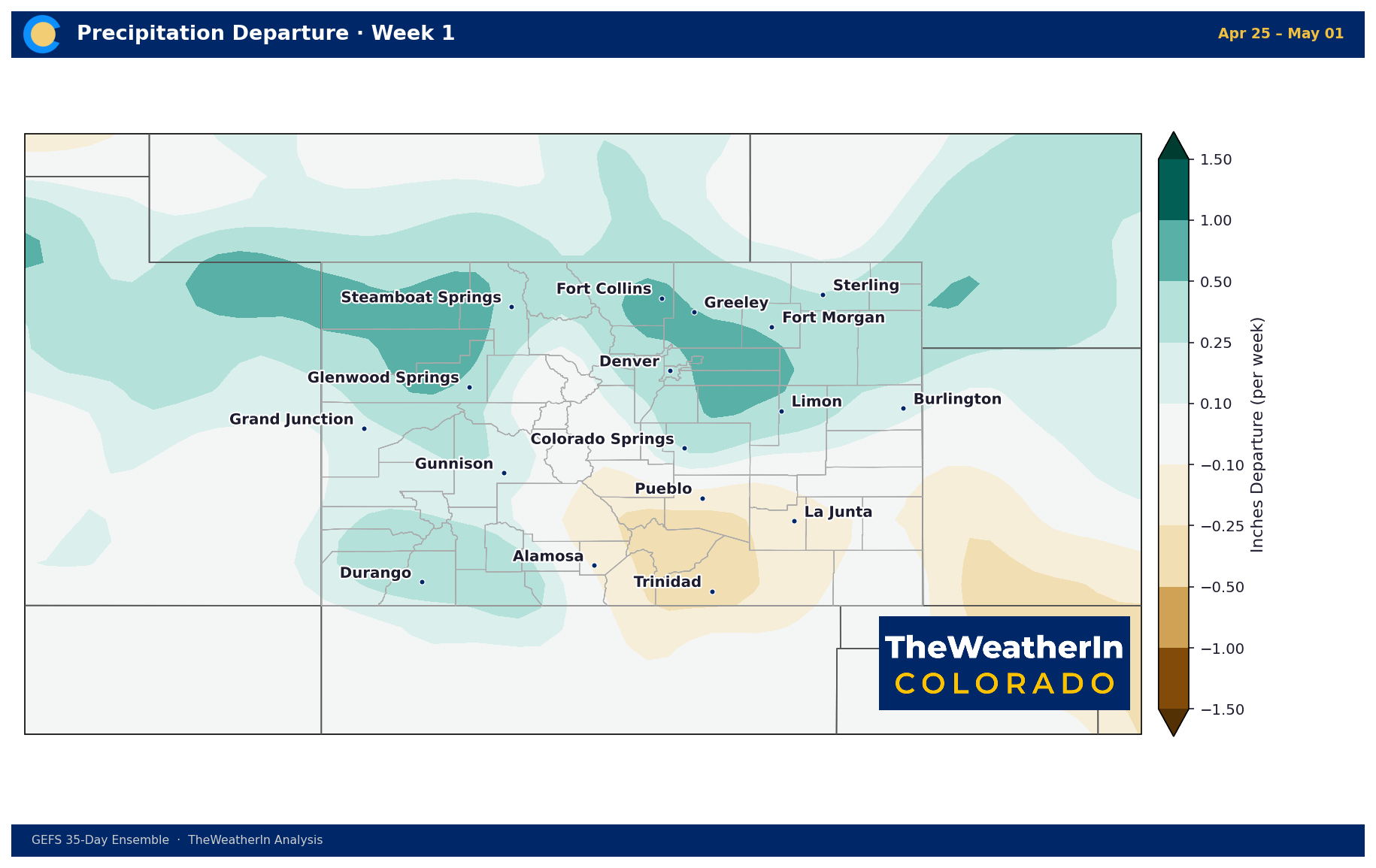
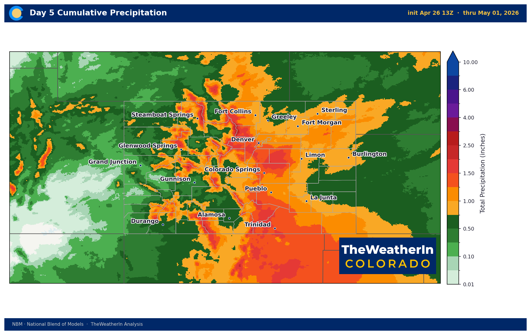
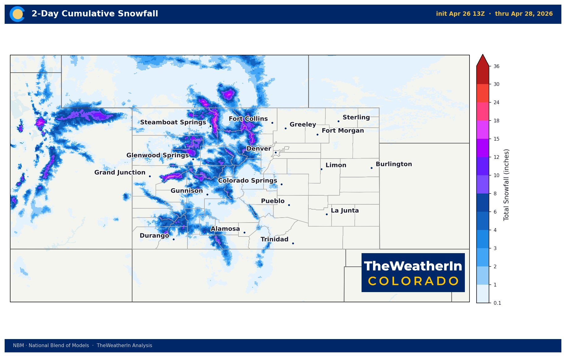
The more consequential event arrives late in the week. A stronger system Thursday into Friday is forecast to bring 0.5 to 1-plus inches of liquid-equivalent precipitation to south-central and southeast Colorado — regions that have been among the hardest hit by this season's drought. Snow levels will sit near 8,000 feet, meaning the mountains collect snowfall while the valleys and plains receive rain, a favorable setup for both water supply and soil moisture. The combination of this week's early systems and the late-week event represents the most sustained precipitation opportunity Colorado has seen in months.
That said, context is essential. La Niña has officially ended, and the climate pattern is transitioning from neutral to El Niño, expected to develop this summer and fall. That transition matters, but it is gradual. The dry, warm grip on Colorado's southern half doesn't release overnight. What we're seeing this week is an encouraging chapter, not a resolution to a drought story that has been building all season.
Weeks Ahead: 2–4 Week Outlook
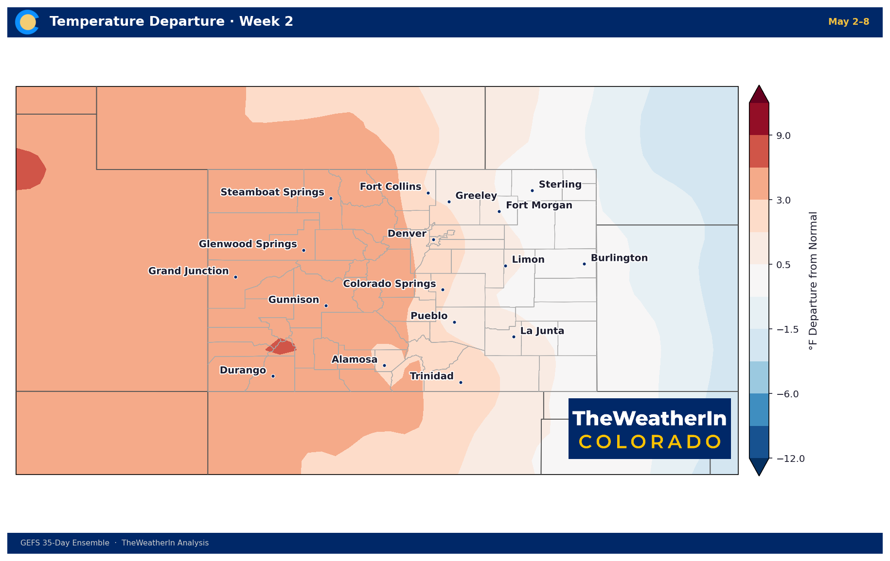
The most important large-scale signal in the medium-range period is the development of an amplified upper-level pattern late this week into next weekend. A strong trough is expected to dig into the northeastern U.S. while an anomalous ridge builds toward Greenland — a configuration that tends to lock in active, stormy weather for the southern and central Rockies. This block-like structure supports an extended active weather window for Colorado through early May, with the late-April through early-May period looking like the wettest stretch of the spring so far.
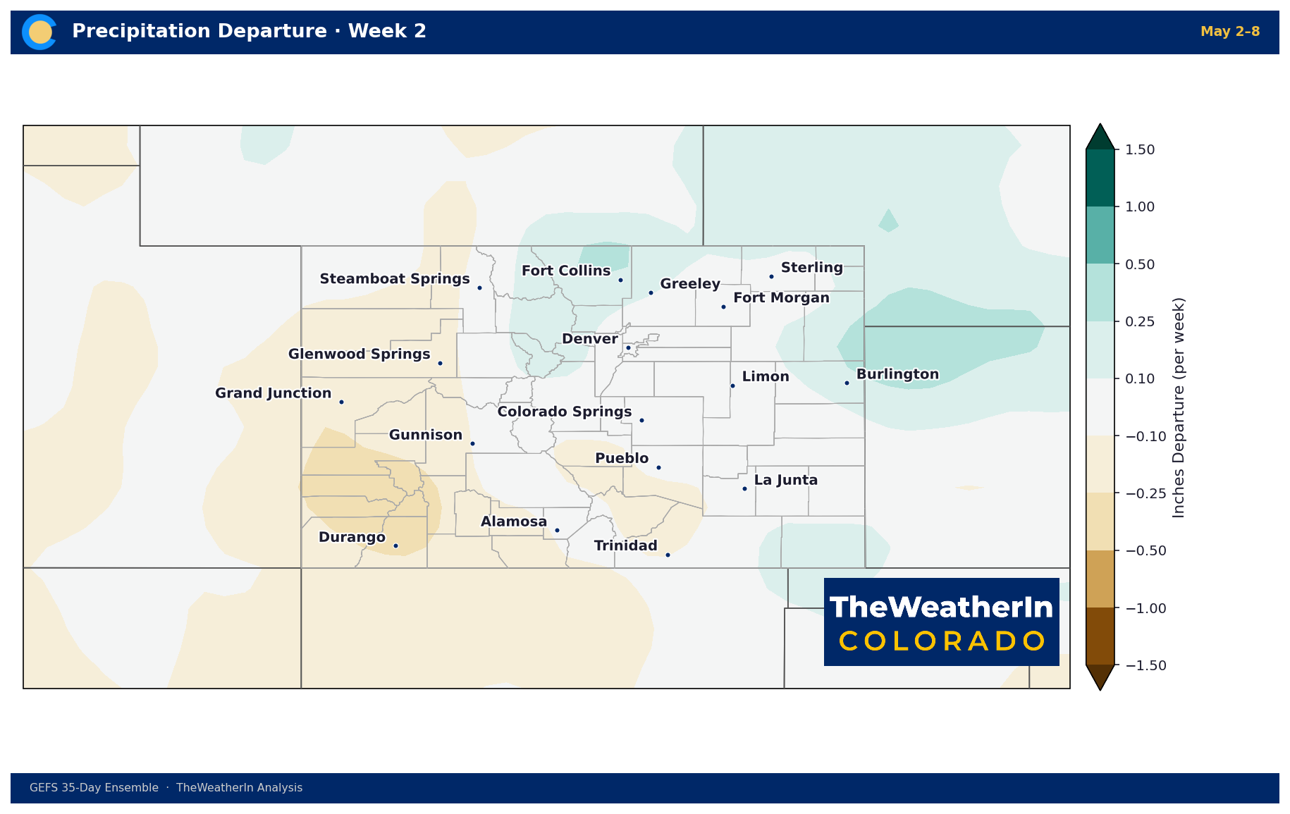
Beyond that active window, the week of May 4–10 shows signs of a transition toward drier and less stormy conditions, with Colorado potentially sitting under upper-level high pressure late that week. Forecast data does not show a sustained wet signal emerging beyond early May at this time. If that drier trend verifies, Colorado will likely enter mid-May with some drought improvement in the most affected areas — but far from the multi-event, multi-week sustained precipitation sequence needed for meaningful, widespread drought recovery.
The pattern evolution to watch: whether the amplified block persists long enough to squeeze additional systems into Colorado before the ridge takes over, and whether any guidance beyond two weeks begins to show a return of moisture into the late-May and early June period as the ENSO-neutral transition continues to unfold.
Regional Breakdown — Week of April 27
| Region | Temperature | Precipitation | Highlights |
|---|---|---|---|
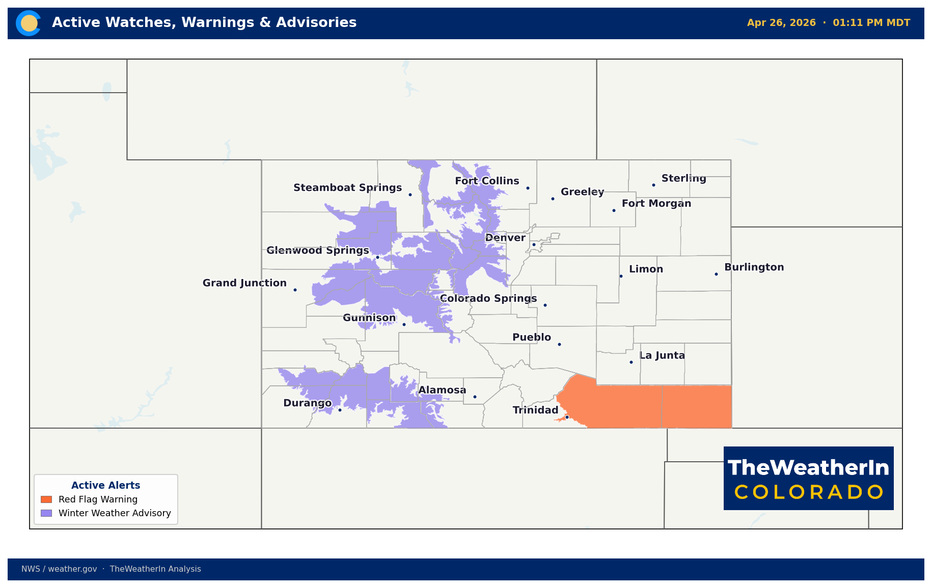
| Front Range / Foothills | Below normal Sun–Wed; 50–62°F highs | Scattered showers/storms today; 40–70% Mon; drier Wed–Thu | Mountain snow 4–8 inches through Monday; late-week system brings additional rain chances |
| Mountains / High Country | Below normal through mid-week | 5–12 inches central and SW peaks; Winter Weather Advisories through midnight Mon; 3–5 inches Flat Tops/Park Range through Tue night | Vail Pass most impacted overnight Sunday; rain/snow mix Thu–Fri with late-week system |
| Western Slope | Below normal through mid-week | Widespread rain/snow today–Mon; 6–12 inches Flat Tops and Central Mtns; drying Tue; strong late-week system Thu–Fri | Gusty winds 20–40 mph gusts this afternoon; significant moisture possible late week |
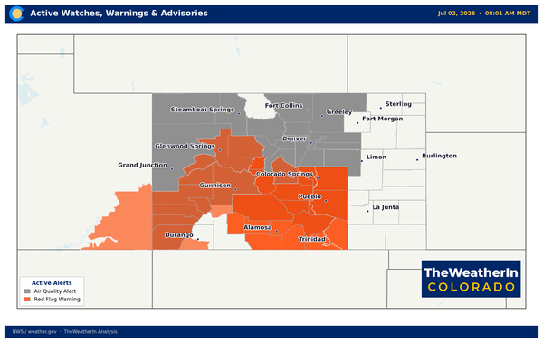
| Eastern Plains | Near to below normal early week; near normal mid-week | Scattered storms today (strongest far SE); upslope showers Mon night–Tue; fair mid-week; precip increases Thu–Fri | Red Flag Warning today Las Animas/Baca counties; dryline may support isolated strong to severe storms far southeast today |
| Southern CO / San Luis Valley | Below normal through mid-week | Mountain snow ongoing; scattered storms plains today; 0.5–1+ inch QPF Thu–Fri | Critical fire weather today (RFW active); elevated fire danger possible Tue–Wed before system arrives; late-week event most significant precipitation opportunity of the month |
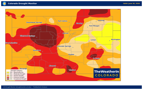
Drought & Water
Drought conditions across Colorado have been expanding and deepening since late winter, a direct product of the La Niña-driven warm, dry pattern that defined the 2025–26 cool season. Widespread D2 to D4 conditions cover much of the state.
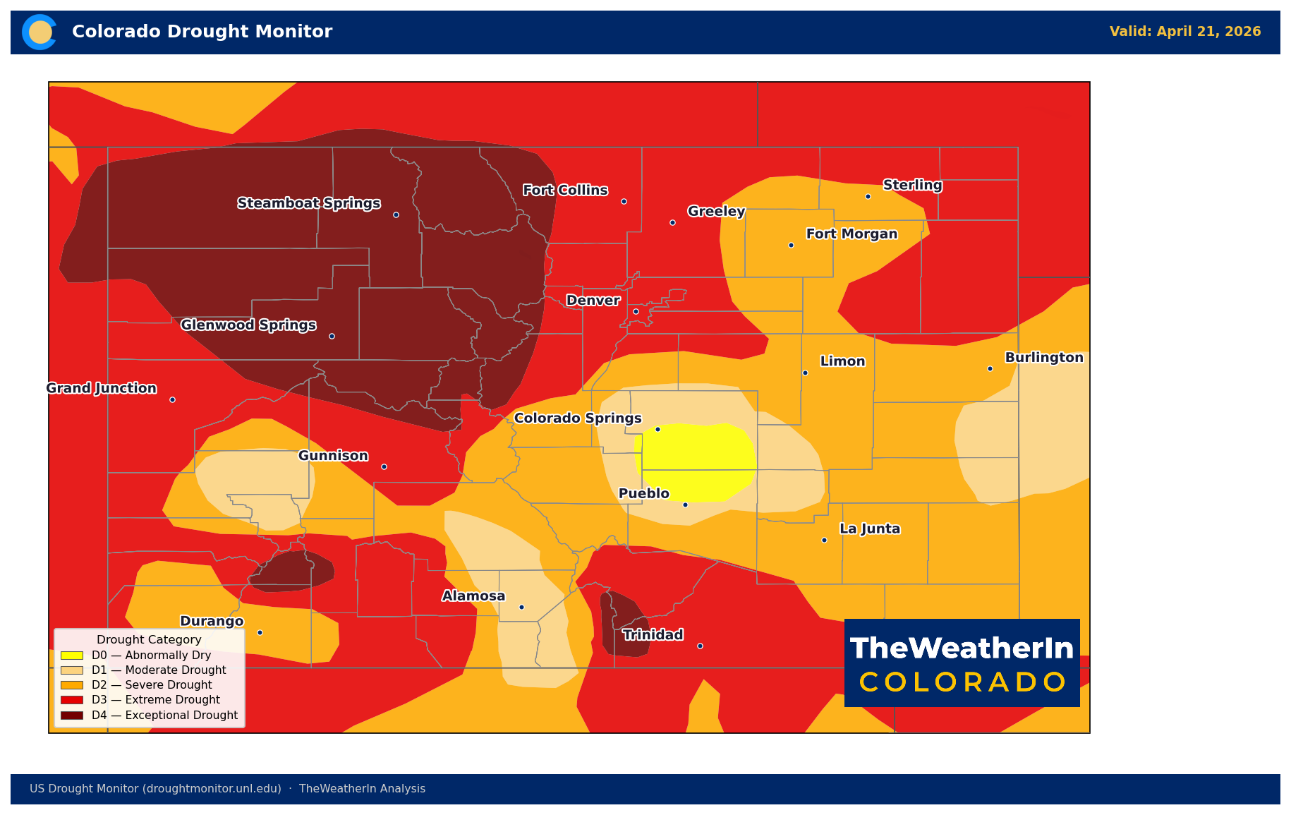
This week's precipitation offers genuine, if modest, relief. Light to moderate amounts Sunday through Monday will begin replenishing topsoil moisture across the Front Range and foothills. The bigger opportunity arrives Thursday and Friday, when 0.5 to 1-plus inches of liquid-equivalent precipitation is possible across south-central and southeast Colorado — areas that have seen multiple Red Flag Warning events this month alone and where fuel conditions remain critically dry. Even this amount won't reverse the drought, but it can meaningfully reduce immediate fire weather risk heading into May.
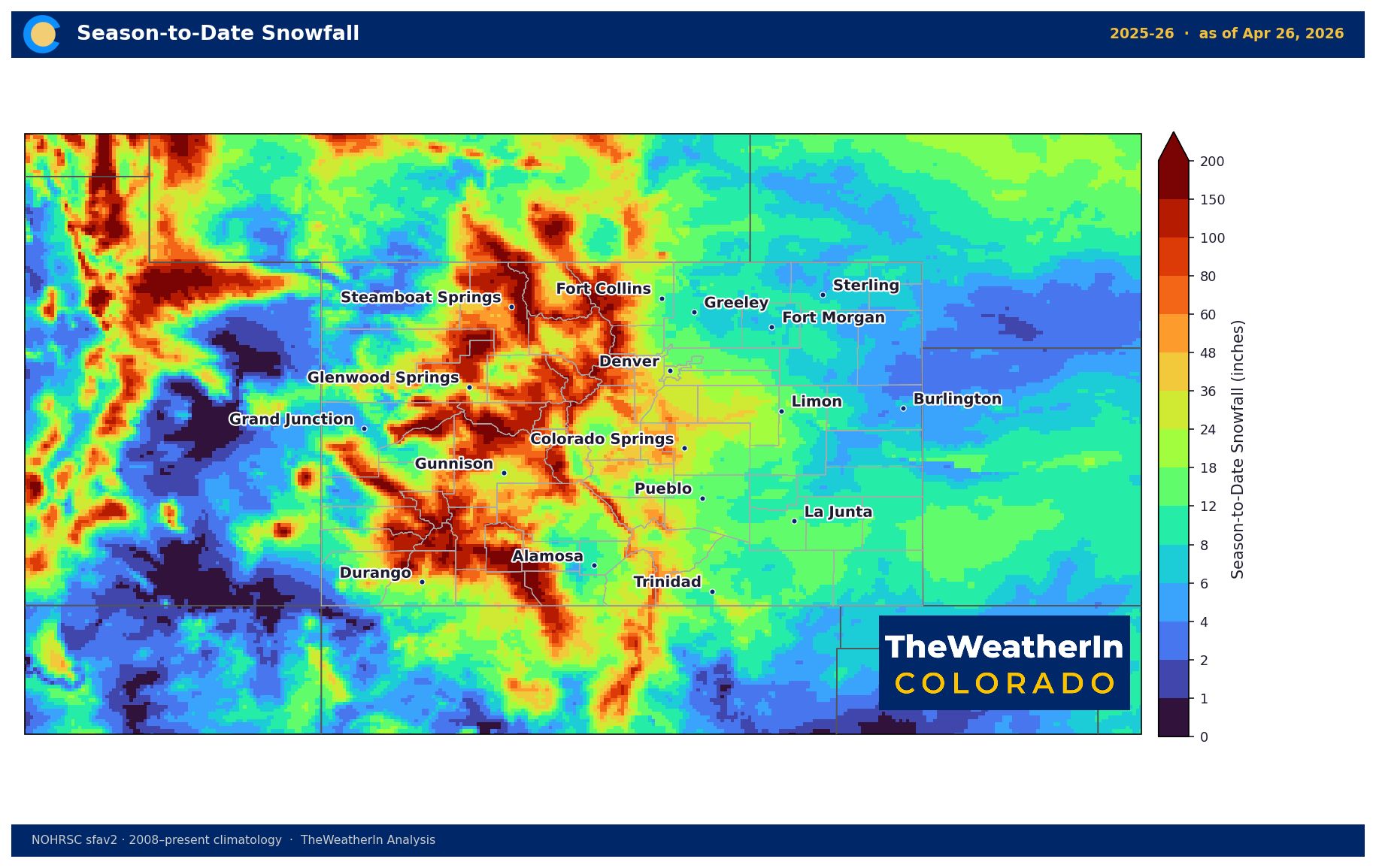
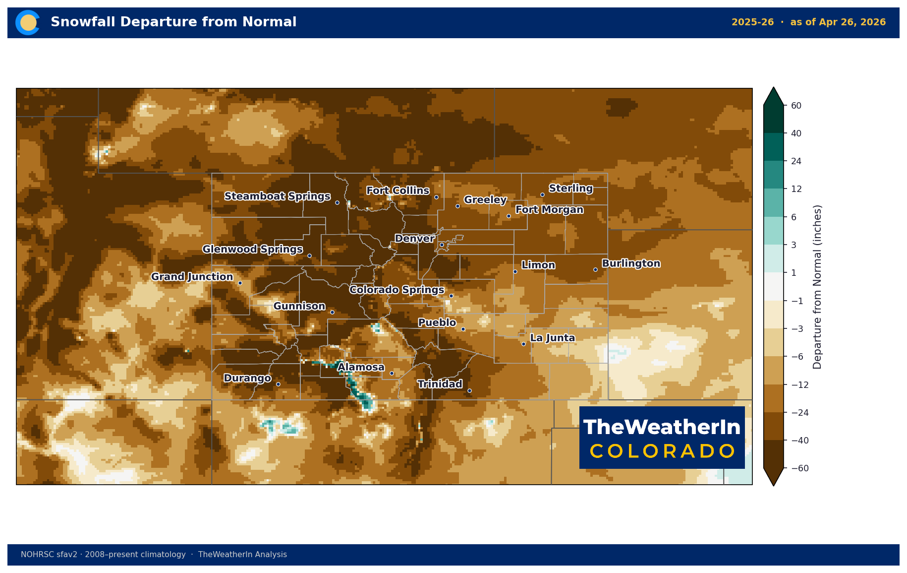
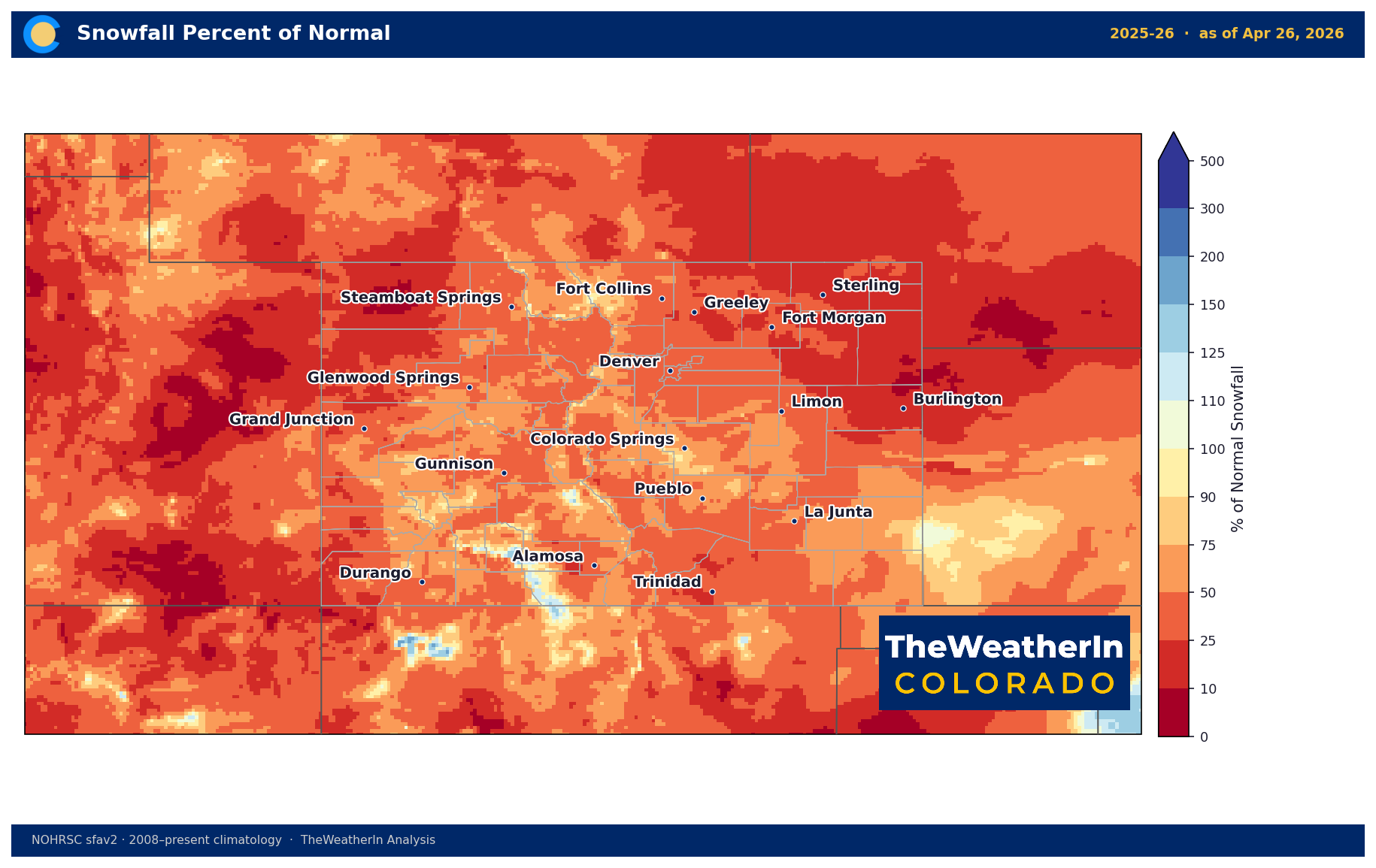
The snowpack picture remains sobering. Statewide snowpack ran below 75 percent of normal for most of the 2025–26 season, with peak runoff arriving two to three weeks ahead of the historical average. What remains is confined largely to terrain above 10,000 feet. This week's mountain snow is welcome — every inch counts — but it arrives late in the season, and the water supply math for the 2026 irrigation season is already set. Tighter-than-normal water availability is the expectation for Eastern Slope and southeastern Colorado irrigators through the summer months.
The slow fade of La Niña toward ENSO-neutral does not deliver immediate drought relief. Historically, this transition loosens the dry grip on the southern Rockies — but gradually, over months, not weeks. Multiple sustained precipitation events will be required before drought categories begin to improve in a meaningful way.
Agricultural Implications
- Wind stress and fire risk today: Producers in Las Animas and Baca counties should be on high alert through 8 PM — Red Flag Warning conditions are in effect with sustained southwest winds of 25 to 45 mph and relative humidity dropping to 10 to 15 percent. Avoid any ignition sources; field work generating sparks or open burning is inadvisable. Elevated fire danger is possible again Tuesday and Wednesday in interior valleys and gap-prone areas before the late-week system arrives.
- Soil moisture and late-week opportunity: Scattered showers today through Monday will deliver light, welcome moisture to fields and rangeland across most of the state. The more significant opportunity is Thursday and Friday across southern and central Colorado, where 0.5 to 1-plus inches could meaningfully replenish topsoil ahead of a dry stretch that may return in mid-May. Pasture and rangeland recovery will be slow given drought depth, but any precipitation at this stage helps slow the deterioration.
- Freeze risk and irrigation timing: No widespread freeze threat is expected through early next week; overnight lows will hold in the 30s to 40s in mountainous areas and the 40s on the plains. The brief cool surge associated with the late-week system may push temperatures down, but no hard freeze signal is evident. Irrigators managing early-season crops should keep an eye on the mid-May pattern — if the dry trend that appears to be developing after early May verifies, soil moisture reserves will matter more than usual heading into summer.
The outlook through October is posted here for Insiders:

The Signal to Watch
The most important question for Colorado's drought and fire season outlook now sits beyond the near-term wet pattern: whether any sustained return of moisture materializes in the late May to June period as the ENSO-neutral transition continues — because without it, the drought that has defined this season will carry significant momentum into the summer before the monsoon and then El Niño's true impacts arrive this fall.