Fire Weather Crisis Now — Dry May Taking Shape
The more important story is what comes after: a brief cooldown followed by a return to below-normal precipitation that keeps drought pressure building through May.

A critical fire weather event is unfolding across Colorado today and Thursday, driven by a powerful upper trough pushing southeast out of the Great Basin — but the more important story is what comes after: a brief cooldown followed by a return to below-normal precipitation that keeps drought pressure building through May.
Pattern Overview
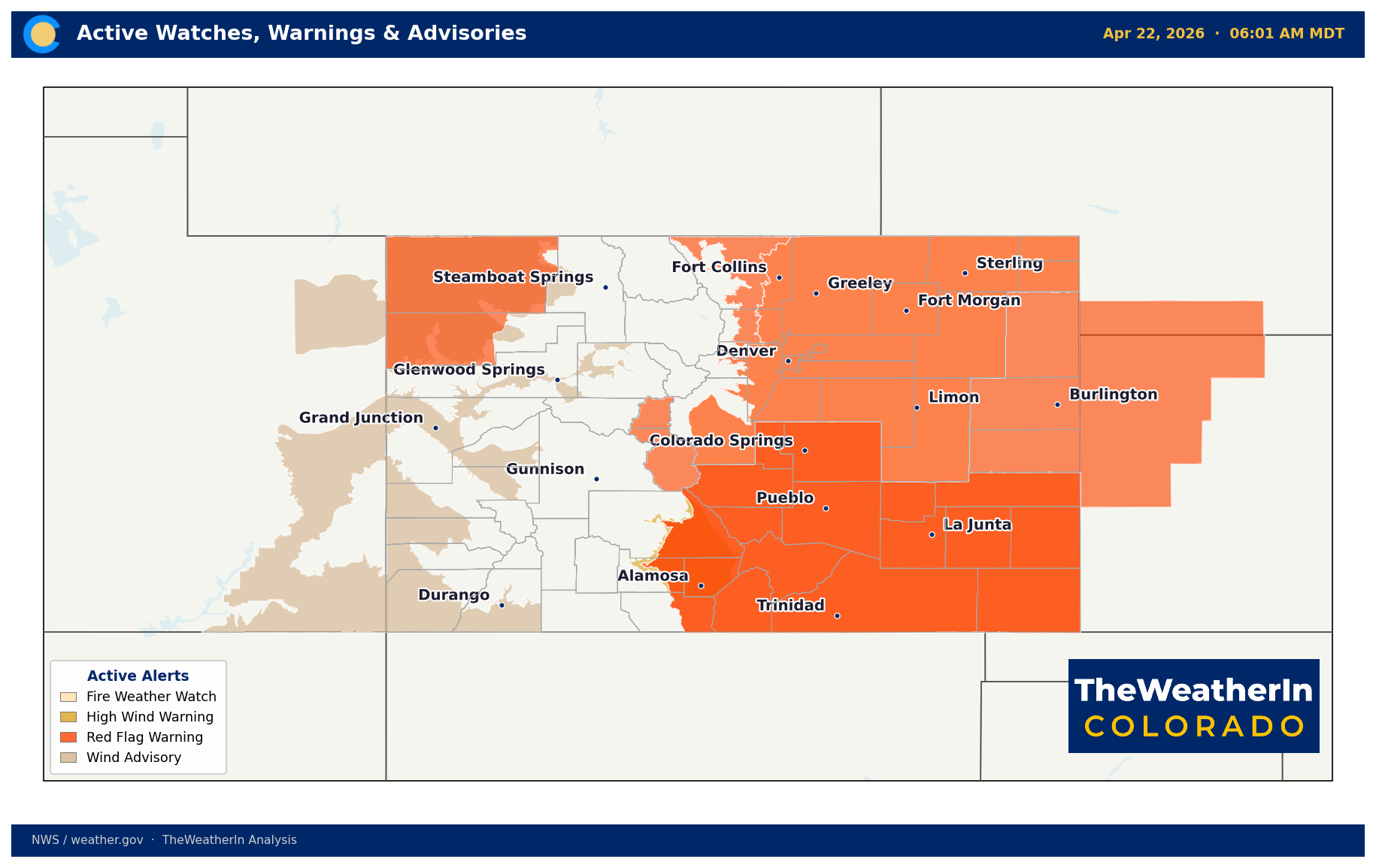
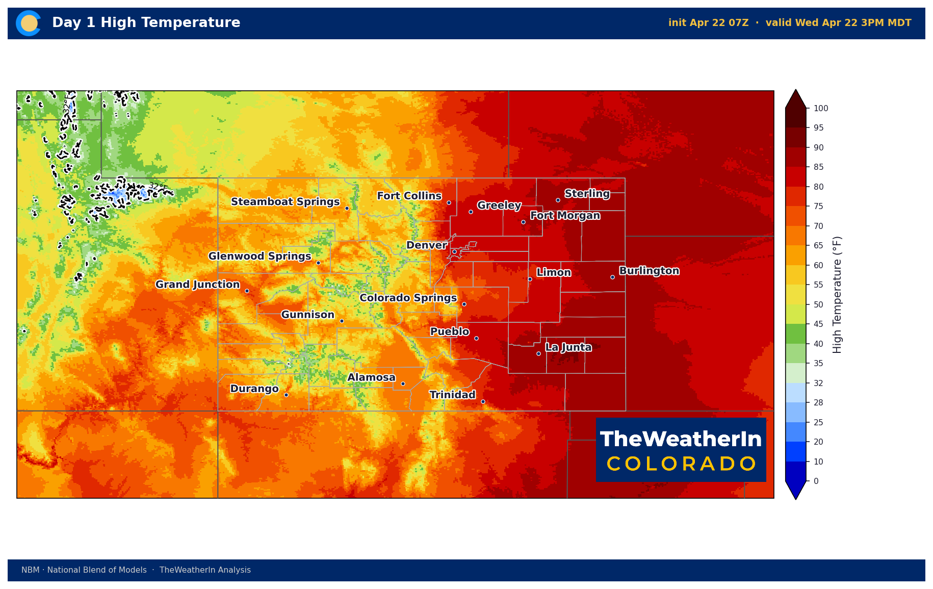
The immediate driver is a deep upper-level trough — essentially a large dip in the jet stream — rotating out of the Pacific Northwest and pressing into the Rockies. As it does, it's pulling exceptionally dry, warm air across the state from the southwest. That combination of single-digit relative humidity, widespread gusts of 45–55 mph, and cured grass from a drier-than-normal spring has pushed fire weather conditions into the critical range. A Particularly Dangerous Situation Red Flag Warning — a designation reserved for when conditions are severe enough to produce fires that may exceed suppression capability — is in effect today across the San Luis Valley, central mountains, and Sangre de Cristos. Red Flag Warnings cover most lower elevations and foothills as well. Peak wind gusts of 45–60 mph are expected across the San Luis Valley and southern Colorado this afternoon, with the worst window roughly 2–4 PM.
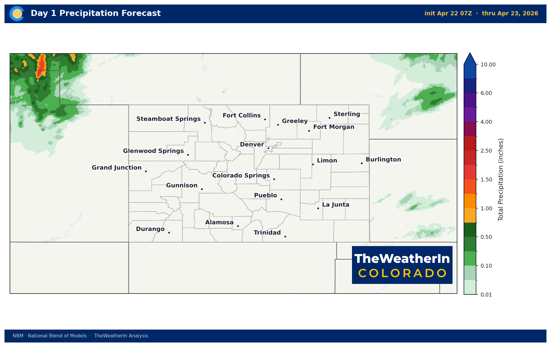
A pattern shift arrives this weekend as the trough digs into the Four Corners region. Temperatures drop 5–15°F Thursday and cooler, unsettled conditions develop Friday through early next week. The best precipitation chance from this system arrives Sunday, primarily along and west of the Continental Divide — mountain zones above 9,000 feet could see several inches of snow, with 0.25–0.5" liquid equivalent near the Divide. That's meaningful but not pattern-changing. An upper low sitting over southern Canada early next week will keep temperatures below normal statewide and introduce freeze risk, especially on the Western Slope and high terrain.
The broader context matters here. This fire weather event isn't happening in a vacuum — it's occurring against a backdrop of a dry spring that has been tightening drought conditions across the state. The pattern driving today's event reflects a large-scale atmospheric setup that has favored below-normal precipitation across the southern Rockies for weeks. Understanding that context is essential to reading what comes next.
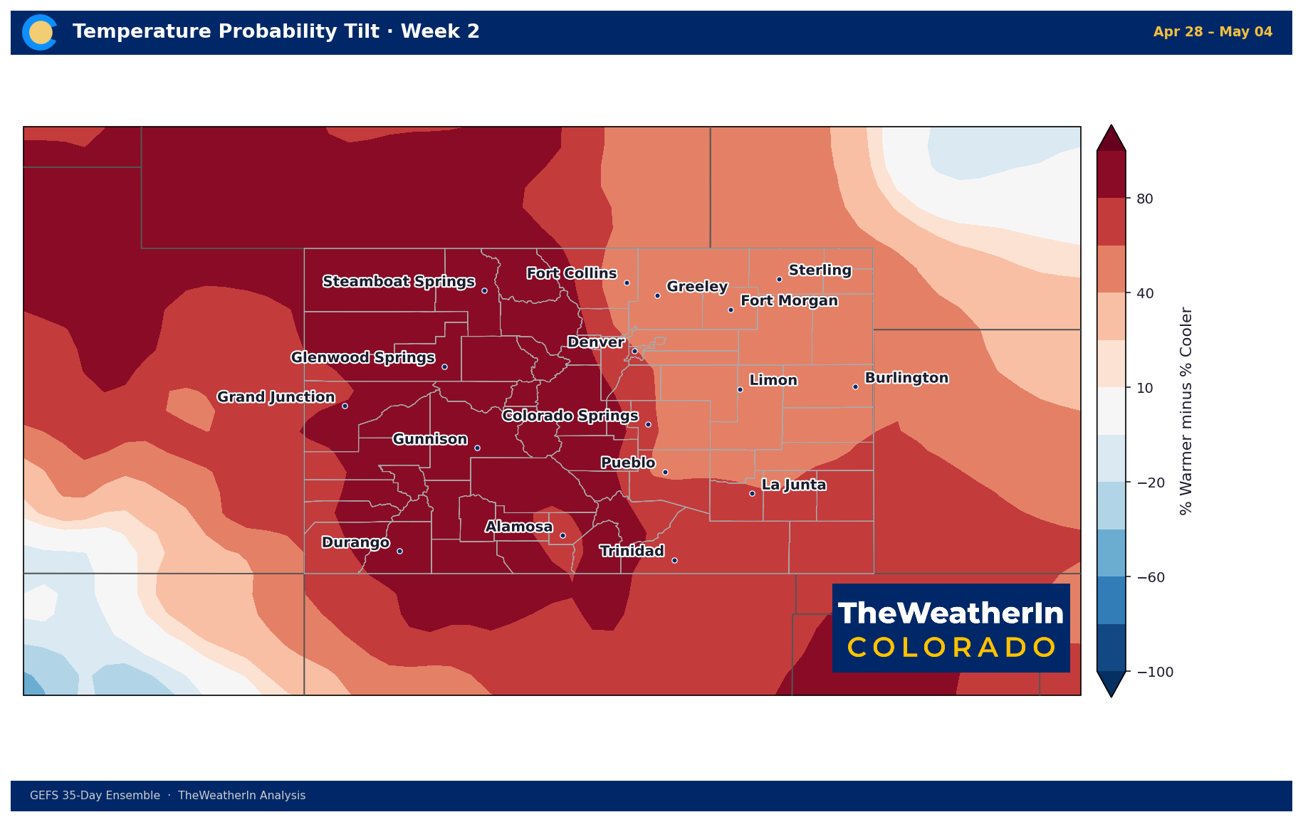
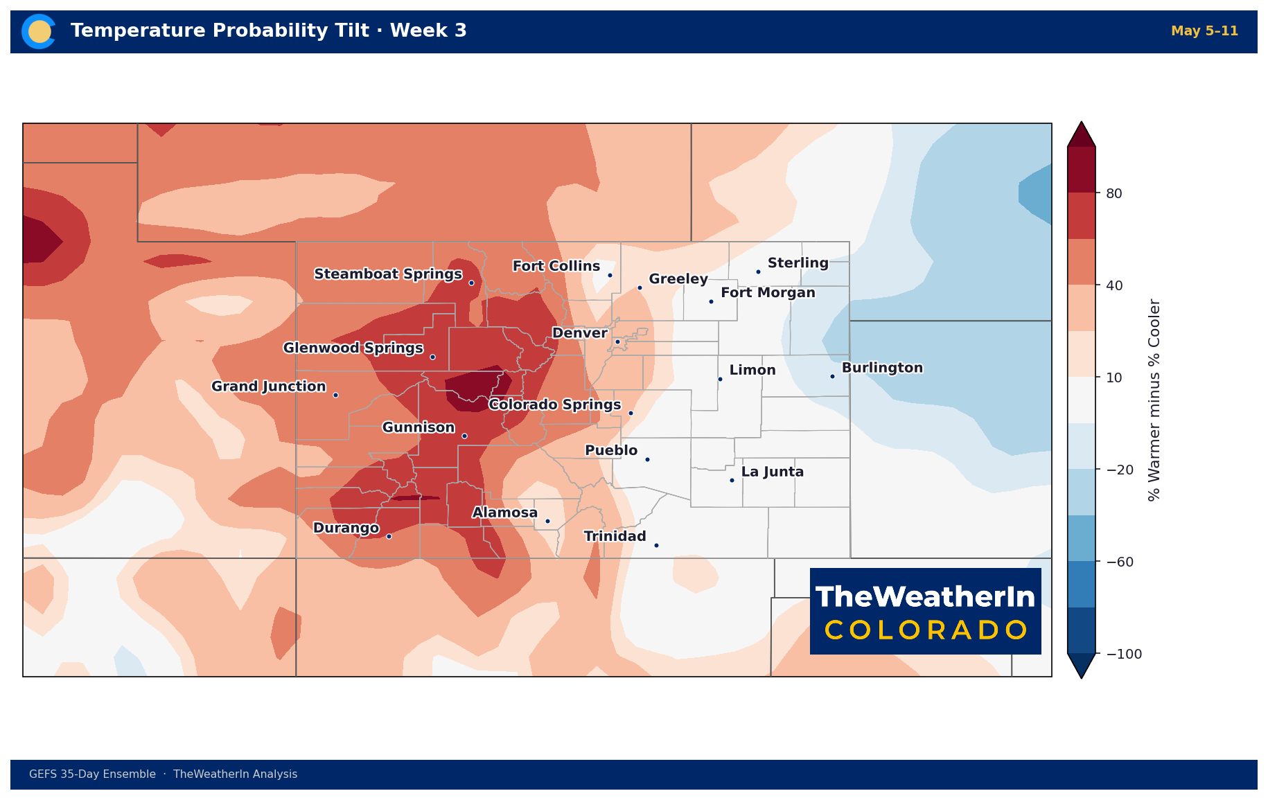
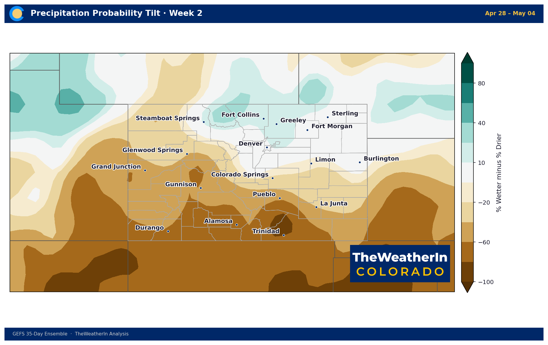
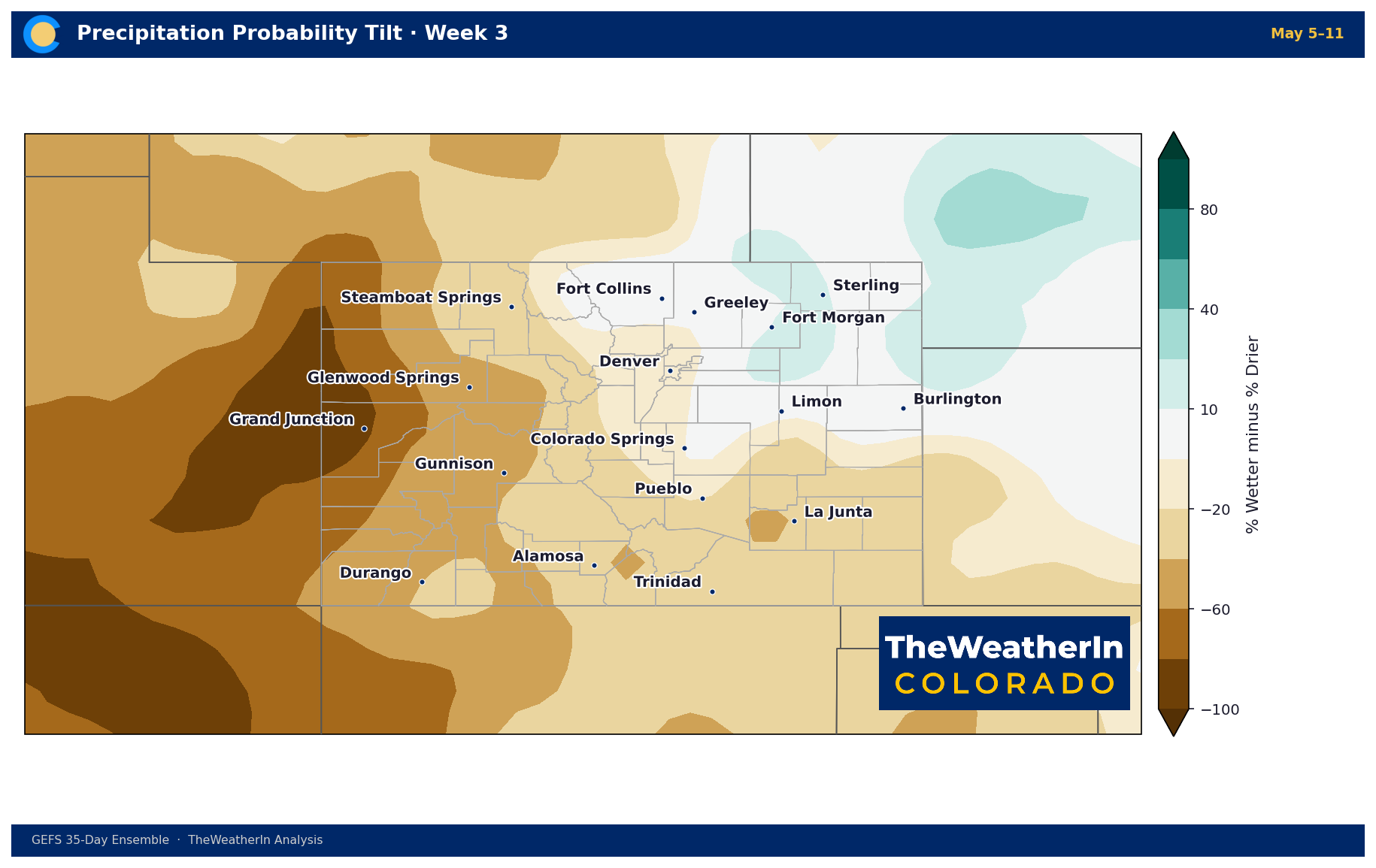
Weeks Ahead: 2–4 Week Outlook
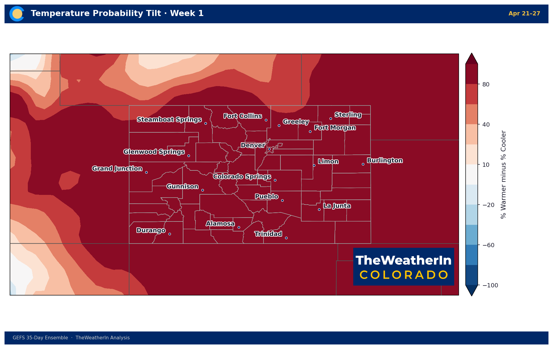
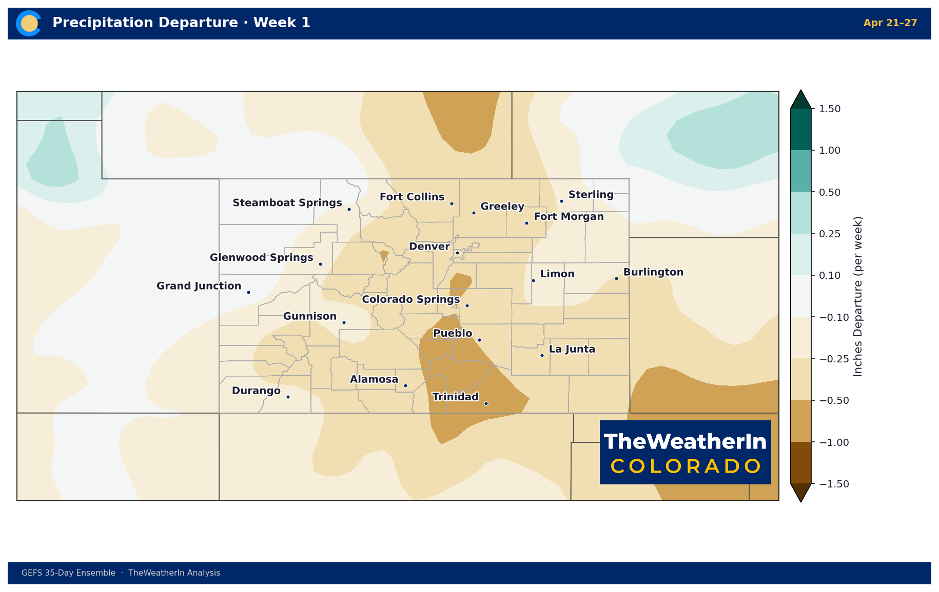
Forecast data through late April and into May continues to signal a predominantly below-normal precipitation pattern for Colorado, with the strongest dry signal across the southern half of the state. Temperature anomalies are expected to remain above normal, particularly during weeks two and three — a reflection of the persistent high-pressure ridge that has been the dominant feature of this spring. There is a signal for a brief cooler period in the week-two window associated with the trough moving through this weekend, but the four-week average leans warm and dry, which does not favor meaningful drought relief.
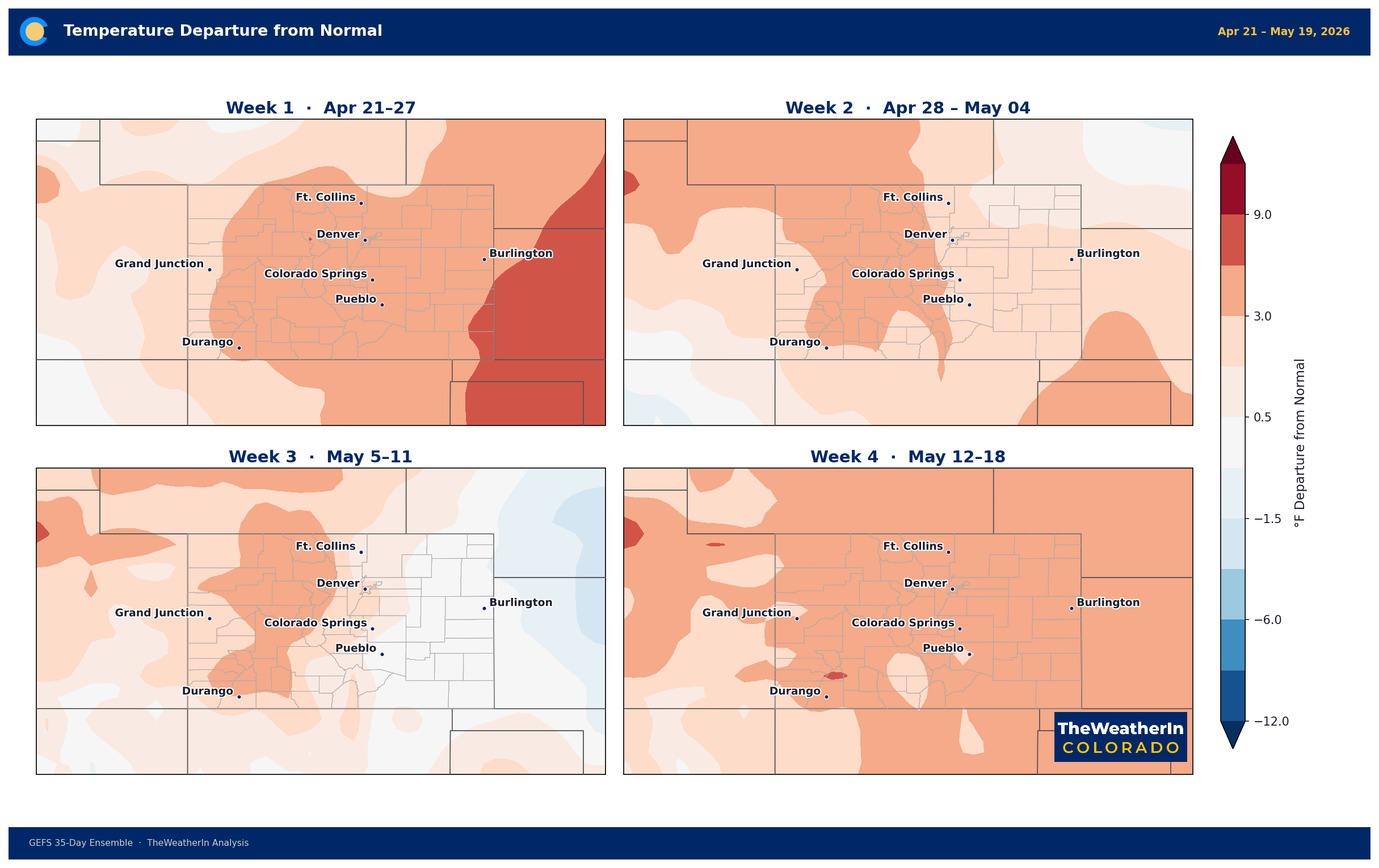
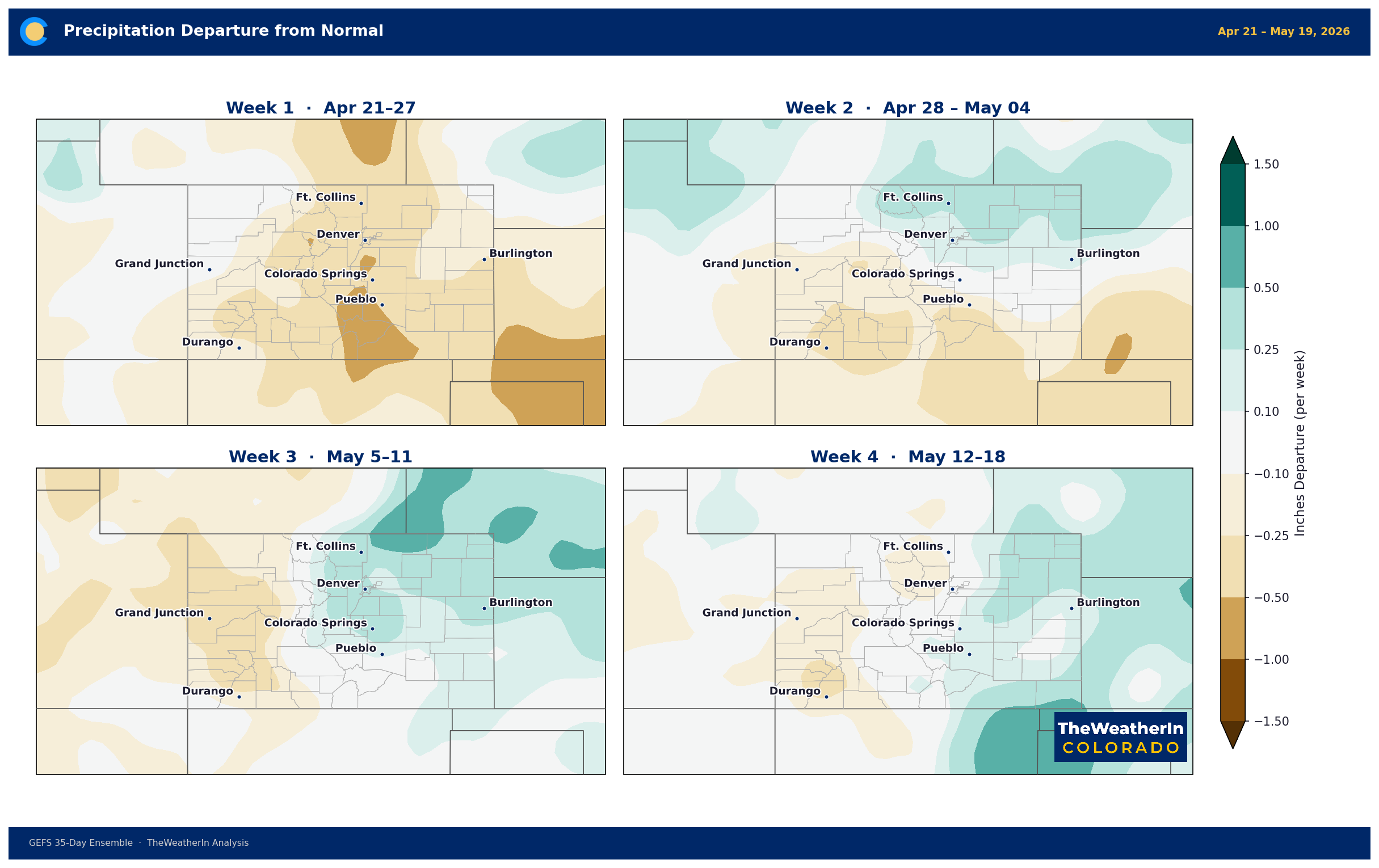
The pattern driver to watch is the ongoing development of El Niño conditions in the tropical Pacific. Historically, the transition away from La Niña into a neutral ENSO state during spring tends to loosen the grip of the dry, warm southwestern pattern — but this transition is gradual, and forecast data is not yet showing a decisive wet pattern emerging for Colorado to start May. The most likely scenario for the next three to four weeks remains near-normal to below-normal precipitation with above-normal temperatures. Any individual storm systems that do push through will be worth watching closely for fire weather, given the ongoing dry fuel conditions.
Regional Breakdown — Week Ahead (April 22–29)
| Region | Temperature | Precipitation | Highlights |
|---|---|---|---|
| Front Range / Foothills | +10–20°F Wed; cooling Thu–Fri; near normal weekend | Near-zero Wed–Fri; sprinkle/flurry chance Sat–Sun | PDS-level fire weather Wed; Red Flag likely Thu; mountain wave gusts 55–60 mph above 8,500 ft Thu morning |
| Mountains / High Country | Below normal late week through early next week | Best chance Sunday (0.25–0.5" liquid; several inches snow above 9k ft) | Strong winds aloft Wed–Thu; daily precipitation chances Fri–Sun; freeze risk early next week |
| Western Slope | Above normal Wed; near to below normal Thu onward | Very low Wed–Thu; isolated showers possible Fri; modest chance Sunday | Gusts 45–55 mph Wed; Red Flag Warnings NW Colorado; freeze risk in lower valleys early next week |
| Eastern Plains | Near 80°F Wed; upper 60s Thu; cooling Fri onward | Near-zero through Thu; low chances Fri–Sun | Critical fire weather Wed–Thu; marginal storm risk far NE counties Wed afternoon; backdoor front improves RH by Friday |
| Southern CO / San Luis Valley | Low 70s Wed; upper 60s Thu; cooling Fri onward | Near-zero through Fri; best chance Sunday near Continental Divide | PDS Red Flag + High Wind Warning Wed (gusts near 60 mph mid-afternoon); Red Flag Thu; freeze risk early next week |
Drought & Water
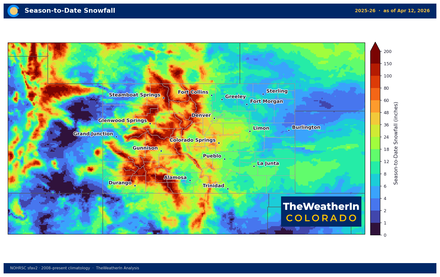
Colorado's drought footprint has been expanding through April, and today's fire weather event underscores why it matters beyond the water supply picture. This week's dry, windy, warm conditions will do nothing to improve that picture — and may push the next Drought Monitor update toward expanded or intensified coverage, particularly in the San Luis Valley and southeastern Colorado where today's most extreme conditions are focused.
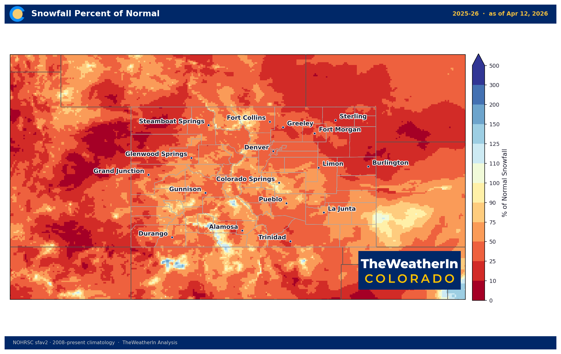
Snowpack has been another dismal trait this season for much of the high country, and what is there is declining rapidly with the warm temperatures of the past several weeks. The Sunday precipitation event will help slow that melt marginally on the western side of the Divide, but with the longer-range outlook favoring a continuation of below-normal precipitation through May, the trajectory for late-season water supply remains a concern — particularly for irrigators relying on late runoff and reservoir carry-in. Fire risk and drought are now directly linked: extended fire weather conditions stress rangeland, reduce soil organic matter, and compound the moisture deficit that is already present.
Agricultural Implications
- Fire and rangeland damage: Today's PDS-level fire weather conditions represent a genuine threat to range condition across the San Luis Valley, southern Colorado, and the Eastern Plains. Any ignition under these conditions — whether from equipment, power lines, or dry lightning — could move rapidly and be difficult to contain. Avoid any activity with ignition potential today and Thursday.
- Freeze risk early next week: The pattern shift that brings cooler air this weekend will extend into early next week with an upper low anchored over southern Canada driving temperatures well below normal. Western Slope lower valleys and high terrain statewide face the greatest freeze exposure. Tender crops, early fruit bloom, and any new pasture growth should be monitored closely heading into the April 27–29 window.
- Soil moisture and the longer range: The dry, windy stretch through Thursday will continue to desiccate the top layer of soils statewide. With forecast data pointing toward a below-normal precipitation pattern through late April and May, irrigation planning should account for an earlier-than-typical need for supplemental water on the Eastern Plains, and dryland producers should manage expectations for spring moisture.
The most important signal to track over the next two to three weeks is whether the La Niña-driven dry pattern from the winter fully releases its grip on Colorado before the peak of fire season arrives in earnest.