Colorado 35-Day Outlook — April 12, 2026
A warm, dry pattern dominates Colorado through late April — eastern plains see the strongest signal while warmth gradually spreads statewide into early May.
The Pattern in Brief
An extended warm and mostly dry stretch is favored through the remainder of April. The eastern plains carry the strongest warm signal early in the period, with warmth building statewide through Weeks 3 and 4. Precipitation runs below normal for most of the state through mid-to-late April, with some recovery possible in early May.
Temperature: Weeks 1–4
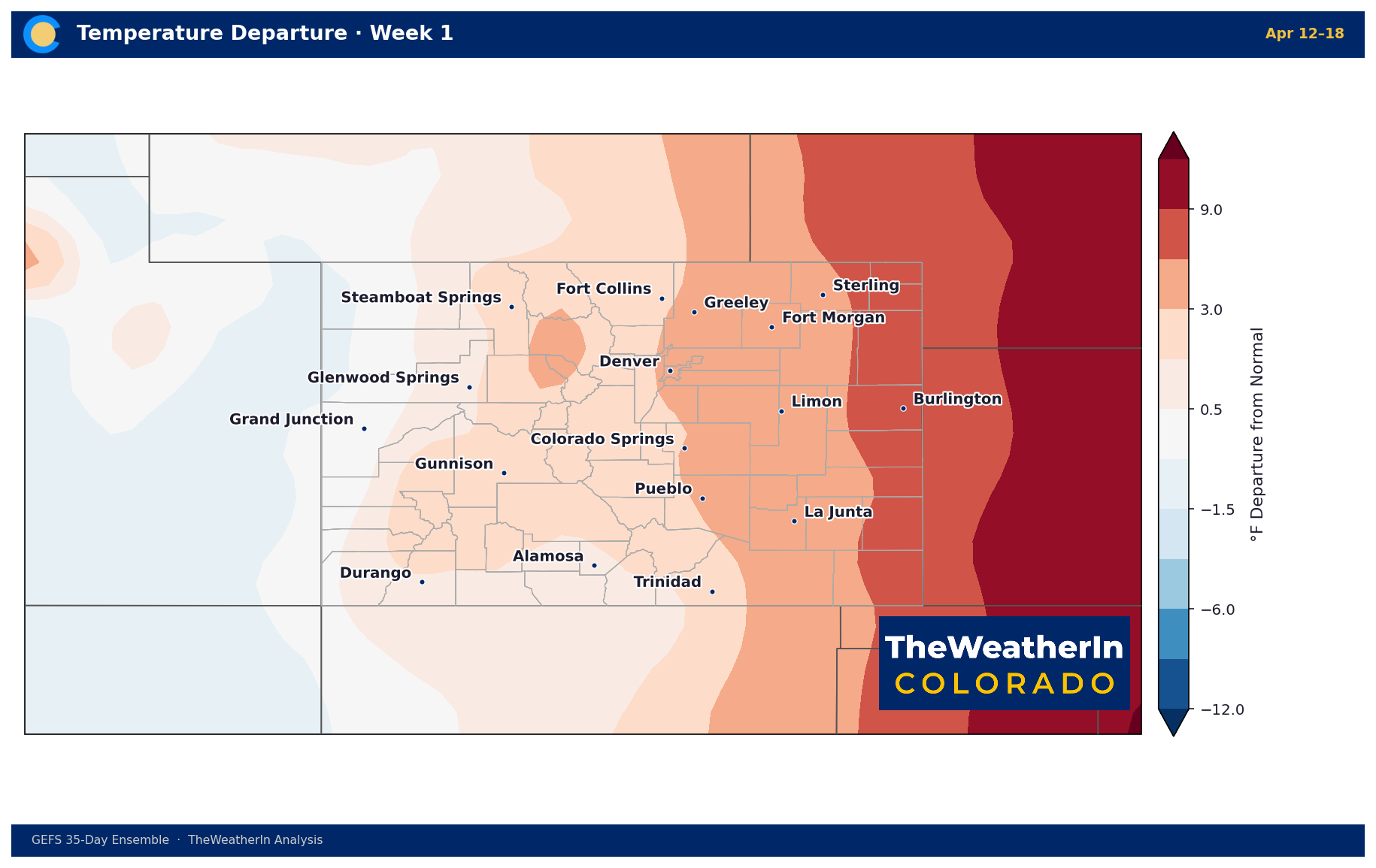
Week 1 features a pronounced warm anomaly across the eastern plains — departures of +6 to +9°F or greater near Burlington and the Kansas border. The Front Range runs +3 to +6°F above normal. The Western Slope is largely
near-normal with isolated warm pockets near Glenwood Springs.
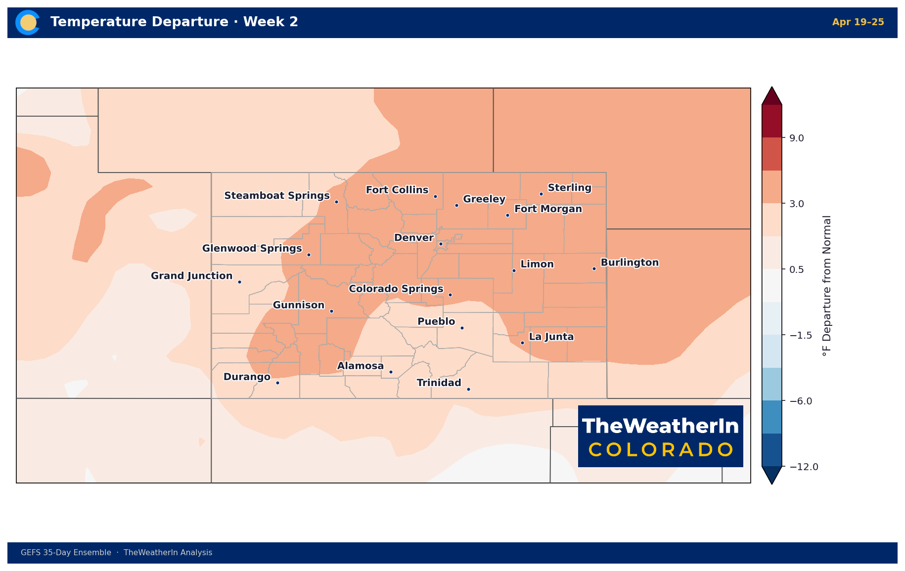
The warm pattern becomes more uniform statewide in Week 2. Eastern Colorado remains +3 to +6°F above normal, and the Western Slope picks up warmth as well. No meaningful cold signal anywhere in the state.
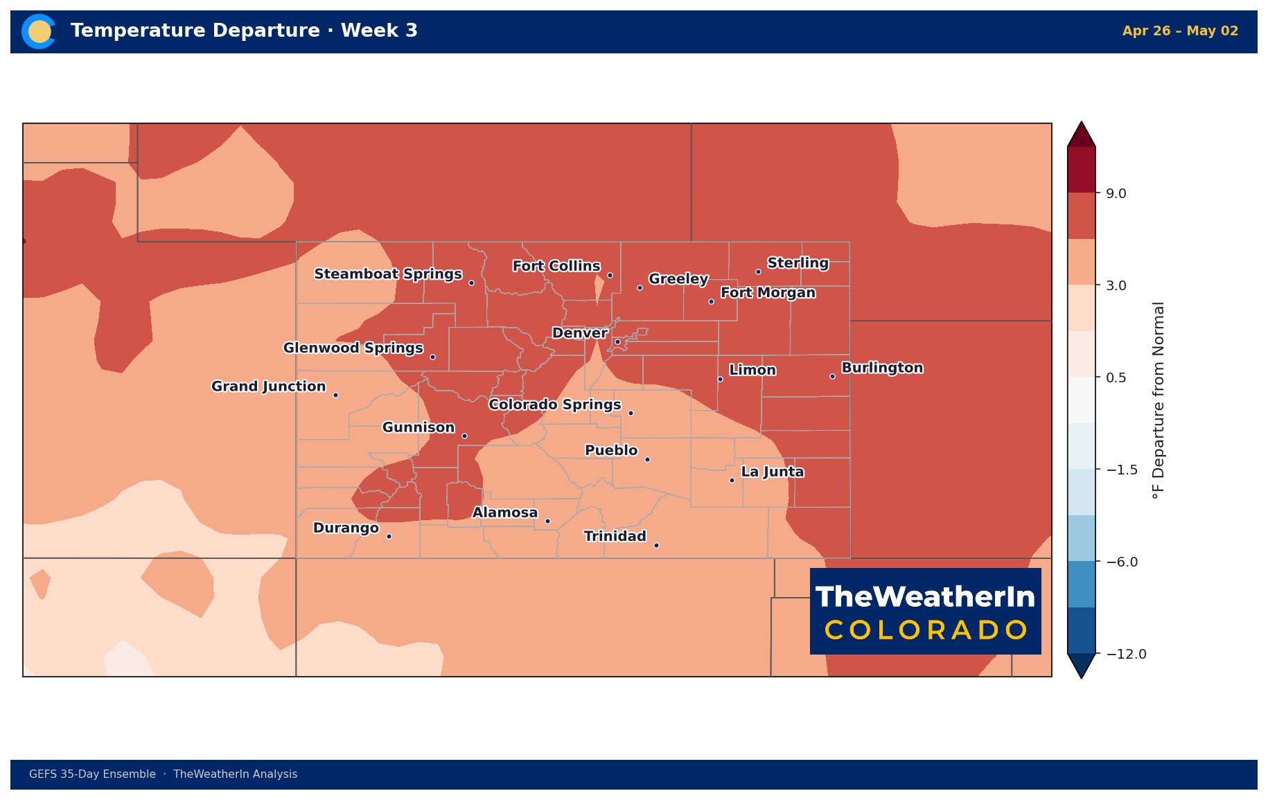
The strongest and broadest warm anomaly of the period occurs in Week 3. Most of the state sits +3 to +6°F above normal, with the eastern half pushing toward +6 to +9°F. This is an unusually persistent warm signal — confidence is moderate at this range but the pattern shows little sign of breaking.
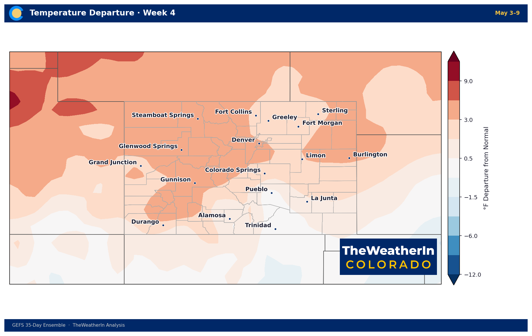
Warmth persists into early May across most of the state. The anomaly modulates slightly but remains above normal statewide. A small near-normal to cool signal appears in the northwest corner — the first hint of pattern change at the far edge of the forecast window.
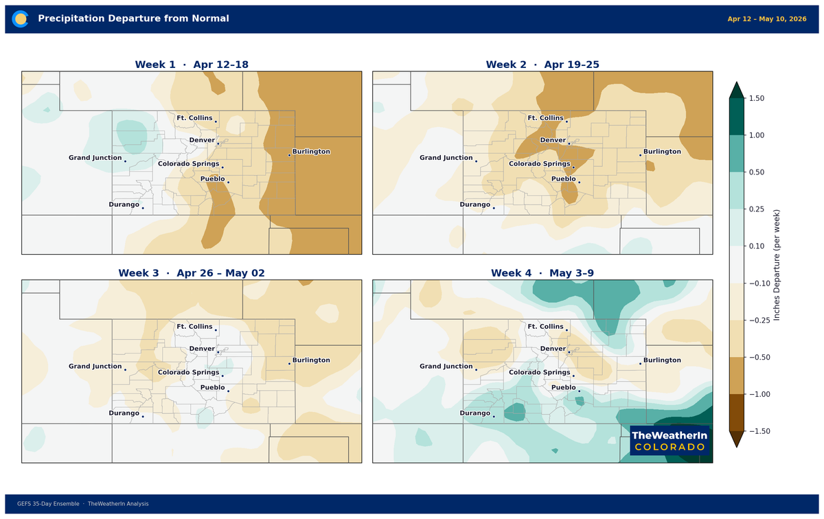
Precipitation: Weeks 1–4
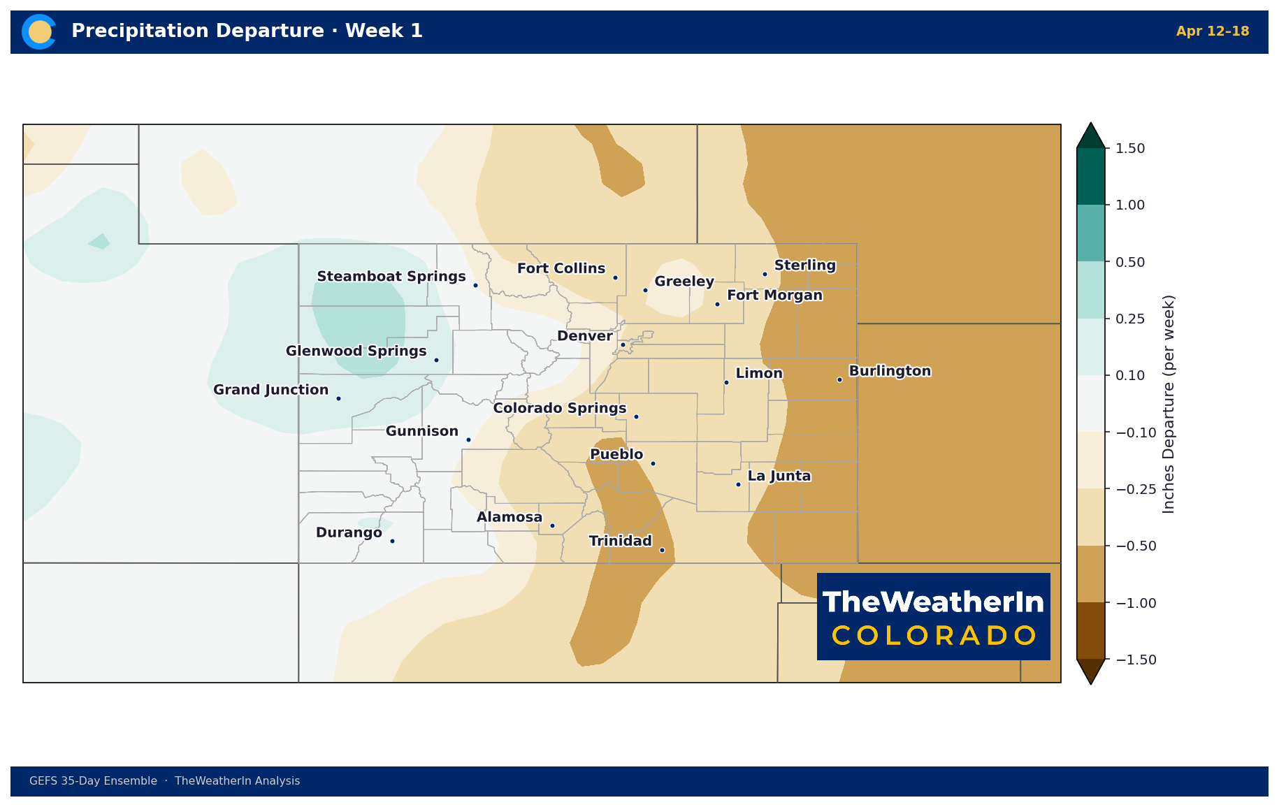
Week 1 is notably dry on the eastern plains — departures of -1.0 to -1.5 inches below normal near Burlington. Central Colorado is near-normal. The northwest corner (Steamboat/Routt County area) picks up modest moisture.
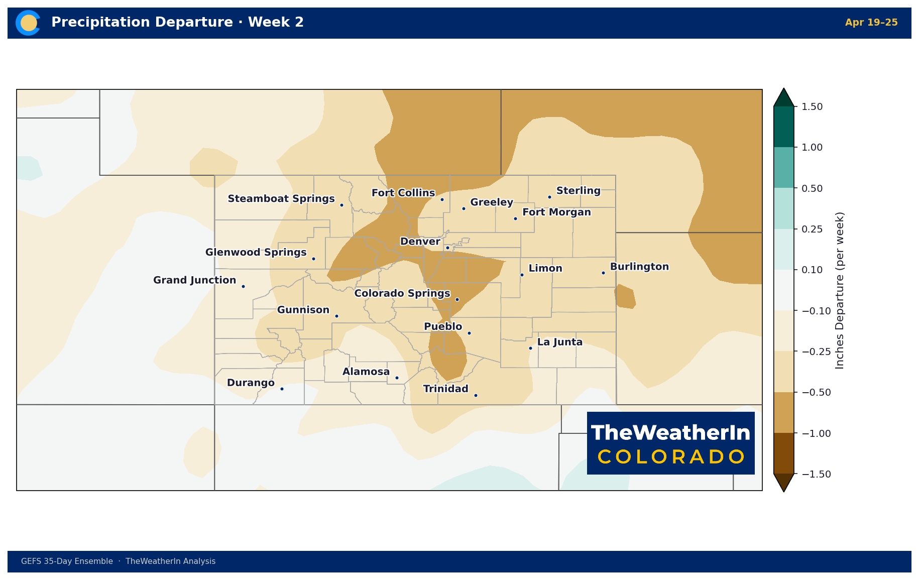
The dry signal expands through Week 2. Eastern and central Colorado run -0.25 to -1.0 inches below normal. A wet signal develops across northwestern Colorado. The southeastern corner stays dry.
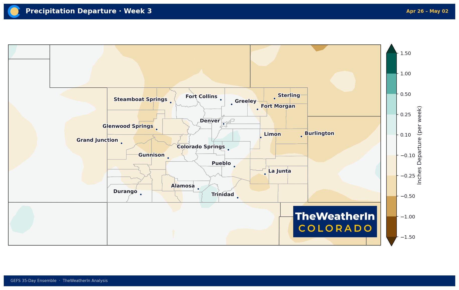
The precipitation pattern becomes more mixed and near-normal across most of the state. Dryness lingers in the southeast. No strong wet or dry signal dominates — this week is the transition.
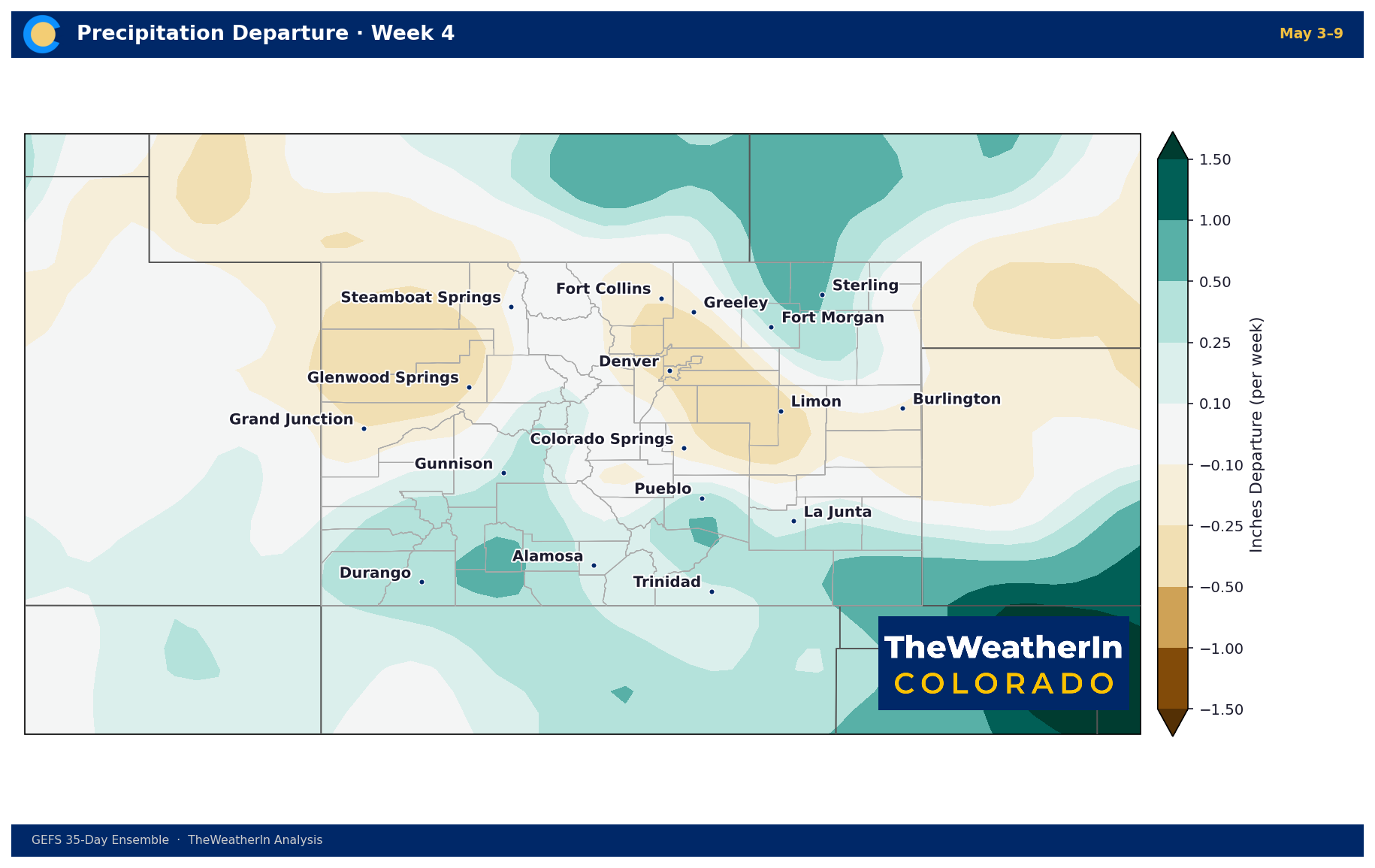
Moisture returns in Week 4. Central and eastern Colorado picks up +0.25 to +0.5 inches above normal, particularly from Denver south through Pueblo. The Western Slope also trends wetter. The southeastern corner remains the driest
part of the state.
Bottom Line
Colorado faces a warm, dry April — particularly for the eastern plains and Front Range where the combined temperature and precipitation signal raises early drought concerns heading into the critical spring moisture season. Rapid
snowmelt is likely with sustained above-normal temperatures statewide through late April. A wetter pattern may develop in early May, but confidence at that range is low.
Maps generated from the weekly ensemble. Confidence decreases beyond Week 2.