
Colorado Drought Update: Week of May 27, 2026
For the third straight week, Colorado's drought metrics improved at the margins — but 100% of the state remains in drought, and the long-game recovery depends on a winter story still months away.

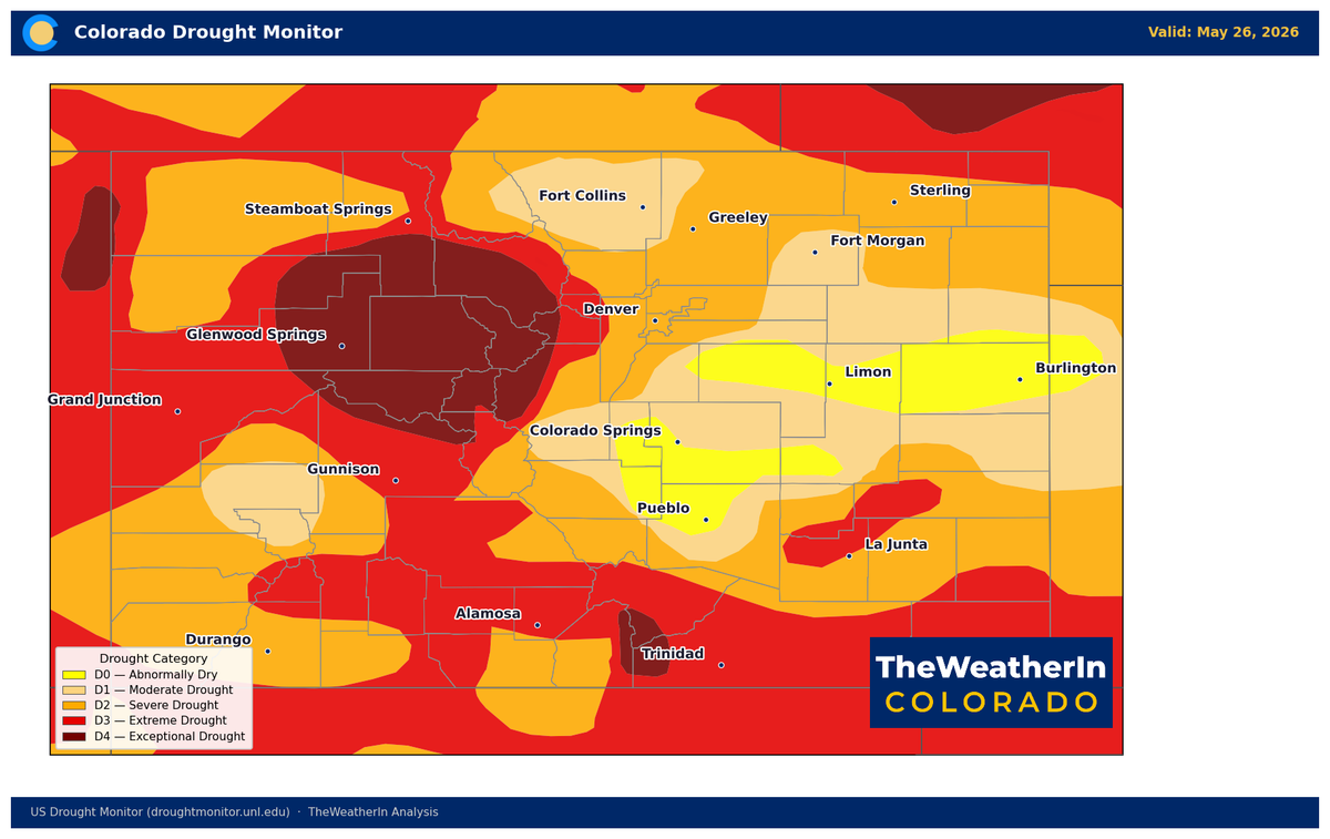
Three Weeks of Gradual Improvement — But Colorado's Drought Footprint Remains Historically Severe
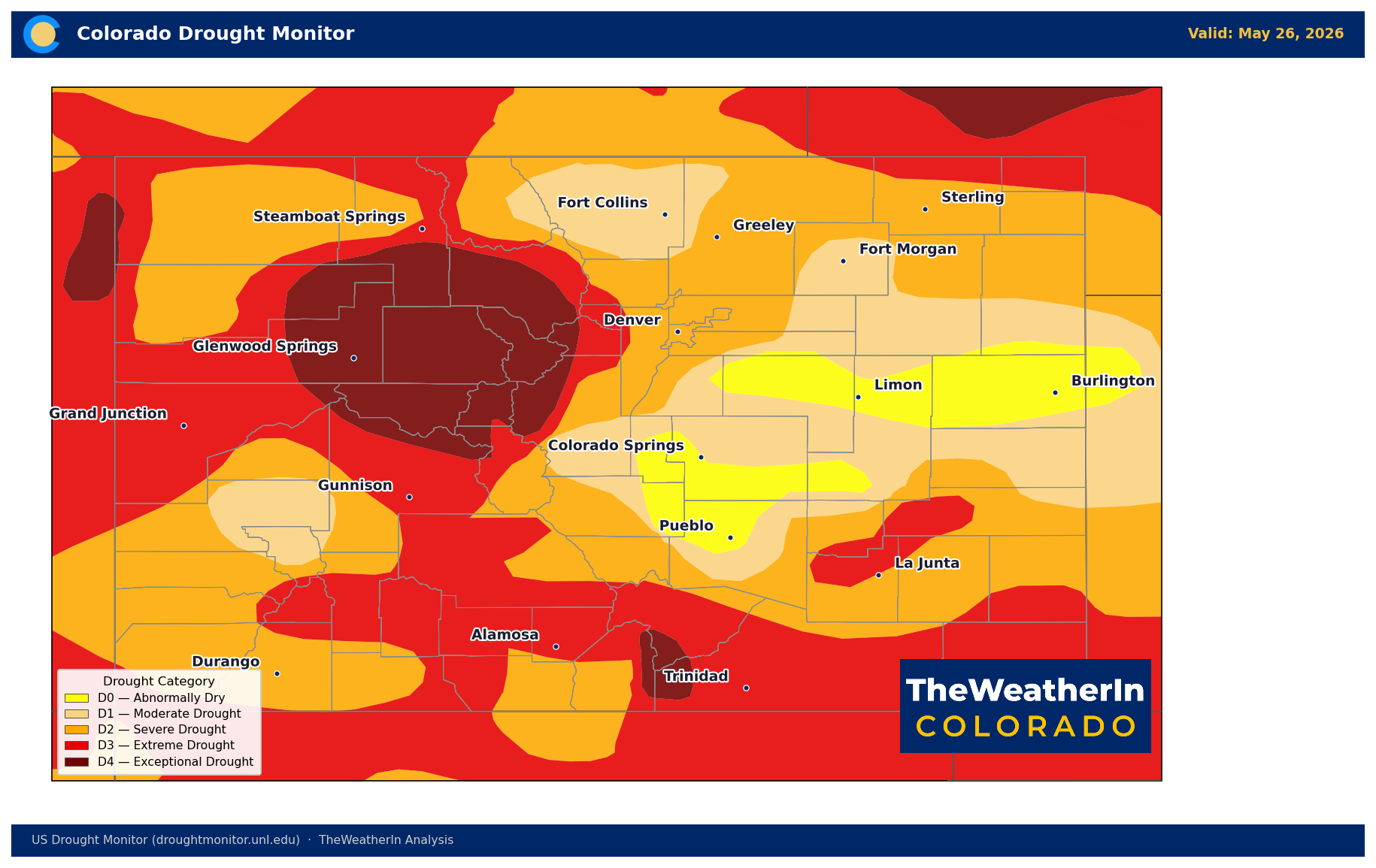
The U.S. Drought Monitor released its latest update this Thursday, and for the third consecutive week, Colorado's drought metrics improved at the margins. The worst categories are retreating — slowly. But with every county in the state still in drought and nearly half in extreme or exceptional conditions, this is a story about the pace of recovery, not the arrival of it.
The Drought Severity and Coverage Index — a composite score that weighs both area and intensity — dropped from 328 last week to 321 this week. That continues a gradual descent from a peak of 359 in mid-May. The improvement is real, but it needs context: a DSCI of 321 is still among the highest values recorded for Colorado in any May in the modern era. The ground is dry, the rivers are low, and the spring runoff window has already closed across most of the state.
The most notable shift this week came in the severe and extreme categories. The area of Colorado in extreme drought (D3 or worse) dropped from 42.9% to 40.2%. Exceptional drought (D4) — the most intense classification — held steady at 9.5% for a second consecutive week, with no expansion and no improvement. That 9.5% is concentrated in the southeastern and south-central portions of the state, where rainfall deficits have been most acute since last fall.
| Drought Category | This Week | Last Week | One Year Ago |
|---|---|---|---|
| Abnormally Dry or Worse (D0+) | 100% | 100% | 66% |
| Moderate Drought or Worse (D1+) | 93.6% | 96.2% | 49.3% |
| Severe Drought or Worse (D2+) | 77.7% | 79.3% | 25.4% |
| Extreme Drought or Worse (D3+) | 40.2% | 42.9% | 6.2% |
| Exceptional Drought (D4) | 9.5% | 9.5% | 0% |
The year-over-year numbers tell the bigger story. A year ago, 34% of Colorado was drought-free. Today, that number is zero. The area in extreme drought has grown from 6% to 40%; exceptional drought was absent entirely one year ago and now covers nearly a tenth of the state. This drought didn't develop gradually — it accelerated through a historically warm and dry winter and spring that has no modern parallel in Colorado's records.
What's Ahead: A Long-Game Recovery
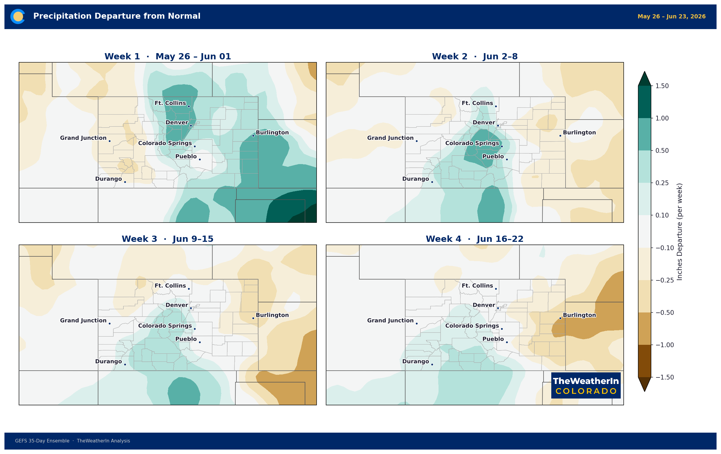
The gradual easing of the worst drought categories reflects some beneficial rainfall in recent weeks, particularly in central and northern Colorado. That's a positive signal. But the water supply math for 2026 doesn't change: the mountain snowpack failed at a historic scale this spring, the runoff window has closed, and reservoirs are drawing down with no meaningful replenishment coming from the mountains. Beneficial summer rainfall can stabilize drought conditions or improve pasture quality — it cannot replace what the snowpack didn't deliver. Expected moisture trends for the next four weeks are shown here:
The longer-range picture continues to show promise. The latest tropical Pacific data now points toward a moderate-to-strong El Niño developing through summer and persisting into winter 2026–27. That's a more confident and more bullish outlook than what was in place just a few months ago — for the first time, a combined two-in-three chance of strong or stronger conditions is now on the table for this coming winter. Historically, that pattern brings above-normal precipitation to the southern Rockies, particularly from October through March. That's the scenario that puts a meaningful dent in this drought — but it's a winter story, not a summer one.
For now, all eyes turn to the Colorado monsoon. Typical monsoon moisture begins arriving in the southern half of the state in July. Whether it arrives on schedule, how far north it penetrates, and how consistent it is will determine how much ground the drought loses — or gains — before fall arrives.
Agricultural and Water Supply Implications
- Irrigation users: Statewide May–July streamflow forecasts are running at roughly 24% of a normal year's volume. That number doesn't improve with rainfall — it reflects the snowmelt that didn't happen. Water allocation stress is locked in for the growing season.
- Pasture and rangeland: Soil moisture deficits across the Eastern Plains and San Luis Valley remain deep. Producers managing grazing pressure now — before summer heat arrives — are ahead of the problem. Forage recovery is possible with adequate summer rain but is not guaranteed.
- Fire weather: Exceptional drought in the southeast combined with upcoming summer heat means fire weather risk remains elevated through June. Any dry, windy stretch warrants attention.
The next Drought Monitor update releases Thursday, June 4. The key variable between now and then: whether the active weather pattern that provided recent beneficial rains maintains, or gives way to the dry summer regime that climatology favors for much of June.



