Colorado Drought Update: Conditions Worsen Again in Early August
The latest Drought Monitor shows Colorado's drought footprint expanding again after a brief late-July improvement -- 99% of the state is now abnormally dry or worse.

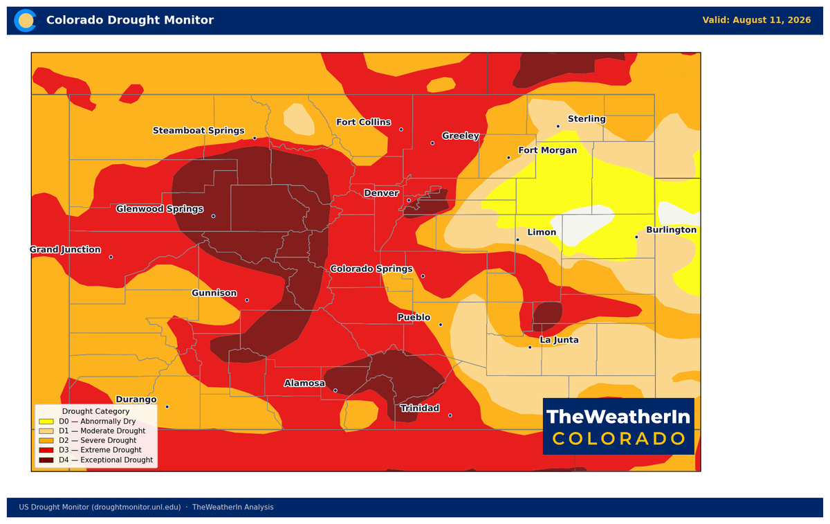
The brief bright spot from late July didn't last. This week's Drought Monitor shows Colorado's drought footprint expanding again, reversing the small improvement that had opened up on the northeast Plains at the end of last month. To know: the drought monitor updates weekly on Tuesdays when it gathers all data from the past week. Then it is processed and released on Thursdays, meaning the heavy rainfall along the Front Range during the weekend will not show up until this week's release.
Where Things Stand
As of August 11, 99.17% of Colorado is abnormally dry or worse, up from 97.29% a week earlier, and just 0.83% of the state remains entirely drought-free. Moderate drought or deeper now covers 93.06% of the state, extreme-to-exceptional drought covers 49.45%, and exceptional drought (the most severe category) covers 14.10%. The statewide Drought Severity and Coverage Index climbed to 336, the highest reading since early May and more than double where the state stood a year ago.
| Comparison | D0-D4 (Abnormal+) | D1-D4 (Moderate+) | D3-D4 (Extreme+) | D4 (Exceptional) | DSCI |
|---|---|---|---|---|---|
| Current (8/11/26) | 99.17% | 93.06% | 49.45% | 14.10% | 336 |
| 1 Week Ago (8/4/26) | 97.29% | 90.95% | 47.10% | 13.48% | 327 |
| 3 Months Ago (5/12/26) | 100.00% | 96.23% | 46.52% | 14.80% | 340 |
| 1 Year Ago (8/12/25) | 62.13% | 47.28% | 20.30% | 7.05% | 177 |
What Reversed the Improvement
Late July had offered the year's first real bright spot: a pocket of the northeast Plains fully exited drought after the North American Monsoon delivered its first real moisture of the season, and the statewide DSCI had eased from its early-summer peak. That improvement didn't hold. Every major category moved the wrong direction over the past week, and the DSCI is now back within a few points of the summer's worst reading (340 in early May). The monsoon's moisture delivery has stayed uneven all season, heavy where it lands, largely absent elsewhere, and this week's numbers reflect another stretch where the dry areas outpaced the wet ones.
Why It Matters
This isn't an isolated dry week; it's the latest data point in a drought that traces directly back to Colorado's warmest winter and spring on record, followed by the lowest snowpack in the 90-plus-year observational record. Streamflow across nearly every major Colorado river remains at or near all-time record lows for this point in the year, and reservoir operators are drawing down 2025 carryover storage with no meaningful replenishment on the horizon from this year's runoff. Fire weather remains an active concern statewide as fuels stay critically dry heading toward the tail end of fire season.
Agricultural & Water Supply Implications
- Dryland producers on the Eastern Plains and in the San Luis Valley should expect continued below-normal soil moisture heading into fall planting decisions.
- Irrigators reliant on reservoir storage face an increasingly tight margin as carryover supplies draw down further with no meaningful replenishment forecast.
- Livestock producers should continue planning around reduced native forage productivity; drought-stressed rangeland conditions show no signs of near-term improvement.
The Long-Range Signal to Watch
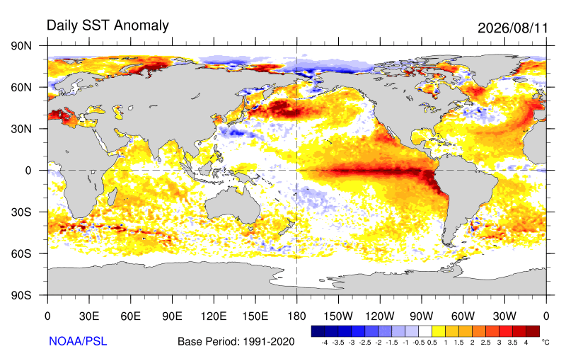
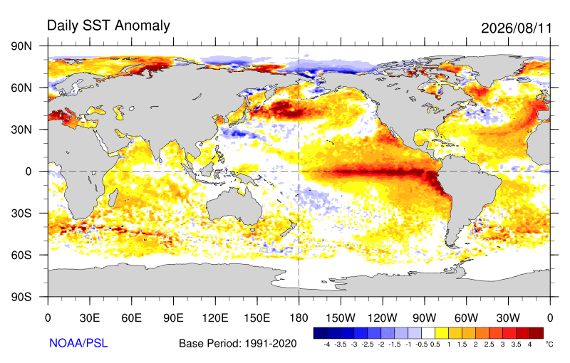
The one genuine reason for optimism sits a couple of months out, not in this week's numbers. NOAA's latest outlook, released this same week, raised the odds of a very strong (potentially record-strength) El Niño event this fall and winter, a pattern that historically favors above-normal precipitation for the southern Rockies. That's definitely worth watching heading into the cold season; however, it changes nothing about where Colorado stands today. See this week's ENSO update for the full picture on timing and what it would take to move the needle on a drought this deep.
 The Weather In Colorado