Pattern Shift Coming But the Drought Isn't Going Anywhere
Storms and a welcome cool-down arrive this weekend. The bigger story? What a potentially record-setting El Niño means for Colorado's drought this winter.

A pattern shift is coming, but the drought isn't going anywhere yet
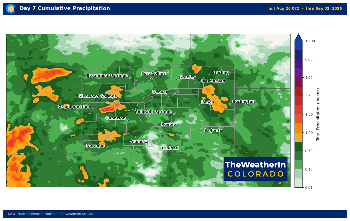
A meaningful cool-down and surge of moisture arrive this weekend; the first real break from the heat that has gripped Colorado for two months. But a pattern shift in late August doesn't rewrite a drought that now covers 97% of the state, and the longer story heading into fall is still about how deep a hole Colorado is in and whether a potentially record-setting El Niño can start filling it this winter.
Pattern Overview
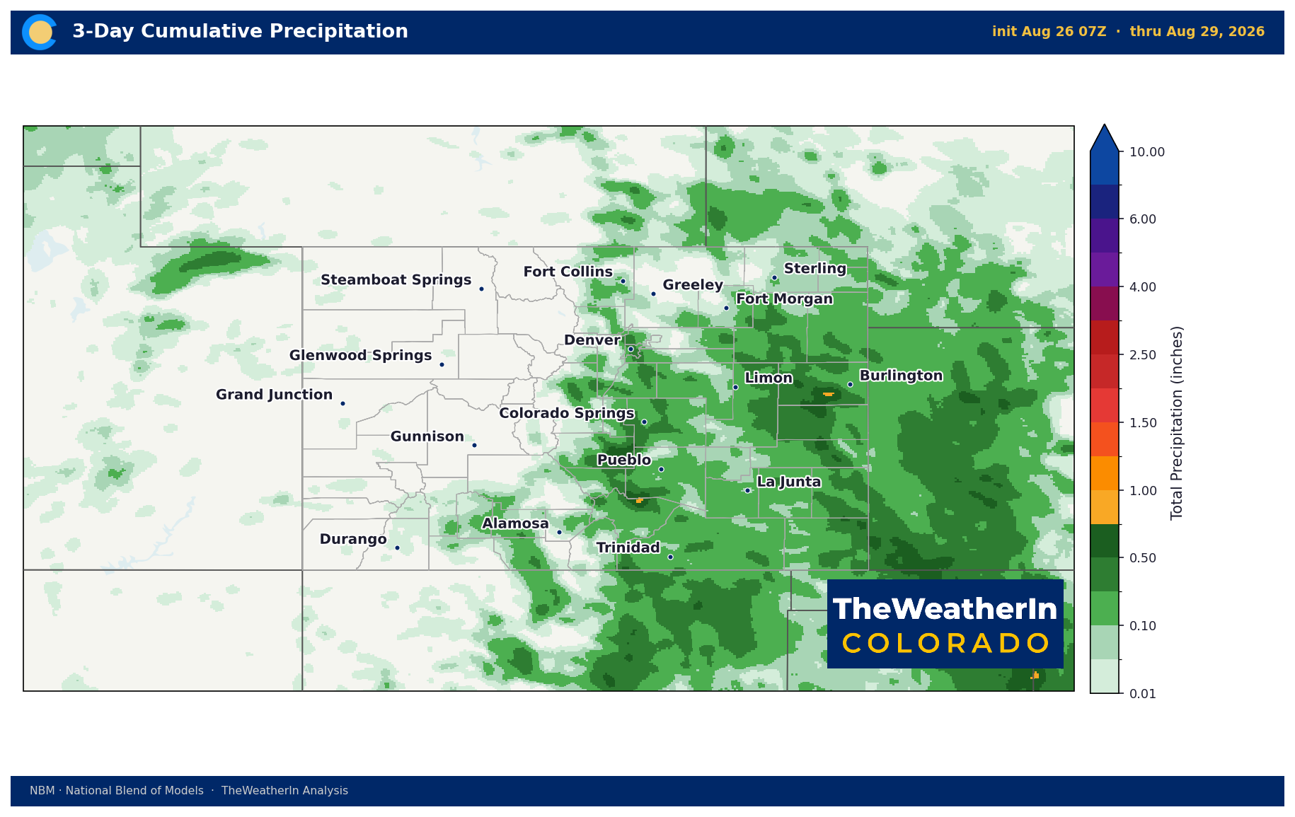
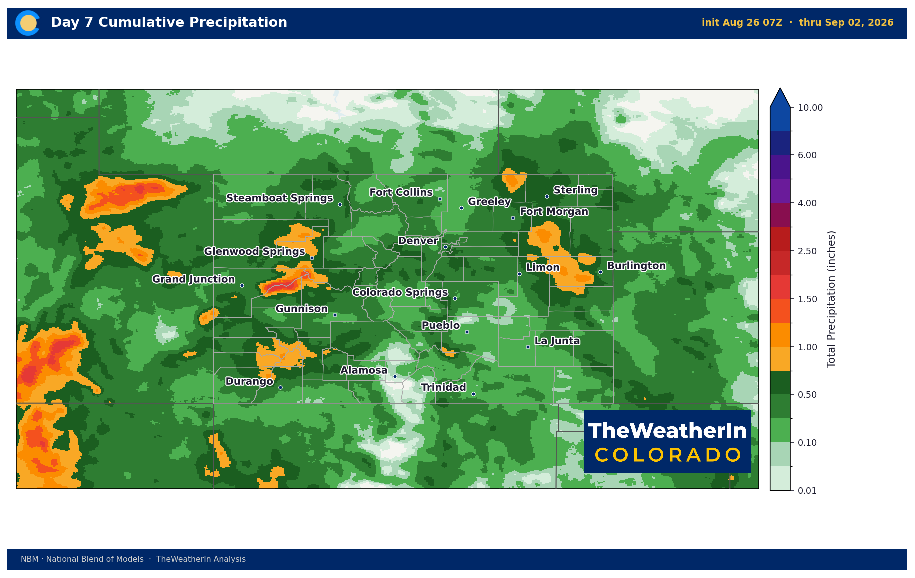
The setup for the next several days is classic late-monsoon Colorado: recycled moisture, a weak disturbance moving through the flow, and daily afternoon thunderstorm chances statewide. That's the near-term. The bigger development is a Pacific trough digging southeastward late this week, arriving Saturday and driving a noticeable pattern change into early September: cooler temperatures, more moisture, and more widespread storm coverage replacing the persistent high-pressure ridge that has dominated since late June.
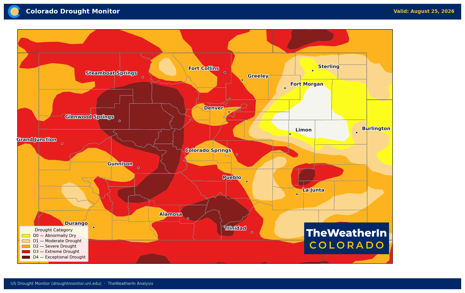
The reason this matters beyond just a cooler weekend: the ridge that drove Colorado's brutal summer is the downstream consequence of the same atmospheric setup that produced the record-warm, record-dry winter of 2025–26. That pattern built the drought. A weakening of that ridge (even temporarily) is a meaningful signal. But one wet week does not move the needle on a drought where 93% of the state sits in moderate drought or worse, and exceptional drought (the most severe category) covers 14% of Colorado's land area.
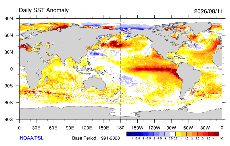
Looking further out, the large-scale driver that most influences Colorado's drought recovery is El Niño; now confirmed, strengthening fast, and tracking toward what could be the strongest event ever recorded. Forecasts currently place a 69% chance on a "historic" event this fall, one that would exceed the strength of every El Niño since 1950, including the famous 1997–98 and 2015–16 events. That matters for Colorado because strong El Niño winters historically deliver above-normal precipitation to the southern Rockies. But that story belongs to November through March. For now, the summer pattern is being driven by other factors: the monsoon, mid-latitude flow, and local convection.
Weeks Ahead: 2–4 Week Outlook
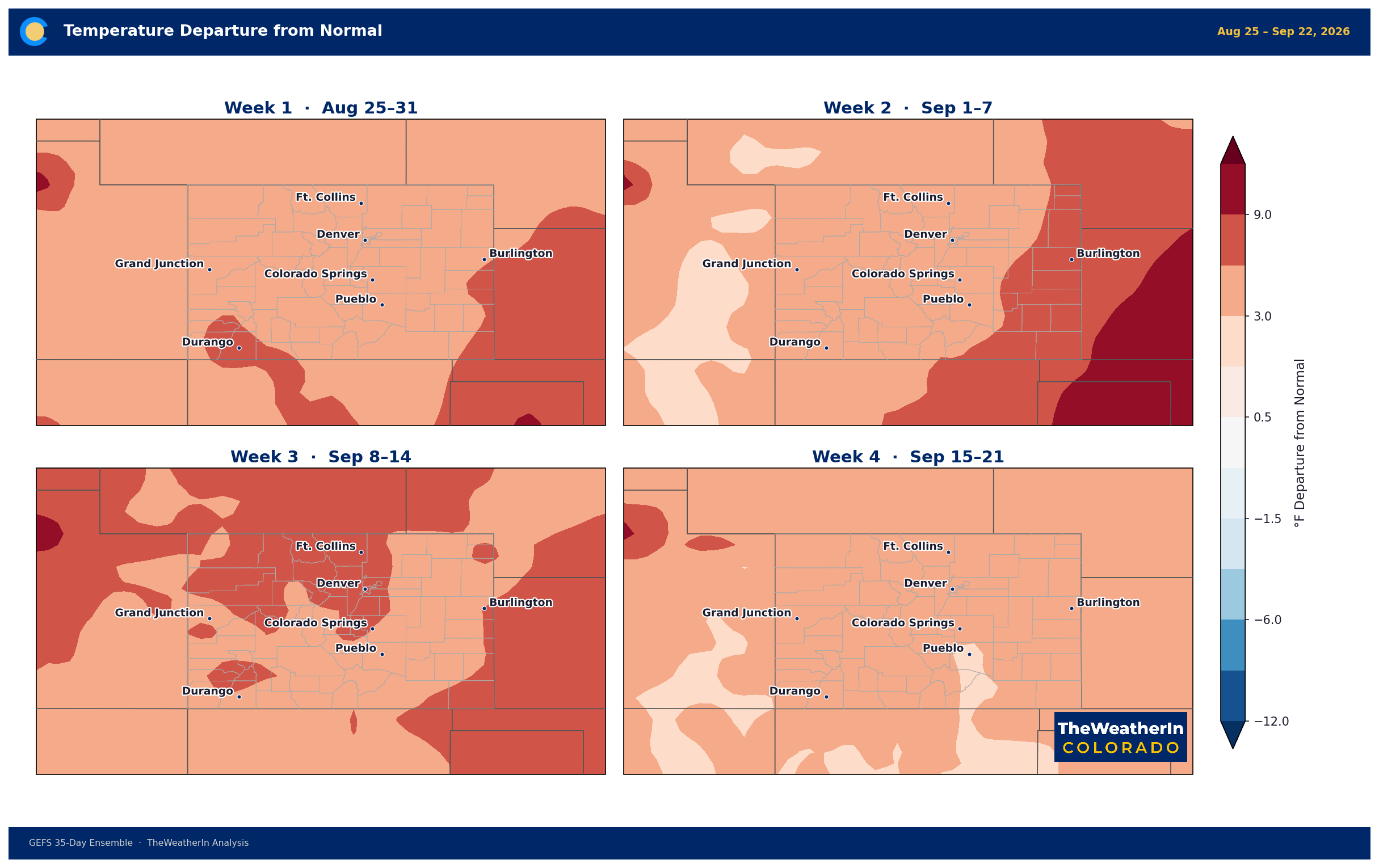
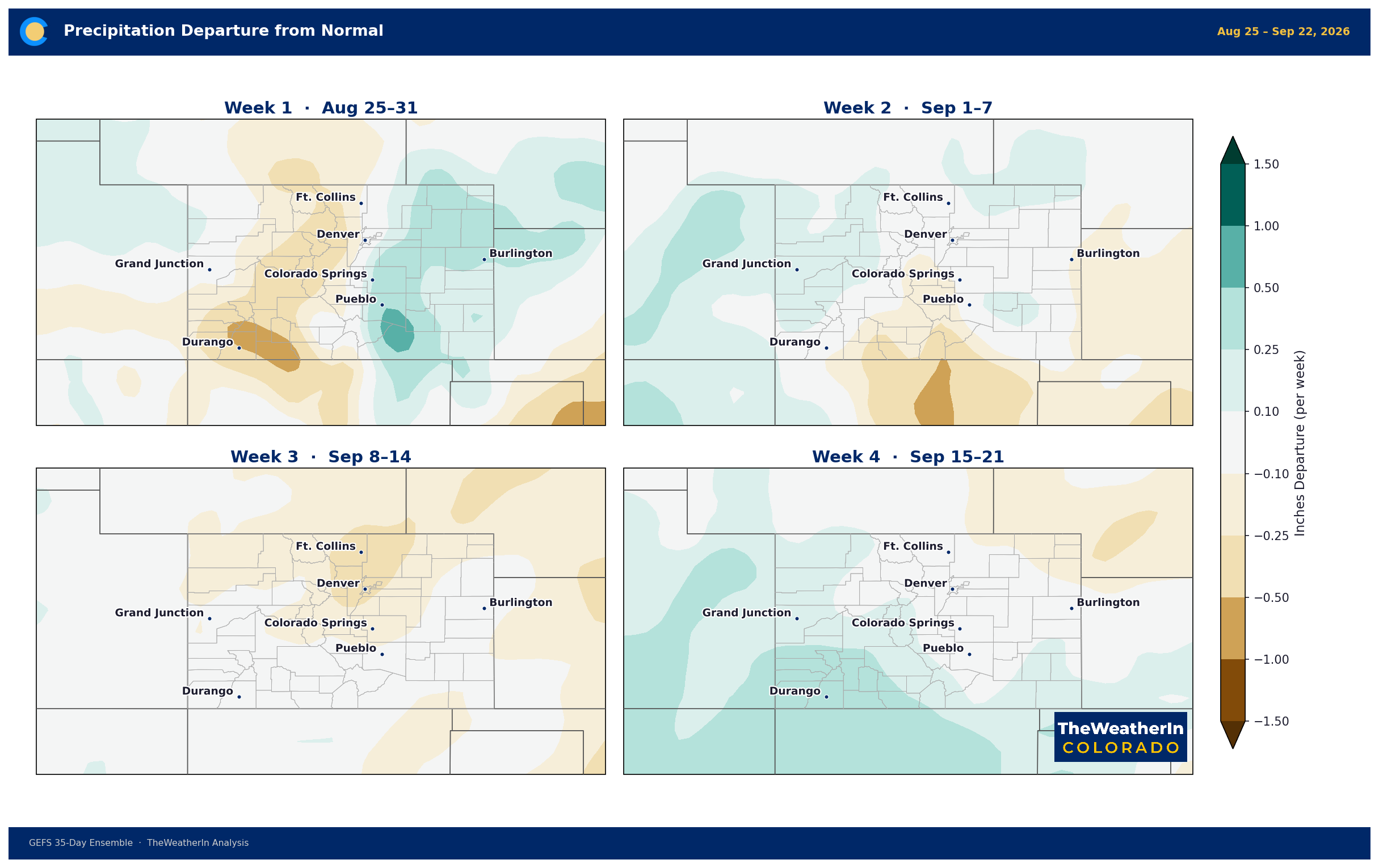
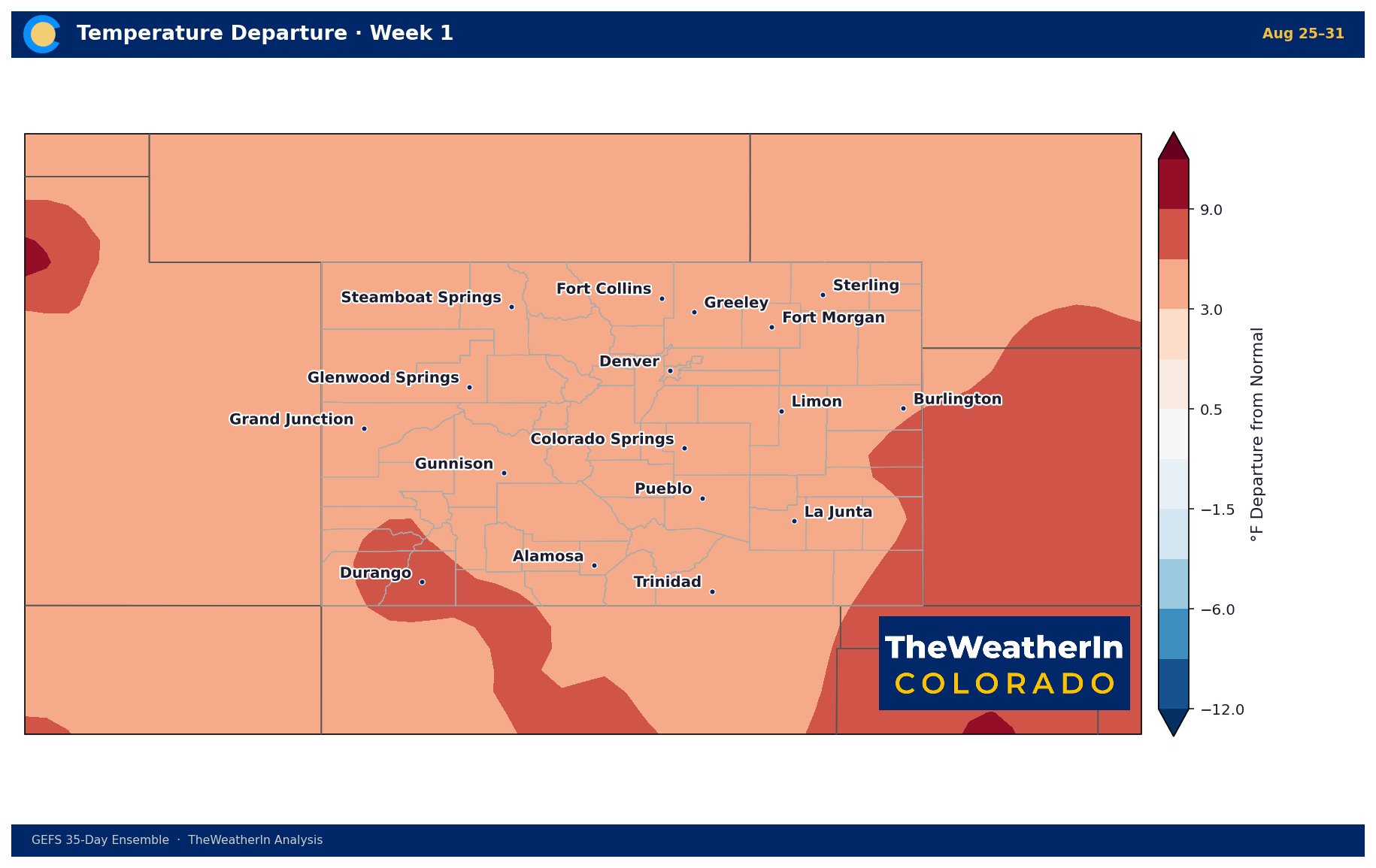
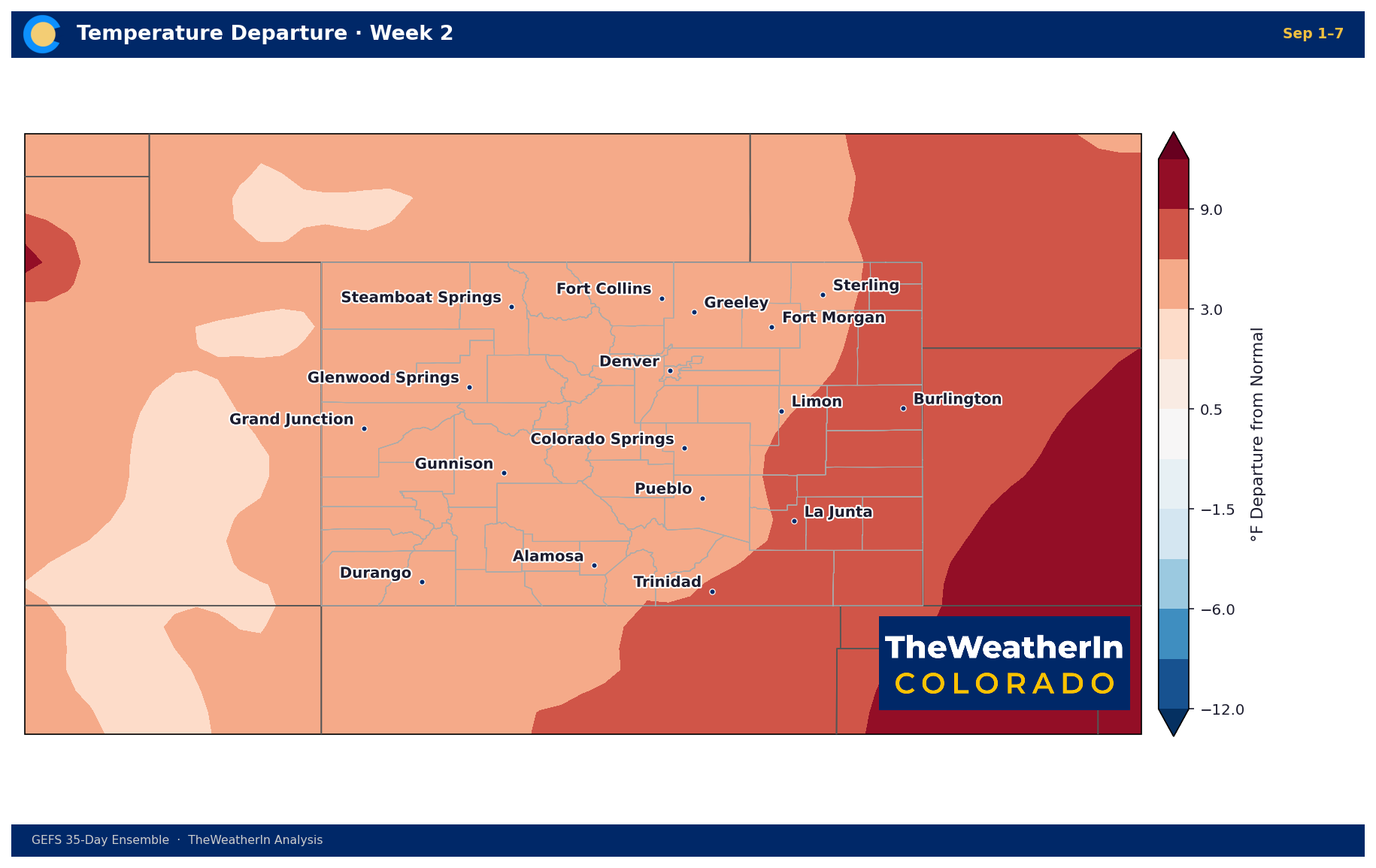
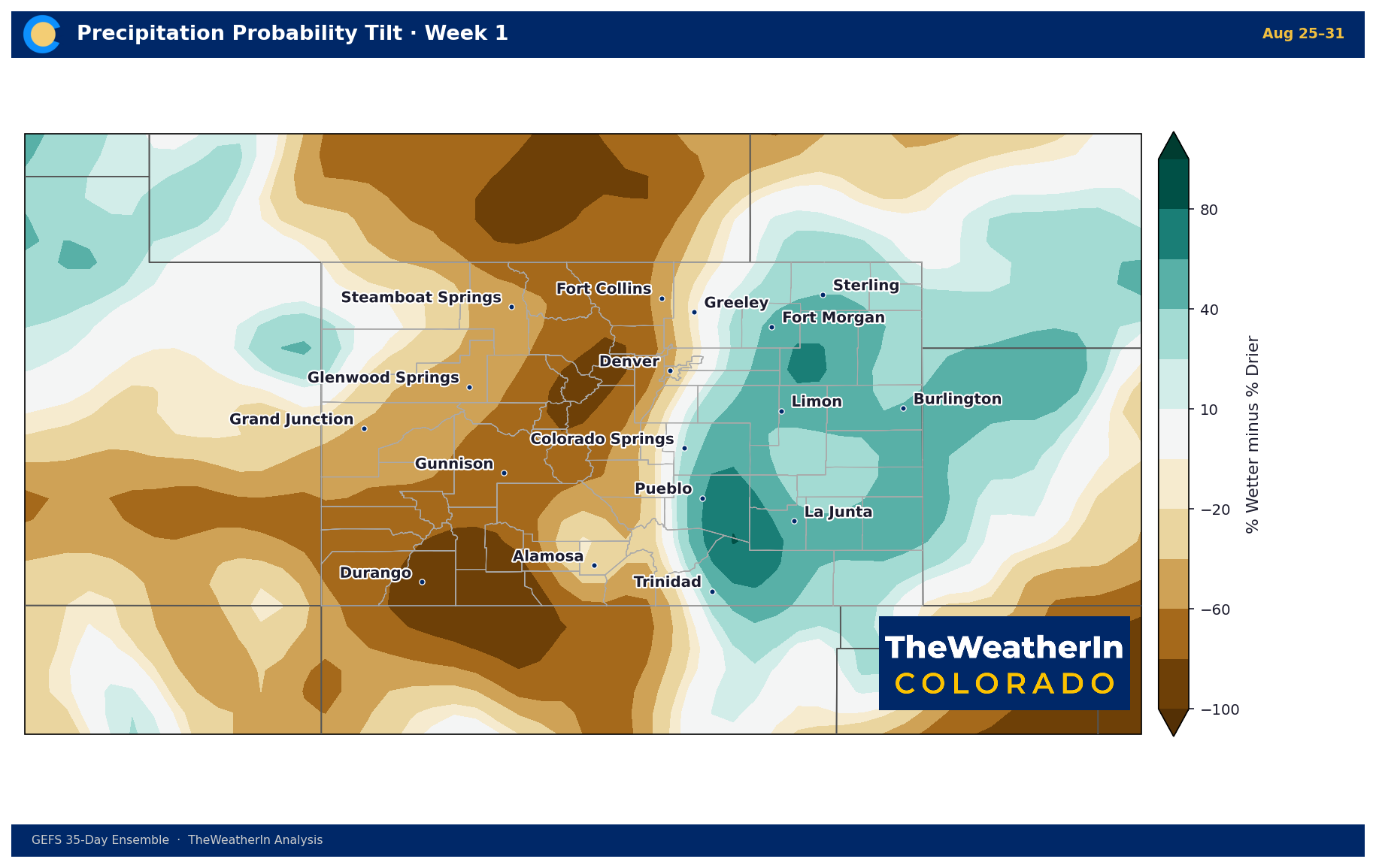
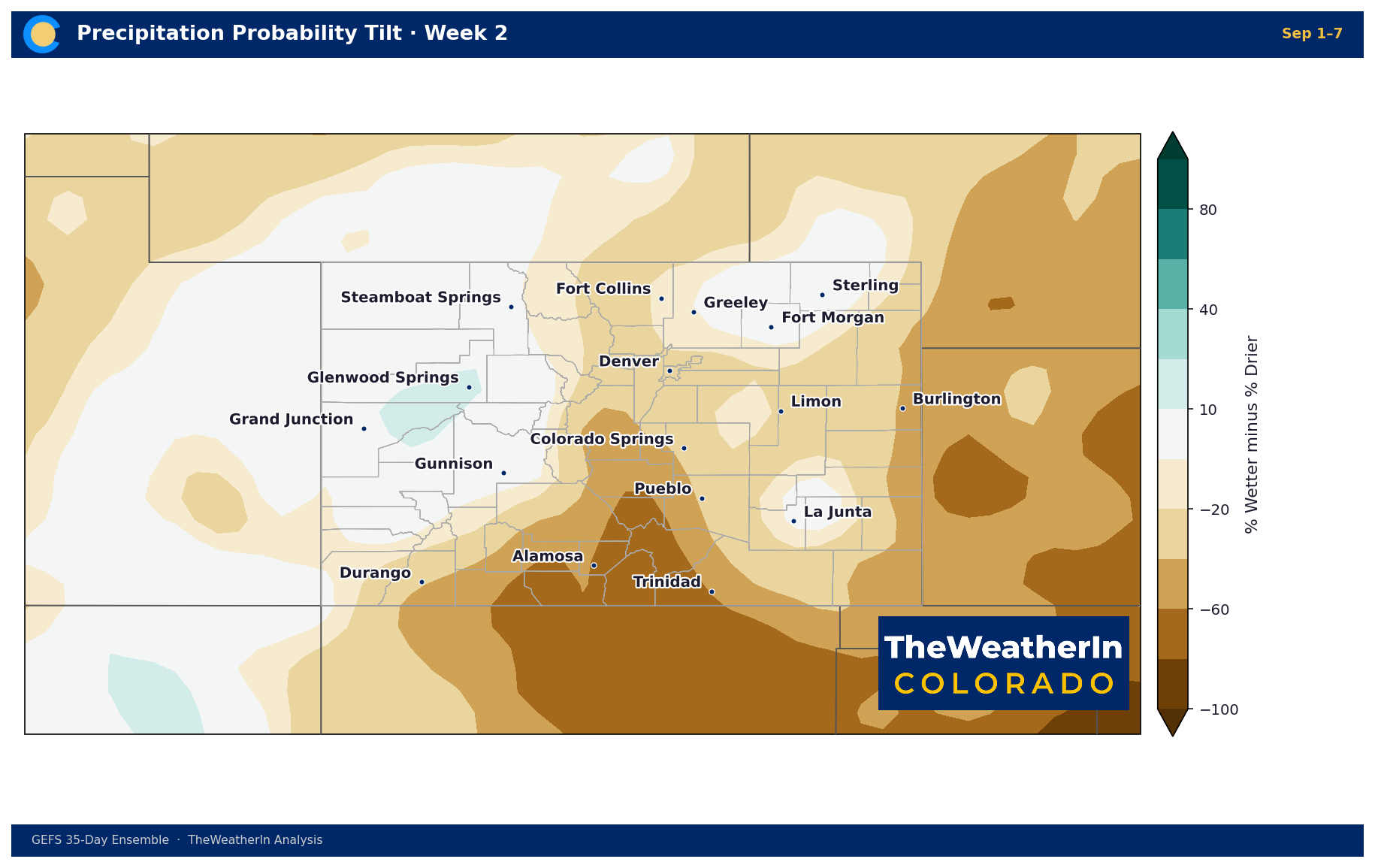
The pattern change arriving this weekend is expected to persist into early September, keeping temperatures near or slightly below seasonal normal and maintaining regular thunderstorm chances, a sharp contrast to the heat and dryness of July and early August. Forecast data through weeks two and three show a continued lean toward below-normal temperatures across the Rockies and Intermountain West, with precipitation trending near to above normal - consistent with a late-summer pattern that no longer has a dominant western ridge calling the shots. By week four, the signal becomes less certain, but the extreme heat that characterized June and July is not expected to return in force. The more important longer-range watch: how quickly El Niño's influence begins to be felt in the early-winter storm track, and whether October and November precipitation (historically hit-or-miss under El Niño) can begin to lay the groundwork for drought recovery before the core of the wet season arrives.
Regional Breakdown — Week Ahead
| Region | Temperature | Precipitation | Highlights |
|---|---|---|---|
| Front Range / Foothills | Above normal Wed–Fri; near normal by weekend | Near to above normal | Scattered severe storms Wed–Thu (hail, gusty winds); cooler and wetter Sat–Mon with pattern change; low-to-mid 80s by Sunday |
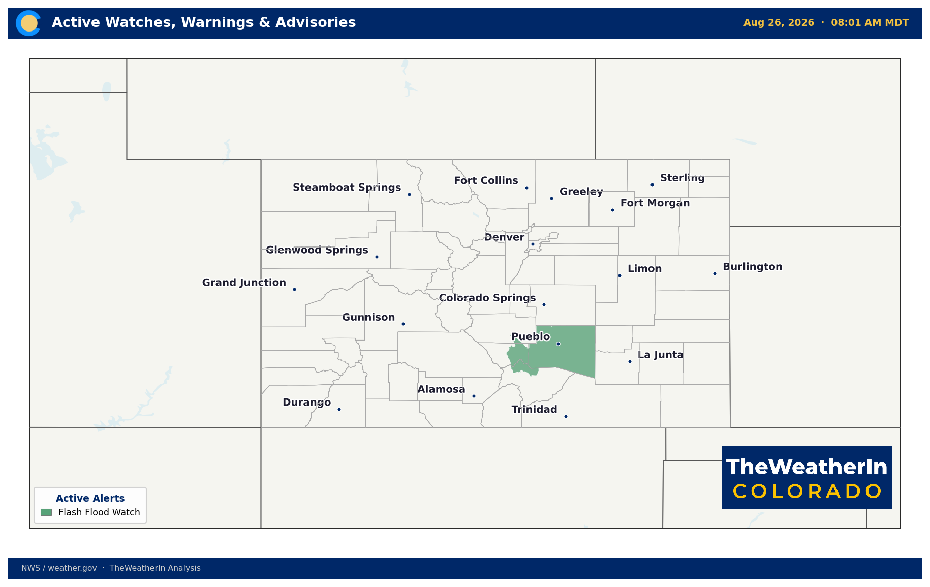
| Mountains / High Country | +5–10°F above normal through Fri; near/slightly below normal weekend | Near to above normal | Daily afternoon storms through Friday; brief drier window Friday afternoon with gusty winds; more widespread storms Sat–Mon; burn-scar flash flood risk continues through Thu |
| Western Slope | +5–10°F above normal through Fri; near/slightly below normal weekend | Above normal Sat–Mon | Isolated afternoon convection through Friday; robust pattern change Sat–Mon with heaviest moisture of the period (moisture anomalies 160–180% of normal); debris-flow risk over burn scars |
| Eastern Plains | Near normal | Variable — below normal Wed–Fri, above normal weekend | Severe storm cluster possible east of I-25 Wednesday evening (hail, damaging wind); mostly dry Thu–Fri; elevated fire weather Friday afternoon; wetter and cooler Sun–Mon |
| Southern CO / San Luis Valley | Near to slightly below normal | Above normal | Flash flood threat over Aspen Acres and other burn scars continues through Thursday; drier Friday with isolated mountain storms; wetter and cooler Sat–Tue; widespread activity likely |
Drought & Water
As of August 18, 2026, the most recent U.S. Drought Monitor release, 97.2% of Colorado remains in at least abnormal dryness, with 90.78% in moderate drought or worse. Extreme-to-exceptional drought (the two most severe categories) covers 49.3% of the state; exceptional drought alone covers 13.68% of Colorado's land area. The Drought Severity and Coverage Index stands at 328, more than double its value a year ago. The most recent prior data point (August 11) showed conditions slightly worse, with 99.17% of the state in at least abnormal dryness and a DSCI of 336, suggesting the ongoing thunderstorm activity may be providing at least marginal localized relief, though the statewide drought footprint remains among the worst on record.
The pattern change arriving this weekend will bring the most widespread moisture the state has seen since the monsoon's spotty July delivery, and cooler temperatures will slow evaporation and reduce stress on irrigated fields. That is real, near-term relief for producers and water managers. What it doesn't change: streamflow across nearly every major Colorado river remains at or near all-time record lows. The Arkansas, Colorado, Gunnison, Yampa, and Rio Grande are all running below the 5th percentile, many at record or near-record low flows for this point in the year. The snowpack that should have replenished them never materialized. This weekend's rain fills soil pores and reduces irrigation demand; it doesn't refill rivers running on fumes from a snowpack that peaked at just 20% of normal in May.
The drought's trajectory from here depends on what happens this fall and winter. A potentially record-setting El Niño raises the odds of above-normal precipitation across the southern Rockies from November through March; the window when mountain snowpack is built, and Colorado's water supply is determined. That's the drought-recovery story. It hasn't started yet.
Agricultural Implications
- Burn-scar flash flood risk through Thursday — the Aspen Acres, Ferris, and other active burn scars remain highly susceptible to flash flooding and debris flows from any heavy-rain-producing thunderstorm; producers with fields, roads, or stock infrastructure near these scars should monitor conditions closely through Thursday evening.
- Brief fire-weather window Friday — a temporary drying trend Friday afternoon will push relative humidity into the teens and teens-to-low-20s range across mountain and foothill terrain, with gusty winds; fuel moisture remains critically low statewide after months of drought and heat, so even a brief drying window carries meaningful fire risk for anyone working near cured fuels on the Eastern Plains, southern mountains, or San Luis Valley.
- Weekend pattern change brings mixed news for fieldwork — cooler temperatures and more widespread rainfall Saturday through Monday will reduce irrigation demand and ease heat stress on late-season crops, but repeated showers and storms may complicate harvest operations and fieldwork; streamflow remains critically low despite the moisture boost, so water-supply constraints on irrigation are not meaningfully eased by one wet week.
Fire Weather
No critical fire weather conditions are expected through the weekend: daily thunderstorm activity and returning moisture keep relative humidity elevated and limit the combination of heat, wind, and dryness required for critical fire behavior. The exception is Friday afternoon and evening, when a brief drying window produces relative humidity in the teens and gusty upslope winds on the mountains (gusts to 20–30 mph); this is a localized elevated fire-weather window, not a widespread critical event, but it warrants attention given how dry fuels remain statewide after 14 consecutive months of above-normal temperatures and a historically failed snowpack. The more persistent concern through Thursday is burn-scar flash flooding; the Aspen Acres scar (Pueblo/Custer counties, 101,964 acres) and the Ferris scar (Montezuma/Dolores counties, 64,881 acres) both remain active flash-flood threats when any storm produces locally heavy rainfall. Lightning and gusty, erratic outflow winds from any storm remain hazards for those working outdoors or near fire-prone terrain.
Bottom Line
The signal worth watching this fall: whether a potentially record-setting El Niño begins bending the winter storm track toward the southern Rockies early enough, and strongly enough, to meaningfully chip away at a drought that has now consumed the better part of two years of Colorado's water supply.