
Colorado's Monsoon Outlook: A Slow Start Gives Way to a Wetter August and September
July opens dry and warm across Colorado, but the forecast data shows a real shift by late summer — here's what the monsoon signal looks like month by month, and who benefits most.


Colorado's summer monsoon is arriving late this year — and for a state fighting its worst drought in decades, that's not a small detail. The good news is that the forecast data doesn't stay dry all season. It shows a real turn by August, with September looking like the wettest month of the stretch. The pattern just isn't ready to deliver yet.
The monsoon works the same way most summers: moisture rides up out of the Gulf and the eastern Pacific, and once the right upper-level pattern sets up, that moisture turns into daily thunderstorm chances across the mountains and southern half of the state. Some years the switch flips in late June. This year, forecast data points to a slower handoff — July still running warm and dry, with the wetter pattern not taking hold until deeper into summer.
That delay matters right now. Colorado is already dealing with several fast-moving wildfires, a statewide drought emergency declared in early June, and streamflow at or near record lows on nearly every major river in the state. A late monsoon means those conditions have more time to build before any real relief shows up.
Month by Month: July Through September
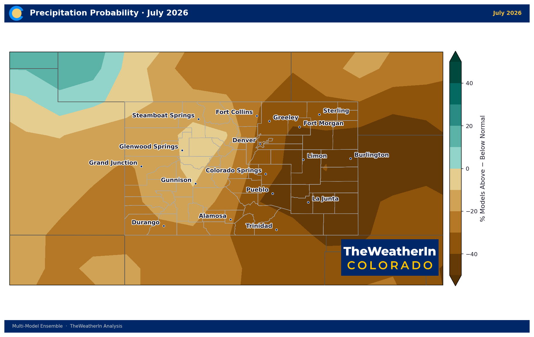
July is the toughest of the three months in the outlook. Statewide, forecast data leans warm (roughly +2°F above average, with about three-quarters of the outlook favoring above-normal heat) and dry — precipitation is tracking below average, with only about one in five signals favoring a wetter-than-normal month. This is squarely a "monsoon hasn't arrived yet" signature, and it lines up with the fire and heat risk already in place.
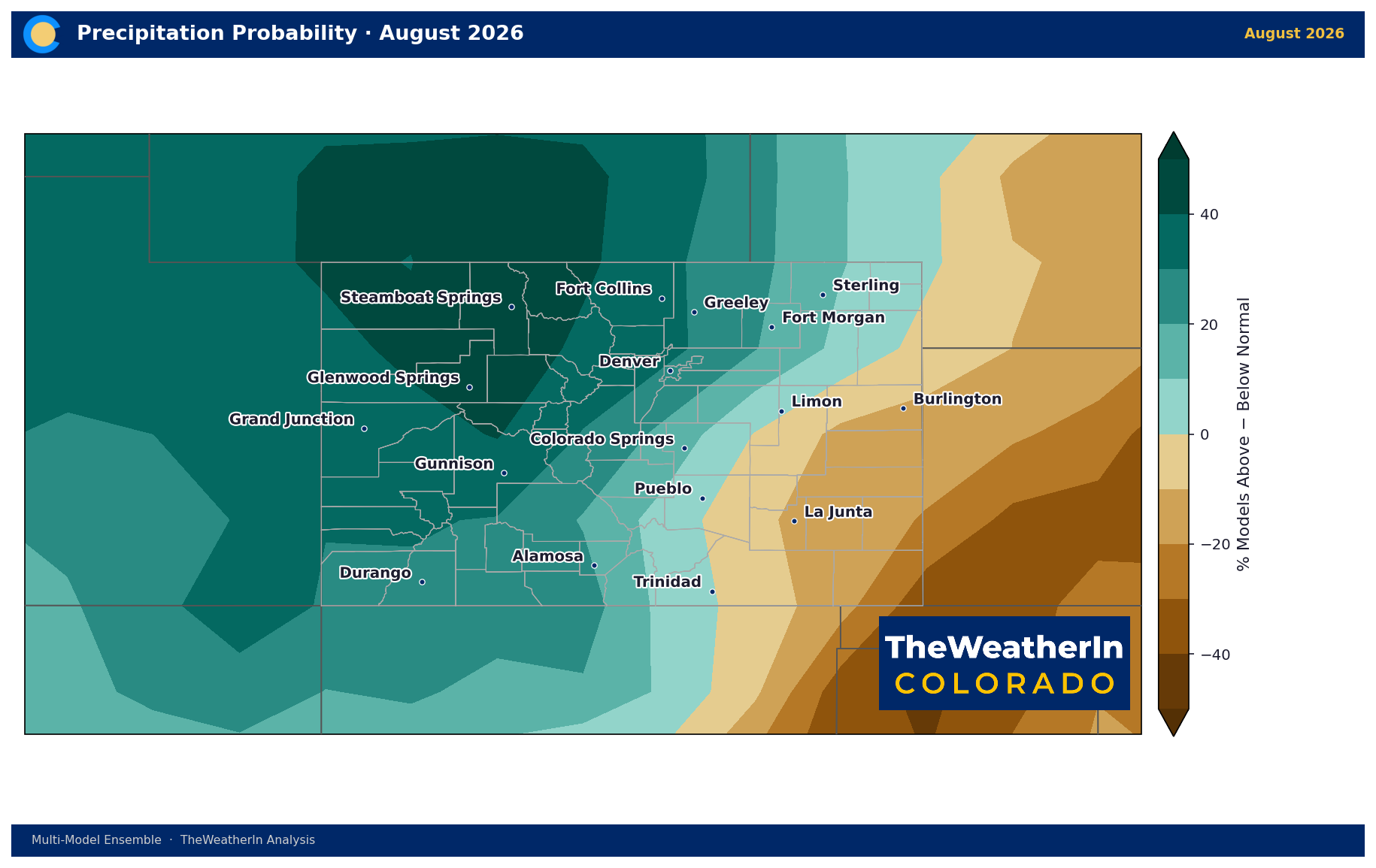
August is where the pattern turns. Temperatures stay warm (again close to +2°F above average), but the precipitation signal flips hard — roughly two out of three signals now favor a wetter-than-normal month, a sharp reversal from July. This is the first real sign that the monsoon has established itself.
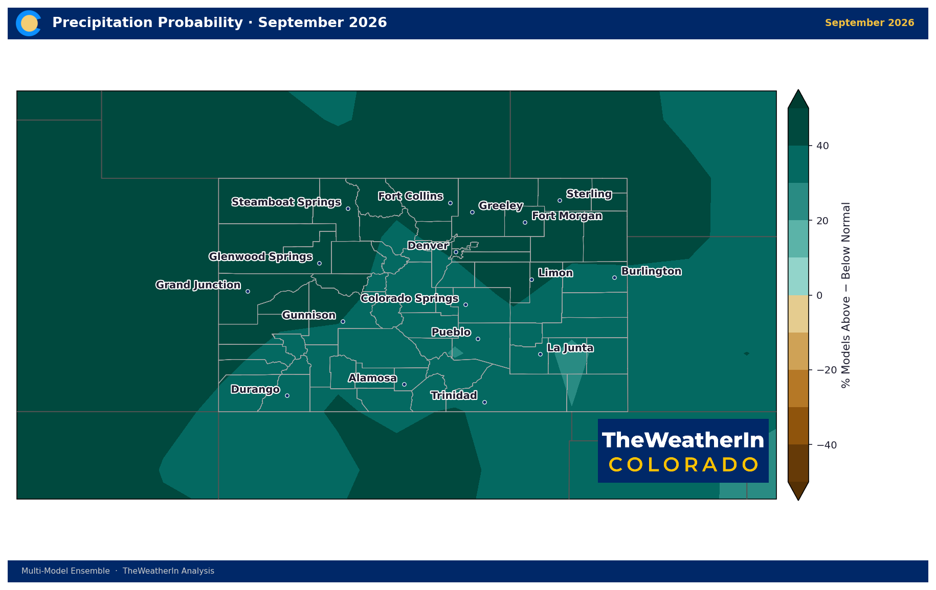
September looks like the strongest month of the outlook for moisture. Temperatures ease back closer to normal (around +1.7°F above average), while the wet signal strengthens further — nine out of ten indications now favor above-normal precipitation. If the monsoon delivers on this signal, September could end up doing more for drought relief than July and August combined.
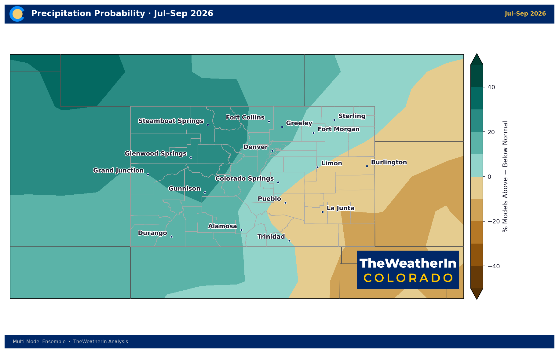
Regional Breakdown — Summer Outlook (July–September)
| Region | Temperature | Precipitation | Notes |
|---|---|---|---|
| Western Slope / Northern Mountains | +1.7°F above normal | Wettest lean of any region — about 3 in 4 signals favor above-normal moisture | Best odds for meaningful monsoon relief this summer |
| Southwest Mountains / Four Corners | +1.7°F above normal | About 2 in 3 signals favor above-normal moisture | Matches the one part of the state CPC's official outlook flags for likely drought improvement this summer |
| Front Range / Northeast Plains | +2.2°F above normal — warmest region | Near-even odds, slight dry lean | Least monsoon benefit of the four regions |
| Southeast Plains / San Luis Valley | +2.1°F above normal | Driest lean of any region — under half of signals favor above-normal moisture | Slowest path to relief; already the hardest-hit drought area |
Drought & Water
As of the most recent U.S. Drought Monitor update, roughly 91% of Colorado is in moderate drought or worse, and nearly 44% is in extreme-to-exceptional drought — a footprint that has only grown since the Governor's statewide drought emergency declaration in early June. NOAA's own seasonal drought outlook, released in late June, calls for drought to persist across most of Colorado through September, with the one exception being the southwestern corner of the state, where at least some improvement is considered likely. That lines up almost exactly with where this forecast data shows the best monsoon moisture odds — the west and southwest.
None of this fixes the water supply problem on its own. Colorado's snowpack failure this past winter drives roughly three-quarters of the state's annual water supply, and no amount of summer rain replaces that. But a strong monsoon by August and September would matter for soil moisture, fire danger, and short-term stress on dryland agriculture — even if the deeper water supply story runs on a much longer clock.
The bottom line: don't expect the monsoon to bail Colorado out in July. The forecast data points to a real change by August, a stronger one by September, and the west and southwest stand to benefit the most. But that's a late-summer story — and even then, it's one piece of a much longer drought recovery timeline that stretches well into winter.



