Heat, Dry Lightning, and a Drought That Isn't Done
A significant heatwave builds into the weekend as dry thunderstorms raise fire ignition risk mid-week. The bigger story runs well beyond this week.

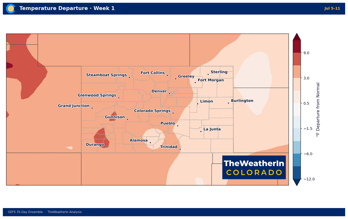
The near-term story is a significant heatwave arriving this weekend — but the more important context is what's already locked in beneath it: a drought covering every corner of Colorado, rivers running at a fraction of normal, and a fuel complex that is historically dry heading into the heart of fire season. This week's weather doesn't create the problem. It just turns up the pressure.
Pattern Overview
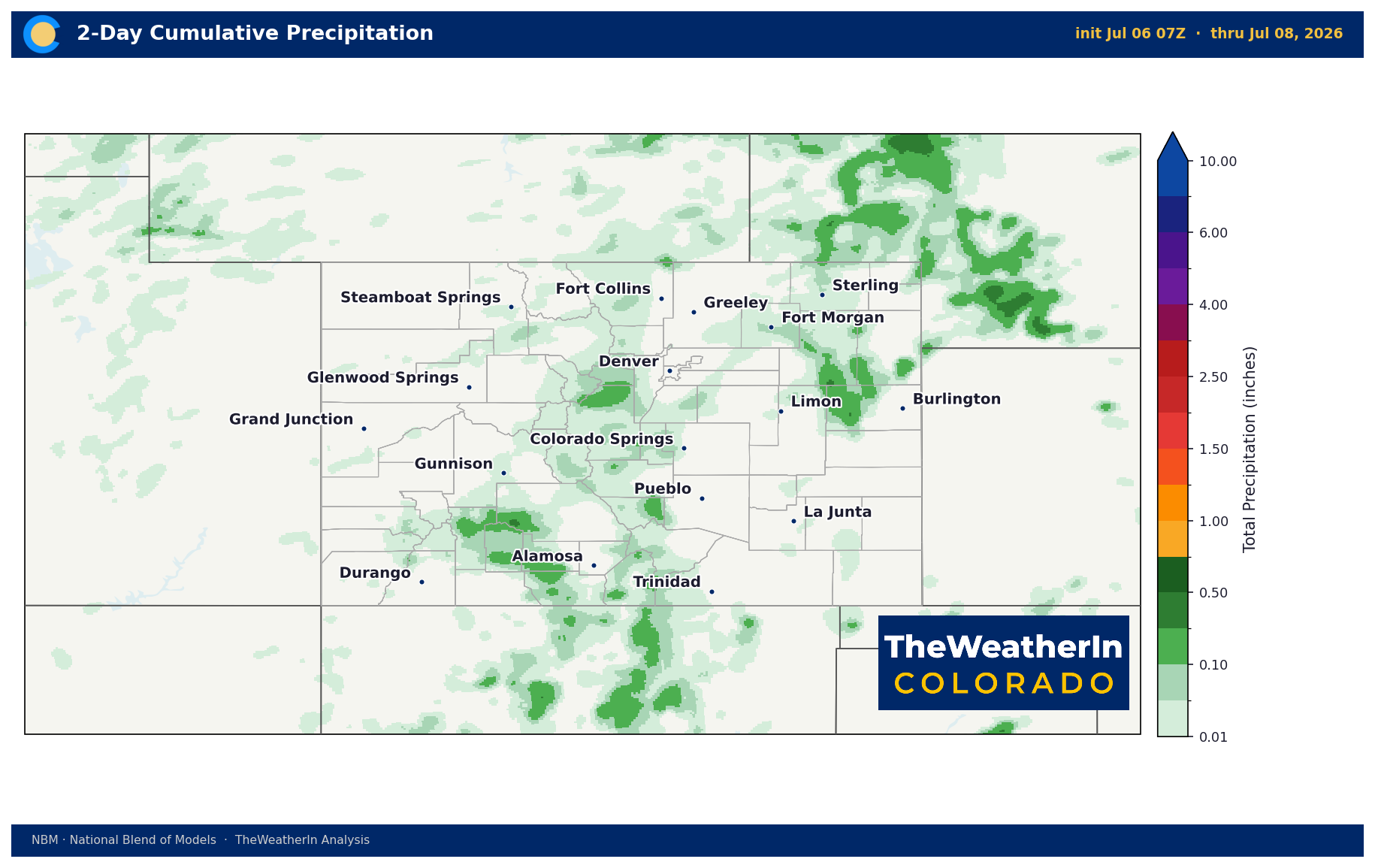
An upper-level ridge — a dome of high pressure aloft that suppresses storm development and drives temperatures upward — is building across the Central U.S. this week and intensifying through the weekend. The immediate result is a brief window Tuesday through Thursday when just enough atmospheric moisture is present to trigger scattered afternoon thunderstorms, primarily over the mountains and higher terrain. Don't let that fool you into thinking relief is coming. The vast majority of those storms will be high-based — meaning the precipitation they generate evaporates before it reaches the ground — while lightning, gusty outflow winds of 35 to 45 mph, and relative humidity in the single digits remain at the surface. That combination is the definition of a fire weather threat, and it's the dominant story through midweek.
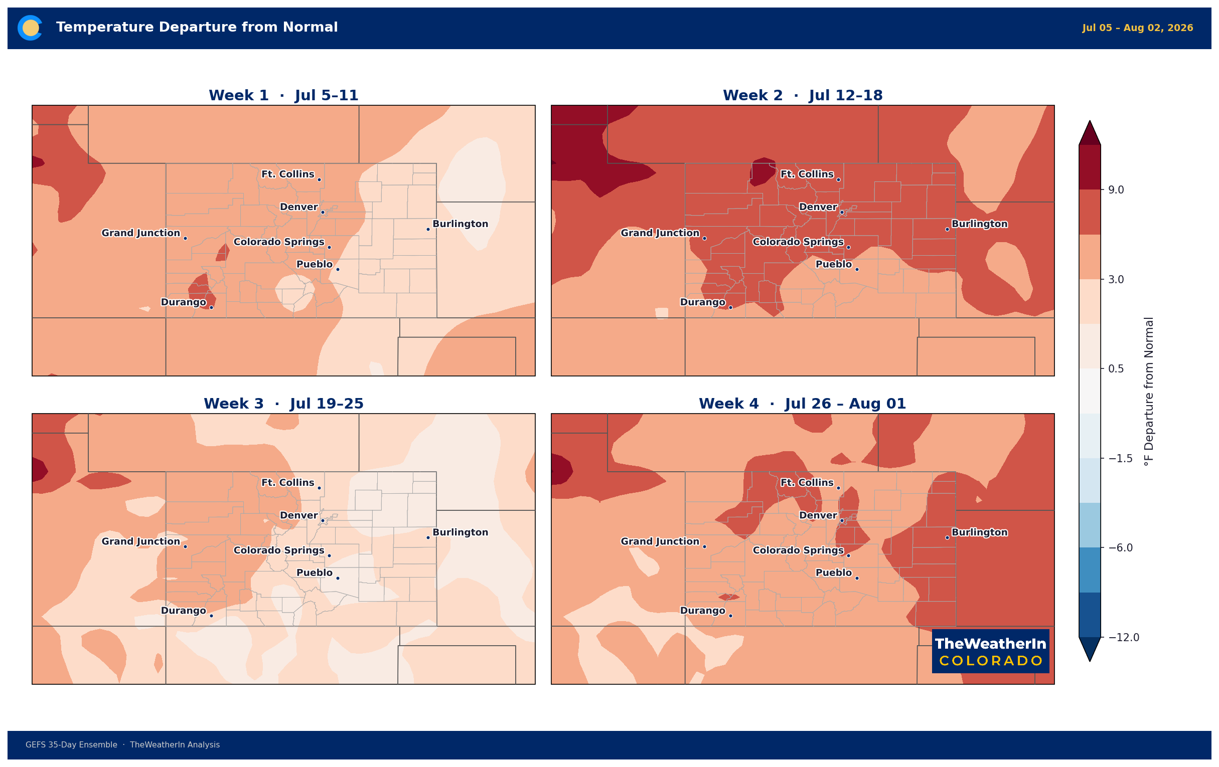
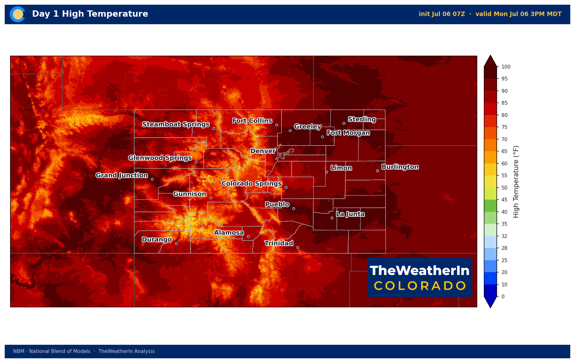
Once that brief storm window closes, the ridge takes over completely. Temperatures will climb sharply through Friday and into the weekend, with record or near-record highs expected Saturday through Monday across virtually all of Colorado. The Eastern Plains and lower desert valleys of the Western Slope are forecast to reach triple digits. Mountain valleys that have been running warm all season will push well above normal. Heat Advisory criteria are expected to be met across multiple regions. This is not a one-day event — the ridge is forecast to lock in and strengthen into week two, meaning the heat has staying power.
The deeper context: this is not a random midsummer heat event. It is the latest chapter in a pattern that has been running since fall 2025 — the warmest winter on record in Colorado, the warmest spring on record, the lowest snowpack ever measured, and a drought that now covers 100% of the state. The ridge building this week is consistent with the same persistent warm, dry pattern that produced all of the above. That pattern is expected to continue through at least the next two weeks with no meaningful break on the horizon.
Weeks 2–4 Outlook
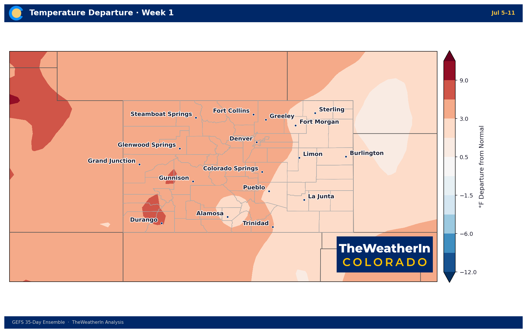
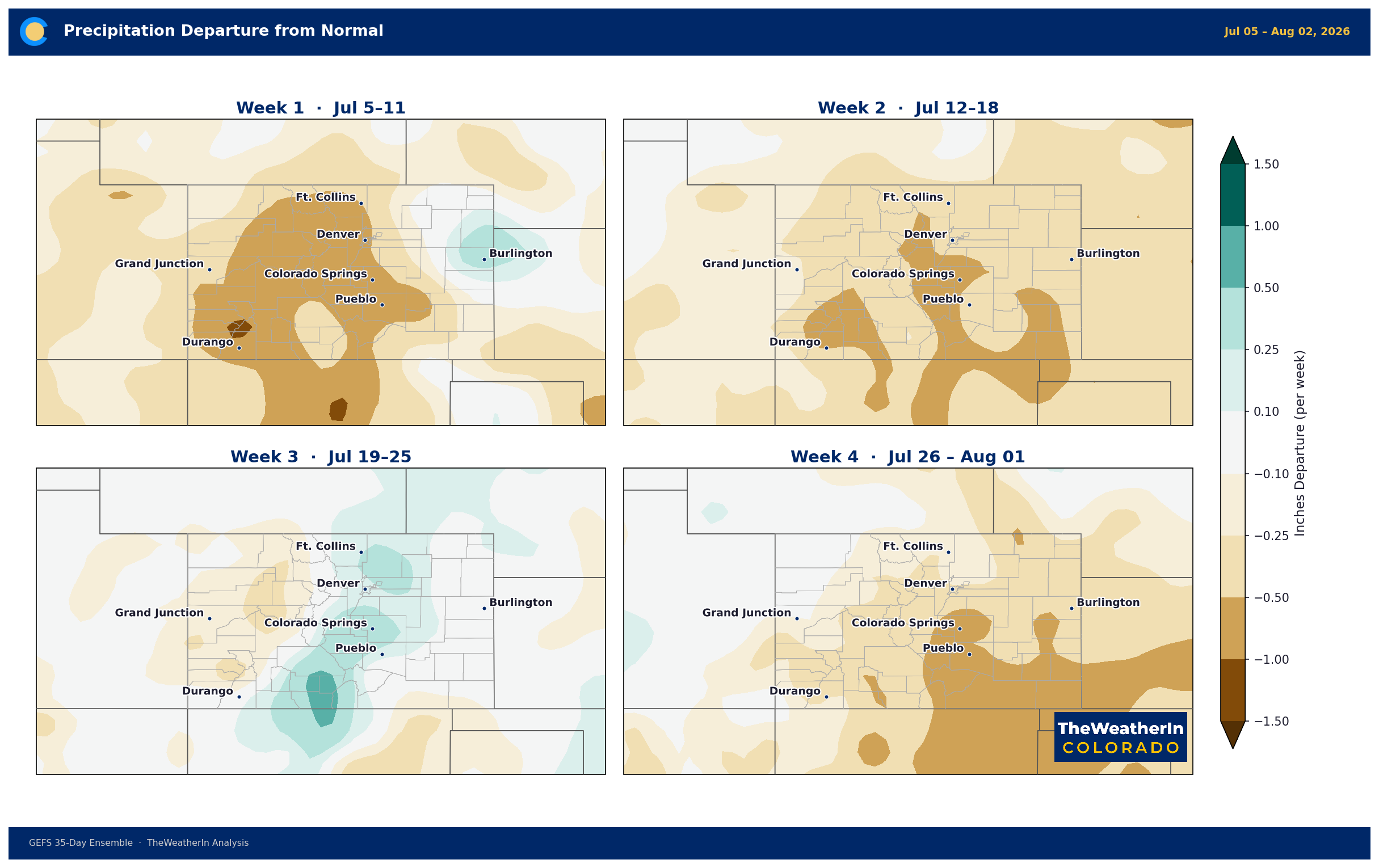
The signal beyond this week points toward continued above-normal temperatures and below-normal precipitation through at least the third week of July. Forecast data shows the ridge amplifying into week two, maintaining the heat pattern across the West and Southwest with minimal atmospheric moisture to support storm development. There is no credible pattern change signal — no significant trough, no meaningful moisture surge — through the end of July based on current data.
The one meaningful longer-range development worth watching is the summer monsoon. Southern Colorado — particularly the San Luis Valley, the San Juans, and the Sangre de Cristos — can begin receiving monsoonal moisture in mid-July in active years. A return of wetter air from the south is the only realistic near-term source of precipitation relief for the southern tier of the state. But monsoon onset timing and intensity vary considerably year to year, and the pattern currently in place is not particularly favorable for an early or robust start. The northern Front Range, Eastern Plains, and Western Slope typically see far less monsoon influence even in good years.
The longer-range story — the one that actually has the potential to change Colorado's drought trajectory — remains El Niño. Conditions in the tropical Pacific have now officially crossed the threshold into El Niño, and forecast data favors a moderate-to-strong event through winter 2026–27, with a 63% chance it ranks among the strongest on record. Historically, that means above-normal precipitation for the southern Rockies in winter. But that impact won't be felt in Colorado until November at the earliest. Summer is still being governed by the dry, warm pattern that has defined the past eight months.
Regional Breakdown — Week of July 6
| Region | Temperature | Precipitation | Highlights |
|---|---|---|---|
| Front Range / Foothills | Near normal mid-week; well above normal by weekend | Below normal; isolated storm chance Tue–Thu | Dry lightning threat Tue–Wed; gusty outflow winds 35–45 mph; record heat possible Sat–Mon; RH 6–15% afternoons |
| Mountains / High Country | Near to slightly above normal mid-week; warming late week | Below normal; storm coverage Tue–Thu highest in San Juans | High-based storms; dry lightning ignition risk elevated (San Juans, Front Range mountains); RH 9–15%; wetting rain possible San Juan valleys 30–60% Tue–Wed |
| Western Slope | Above normal; triple digits developing late week/weekend in lower valleys | Well below normal; isolated afternoon storms Tue greatest coverage | Dry thunderstorm threat over lower San Juan slopes; RH sub-20% consistently; extremely hot and dry by weekend; critically dry fuels |
| Eastern Plains | Mid-90s to low 100s early week; record/near-record heat weekend | Best precipitation potential of any region; scattered storms Tue–Wed | Locally wetting rains possible Tue–Wed; gusty outflows if storms develop; triple digits expected Sat–Mon; light winds Fri–Sun |
| Southern CO / San Luis Valley | 76–90°F valleys; above normal; hotter late week | Below normal; daily afternoon storm chances but mostly dry | Burn scar flash flood threat if storms develop over fire-affected terrain; gusty outflow winds; RH 9–15%; triple digits in lower valleys by weekend |
Fire Weather
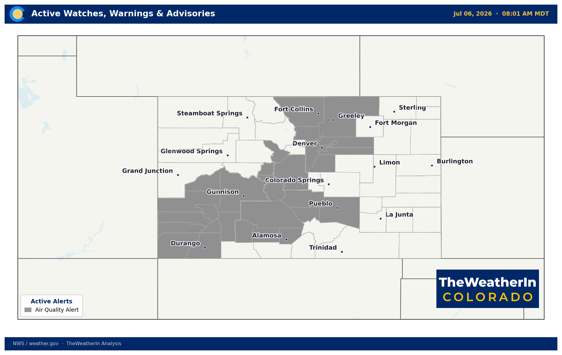
Elevated fire weather conditions are expected through Thursday, then transitioning to a different but still-dangerous profile through the weekend. Tuesday through Thursday is the critical window: isolated to scattered high-based thunderstorms will produce lightning strike potential of 35% or higher over the San Juans and elevated terrain statewide, with gusty erratic outflow winds reaching 35 to 45 mph and relative humidity dropping as low as 6% in lower valleys and 9 to 13% in mountain valleys. Most of those storms will deliver no meaningful precipitation to the surface. New fire starts from dry lightning are a legitimate concern, particularly over the lower slopes of the San Juans and the Front Range mountains Tuesday and Wednesday.
The weekend pattern shifts somewhat — lighter winds and weaker flow aloft reduce the outflow wind threat — but the underlying fuel and atmospheric conditions remain historically dangerous. Fuels across the Eastern Plains, San Luis Valley, and southern Colorado are critically dry and cured well ahead of schedule. Any new ignition in those areas, from lightning or any other source, will find conditions primed for rapid spread. This is not a theoretical risk — Colorado has had multiple significant fire events already in 2026, all tracing back to the same drought-stressed fuel complex now heading into peak summer.
Where recent burn scars exist, any precipitation that does fall from Thursday's storms carries a secondary risk: flash flooding. Burned terrain loses the ability to absorb rainfall, and even modest precipitation totals can generate rapid runoff and debris flows. Southern Colorado producers and residents near active burn areas should monitor any approaching storm closely.
Drought & Water
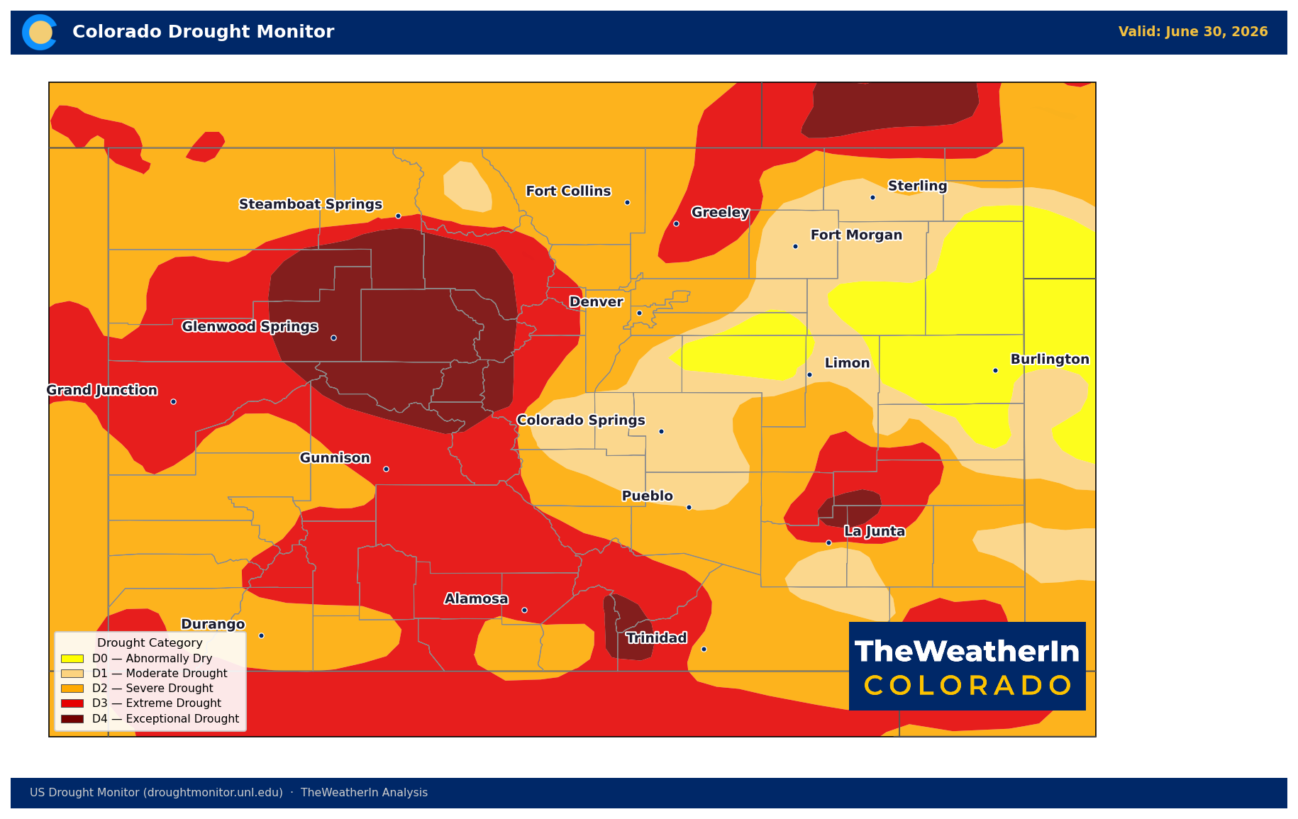
As of June 30, 2026, every part of Colorado remains in some level of drought — 100% of the state is at least abnormally dry (D0), 93% is in moderate drought or worse (D1–D4), 80% is in severe drought or worse (D2–D4), and roughly 39% of the state sits in extreme to exceptional drought (D3–D4). Exceptional drought (D4) — the highest category on the scale — covers just over 9% of Colorado, concentrated in the north-central mountains and the Sangre de Cristos. The Drought Severity and Coverage Index stands at 321, more than double where it sat at the start of the calendar year (127) and more than double the reading one year ago (133).
The slight week-over-week improvement from last week's reading of 329 reflects minor, localized precipitation — not a trend reversal. Drought at this scale does not respond to scattered July thunderstorms. The statewide May–July runoff forecast sits at 24% of normal; 48 of 86 NRCS streamflow forecast points are on track for record or near-record low flows this season. Reservoirs are drawing down on carryover storage from 2025 with no meaningful mountain runoff replenishment coming. That picture does not change this week.
Looking further out, the summer monsoon represents the only realistic source of drought mitigation for southern Colorado this season, and even a robust monsoon cannot reverse a water supply deficit of this magnitude. Meaningful drought recovery for Colorado is a winter story — tied to El Niño's confirmed and strengthening influence on the southern Rockies precipitation pattern beginning this fall and winter. It is worth watching, but it is months away.
Agricultural Implications
- Livestock heat stress is the immediate priority this weekend. Record or near-record temperatures are expected Saturday through Monday, with triple digits across the plains. Ensure adequate water access and shade for cattle, especially in confined feeding operations. Heat stress in livestock builds cumulatively — monitor closely through early next week as the ridge strengthens.
- Irrigation demand will surge through the weekend and into next week precisely when supplies are most constrained. Statewide May–July runoff is forecast at just 24% of normal; the Arkansas basin is running at approximately 20% of its historical average. Prioritize available water for high-value crops and permanent plantings. Dryland producers on the Eastern Plains and in the San Luis Valley face persistent moisture deficits with no meaningful precipitation relief expected this week — evapotranspiration demand will increase sharply with the heat.
- Dry lightning over mountains and rangeland Tue–Thu is a direct fire ignition threat for producers. Critically dry grass and brush fuels across eastern Colorado, southern Colorado, and rangeland at all elevations are primed for rapid fire spread. Stage suppression resources, clear firebreaks where possible, and avoid any ignition sources during the afternoon storm window through Thursday.
The signal that matters most beyond this week: the monsoon's arrival timing for southern Colorado will set the tone for forage recovery and fire risk through the back half of summer — and right now, the pattern is not favorable for an early or strong start.
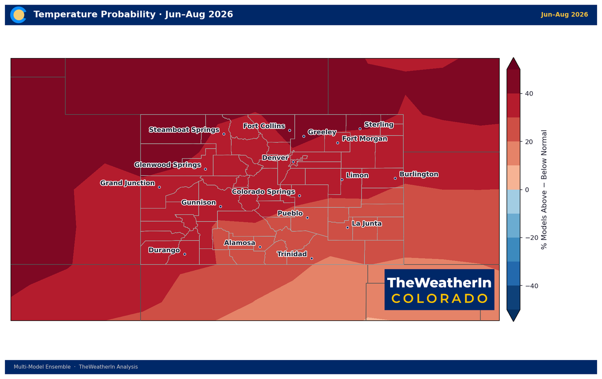
Recall how this fits into our summer outlook:
 The Weather In Colorado