How Long Until Colorado Sees Real Drought and Fire Relief?
Between an active, dangerous fire season and a strengthening El Niño, Colorado is caught between two very different timelines. Here's a realistic look at when relief actually arrives — and when it doesn't.

It's a fair question to ask right now: with a strengthening El Niño in the headlines and a wetter monsoon in the forecast data, when does this drought actually start to break? The honest answer is that Colorado is working against two very different clocks — one measured in weeks, one in seasons — and they don't arrive at the same time.
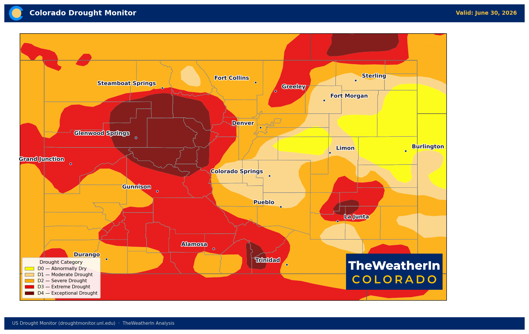
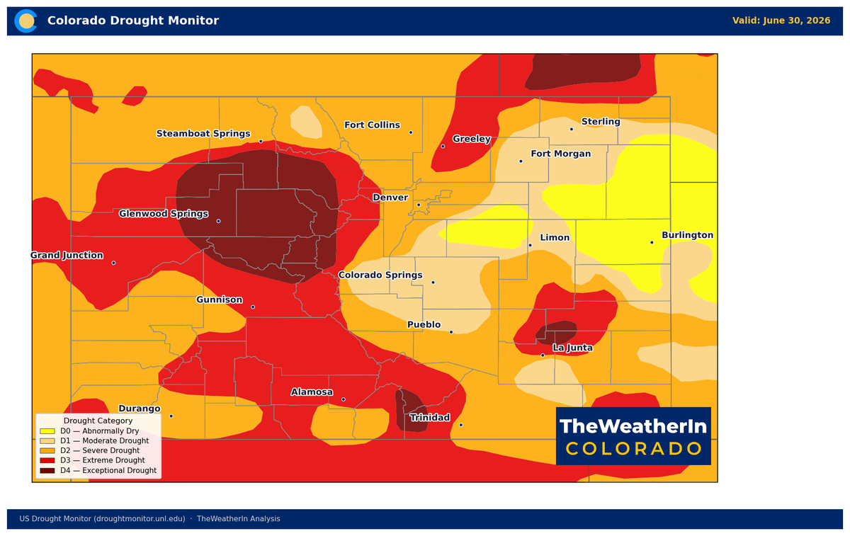
The backdrop makes the question urgent. Colorado remains in a statewide drought emergency declared in early June. Roughly 91% of the state sits in moderate drought or worse, and nearly 44% is in extreme-to-exceptional drought. Streamflow on nearly every major river is running at or near all-time record lows for this point in the year. And fire season has turned dangerous — multiple fast-moving wildfires ignited across the state in late June, including one, the Knowles Fire, that took the lives of three firefighters. That's the reality this outlook has to be measured against.
The Short Clock: No Relief in July
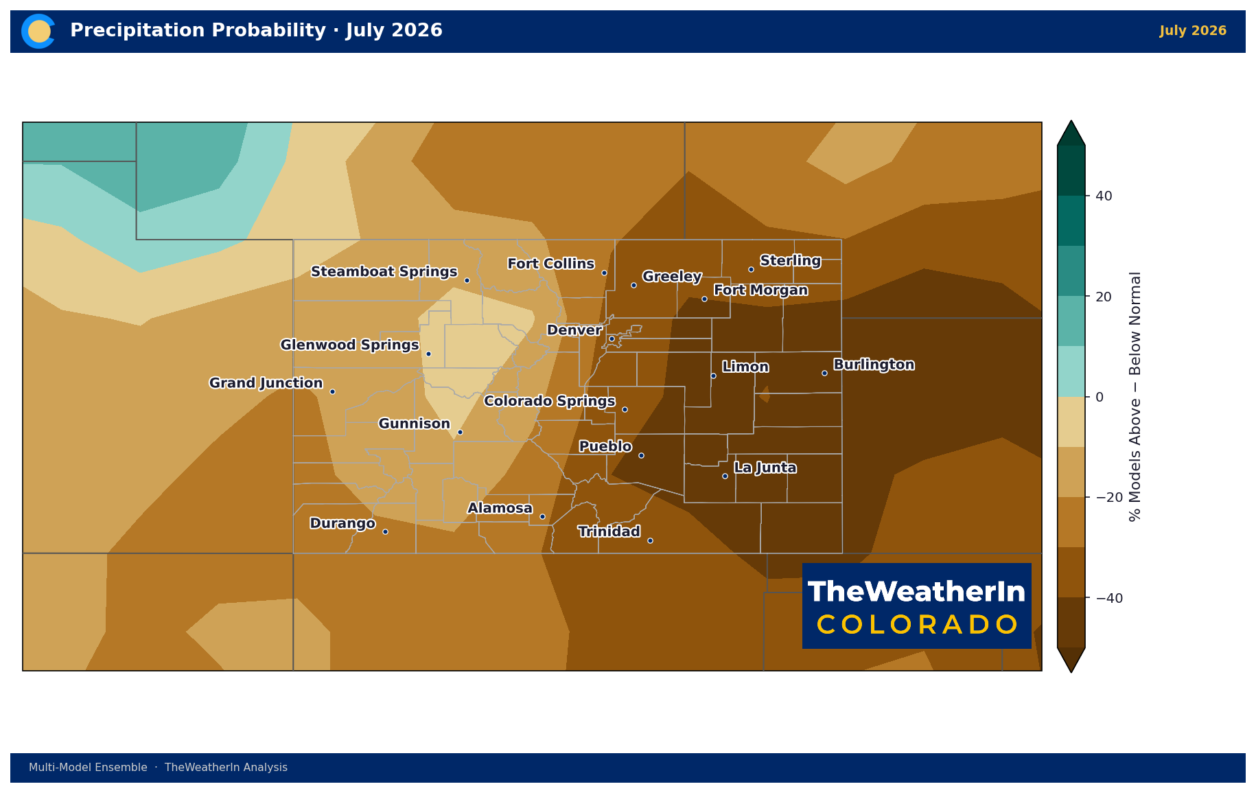
Start with the bad news. Forecast data for July shows a continuation of the pattern that built this drought — warm (about +2°F above average) and dry, with only around one in five signals favoring above-normal moisture statewide. The monsoon hasn't arrived yet, and until it does, fire weather and drought conditions have no reason to ease. NOAA's own seasonal drought outlook, issued in late June, backs this up directly: it calls for drought to persist across nearly all of Colorado through September, with just one exception.
The Medium Clock: Partial, Regional Relief by Late Summer
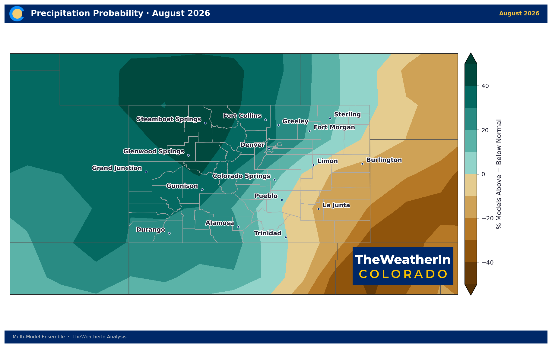
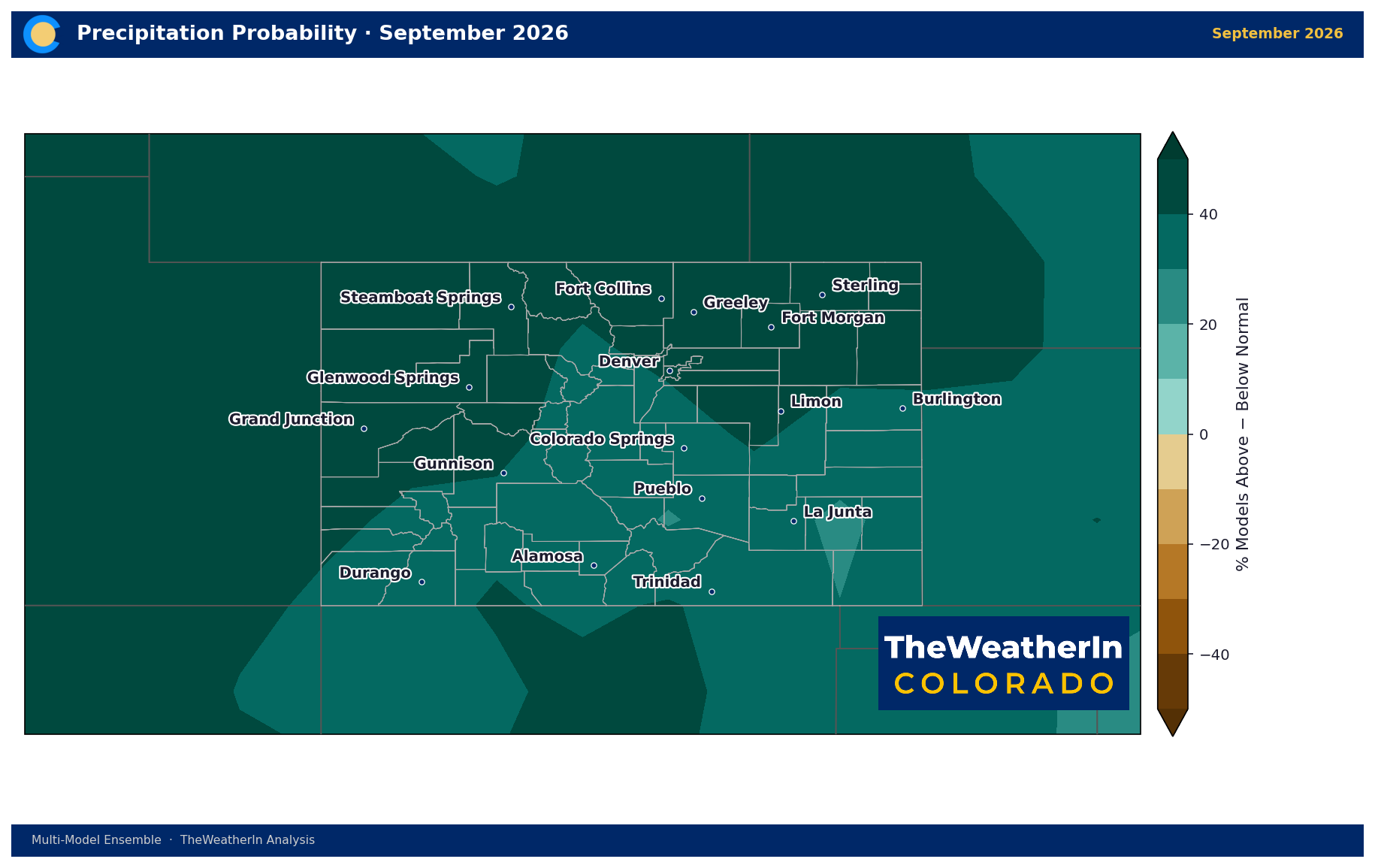
That one exception matters. The forecast data shows a real shift by August, with the wet signal strengthening further by September — roughly two-thirds of the outlook favoring above-normal moisture in August, climbing to nine in ten by September. But this relief isn't evenly distributed. It's strongest across the western half of the state — the mountains and southwest corner, which is also the one region NOAA's drought outlook flags for likely improvement this summer. The eastern plains and San Luis Valley, already among the hardest-hit areas, show the weakest monsoon signal of anywhere in the state. For them, late summer likely means "less bad," not "recovered."
This is also the timeline that matters most for the active fire season. A stronger monsoon by late August and September would meaningfully calm fire behavior in the areas it reaches — but it arrives after, not before, the most dangerous stretch of the season plays out.
The Long Clock: Real Trend Change Arrives With Winter
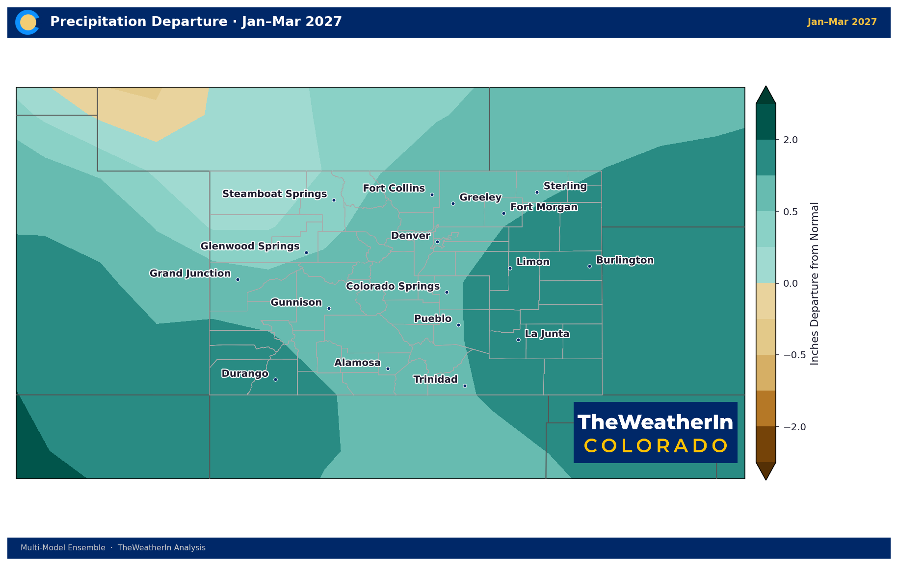
The bigger shift doesn't show up until El Niño takes over the pattern in winter. Forecast data shows Colorado's temperature signal flipping from this year's extreme warmth to near-or-below-normal by December, while precipitation odds climb through the winter, peaking in January–March 2027 at nearly 8 in 10 signals favoring above-normal moisture — the strongest signal anywhere in this entire outlook. If that holds, it would be the most favorable stretch for mountain snowpack since this drought began.
But strongest signal in the outlook is not the same as "problem solved." Two things temper that optimism. First, the El Niño moisture signal favors the southern and eastern parts of the state more reliably than the northern mountains — and the northern mountains are exactly where a lot of Colorado's water supply originates. Second, and more fundamentally: this past winter's snowpack failure was the lowest on record, by a wide margin. Streamflow, reservoir storage, and soil moisture deficits built up over more than a year don't reverse in a single wet season, even a strong one. A good winter would be the first real step toward recovery — not the finish line.
Putting It Together
| Timeframe | What Changes | What Doesn't |
|---|---|---|
| Now – July | Nothing meaningfully improves | Drought, fire risk, and stream deficits all persist statewide |
| Late August – September | Monsoon moisture builds, especially in the west and southwest | Eastern plains and San Luis Valley see limited benefit; water supply deficit unchanged |
| October – December | Transition month; moisture odds trend wetter as El Niño strengthens | Still a build-up phase, not the main event |
| January – March 2027 | Strongest wet + cool signal in the entire outlook; best shot at real snowpack recovery | Northern mountains see the weakest benefit; one season can't fully erase a record deficit |
Agricultural and Community Implications
- Near-term (through summer): Plan for continued heat stress, irrigation demand, and fire weather with no statewide relief before late August at the earliest.
- Regional awareness: Western Slope and southwest Colorado operations should watch for the earliest signs of improvement; eastern plains and San Luis Valley operations should plan for the drought to persist longer.
- Winter planning: The best odds for a real turnaround arrive with El Niño this winter — worth building into water and forage planning for 2027, while not counting on it to solve 2026.
The short version: no relief in July, partial and uneven relief by late summer, and the real trend change waits for winter — with full recovery from a drought this deep likely taking longer than even a strong El Niño winter can deliver on its own.