Colorado Snowpack 2025–26: A Below-Normal Season and What It Means This Spring
Colorado's 2025–26 snow season wrapped up well below average statewide, with most mountain ranges running at 50–75% of normal. Combined with a warm spring outlook, early runoff and drought stress are the headline concerns.

Data: NOHRSC National Snowfall Analysis, season-to-date through mid-April 2026.
The Season in Numbers
Colorado's 2025–26 snow season was among the worst on record for most of the state's mountain ranges. The maps below tell the story — and the numbers behind them are striking.
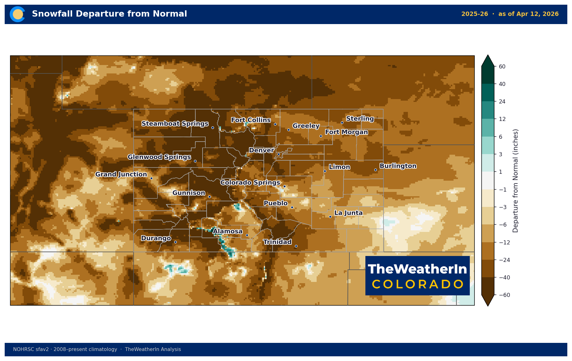
Most of Colorado's core mountain ranges on the season-to-date are 40 to 115 inches below normal:
Silverton (San Juans) │ −116" │ 48%
Crested Butte (Elk Mtns) │ −92" │ 49%
Steamboat Springs │ −89" │ 45%
Leadville (Sawatch) │ −78" │ 38%
Vail (Gore Range) │ −73" │ 55%
Aspen (Sawatch) │ −64" │ 53%
Telluride (San Juans) │ −58" │ 66%
Rocky Mountain NP │ −19" │ 87%
The Elk Mountains, central Sawatch, and the Flat Tops/Steamboat area were the hardest hit, running at 45–50% of normal — roughly half of an average season. The notable exception is Wolf Creek Pass, which finished near 100% of normal, benefiting from its position in the path of persistent southwest flow.
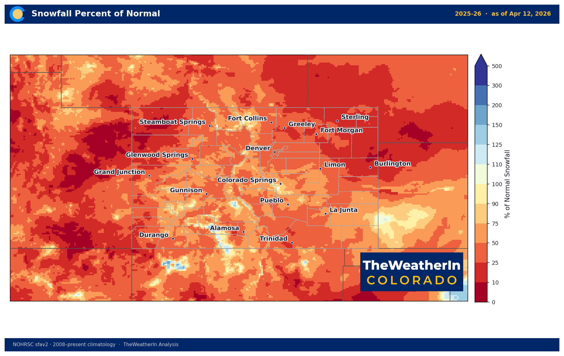
The percent-of-normal map shows how widespread the deficit is. Nearly every mountain county in western Colorado sits in the orange-to-red range — 25 to 75% of normal.
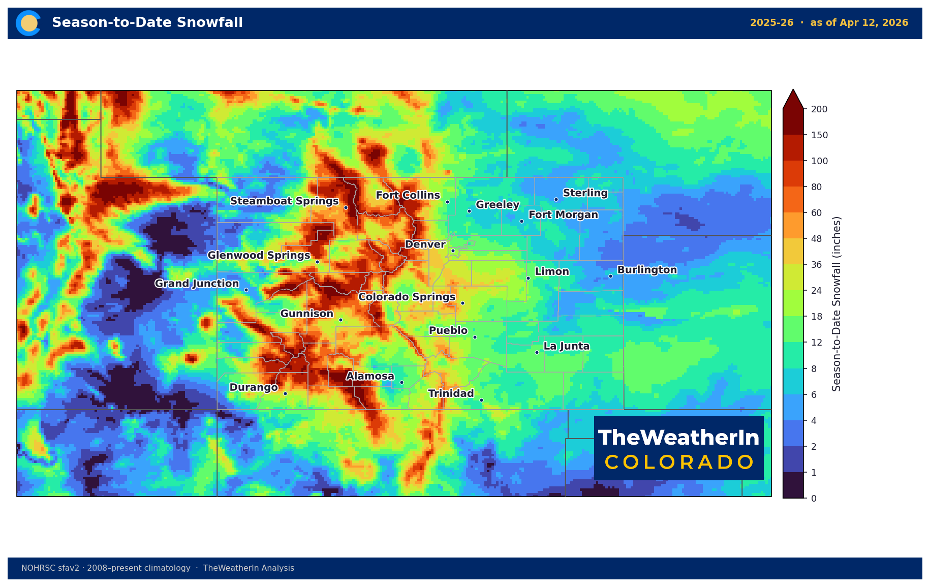
In raw accumulation, stations like Vail (91"), Crested Butte (89"), and Aspen (73") still saw substantial snow totals. But those same stations average 160–180 inches in a normal season, making the deficit feel especially severe.
Why This Matters
Water supply. Snowpack is Colorado's primary water storage mechanism — the mountains act as a natural reservoir, holding water through winter and releasing it gradually through spring and summer melt. A below-normal snow season
means less water entering streams and reservoirs during the critical runoff window.
Runoff timing. With the seasonal outlook pointing to above-normal temperatures through May and June, snowmelt will run fast and early. Early runoff is less useful for irrigation — it moves through the system before crops need it most. Expect peak streamflows to arrive 2–3 weeks ahead of average in most basins.
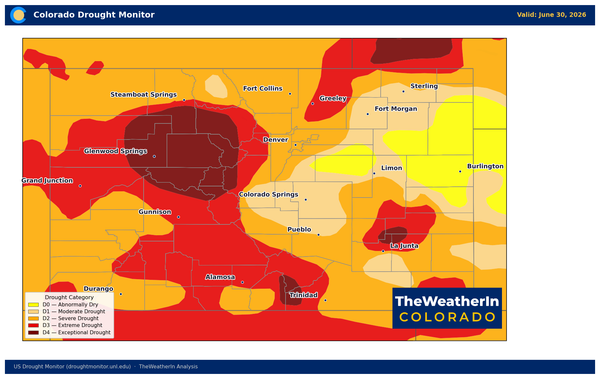
Drought risk. Eastern plains dryland agriculture was already the most vulnerable area in the seasonal outlook, and limited mountain snowpack reinforces that concern. If the dry April–May signal in the models verifies, soil moisture
on the plains enters summer at a deficit.
Wildfire. A below-normal snowpack combined with warm, dry spring conditions is the setup for an active fire season. Fuels dry out earlier, and the transition from snow-covered terrain to fire-ready conditions happens faster than average years.
The Silver Lining
The May–July precipitation outlook does lean wetter for the mountains — if early summer moisture arrives, it can partially offset the snowpack deficit for water supply and suppress fire risk heading into the peak season. That signal deserves watching as we move through April and May.
Snowfall analysis from the NOHRSC National Snowfall Analysis v2 (~4km CONUS grid). Climatology based on 2008–2025 period of record.