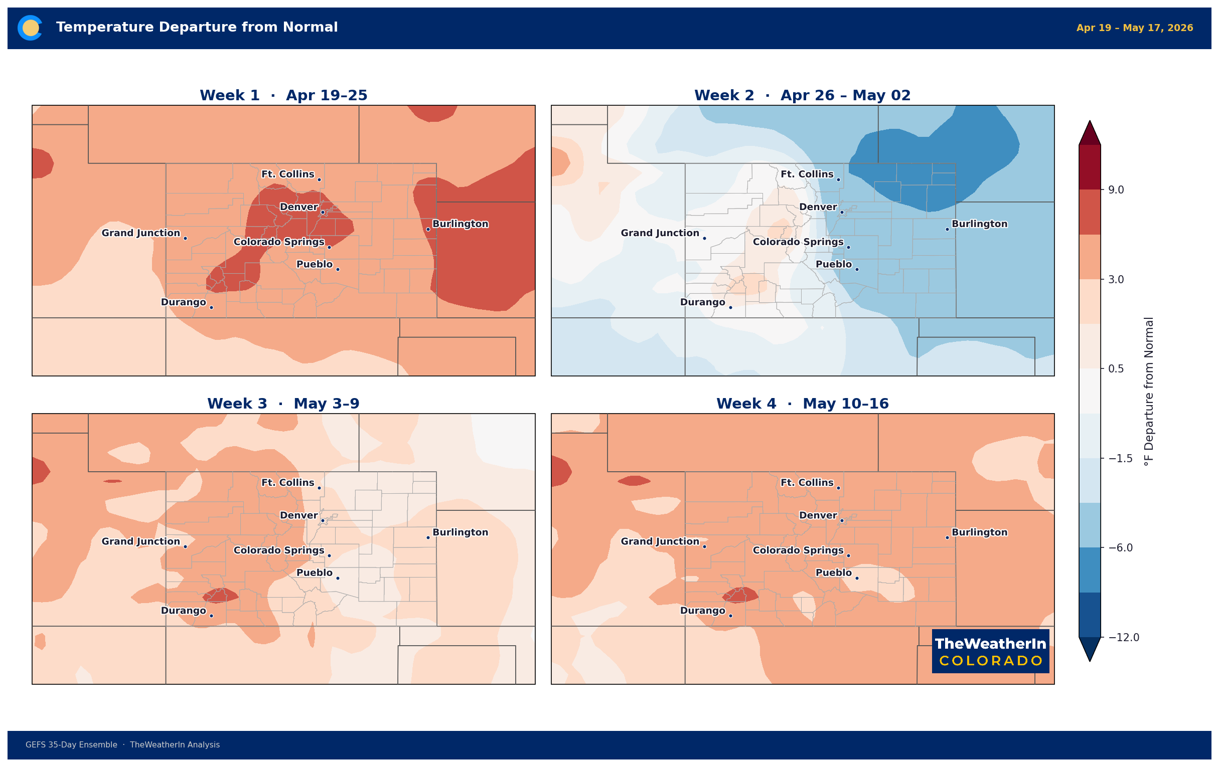
Colorado Weather Outlook: April 21–27 — Dangerous Fire Conditions Wednesday, Cooler Pattern Returns by Weekend
A warm, dry stretch mid-week gives way to one of the more serious fire weather setups of the season Wednesday, before a significant pattern change brings cooler, unsettled conditions through the weekend.

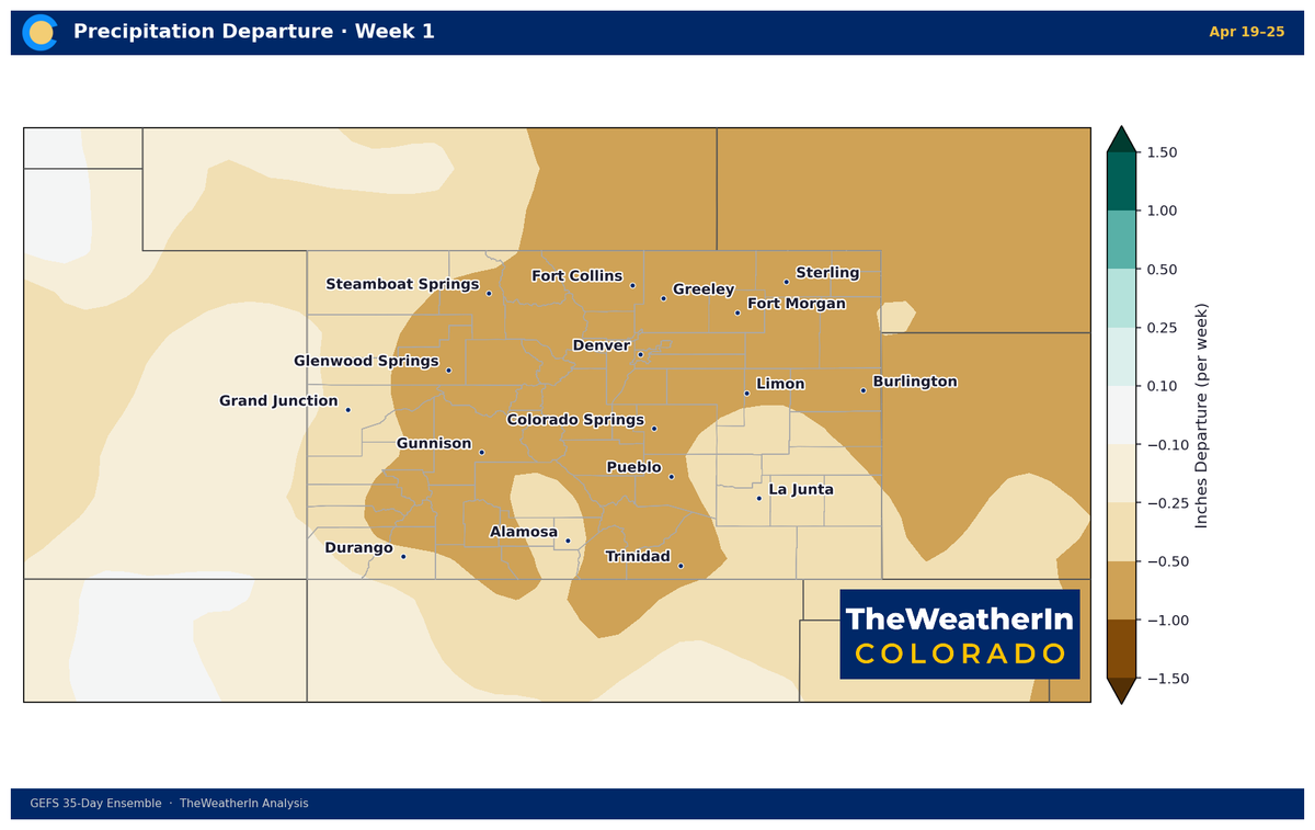
It was nice to see some moisture on Friday, at least a little bit, to help with our drought. Temperatures this week will skyrocket, so the trails will be dry again in no time... probably already are.
Week at a Glance
| Day | Conditions | Key Concern |
|---|---|---|
| Monday Apr 21 | Sunny, well above normal | Plains 70s–80s; afternoon showers possible southern/central mountains and W. Slope |
| Tuesday Apr 22 | Hot, 12–25°F above normal | Southern plains could touch 90°F; isolated mountain showers; winds increasing overnight |
| Wednesday Apr 23 | Critical fire weather | Red Flag Warnings statewide; 30–60 mph gusts; RH single digits; potentially dangerous |
| Thursday Apr 24 | Cold front passage, elevated fire risk continues | Winds remain elevated through morning; scattered light showers by evening |
| Friday Apr 25 | Cooler, unsettled | Mountain snow, rain for plains; temps near to below normal |
| Weekend Apr 26–27 | Below normal, multiple disturbances | Continued mountain snow chances; unsettled pattern persists |
Monday–Tuesday: Unseasonably Warm, Quiet on the Plains
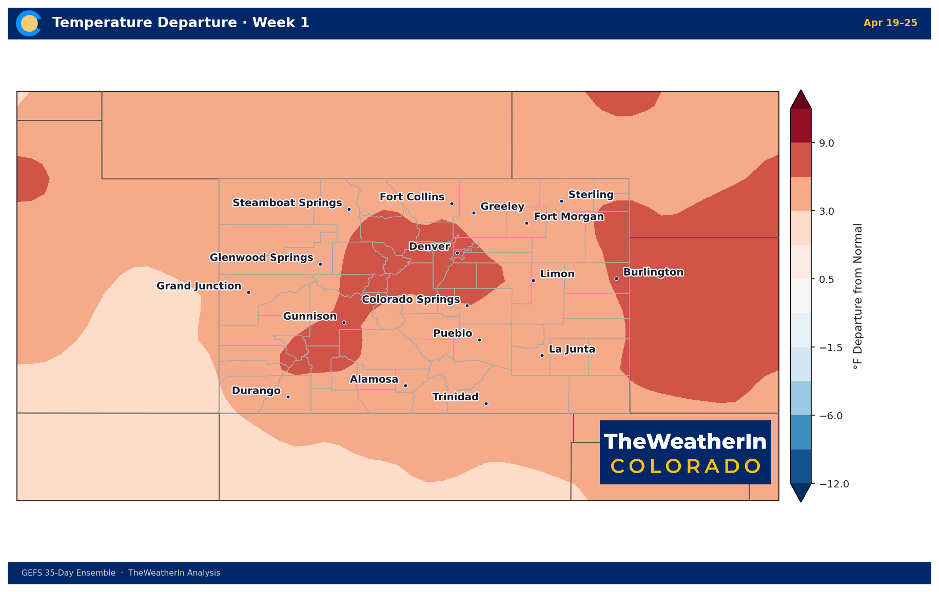
A strong upper-level ridge parked over the Rockies is keeping temperatures well above normal to start the week. Plains communities from Denver south through Pueblo should see highs in the upper 70s and low 80s Monday, climbing a bit higher Tuesday as the warmest air builds in. Some southern plains locations could approach 90°F by Tuesday afternoon — roughly 15–20 degrees above where we should be this time of year.
The Western Slope and mountain valleys will also run warm, with afternoon highs in the 60s. Some moisture wrapping around the ridge will generate scattered afternoon showers and isolated thunderstorms over the southern and central mountains both days, though most of this activity will be virga or very light — not amounting to much at the surface.
A Freeze Warning remains in effect through Monday morning for some of the higher Western Slope valleys, so growers with early-season plantings at elevation should take note.
Wednesday: High-End Fire Weather Event
This is the main story of the week. A deep upper-level trough pressing into the Intermountain West will drive a sharp wind and humidity event across Colorado Wednesday afternoon and evening. This has the potential to be one of the more dangerous fire weather days of the season.
Wind gusts of 30–40 mph are expected across the Front Range and northeast plains, with 40–55 mph gusts common across the Western Slope and mountain valleys. Southern Colorado is facing the most extreme conditions — forecasters are flagging the potential for gusts of 50–60 mph with relative humidity values under 10% for much of the region. The San Luis Valley and Fremont County area may see the strongest winds, with High Wind Warning criteria possible.
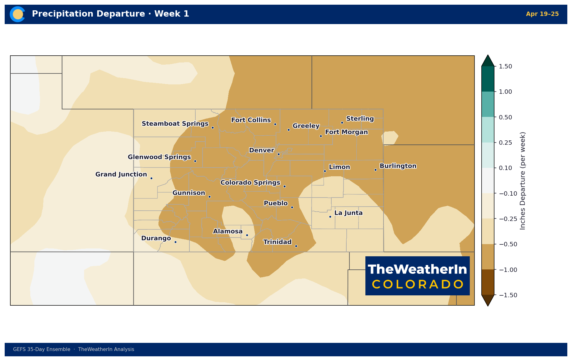
Red Flag Warnings are already in effect for portions of southeast Colorado today, and widespread Red Flag Warnings are expected statewide for Wednesday. The combination of these wind speeds, critically low humidity, and dry fuels following months of below-normal precipitation represents a genuine threat. Any outdoor burning or activity that could spark ignition should be avoided entirely Wednesday.
Conditions won't improve quickly. Poor humidity recovery overnight Wednesday into Thursday, combined with continued elevated winds, means fire danger will remain elevated through much of Thursday before slowly improving.
Thursday–Weekend: Pattern Change Arrives
A cold front pushes through Wednesday night, dropping temperatures back toward seasonal norms by Thursday and likely below normal through the weekend. This is a meaningful pattern shift after the prolonged above-normal stretch.
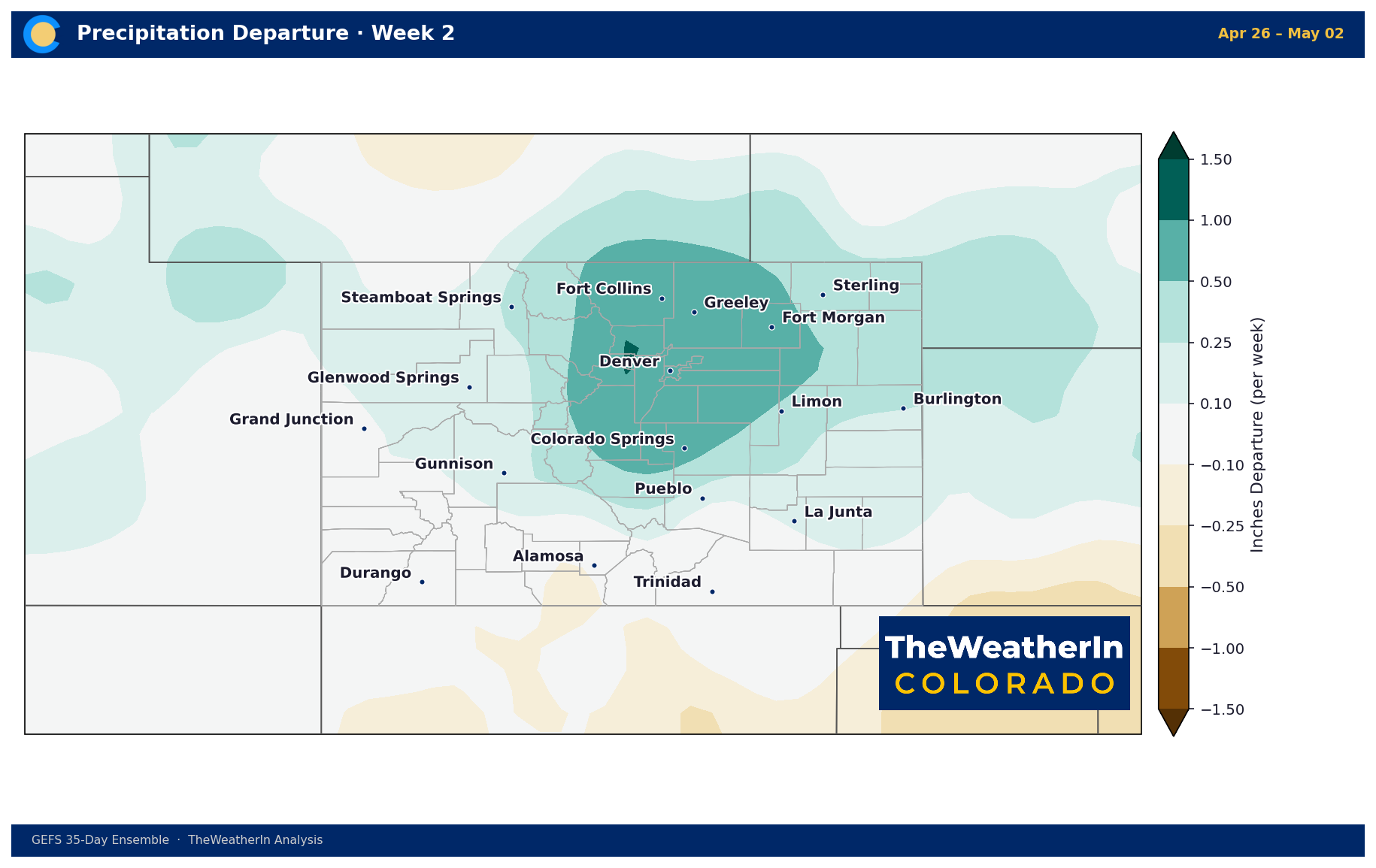
The pattern change brings precipitation chances back to the forecast — mountain snow and rain for the plains look increasingly likely Friday through the weekend, with multiple disturbances rotating through an upper-level trough over the Rockies. Exact timing and amounts remain uncertain this far out, but the overall character shifts from warm and dry to cooler and unsettled. After a very dry stretch across much of the state, even modest accumulations would be beneficial.
Agricultural Notes
Producers across eastern and southern Colorado should treat Wednesday as a no-burn, high-vigilance day regardless of other operations. The combination of critically low humidity, strong winds, and dry conditions creates conditions where fire can establish and spread very rapidly.
The cooler, wetter pattern developing late in the week is a positive signal for soil moisture going into the growing season, though accumulations will need to be monitored as the week progresses.