Critical Fire Weather Continues Monday — Relief Arrives Tuesday
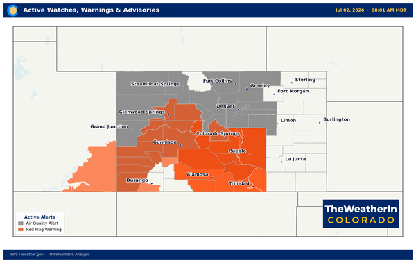
Red Flag Warnings are in effect again today across southern Colorado and the SE plains as the second consecutive day of critical fire weather conditions unfolds.
Not surprisingly, we have high fire danger, who'd have thought, eh - insert eye roll here?
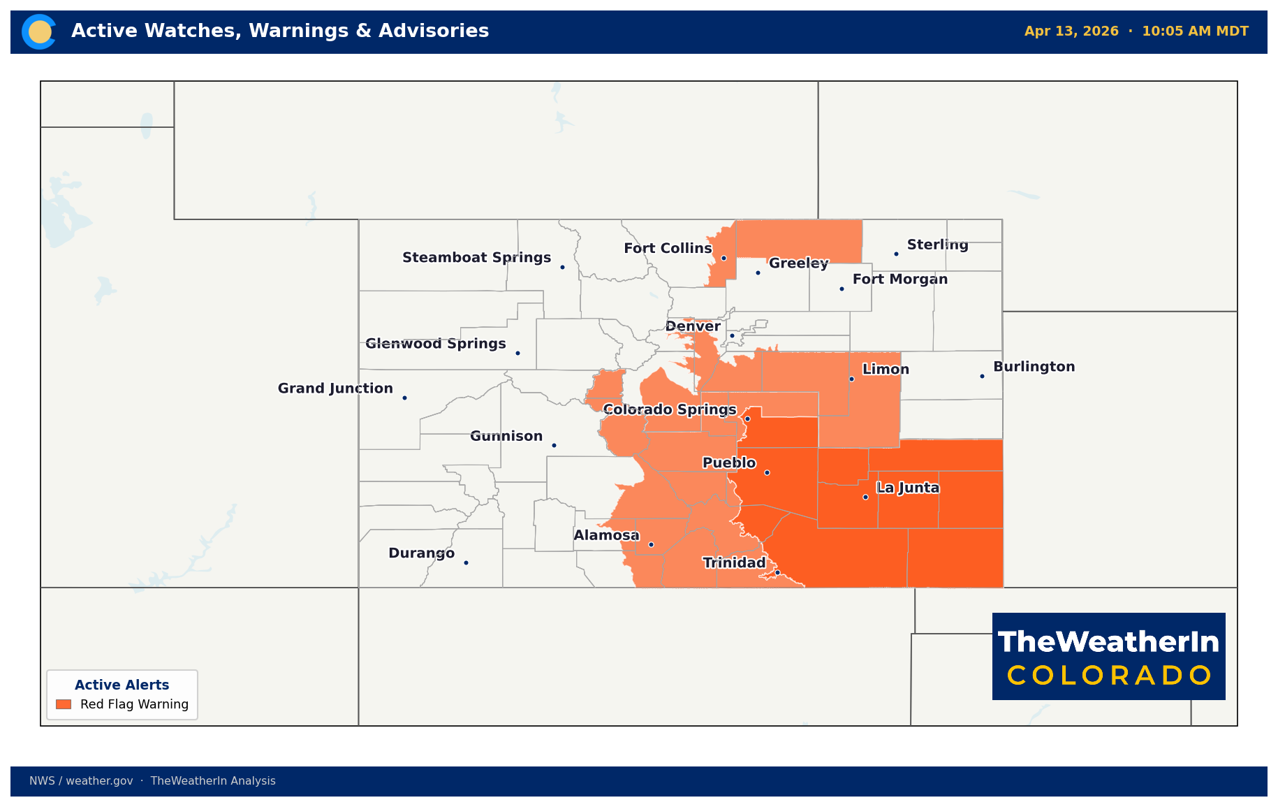
Red Flag Warnings are active again on Monday across a large portion of Colorado, marking the second straight day of critical fire weather conditions. Afternoon relative humidity values are expected to drop into the 9–16% range across the warned zones, with wind gusts of 25–35 mph. Near the Sangre de Cristo mountains, isolated gusts to 50 mph are possible.
Fuels remain extremely dry across the warned areas. No significant precipitation has fallen across southern and southeastern Colorado in recent weeks, and the combination of record-warm temperatures this weekend — plains highs reached the low to mid 80s Sunday — has accelerated fuel moisture loss heading into this afternoon.
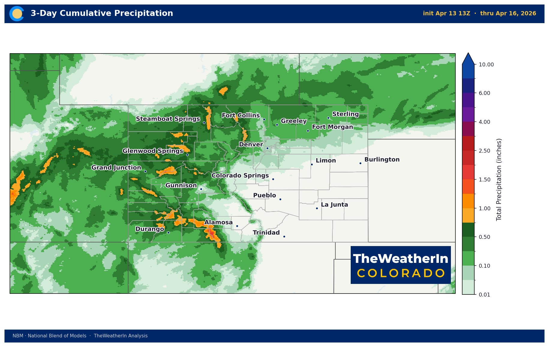
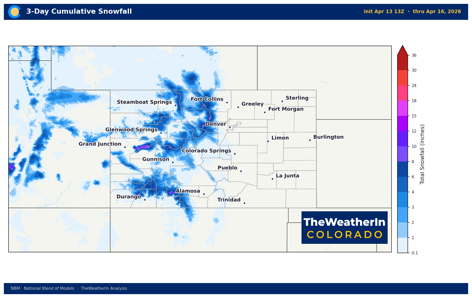
Tuesday brings a shift. A cold front is expected to push through the eastern plains Tuesday afternoon and evening, dropping temperatures 10–15 degrees and bringing increasing chances of rain. The mountains will see rain and mountain snow beginning Monday night, with the San Juan Mountains picking up 3–8 inches of snow above 9,000 feet by Wednesday morning. Mountain pass travel — particularly over Wolf Creek and the southern passes — could be slushy and slick Tuesday.
The pattern does not stay quiet for long. Fire weather conditions are expected to return by Thursday and Friday ahead of another system late in the week. That system brings another chance of rain and snow statewide, along with the possibility of freezing temperatures across southern Colorado by Saturday morning.
For agricultural operations across the southern plains and eastern Colorado, any outdoor burning should be avoided through at least Tuesday evening. The combination of critically low humidity, gusty winds, and cured grass fuels represents the highest fire spread potential of the season so far.