
El Niño Is Strengthening Fast — Here's What That Means for Colorado's Winter
NOAA's latest update pushes the odds toward one of the strongest El Niño events on record. Here's what the forecast data shows for Colorado season by season — and why the payoff is still months away.

The tropical Pacific pattern behind this year's brutal drought has officially flipped — and it's flipping harder than expected. NOAA's latest update, released July 9, now puts the odds at 81% that this El Niño reaches "very strong" intensity by the October–December window, and forecasters carry very high confidence it holds through early spring 2027. A month ago, that very-strong probability was sitting at 63%. This is moving fast.
You may be seeing headlines calling this a "Super El Niño." That's not an official designation — it's a media shorthand, not a NOAA category — so treat it as color commentary, not a forecast term. What is official: ocean temperatures in the tropical Pacific are running well above average, the atmosphere has fully coupled with that warmth, and government and university forecast models agree this event keeps strengthening through the rest of the year.
Here's the part that matters most for Colorado: this is a winter story, not a summer one. The pattern that's driving this year's drought and fire season won't be touched by El Niño until much later in the year — and even then, one strong winter doesn't undo a multi-year deficit overnight.
How the Signal Builds Through Fall and Winter
Forecast data for Colorado shows a pattern that gradually shifts as El Niño strengthens into winter:
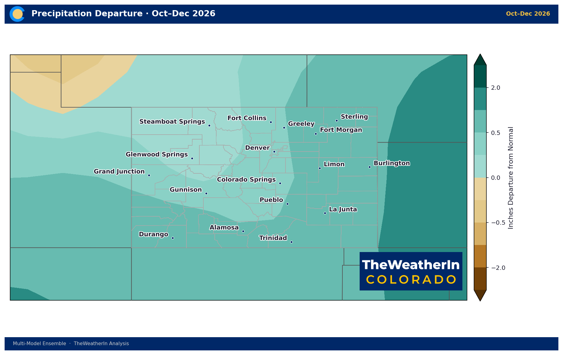
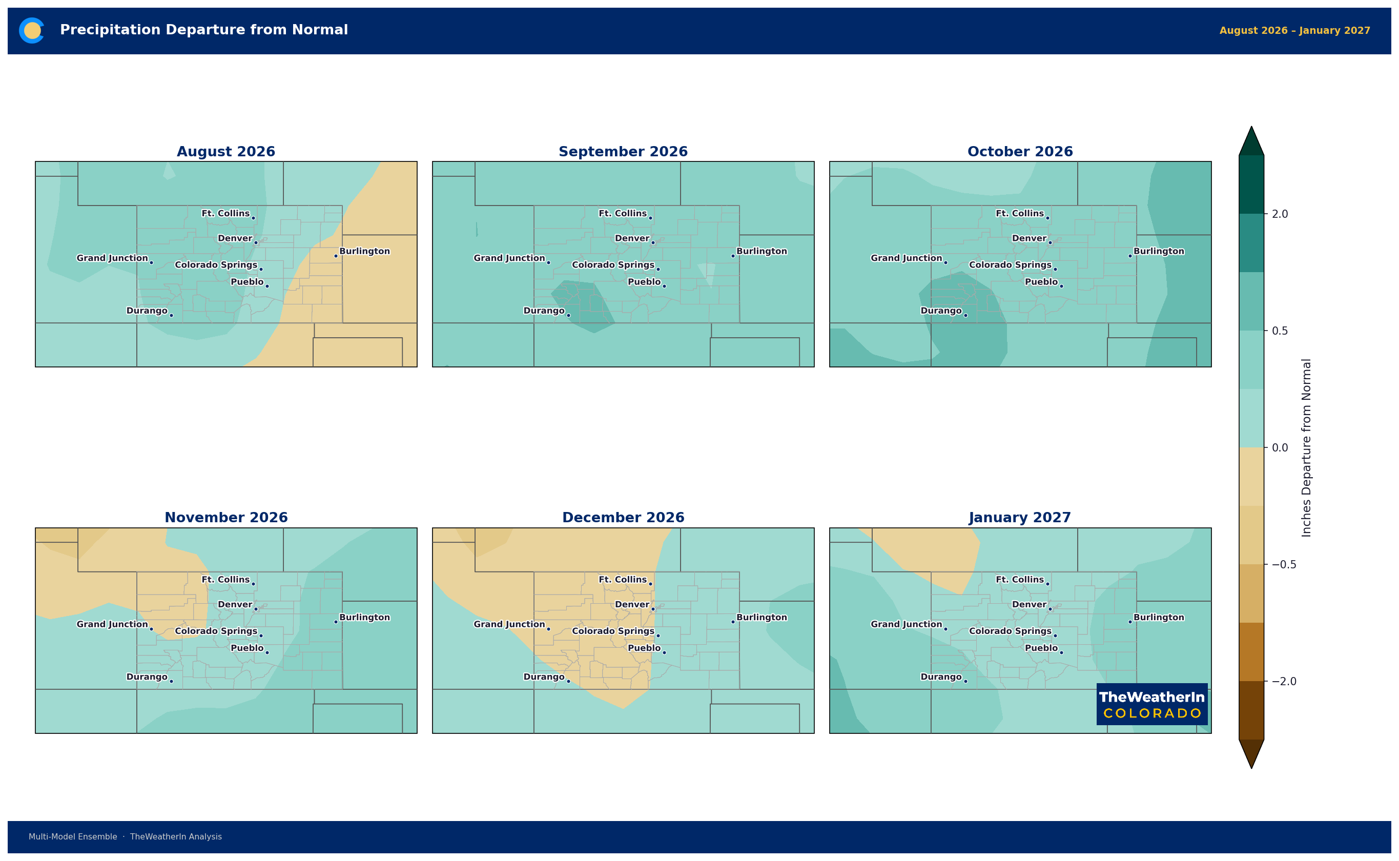
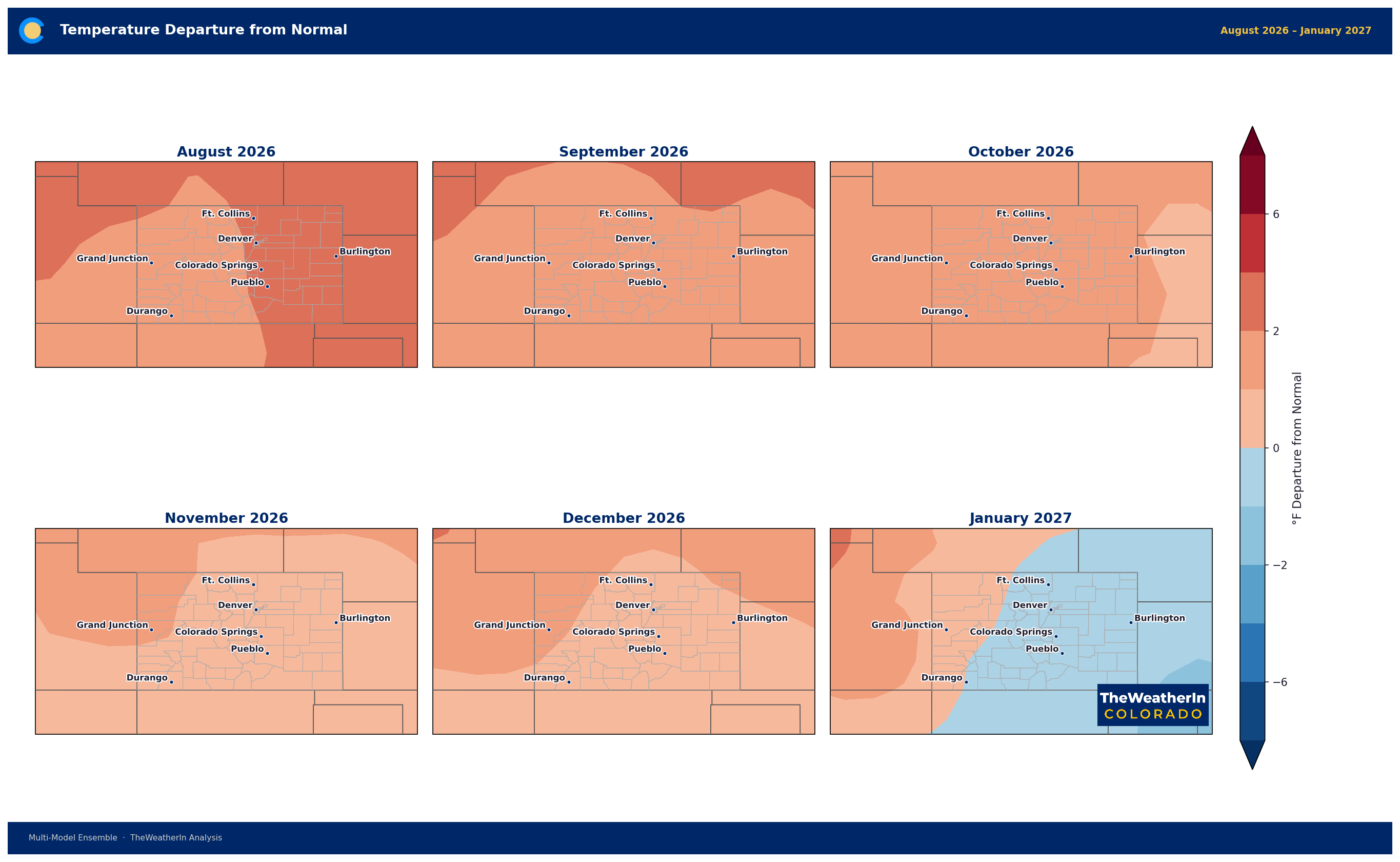
October–December: Temperatures ease from summer's extremes to a more modest lean above average (roughly +1°F), while precipitation odds tilt meaningfully wet — about 7 in 10 signals now favor above-normal moisture. This is the transition window, not the main event.
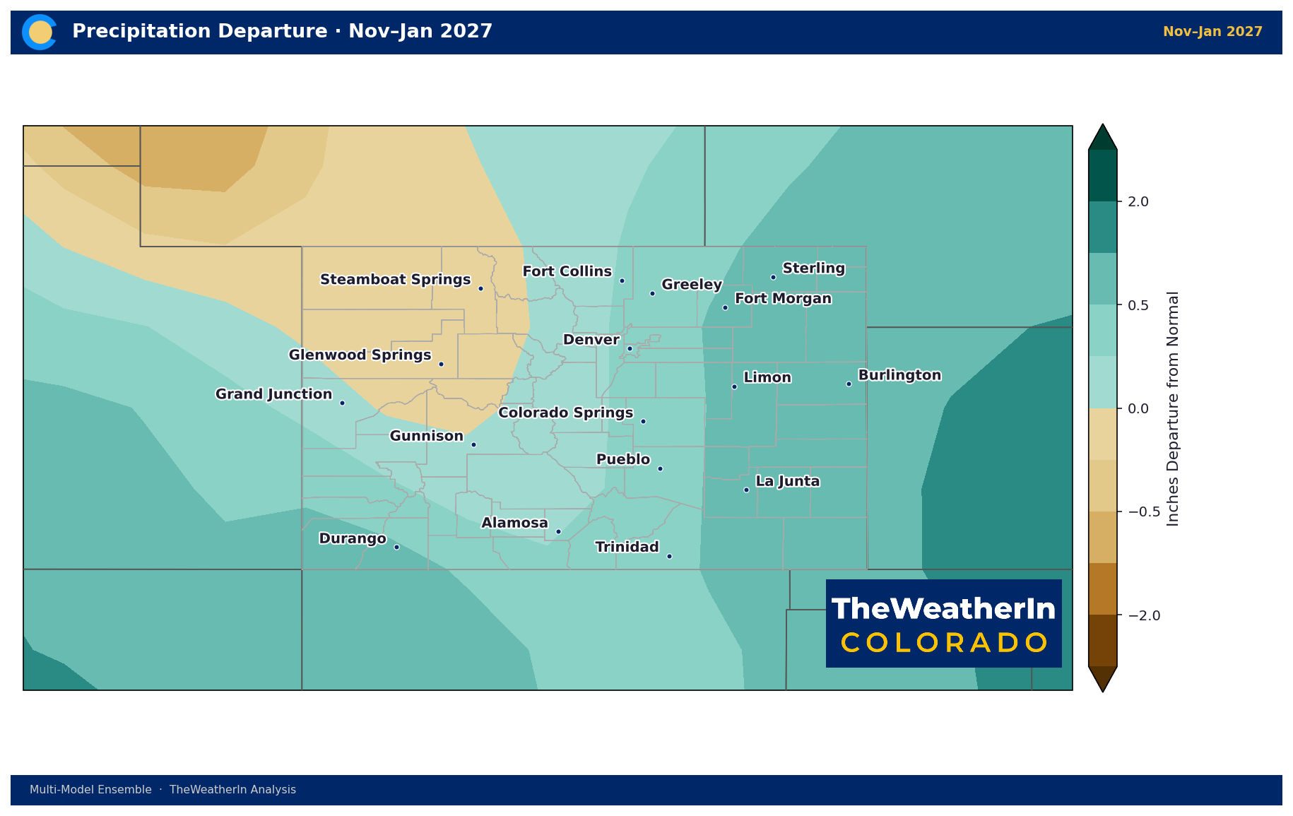
November–January: Temperatures move close to a coin flip — only about a third of the outlook still favors above-normal warmth, meaning cooler-than-recent-normal conditions are now the more likely outcome. Precipitation odds hold in wet territory, with roughly 6 in 10 signals favoring above-normal moisture.
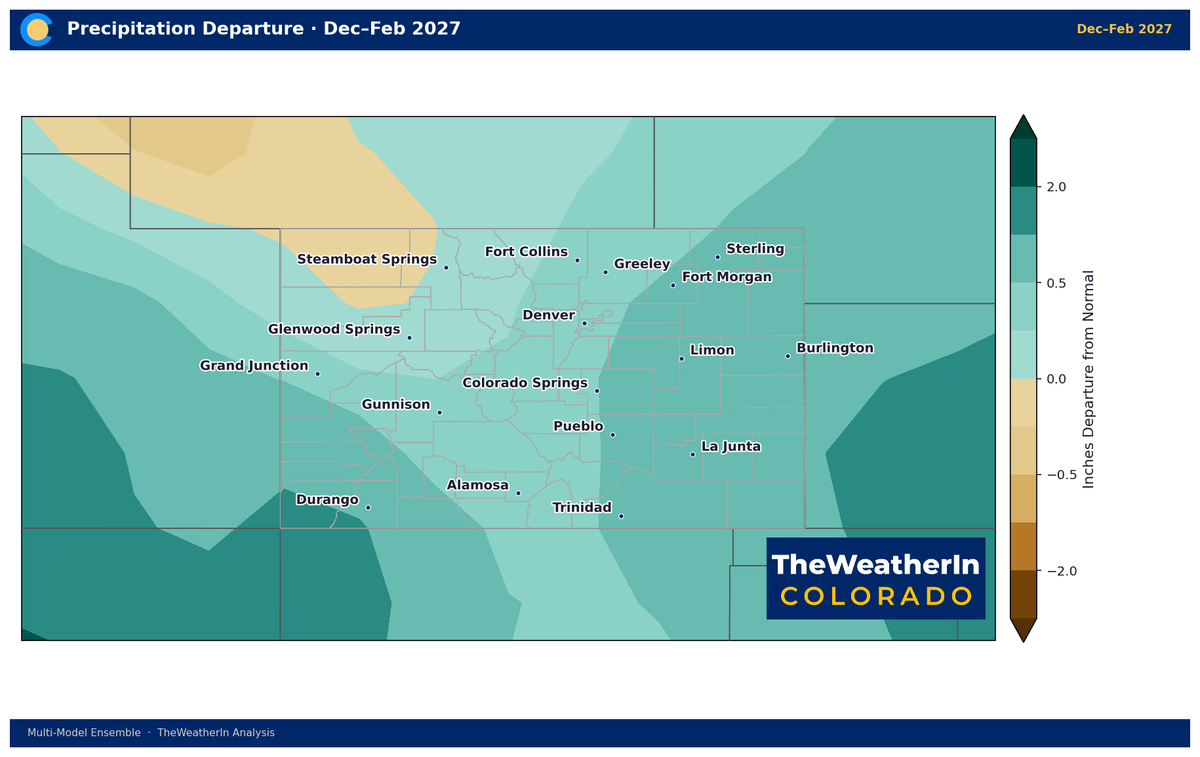
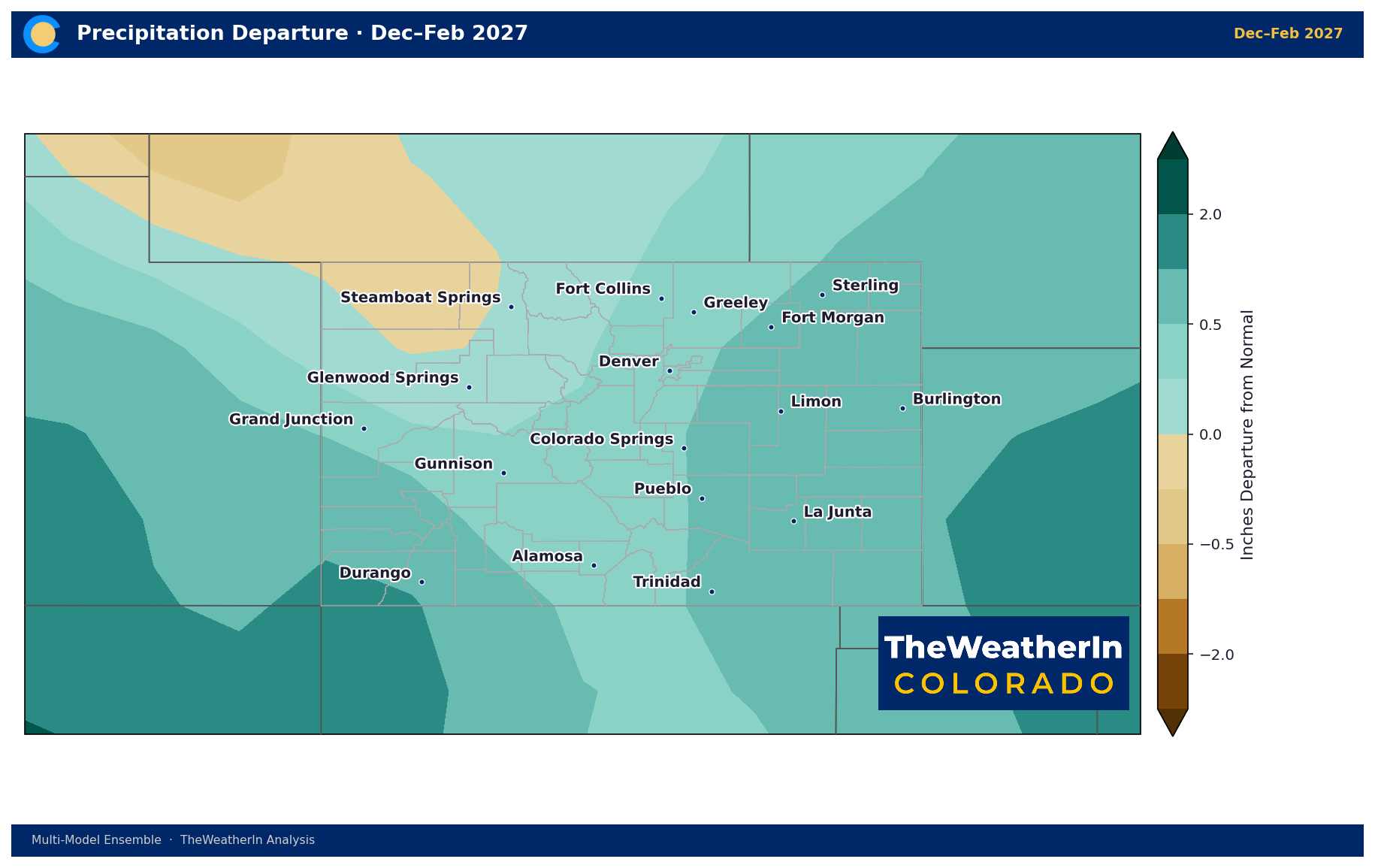
December–February: This is where the pattern really turns. Temperature odds now favor near-to-below-normal conditions outright — a sharp reversal from the record warmth of last winter — while precipitation odds strengthen further, with about two-thirds of signals favoring above-normal moisture.
January–March 2027: The strongest signal of the entire outlook. Temperatures lean solidly below average, and precipitation odds peak — more than three-quarters of the outlook now favors above-normal moisture. If this holds, it would be the most favorable stretch for snowpack and moisture recovery since this drought began.
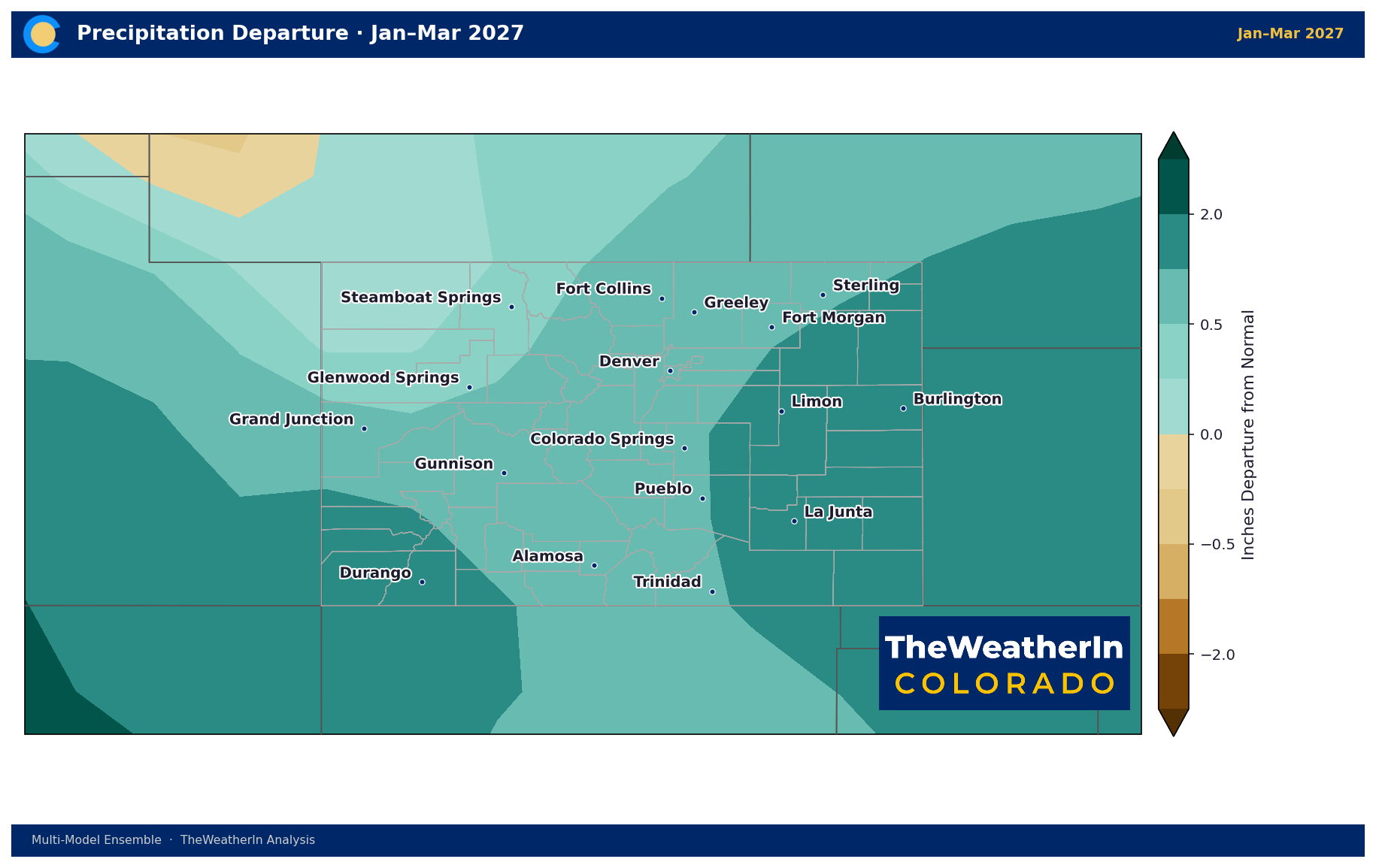
Regional Breakdown — Winter Outlook (December–March)
| Region | Temperature | Precipitation | Notes |
|---|---|---|---|
| Southeast Plains / San Luis Valley | Near to below normal | Wettest lean of any region — 8 in 10 signals favor above-normal moisture | Classic El Niño "southern storm track" region — best odds in the state |
| Front Range / Northeast Plains | Below normal — coolest region | Strongly favors above-normal moisture | Second-best odds in the state |
| Southwest Mountains / Four Corners | Near normal | Favors above-normal moisture, though less strongly than the eastern half | Solid odds, but not the standout region this winter |
| Western Slope / Northern Mountains | Closest to normal of any region | Weakest wet lean of the four regions — still favors above-normal, but by the smallest margin | Worth watching — the mountains that feed the most snowpack show the least confident signal |
That last point is worth sitting with. The classic El Niño pattern favors the southern jet stream — good news for the Arkansas Valley, southeast plains, and San Luis Valley — but it's historically a less reliable signal for the northern mountains and Western Slope, which is exactly where this outlook shows the weakest (though still positive) moisture lean. A strong El Niño winter won't necessarily help every basin equally.
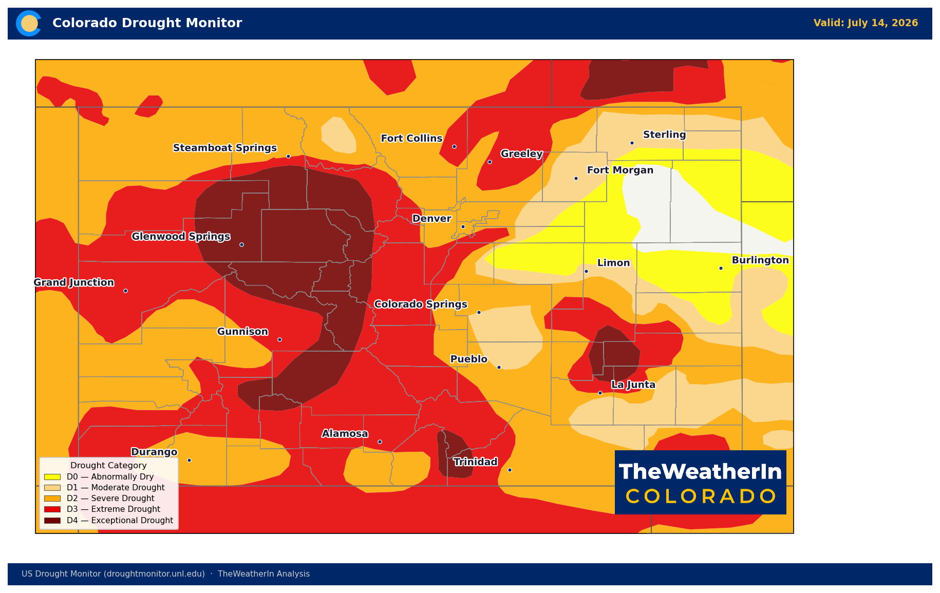
Drought & Water — Why This Is a Long Game
This is the pattern shift that could finally start turning Colorado's drought around — but "start" is the key word. The snowpack failure that produced this drought was the lowest on record, and the water supply gap it created for 2026 is already locked in; nothing happening in the tropical Pacific right now changes that. What a strong, wet El Niño winter can do is put meaningful snow back into the mountains for the 2027 water year — but that snow has to fall, has to hold through spring, and even then follows months behind the wildfire and drought conditions playing out right now.
Treat this as the forward-looking half of the story: the odds are shifting in Colorado's favor, and they're shifting faster than expected a month ago. The relief itself is still a winter event.
Agricultural and Recreation Implications
- Livestock producers: A wetter, cooler winter signal supports better range recovery heading into 2027 — but this year's forage and water stress still has to be managed through fall first.
- Irrigators and water managers: Watch the December–March window closely; this is the stretch that will determine next year's snowpack and streamflow starting point.
- Ski and winter recreation: The regional breakdown favors the southern mountains and Front Range corridor over the northern high country for snow odds — worth factoring into early-season planning.
The next official update on this event comes from NOAA on August 13. Given how much the numbers moved between June and July, that update is worth watching closely.



