Fire Weather, a Hard Freeze, and 80s — Colorado's Most Active Week of April
Colorado is about to run through every season in 72 hours. Critical fire weather is ongoing today, a cold front and mountain snow arrive tonight through Friday, a hard freeze follows Friday night, and by Tuesday plains temperatures are back in the lower 80s.

Drought-buster? No, but at least a little bit of moisture on the way - but be careful, temperatures will be mighty cold Saturday morning. Colorado is about to run through every season in 72 hours. Critical fire weather is ongoing today, a cold front and mountain snow arrive tonight through Friday, a hard freeze follows Friday night, and by Tuesday plains temperatures are back in the lower 80s. Here's what to know for each phase.
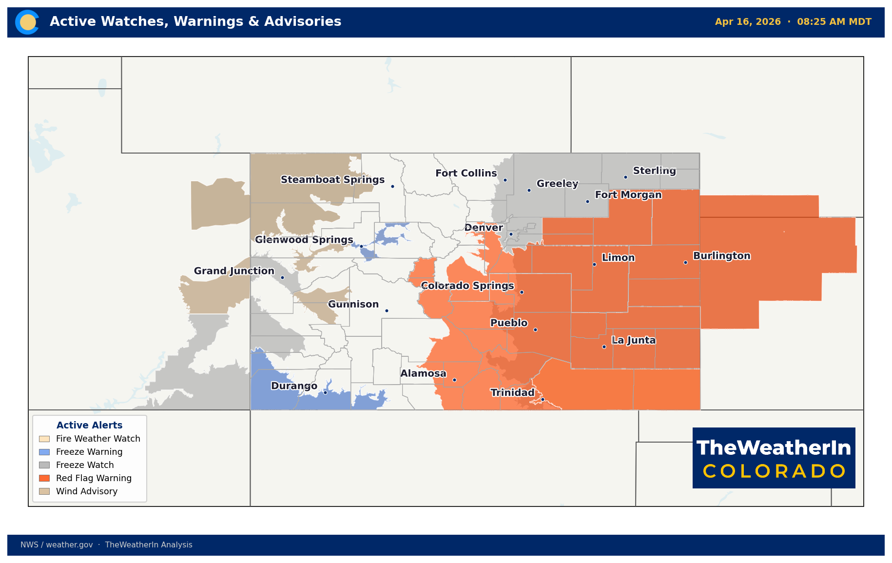
Today — Fire Weather in Effect
A Red Flag Warning remains active through this evening for the southern Foothills, Palmer Divide, and areas generally east of the urban corridor south of US 34. Relative humidity is dropping into the single digits to low teens across the plains, with southwest wind gusts 20–35 mph. Similar critical fire weather conditions extend across much of southern Colorado, where gusts near the mountains could reach 60 mph. If you're in or near fire-prone terrain, avoid any open burning today.
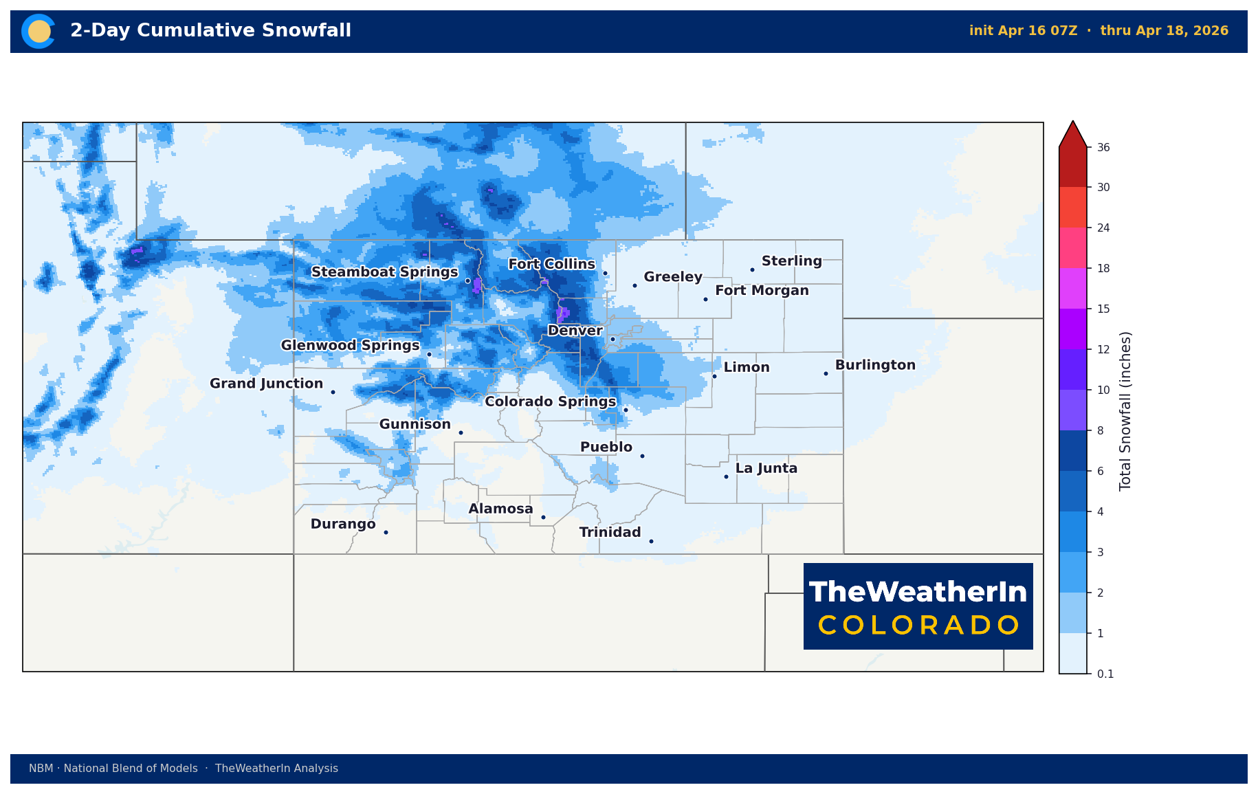
Tonight Through Friday — Cold Front and Mountain Snow
A cold front pushes through Colorado tonight into Friday, bringing a rapid change. Wind gusts 35–50 mph from the north follow the frontal passage. Snow develops in the mountains overnight and spreads to the plains Friday morning.
Most likely snowfall totals:
| Area | Likely Accumulation | Notes |
|---|---|---|
| Mountains | 2–8 inches | Higher totals in northern ranges |
| Foothills / Palmer Divide | 1–4 inches | Low chance (~10%) of up to 8 inches with banding |
| Urban Corridor / Plains | Trace to 2 inches | Warm roads will limit accumulation |
| Western Slope Valleys | 1 inch or less | Grand Valley: dusting only |
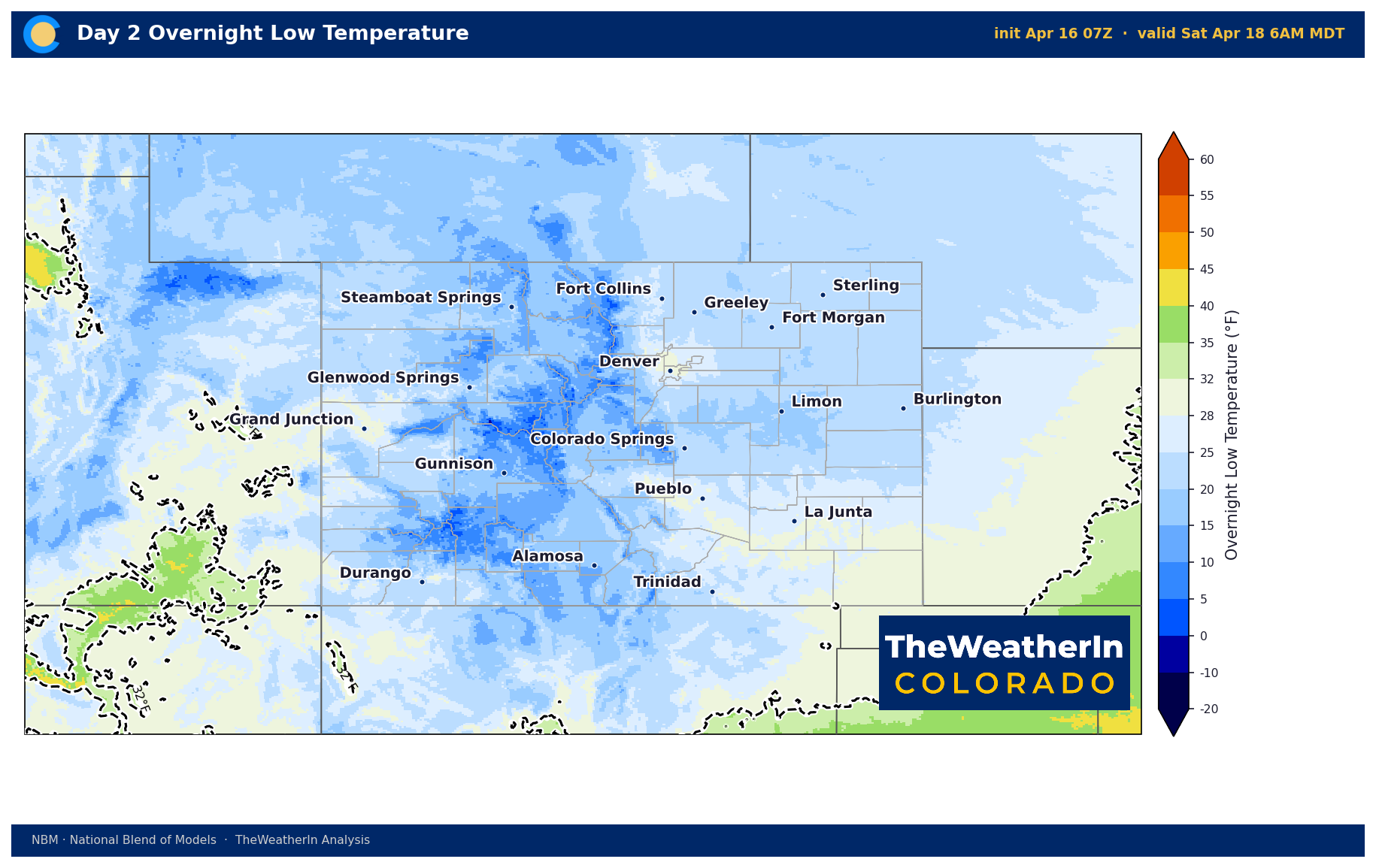
Friday Night / Saturday Morning — Hard Freeze
This is the headline for gardeners, growers, and anyone with livestock operations. After snow clears Friday evening, skies clear rapidly and temperatures plunge. Freeze Watches have been issued statewide.
Expected overnight lows Friday night into Saturday morning:
| Region | Forecast Low | Departure |
|---|---|---|
| Eastern Plains | Low–mid 20s | 10–15°F below normal |
| Western Slope Valleys | Teens to upper 20s | 10+ °F below normal |
| Mountains / Palmer | Teens | Well below normal |
This has been an unusually warm April — many fruit trees and ornamental plants have already leafed out or flowered. Tender vegetation is at high risk. NWS is indicating a 75–100% probability of sub-freezing temperatures across southern Colorado, and 50–100% probability of a hard freeze (28°F or lower) in many areas. Cover plants, protect irrigation systems, and move potted plants indoors Thursday evening.
An additional below-freezing night is possible Saturday night into Sunday morning across central and southern Colorado before temperatures begin recovering.
This Weekend and Next Week — Rapid Rebound
High pressure builds quickly behind the departing system. Conditions dry out Saturday and warm rapidly — portions of the plains are forecast to reach the lower 80s by Tuesday. A potential system is being watched for late next week, but timing and track remain uncertain. For now, plan on a very warm and dry stretch from Saturday through Wednesday.
Drought Context
The broader West continues to deal with a concerning snowpack picture. Temperatures ran 6–8°F above normal across Colorado and much of the surrounding region last week, accelerating snowmelt and keeping the water supply outlook below normal. The modest snow this weekend provides a small boost but does not meaningfully change the seasonal water picture for most river basins.
At least we have some moisture coming in, albeit not a lot, on Friday.