
Fire Weather, Severe Storms, and a Pattern That Won't Let Go
Colorado faces a week of critical fire weather and severe thunderstorms — and the conditions driving both trace back to a drought that keeps deepening. Here's the full picture.

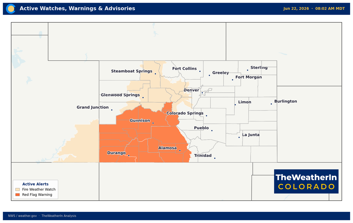
Colorado is running two simultaneous weather stories this week — and both of them trace back to the same drought that has defined 2026. Severe thunderstorms are hammering the eastern plains through midweek while critical fire weather conditions grip the mountains and western valleys. Neither story ends cleanly: a brief moderation late in the week gives way to a return of widespread critical fire weather conditions this weekend, and the longer-range picture shows no sustained relief in sight.
Pattern Overview
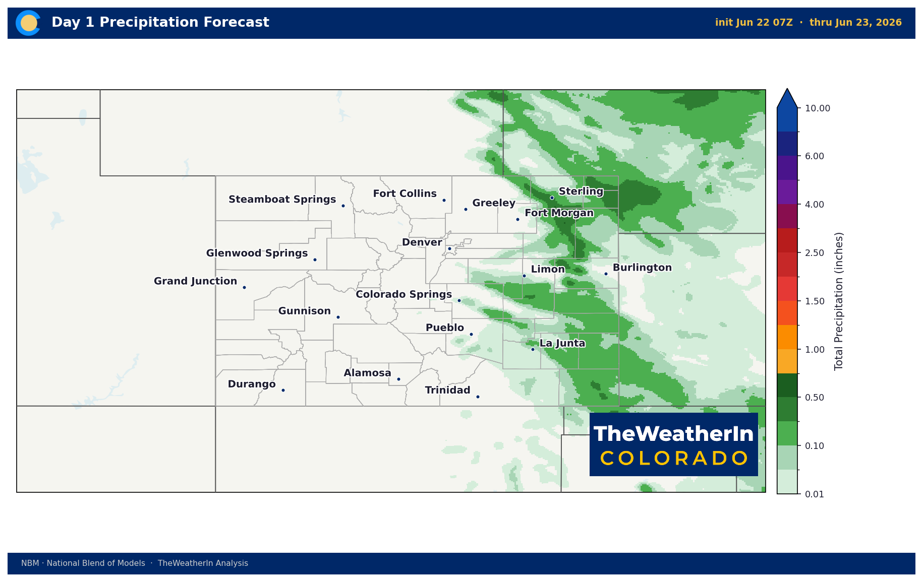
A warm, moist, and unstable airmass has pooled across Colorado's lower elevations, fueling repeated rounds of afternoon and evening thunderstorms across the plains. Successive shortwave disturbances — short-wavelength energy pulses embedded in the flow aloft — are providing the trigger needed to fire those storms, keeping the severe threat elevated through at least Wednesday. Moisture is deepest along and south of Interstate 70, which is why the severe threat is most concentrated there.
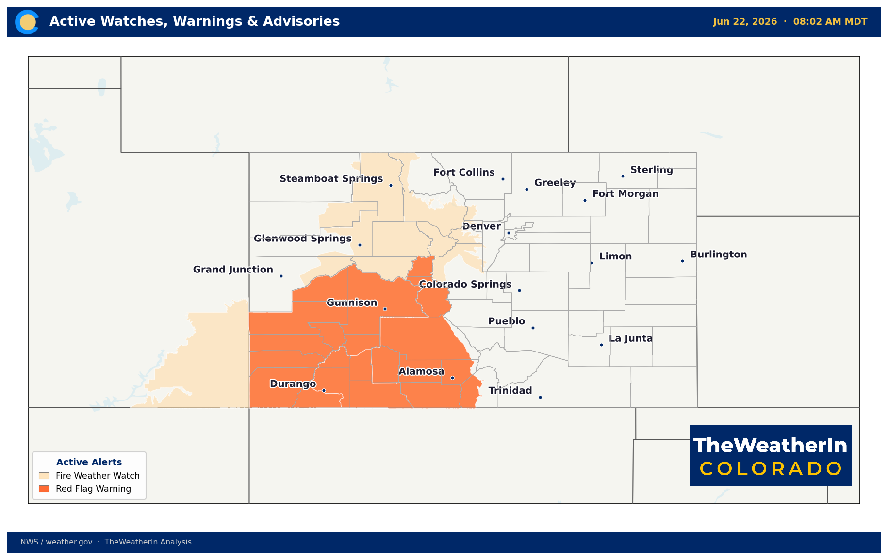
Meanwhile, the mountains and western valleys are running a fundamentally different story. Downsloping, drying westerly winds are compressing what little moisture exists as air descends the terrain, pushing relative humidity into the single digits and turning already critically dry fuels into a fire weather emergency. Red Flag Warnings are in effect today across the Western Slope and San Luis Valley; Fire Weather Watches are posted for much of the mountain zone Tuesday. The same atmospheric setup that produces afternoon storms on the plains — energy moving through the flow aloft — can also generate dry lightning over higher terrain, where rainfall evaporates before reaching the ground.
The driving force behind both stories is the same historically depleted moisture base that has characterized 2026. Fuels across the eastern plains, San Luis Valley, and southern mountains are critically dry — cured weeks ahead of schedule after a winter and spring that set all-time temperature records and left snowpack at levels without modern parallel. An amplifying upper-level trough is expected to swing into the northern Rockies this weekend, initially bringing gusty southwest winds and another round of critical fire conditions before brief moderation arrives at the tail end of the period. The deeper story — the one worth watching — extends well beyond this week.
Weeks 2–4 Outlook
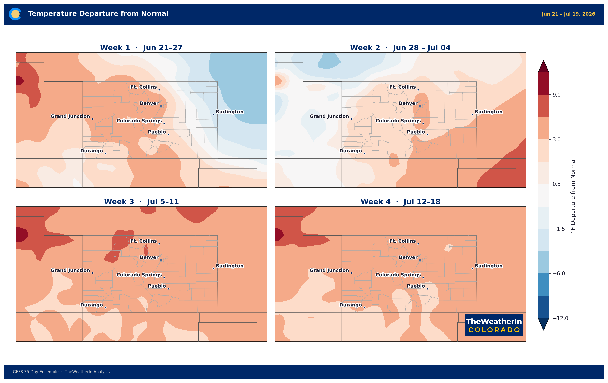
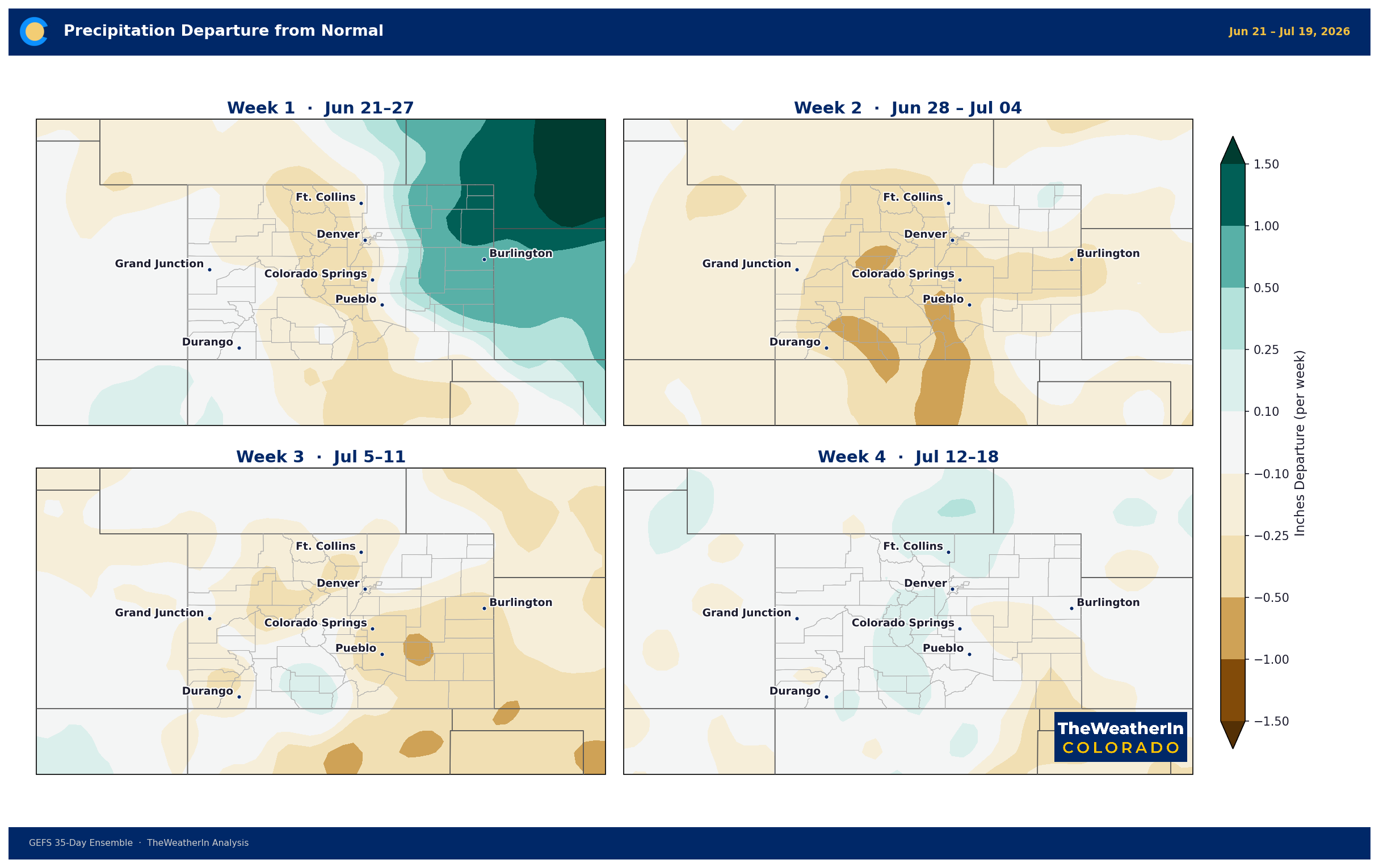
The pattern through the back half of June does not offer a clean break. Forecast data shows temperatures trending above normal through at least the third week of June, with periodic critical fire weather windows likely as the atmosphere cycles through dry, windy setups — particularly for the mountains and Western Slope. Precipitation probabilities during this period lean below normal across most of the state, which means the fuel moisture deficit will continue to deepen rather than recover.
The most meaningful potential for pattern change remains tied to the summer monsoon. Southern Colorado typically sees its first significant monsoon moisture in mid-July, when the seasonal shift in atmospheric flow draws Gulf of California and Gulf of Mexico moisture northward. This year, given how dry the fuel complex already is, every day of monsoon delay carries added consequence — and even an on-time monsoon arrival would provide only localized and intermittent relief, not a statewide reset. North of the Arkansas River drainage, monsoon moisture is inconsistent in a typical year; in a year when the background pattern is trending warm and dry, relying on it for drought relief is a long shot.
The larger long-range signal worth watching is the confirmed emergence of El Niño in the tropical Pacific. That shift — now underway and expected to strengthen substantially through the fall — historically delivers above-normal precipitation to the southern Rockies. But that impact arrives in November through March, not July. For Colorado's drought, El Niño is a winter story. The summer ahead will be defined by how quickly the monsoon can establish itself, and whether periodic storm cycles can provide at least temporary relief to the driest fuels.
Regional Breakdown — Week of June 22
| Region | Temperature | Precipitation | Highlights |
|---|---|---|---|
| Front Range / Foothills | Near to slightly below normal Mon–Wed | Scattered to widespread storms Mon–Wed; mostly wetting rain Thu–Fri | Severe storm threat each afternoon through Wednesday — large hail, damaging winds, isolated tornadoes possible; critical fire weather returns high country this weekend |
| Mountains / High Country | Near normal Mon, warming Thu–Sat | Mostly dry Mon–Wed; wetting rain possible Thu–Fri; drying again weekend | Critical fire weather Tuesday–Wednesday (RH to 10%, SW winds to 30+ mph, mixing heights near 15,000 ft); dry lightning risk Wed–Fri; widespread critical conditions return Saturday–Sunday |
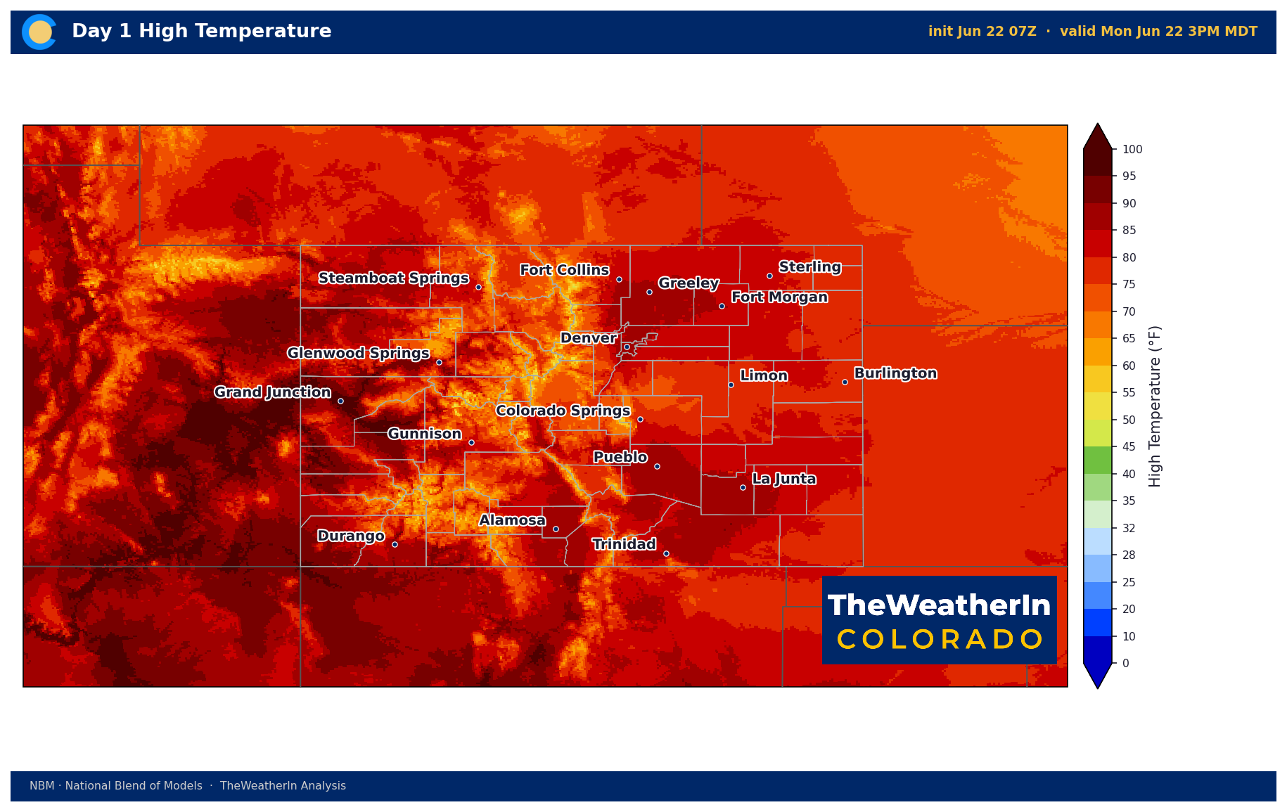
| Western Slope | Above normal; triple-digit highs possible in lower valleys Tue–Wed | Mostly dry; dry thunderstorm risk Wed–Fri (virga, outflow winds to 60 mph) | Red Flag Warning today; Fire Weather Watch Tuesday; critical conditions likely to persist or return through the weekend; extreme fire behavior possible |
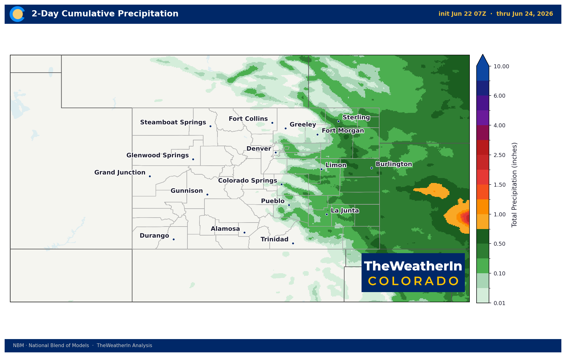
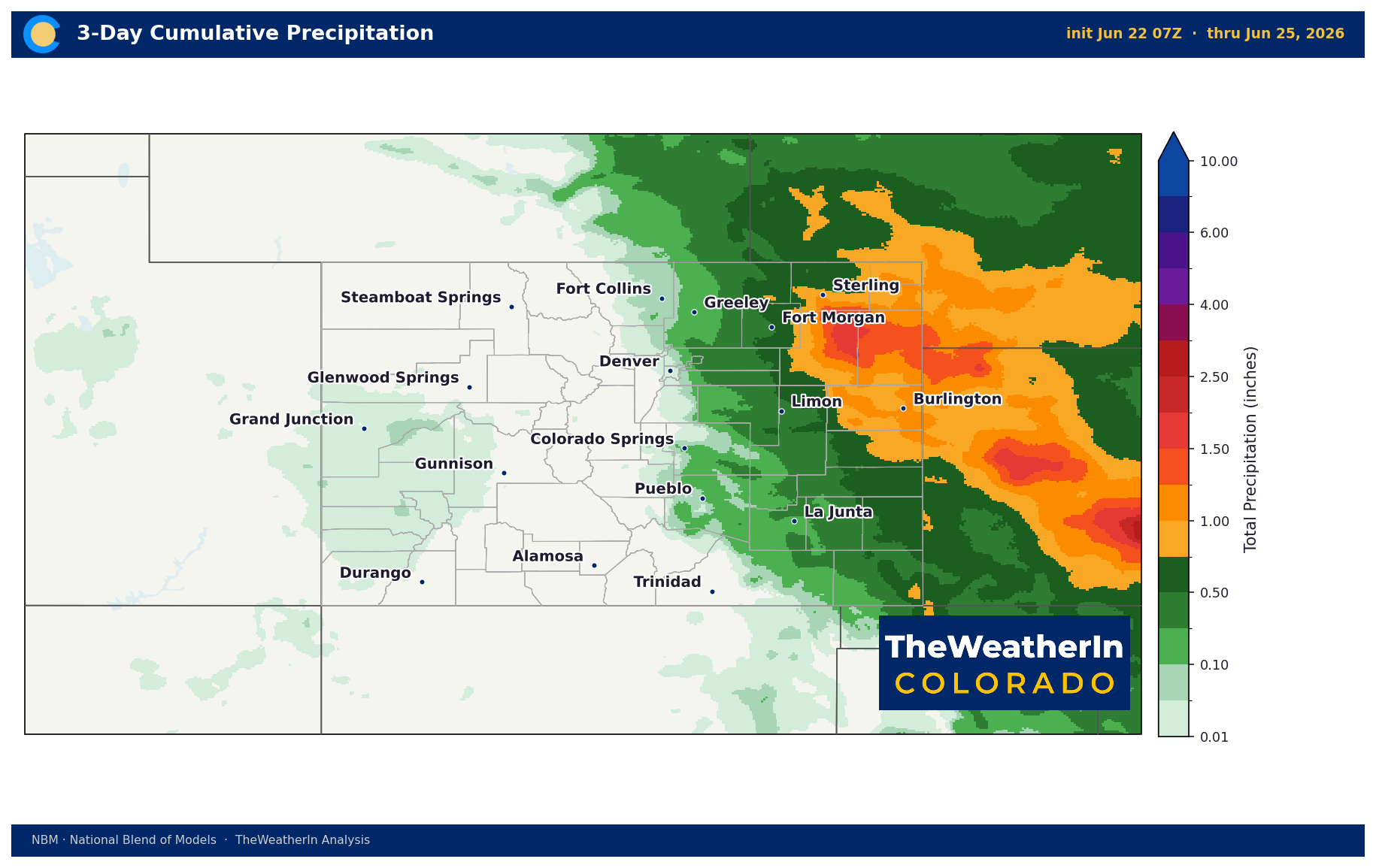
| Eastern Plains | Below normal Mon–Wed; warming late week | Strong to severe storms each afternoon Mon–Wed; flash flooding risk increases midweek | Severe threat highest south of I-70; large hail, damaging winds, isolated tornadoes each day; hail damage to crops possible; localized flooding concern midweek from successive convection |
| Southern CO / San Luis Valley | Above normal; highs 74–88°F with low humidity | Red Flag Warning today; critical fire weather each afternoon through Wednesday; dry lightning risk Wed–Fri | RH to single digits; SW winds gusting 25–35 mph; Upper Arkansas River Valley and San Luis Valley most threatened; wetting rain possible Thu–Fri before critical conditions return weekend |
Drought & Water
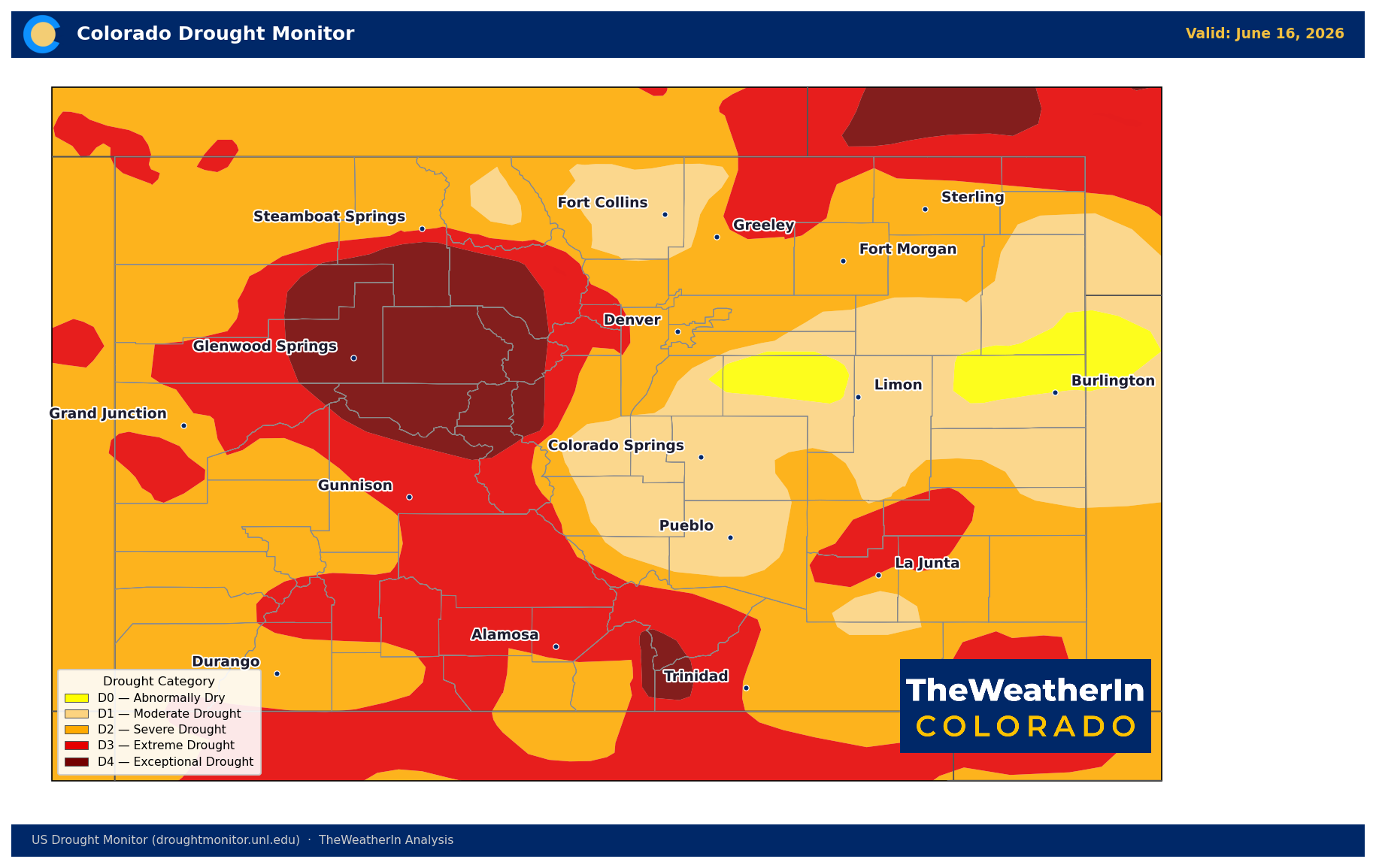
There is no version of this week's weather that meaningfully moves the drought needle. As of June 9, 99.45% of Colorado remains in at least abnormal dryness — that number has been effectively unchanged for months. Moderate drought or worse covers 95.26% of the state. Extreme to exceptional drought (the two most severe categories) blankets 36% of Colorado, with exceptional drought alone covering nearly 9% of the state, concentrated in the north-central mountains and Sangre de Cristos. The Drought Severity and Coverage Index stands at 316 — more than double where it sat a year ago and more than double the start-of-year reading.
The storms moving across the eastern plains this week will deliver locally meaningful rainfall to some areas, and the brief moisture window Thursday–Friday could provide spot relief across the mountains and southern Colorado. But successive convective days also bring flash flooding risk to areas where soils are too dry and compacted to absorb heavy rain quickly — a dry-land flooding paradox that becomes more common as drought deepens. None of this precipitation pattern constitutes a trend reversal.
The water supply picture is not improving. Statewide May–July runoff is forecast at just 24% of the historical median. Streamflow on the Colorado River near the Utah state line is running at roughly 23% of a normal year's volume — a shortfall equivalent to about 2.5 million acre-feet of water. Nearly half of all Colorado streamflow forecast points are tracking toward their lowest or second-lowest flows on record. Reservoirs are drawing down carryover from 2025 with no meaningful replenishment coming from the mountains. The snowpack window closed months ago.
Agricultural Implications
- Severe storm and hail damage risk, Monday through Wednesday: Each afternoon brings potential for large to very large hail, damaging winds, and isolated tornadoes across the eastern plains — the highest risk south of I-70. Crops and structures in the path of any storm are vulnerable. Flash flooding risk also increases midweek as successive convective days saturate localized areas faster than dry soils can absorb. Assess field conditions before each afternoon's storm window.
- Critical fire weather — range and pasture threat through the week and again this weekend: Wind-driven fire spread on critically dry grass and brush remains the dominant risk for livestock and forage operations across the Western Slope, San Luis Valley, and eastern plains. The brief moderation Thursday–Friday does not eliminate the threat — dry lightning during that window can still ignite fires in terrain where wetting rain doesn't reach. Widespread critical conditions are expected to return Saturday–Sunday with gusty southwest winds and humidity back near 10% or lower. Have evacuation plans current.
- Heat and livestock stress in southwestern Colorado and interior valleys: Triple-digit temperatures are possible in lower-elevation areas by midweek. Confined livestock operations should ensure access to shade, water, and ventilation. The heat moderates briefly late weekend but the broader pattern through late June favors continued above-normal temperatures with no sustained cool-down on the horizon. Soil moisture across the state remains below normal heading into the peak of summer — dryland producers are entering the critical growth window with little buffer.
The Signal Worth Watching
El Niño conditions are now confirmed in the tropical Pacific — a moderate-to-strong event is the favored scenario and could rank among the strongest on record — but Colorado's drought relief tied to that shift remains a winter story, and the summer monsoon's timing and northern reach will determine how much of a bridge the next several months can provide.



