Fire Weather Watch Thursday, Hard Freeze Friday Night — What Colorado's Next Storm Means for You
Spring's rollercoaster is back. After a drier Wednesday, Colorado faces two back-to-back hazards before the weekend: critical fire weather on Thursday, followed by a hard freeze on Friday night into Saturday. Here's the full breakdown.
Spring's rollercoaster is back - better than the doldrums we called our "winter". After a drier Wednesday, Colorado faces two back-to-back hazards before the weekend: critical fire weather on Thursday, followed by a hard freeze on Friday night into Saturday. Here's the full breakdown.
After a drier Wednesday, Colorado faces two back-to-back hazards before the weekend: critical fire weather on Thursday, followed by a hard freeze on Friday night into Saturday.
Today is the calm before the storm. The trough that brought Tuesday's showers has pushed east, leaving mostly sunny skies and temperatures in the 60s on the Front Range and eastern plains. Western Slope valleys are starting the morning with a Freeze Warning was in place through 9 AM — the growing season is well underway, so those with outdoor plants got one more reminder this morning.
Thursday, April 16 — Critical Fire Weather Conditions Return
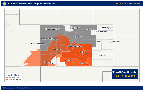
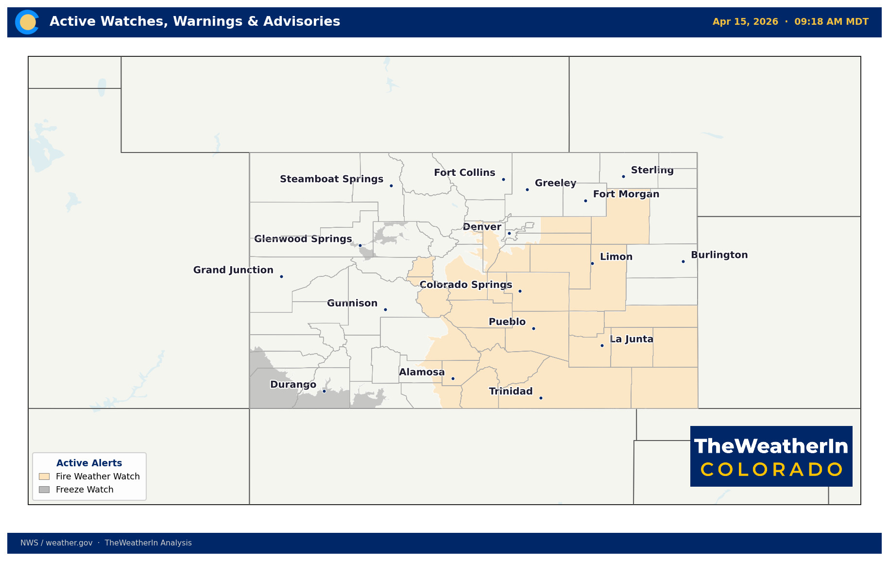
Thursday will be the warmest day of the stretch — and one of the most dangerous for fire weather. A Fire Weather Watch has been issued for much of Colorado.
As an upper ridge pushes east ahead of Friday's storm, strong southwest winds will combine with rapidly dropping humidity to produce widespread elevated-to-critical fire weather conditions. Forecasters are noting the potential for single-digit relative humidity values Thursday afternoon across parts of the plains.
Fire Weather Watch areas: South Park, Palmer Divide, and adjacent plains; a large area of southern Colorado from the San Luis Valley to the SE plains.
For those in agricultural and outdoor operations, Thursday afternoon is not the day to burn debris, run equipment in dry grass, or leave equipment unattended in high-risk areas.
Friday, April 17 — Cold Front, Snow, and a Rapid Cooldown
A strong trough swings through Colorado Friday, bringing the season's sharpest cold snap yet. The cold front arrives sometime Friday morning on the Front Range — timing is still uncertain enough that forecasters are watching carefully.
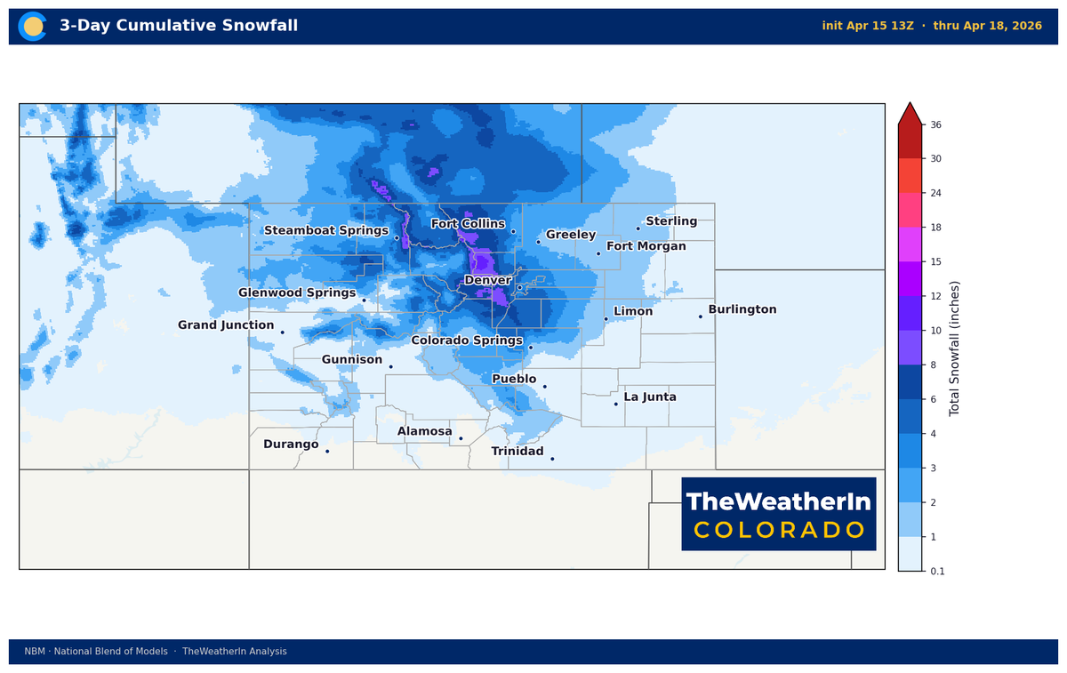
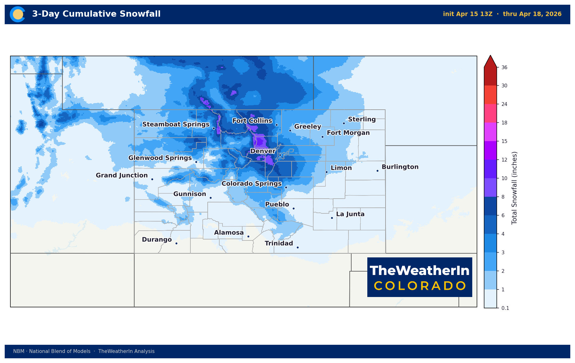
Snow: Light to moderate snow is expected for the mountains Friday into Friday evening. Snow will spread east across the high terrain, with a brief window for light accumulation along the Palmer Divide and north of Colorado Springs. The Pikes Peak region and Teller County are expected to see 2–5 inches. South of the Arkansas River, most areas will see little to no rain or snow.
On the Western Slope, snow levels fall to 5,000 feet with widespread showers, and brief snow squalls are possible with the cold front Thursday night, leading to rapidly deteriorating road conditions.
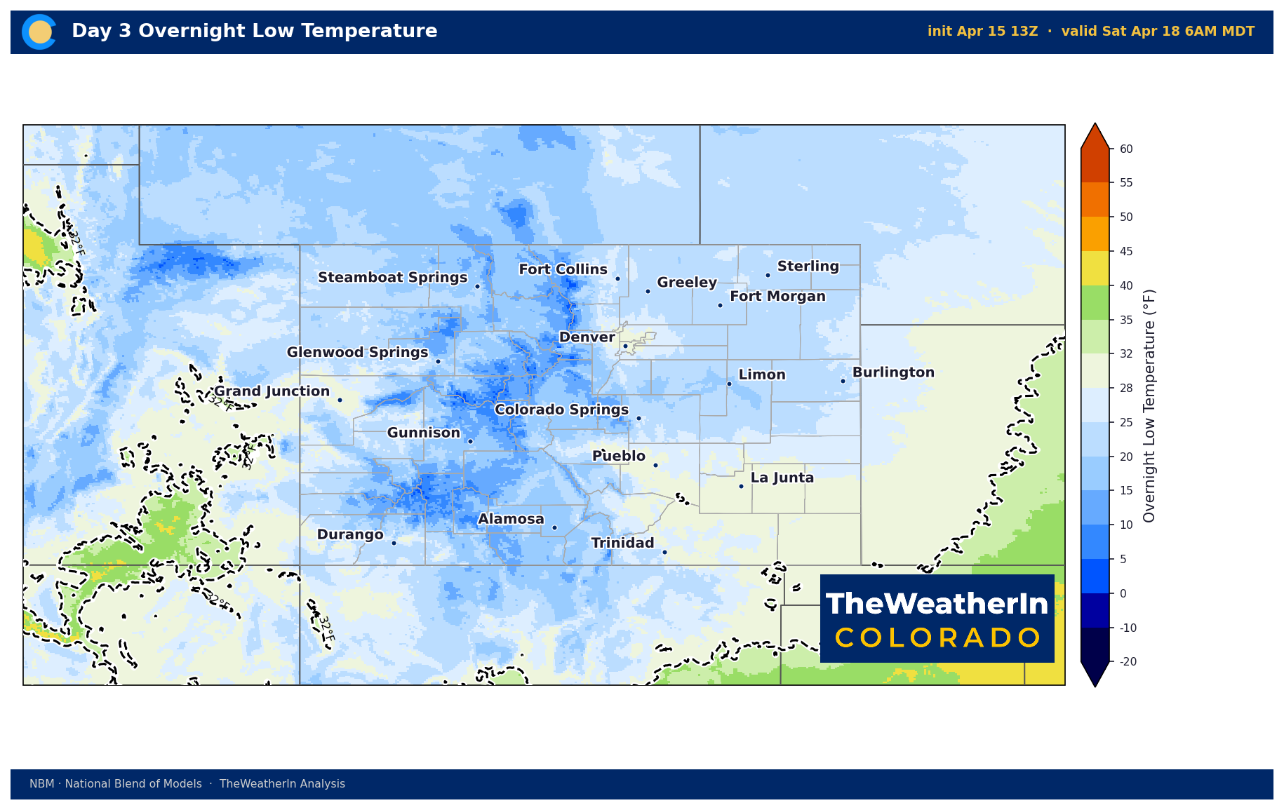
Friday Night — Hard Freeze Warning Likely
This is the headline for agricultural operations. Once the system clears out Friday night, skies clear rapidly and temperatures crash. A hard freeze is expected for nearly all of Colorado.
Hard freeze headlines are expected from NWS within the next day or so. If you have orchards, row crops, sensitive livestock operations, or outdoor plants, now is the time to plan. Fruit trees across the Western Slope are in a vulnerable growth stage — this event is worth watching closely.
Weekend — Recovery, Then Another System on the Horizon
Saturday stays cold and dry across most of the state. Warming begins Sunday and continues into early next week as a broad ridge builds back in. Temperatures are expected to return to above-normal levels by early next week.
However, we are already watching another potential system for mid-to-late next week. Colorado remains in a progressive, unsettled spring pattern.