
Heat Wave, Fire Weather, and a Drought That Isn't Going Away
Critical fire weather and near-100°F heat arrive Tuesday — but the bigger story is a drought that's only getting harder to break.

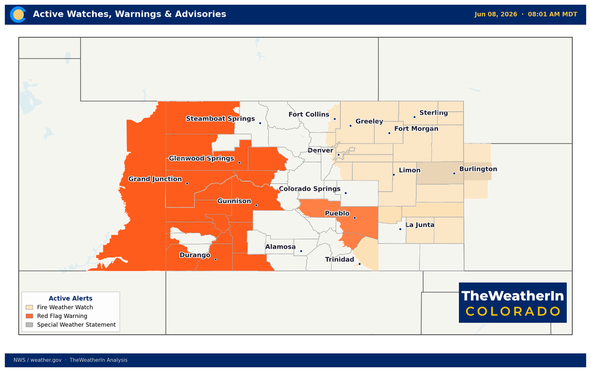
A multi-day fire weather and heat event is arriving on the heels of today's severe storms — but the week's extreme conditions don't exist in a vacuum. They're the latest chapter in a drought that now covers every square mile of Colorado, fed by a winter that shattered every record in the books.
Pattern Overview
A shortwave trough moving through Colorado this morning is wringing out one last round of storm energy before departing. Behind it, an upper-level ridge — a large dome of high pressure in the mid-to-upper atmosphere that suppresses clouds, accelerates surface heating, and drives strong downslope winds — builds aggressively through Tuesday and Wednesday. That combination of sinking air, intensifying southwest flow aloft, and critically dry surface conditions produces the most dangerous fire weather window of the year so far across the Western Slope and southern Colorado.
The ridge breaks briefly Wednesday night as a cold front pushes through, dropping temperatures into the 80s Thursday before the pattern rebounds into the weekend. There is no significant rain in this sequence for most of the state. Isolated dry thunderstorms — storms that produce lightning but little or no rainfall, allowing that lightning to ignite dry fuels without extinguishing them — are possible daily over the higher terrain through Friday, which adds new ignition risk to an already critical fire weather setup.
The deeper driver here is the same one that's been running Colorado's weather all season: a persistent pattern of above-normal warmth and blocked moisture rooted in the La Niña that dominated winter 2025–26. That La Niña is now fading — El Niño is forming in the tropical Pacific and is expected to strengthen through summer — but that climate-scale shift has not yet changed what's happening on the ground in Colorado. The fuels are critically dry, the soils are depleted, and the snowpack that would normally be releasing cool, moist air into mountain valleys is already gone. This week is that reality made visible.
Weeks 2–4 Outlook
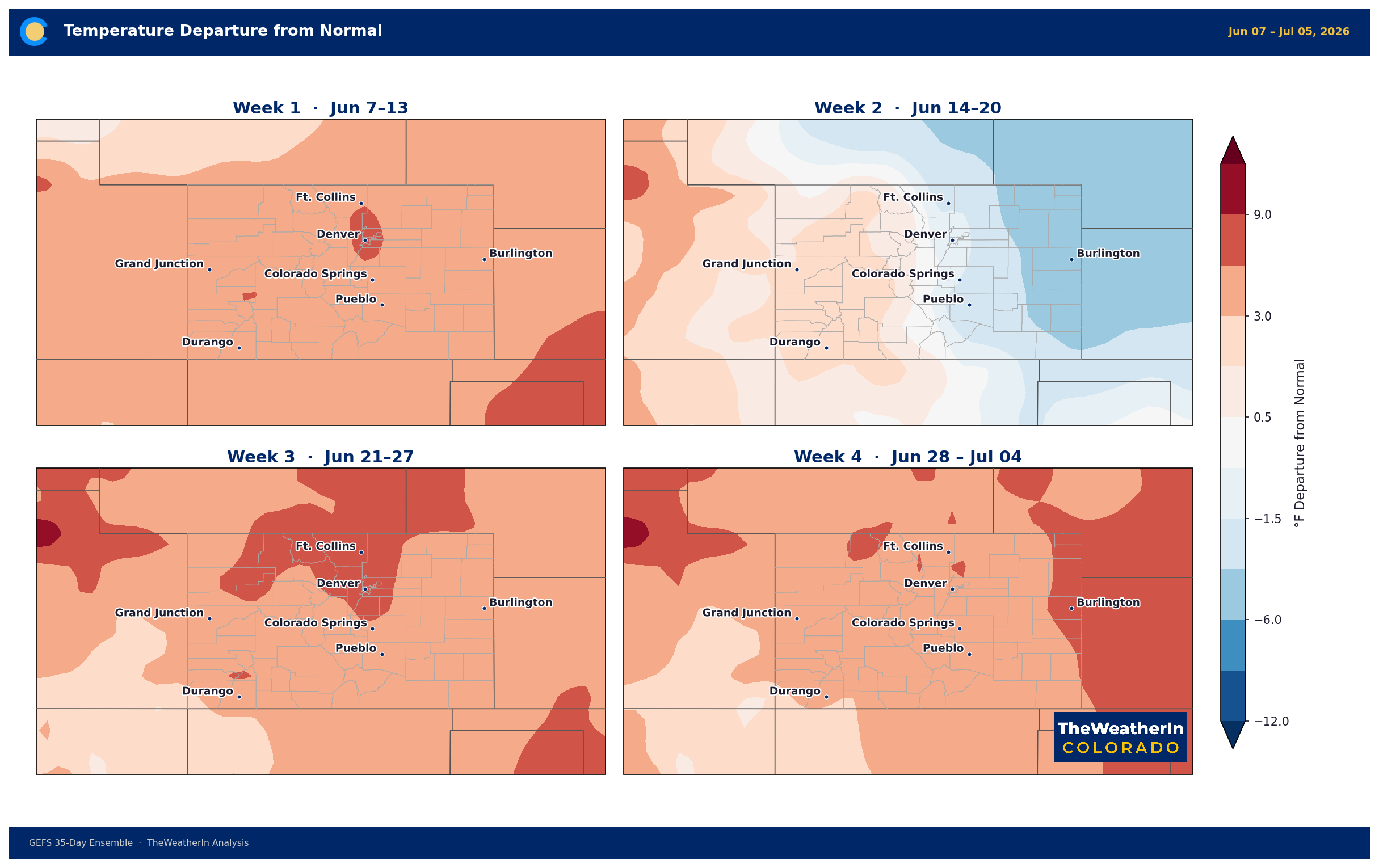
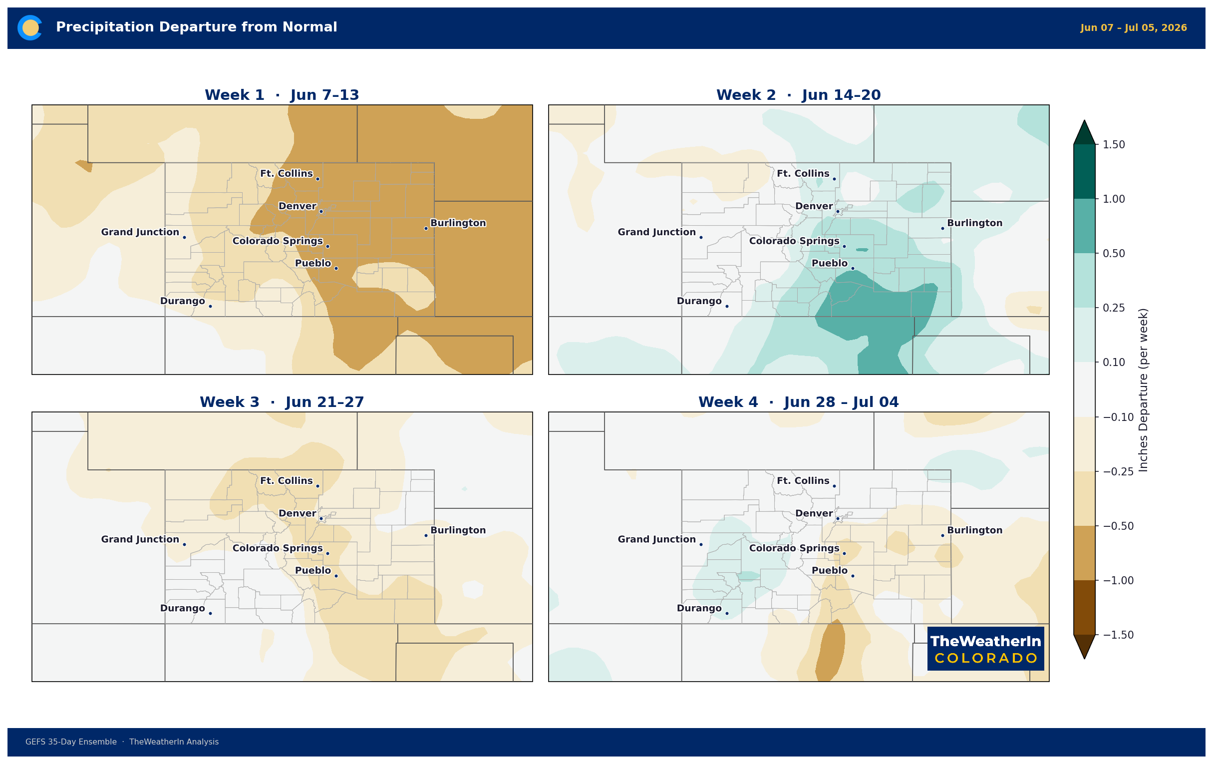
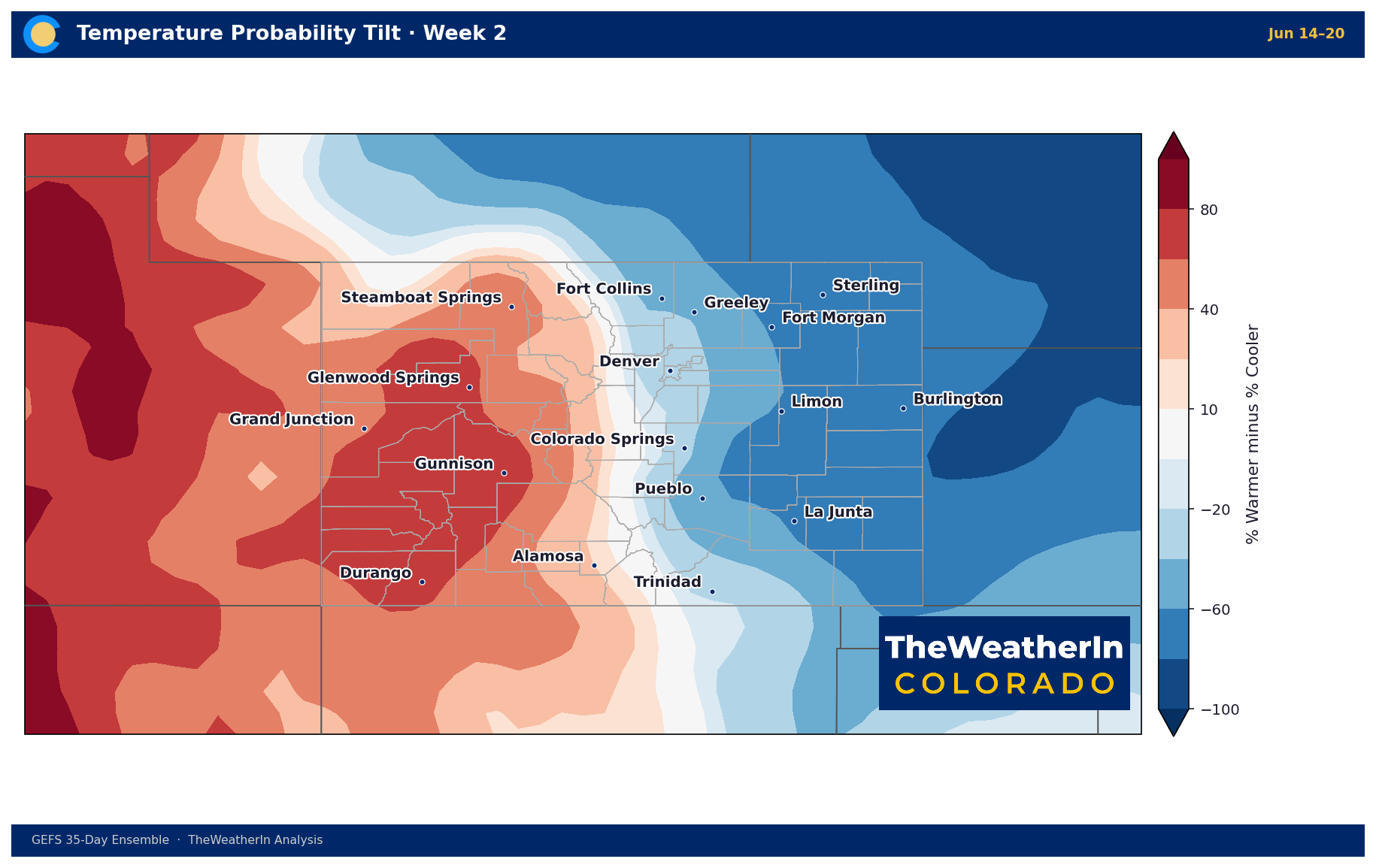
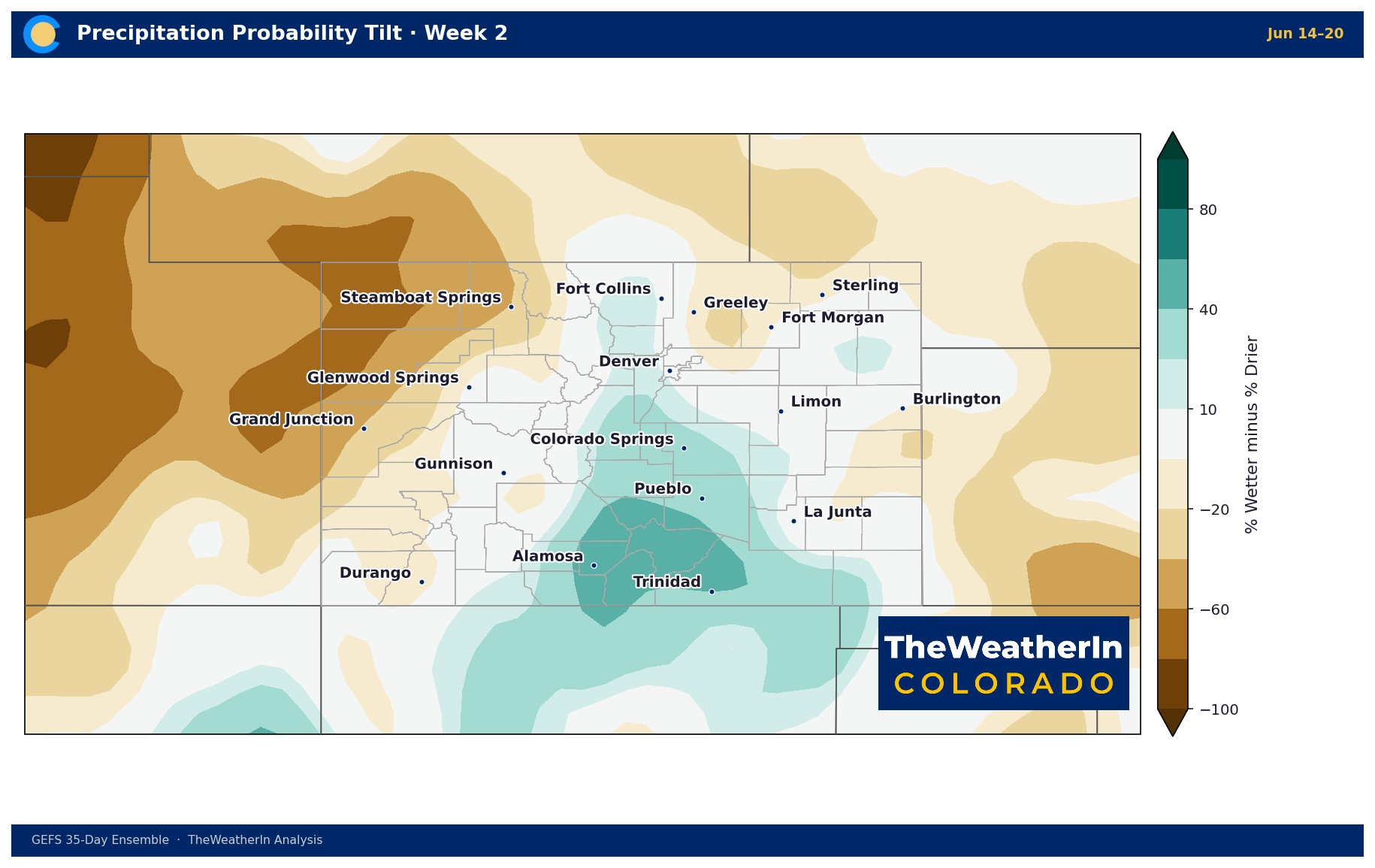
Forecast data through the end of June continues to favor above-normal temperatures across Colorado, with the warmest departures most likely across the southern half of the state. Precipitation signals remain below normal through at least the next three weeks — the transition toward a more active monsoon pattern is the eventual relief valve, but that arrival is still weeks out at best, and confidence in timing decreases significantly beyond week two.
El Niño is forming in the tropical Pacific — all the early signs are in place, and it is expected to emerge this summer. The latest outlook now favors a moderate-to-strong event through winter 2026–27, a meaningful upgrade from earlier forecasts. Historically, that pattern delivers above-normal precipitation to the southern Rockies — particularly in winter. That is a genuine forward-looking bright spot for Colorado's long-term water picture. But it doesn't help this summer. Drought relief at the scale Colorado needs is a winter story at the earliest, and even then it will take sustained above-normal moisture over multiple seasons to make a meaningful dent in deficits this deep.
Regional Breakdown — Week of June 8
| Region | Temperature | Precipitation | Highlights |
|---|---|---|---|
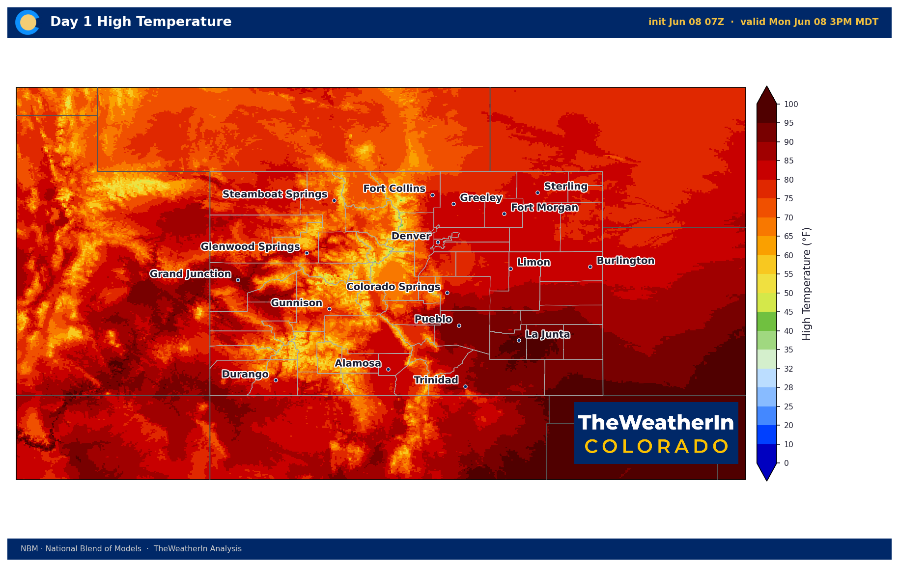
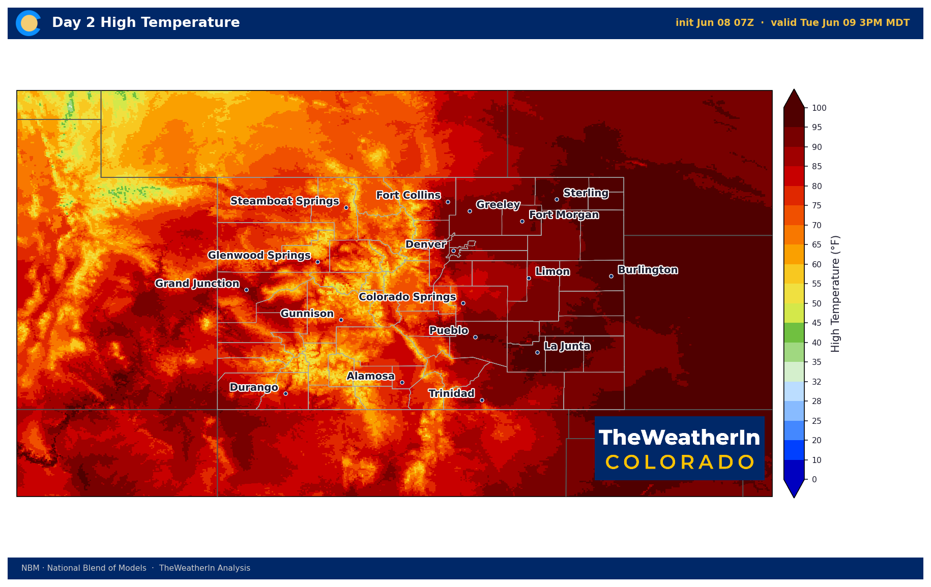
| Front Range / Foothills | +5–8°F above normal; highs 94–99°F Tue–Wed | Minimal; isolated dry storms | Severe storm threat today 1–3 PM (large hail, isolated tornado near Palmer Divide); critical fire weather Tue–Wed, gusts 30–40 mph, RH single digits/low teens |
| Mountains / High Country | +3–6°F above normal for elevation | Minimal; dry lightning possible | Elevated to critical fire weather below ~9,000 ft through Wednesday; isolated afternoon dry thunderstorms daily; no meaningful rain expected |
| Western Slope | +5–8°F above normal; highs 90–98°F | Near zero through the week | Most critical fire weather in the state. Red Flag Warnings Mon–Tue; Fire Weather Watch Wed–Thu. Gusts 35–50 mph Tuesday. RH in single digits. Dry thunderstorms possible but no rain relief. |
| Eastern Plains | +5–8°F above normal; highs 85–95°F | Minimal; isolated storms today | Severe weather threat today 2–7 PM (hail, gusty winds, isolated tornado — Kiowa, Bent, Prowers, Baca counties); critical fire weather Tue–Wed, gusts 30–40 mph |
| Southern Colorado / San Luis Valley | +4–7°F above normal; highs 68–81°F lower elevations | Near zero; isolated storms today–Tue | Red Flag Warning today noon–7 PM (Fremont, Pueblo, lower Huerfano); Fire Weather Watch Tue–Wed; isolated severe storms far eastern plains today–Tue; Wednesday critical fire weather likely |
Drought & Water
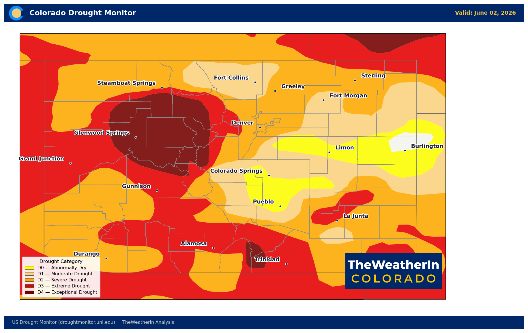
As of the June 2 U.S. Drought Monitor, 99.5% of Colorado remains in some level of drought — and the map has been at 100% coverage for weeks. Severe drought or worse (D2 and above) covers 76% of the state. Extreme drought (D3) affects 36%. Exceptional drought (D4) — the worst category on the scale — covers nearly 9% of Colorado, concentrated on the Eastern Plains, the San Luis Valley, and the southern mountains. The Drought Severity and Coverage Index (DSCI), a composite measure of drought extent and intensity, stands at 313 — roughly double what it was just three months ago.
This drought developed with unusual speed and unusual depth. Parts of southeastern Colorado went from no drought to extreme drought (D3) in just seven weeks this spring — a textbook flash drought event. The root cause is the winter that preceded it: December 2025, February 2026, and March 2026 all ranked as the warmest ever recorded in Colorado's 132-year record. Winter 2025–26 as a whole was the warmest on record by 1.6°F over the previous record. Statewide snowpack entered April at just 1.66 inches of water equivalent — less than one-third of the previous all-time low set in 1977. That snowpack collapse has already translated directly into near-record-low streamflows across every major river basin in the state, with the statewide May–July runoff forecast at just 24% of normal.
This week's heat and wind will accelerate evaporation and further stress already-depleted soils. There is no meaningful precipitation in the forecast through at least mid-June. The fire weather threat this week is a direct extension of the drought — critically dry fuels, single-digit relative humidity, and gusty winds are the same conditions that have been building all spring, just concentrated into their most intense expression yet.
Agricultural Implications
- Wind damage and fire risk, Monday–Wednesday: Gusts of 30–50 mph across all regions — peaking on the Western Slope Tuesday — put orchards, row crops, and any field equipment or operations at serious risk. Avoid any ignition sources in the field through at least Wednesday. Red Flag Warnings and Fire Weather Watches are in effect across much of the state; field burning is not advisable under any circumstances this week.
- Heat stress and soil moisture: Near-100°F temperatures Tuesday–Wednesday combined with single-digit relative humidity will drive exceptional evapotranspiration rates. Irrigated systems should check scheduling against actual soil moisture rather than calendar assumptions — surface drying will be rapid. West Slope fruit crops, already stressed from the April freeze, now face an intense heat wave; growers should monitor closely for compounding heat damage on recovering trees.
- Longer-range soil moisture outlook: Forecast data through late June continues to favor below-normal precipitation across Colorado. With soils already critically depleted and streamflow forecasts at 22–37% of normal across most basins, dryland producers on the Eastern Plains and San Luis Valley are entering the peak growing season under stress that cannot be resolved by summer rain alone. Water supply allocations will remain tight through the entire 2026 irrigation season — the snowpack window has closed, and the deficit is locked in.
Fire Weather — Extended Outlook
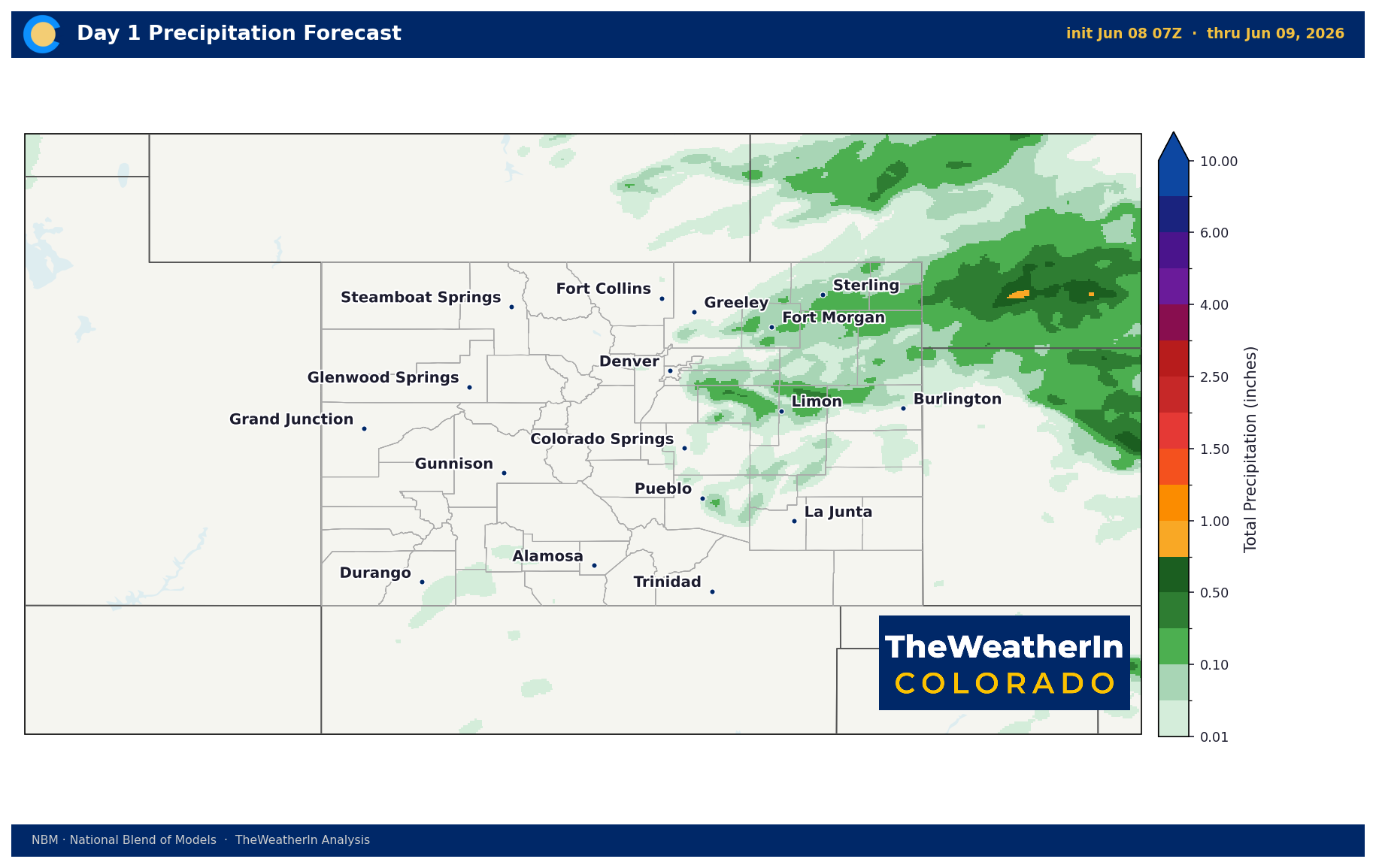
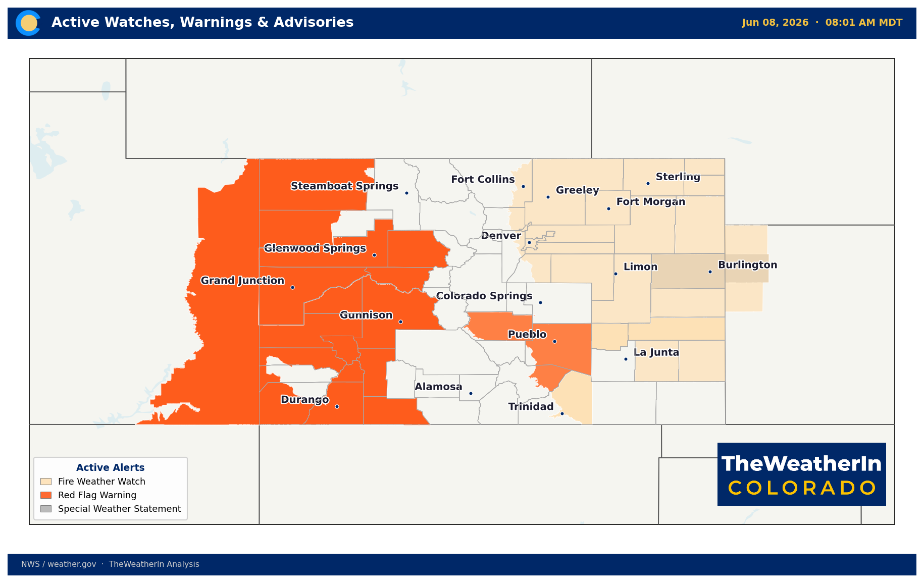
Red Flag Warnings are in effect today across the Western Slope and southern Colorado (Fremont, Pueblo, lower Huerfano counties). Tuesday brings the highest-confidence critical fire weather day of the period: Red Flag Warnings are expected to expand statewide, winds will gust 30–45 mph on the Front Range and plains and 35–50 mph on the Western Slope, and relative humidity will drop to single digits across much of the state. Wednesday remains critical on the Western Slope and southern mountains even as the cold front brings some relief to the east. Elevated to critical conditions persist Thursday–Friday as humidity stays suppressed despite lower wind speeds. Isolated dry thunderstorms are possible daily over the high terrain, adding lightning-start risk without the rain that would reduce fire danger.
The Western Slope and southern Colorado's fuel-critical zones face the most acute window Monday through Tuesday, where there is very high confidence of critical fire weather conditions. These are the same zones that have been under fire weather pressure all spring — the fuels have had months to cure under a historically dry and warm pattern, and this week is the first genuinely high-end multi-day critical window of the summer season.
The signal worth watching as this summer unfolds: whether the North American Monsoon arrives on its typical mid-July schedule or runs late — a delayed monsoon would extend this fire weather and drought stress window deep into August.



