Storm Moves Through Tuesday — Snow, Rain, Fire Warnings, and a Freeze Watch All at Once
An upper-level low is pushing across Colorado today, and it's bringing an unusual mix of conditions depending on where you are in the state.
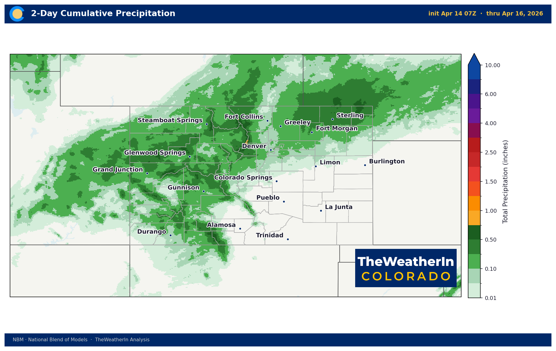
An upper-level low is pushing across Colorado today, and it's bringing an unusual mix of conditions depending on where you are in the state. Snow is falling in the mountains, rain showers are expected on the plains this afternoon, fire warnings remain in effect across the southern and eastern areas, and a Freeze Watch has been issued for Western Slope valleys tonight.
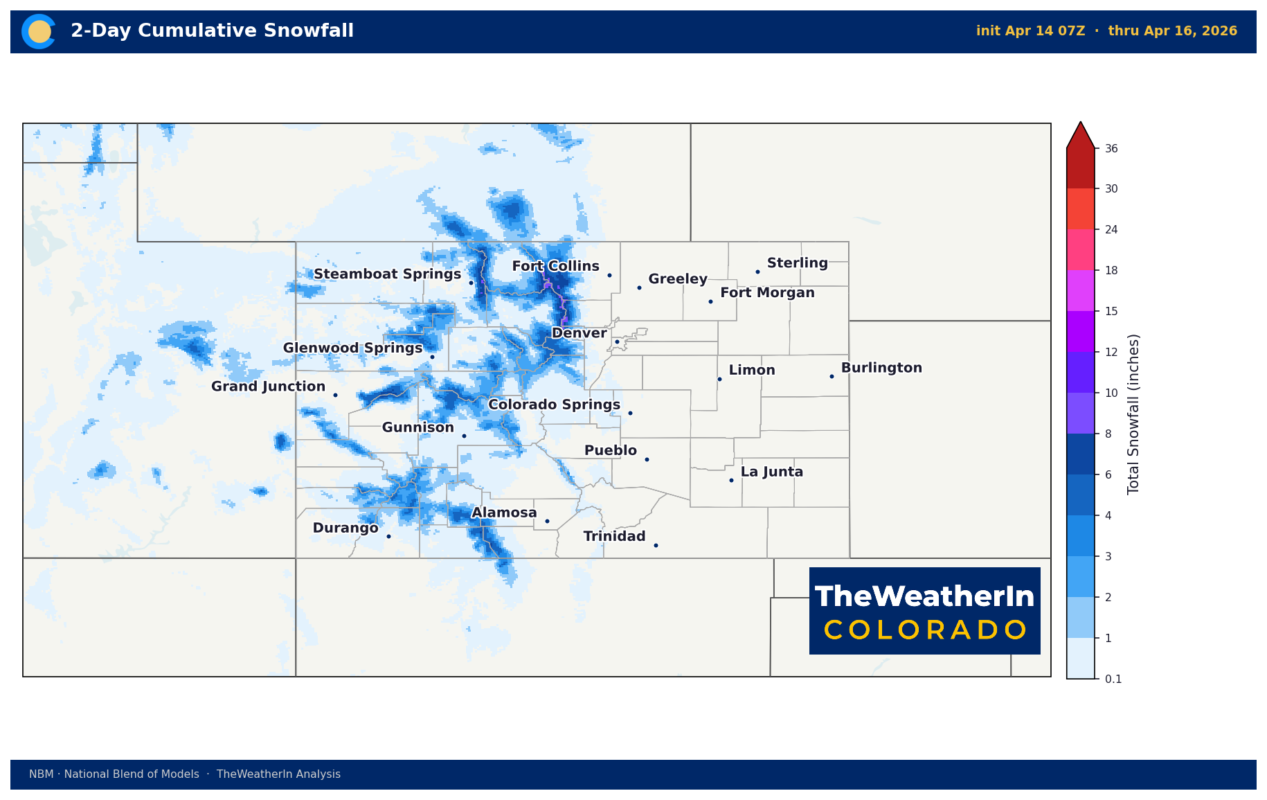
Mountain Snow and Pass Travel
Snow began overnight across the Western Slope and along the Continental Divide. Wolf Creek Pass and Monarch Pass were showing slushy and icy road conditions by early this morning. Expect those conditions to persist through midday before improving.
Snow accumulations are focused above 9,000 feet, with most high terrain picking up 3–6 inches through this evening. Isolated higher terrain could approach 10 inches total. Below 9,000 feet, the storm is producing rain showers and a rain-snow mix with little to no accumulation in the lower valleys.
Fire Danger Remains — Even During the Storm
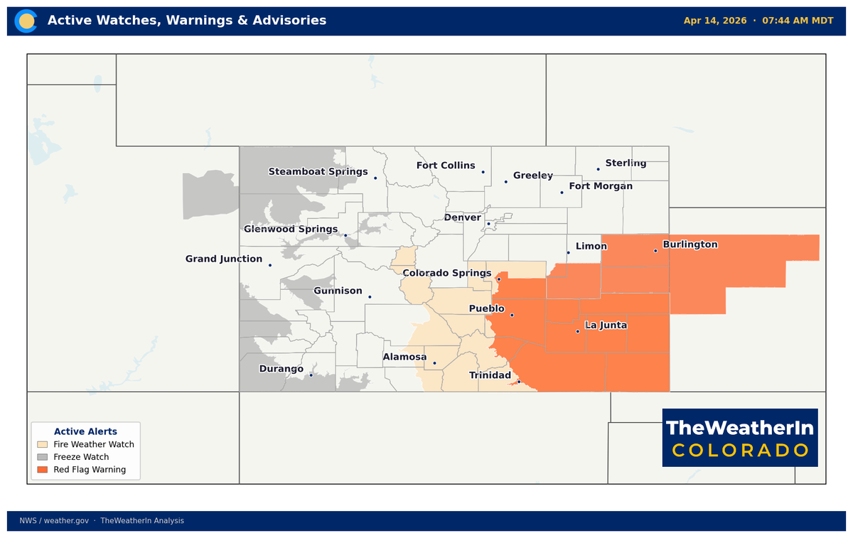
Despite the incoming moisture, fire weather conditions remain critical across the southern plains and southeastern Colorado today. A Red Flag Warning is still in effect for southern Lincoln County through 8 PM, with humidity values dropping to 12–17% and gusts to 40 mph in the afternoon. The Western Slope and San Luis Valley are seeing elevated winds but higher humidity, keeping conditions below critical there.

Freeze Watch for the Western Slope Tonight
As skies clear behind the storm overnight, temperatures in the lower valleys of western Colorado and eastern Utah are expected to drop below freezing by Wednesday morning. A Freeze Watch is in effect for those areas. Fruit trees and early-season crops that have broken dormancy are at risk — growers in the Grand Junction, Palisade, and Montrose areas should take protective measures tonight.
What Comes Next
Wednesday brings a quiet break — dry conditions and temperatures in the 60s across most of the state. Enjoy it. Critical fire weather conditions return Thursday across the entire plains, with southwest winds gusting 30–45 mph and humidity again falling to dangerous levels. A Fire Weather Watch has already been issued for southern Colorado for Thursday afternoon.
Friday into Saturday brings the more significant story: a colder, stronger system moving through the Rockies with the potential to drop temperatures 15–25 degrees behind the front. Widespread overnight lows in the 20s are possible Saturday and Sunday mornings — including some locations on the plains. Snow is possible at lower elevations than this week's storm. Details will sharpen over the next 48 hours.