
Storm Update: Snow Falling Across Colorado, Hard Freeze Warning Issued for Tonight
The cold front moved through overnight — Denver saw frontal passage between 1 and 2 AM, with temperatures dropping roughly 30 degrees in about two hours behind it.

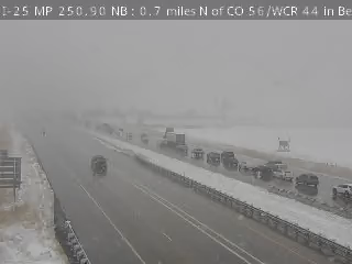
Update at 11:30am: widespread snow dropping southward across the Denver Metro Area.
Snow is falling across the mountains and Foothills this morning, and the Freeze Watch issued yesterday has been upgraded to a Freeze Warning for tonight.
Today's Snow — What to Expect
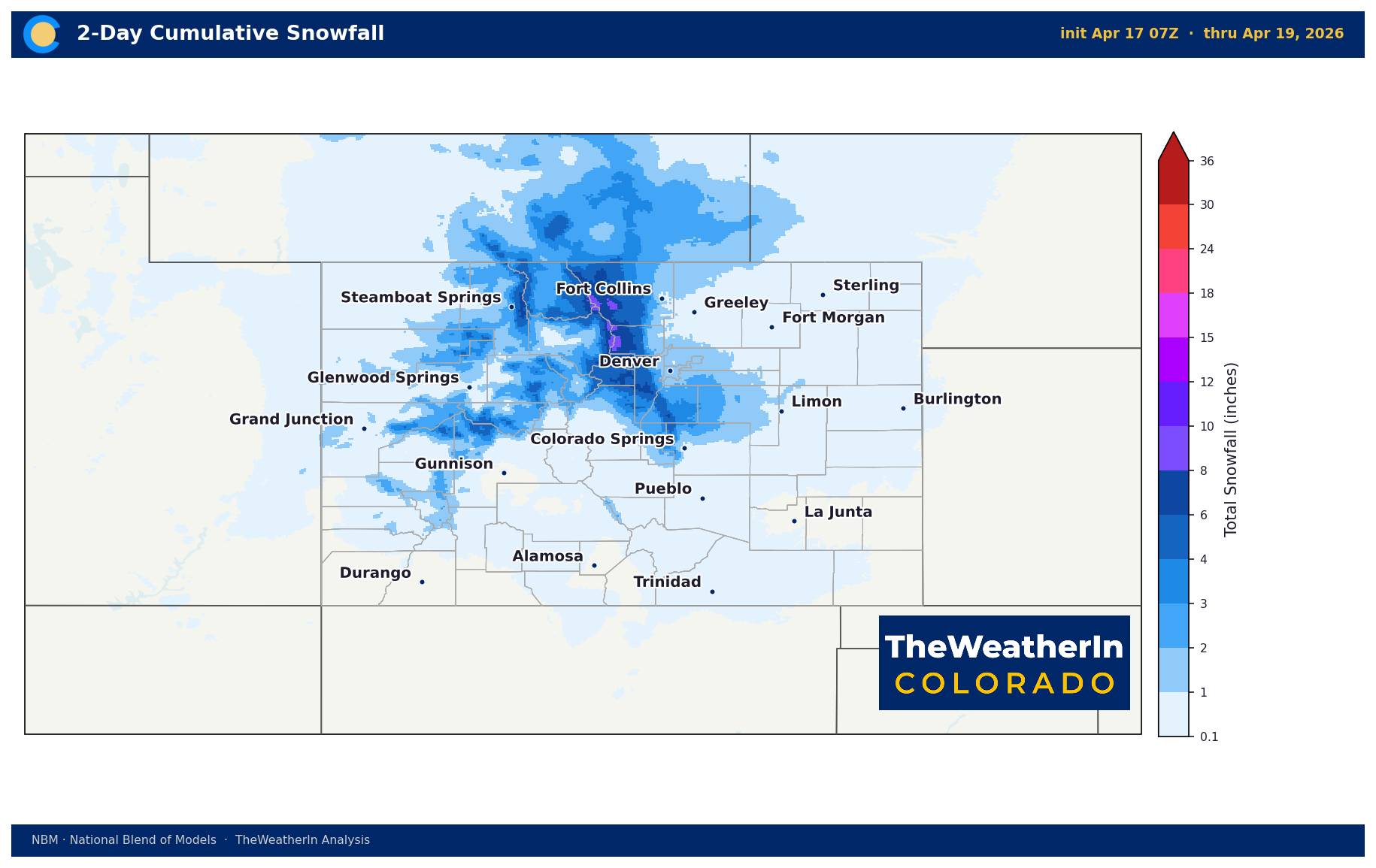
Snow showers will continue through early to mid afternoon across most of the state. A Winter Weather Advisory is in effect through this afternoon for the higher mountain elevations and southern Foothills.
| Area | Expected Snow |
|---|---|
| Mountains (above 9,000 ft) | 2–9 inches |
| Foothills / Palmer Divide | 2–6 inches; highest in Jefferson County |
| Eastern Plains / Urban Corridor | Trace to 3 inches (mostly lower end) |
| Western Slope Valleys | Light amounts; snow showers lingering into afternoon |
Travel note: I-70 through the Foothills and mountain passes could see hazardous driving conditions through early this afternoon. Warm road temperatures will limit accumulation on most plains roads, but areas under heavier snow bands could see slick conditions. Allow extra time if heading into the mountains today.
Tonight — Hard Freeze Warning
This is the most significant part of this event for agriculture and gardening. A Freeze Warning is now in effect beginning this evening. Once snow clears and skies open up, temperatures will drop quickly.
| Region | Forecast Low Tonight |
|---|---|
| Eastern Plains | Upper teens to lower 20s |
| Palmer Divide / Southern Front Range | Teens; sub-freezing by 10 PM |
| Western Slope Valleys | Below 25°F (90% probability) |
| Mountains | Single digits |
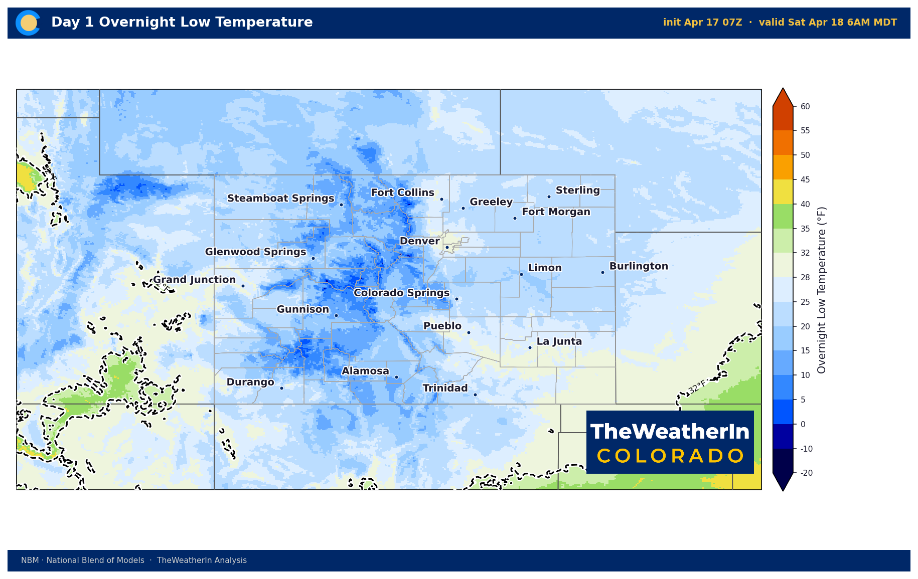
NWS is specifically calling out the potential for larger-than-usual impacts given how warm April has been — trees and plants are much further along in their growth cycle than normal for this date. Any slush or water left on roads after today's snow could also refreeze overnight, creating slick spots Friday morning.
Action items before dark tonight: Cover tender plants, drain above-ground irrigation lines, bring potted plants indoors, and be cautious on untreated roads tomorrow morning.
Saturday Night — A Second Freeze Possible
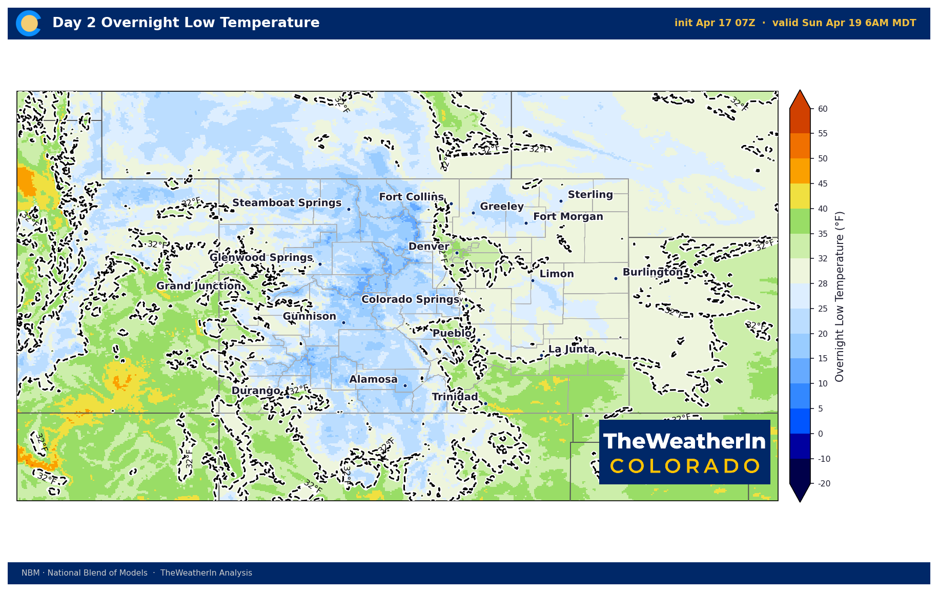
A Freeze Watch has been issued for Saturday night into Sunday morning across central and southern Colorado. Lows Saturday night look less severe — mainly the 20s to lower 30s — but areas along and north of the Arkansas River could see another hard freeze. This is not over after tonight.
Next Week
Temperatures rebound quickly. The plains return to the upper 70s to mid 80s by Tuesday with dry conditions. The second half of next week remains uncertain — a complex pattern could bring one or two chances at precipitation Wednesday through the weekend, but the timing and coverage are too unclear to nail down. We'll track it as models come into better agreement.



