
Storm Week in Colorado — Then the Drought Reasserts Itself
Severe storms arrive to open June, but the bigger story is what comes after: a drying pattern that keeps Colorado's historic drought firmly in place heading into summer.

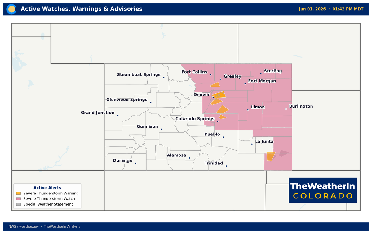
June opens with the most active severe weather stretch in months — but the storms are a brief interruption, not a pattern change. By the weekend, Colorado's dry, warm summer pattern reasserts itself, and the historic drought that has defined 2026 continues to deepen.
Pattern Overview
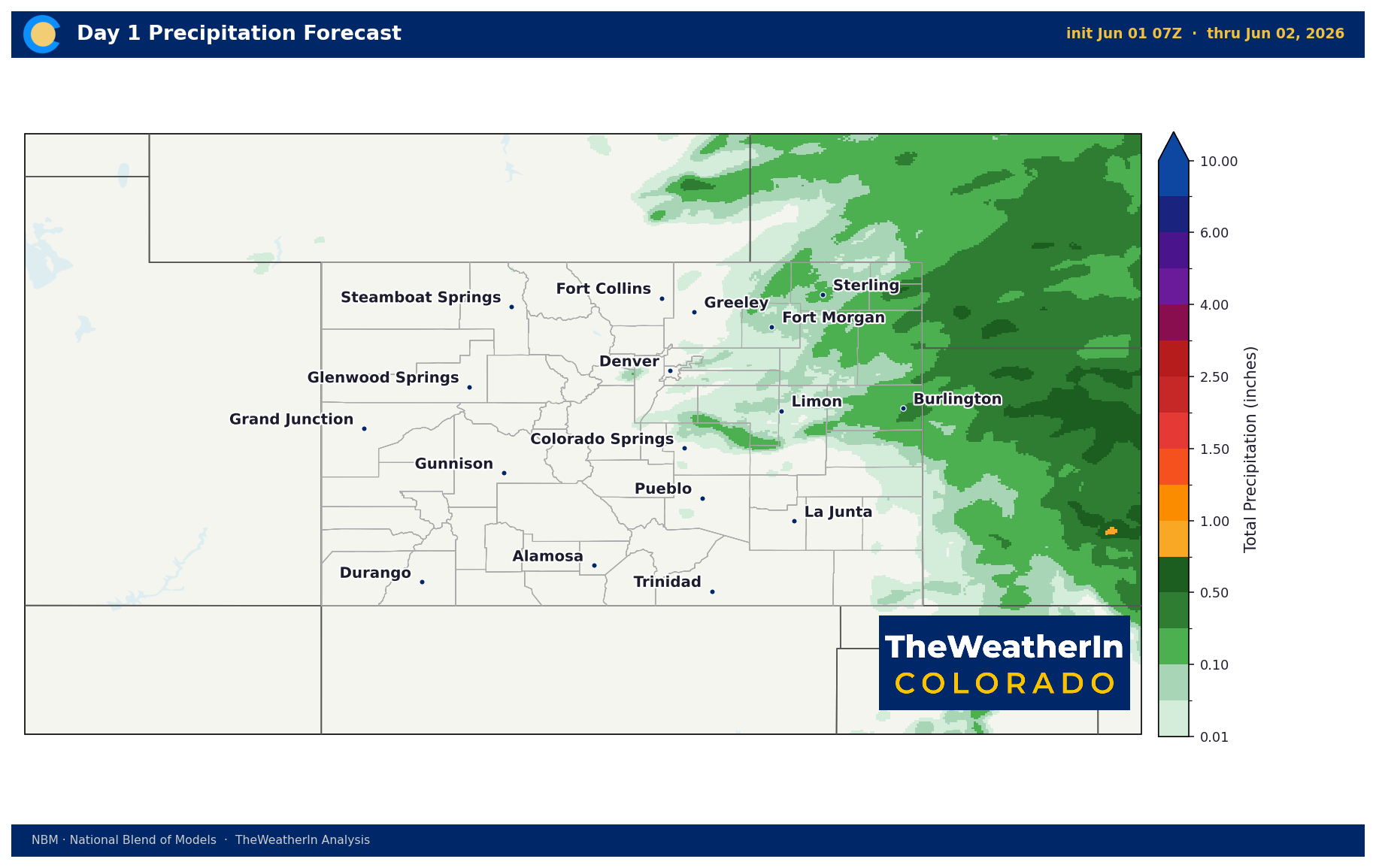
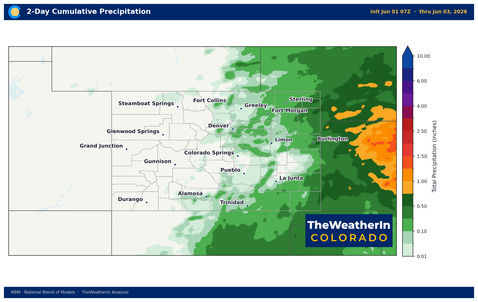
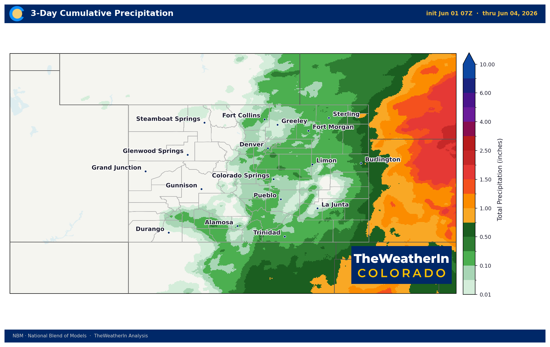
A series of weak upper-level disturbances embedded in southwesterly flow will push scattered to widespread thunderstorm activity across Colorado through mid-week. Monday and Tuesday carry the highest severe threat, particularly along the Front Range, Palmer Divide, and Eastern Plains, where strong wind shear and atmospheric instability in the range of 1,500–2,000 joules per kilogram (a measure of the atmosphere's energy available to power storms) will support large hail, damaging winds, and an isolated tornado threat. Wednesday's storms will be less organized for severe weather but slower-moving — that's actually the more impactful rain day for drought-stricken soils, as training storms (storms that repeatedly roll over the same geography) could produce locally heavy rainfall and flash flooding.
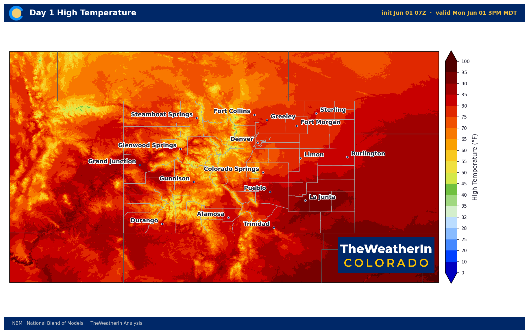
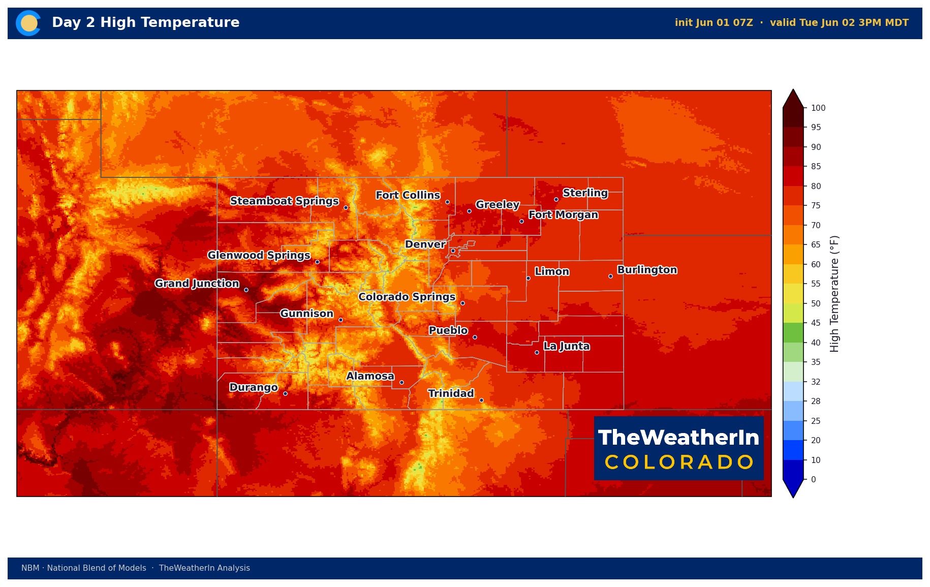
The upper-level disturbances weaken by Thursday, and westerly flow takes over for the back half of the week. Temperatures rebound into the upper 80s and 90s across the plains by Friday, and the weekend shapes up warm and mostly dry. Isolated afternoon storms remain possible each day — this is June in Colorado — but no widespread rainfall is expected late in the week.
The deeper context matters here: this active stretch traces back to the same transitional tropical Pacific pattern that has been setting up all spring. A weakening La Niña gave way to ENSO-neutral conditions through spring, and now El Niño is forming in the tropical Pacific — all the early signs are in place and it's expected to arrive this summer. That shift historically means wetter and cooler conditions for the southern Rockies, particularly in winter. But even with El Niño on the way, meaningful drought relief for Colorado is a winter story at the earliest. This week's storms help at the margins. The water supply picture for 2026 is already written.
Weeks Ahead: 2–4 Week Outlook
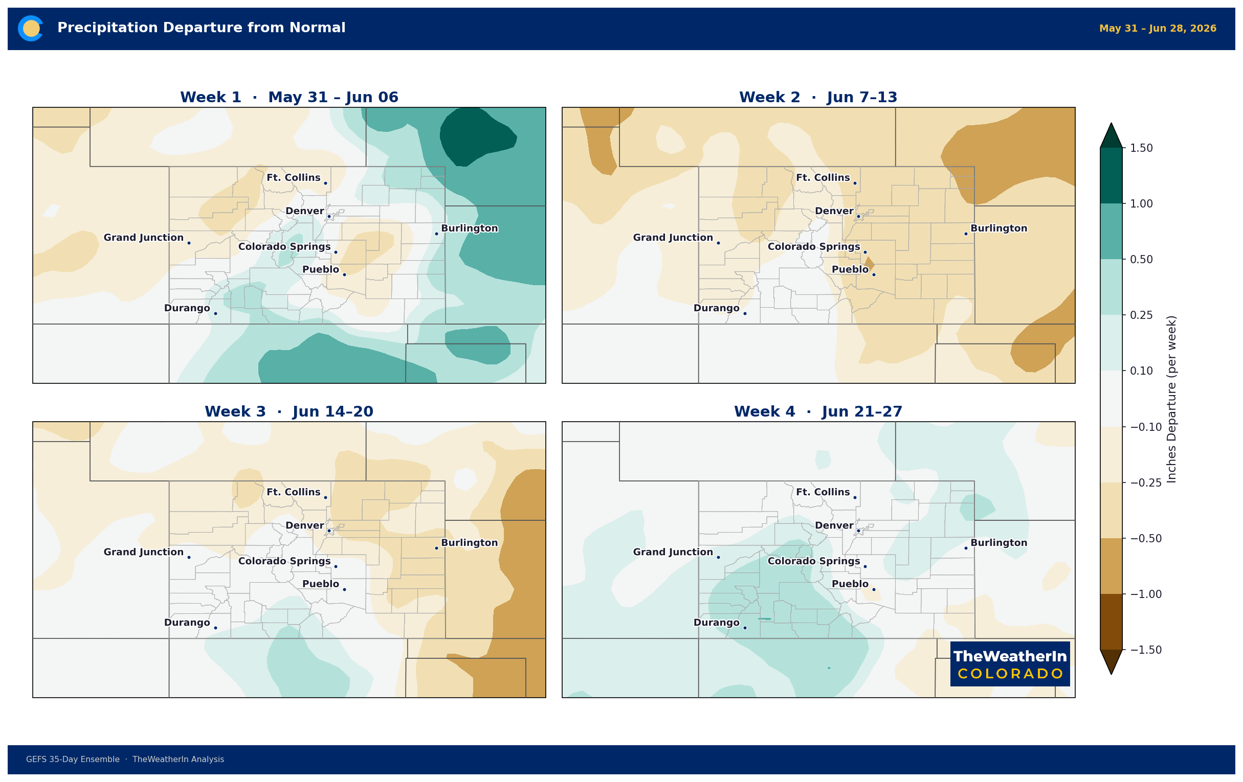
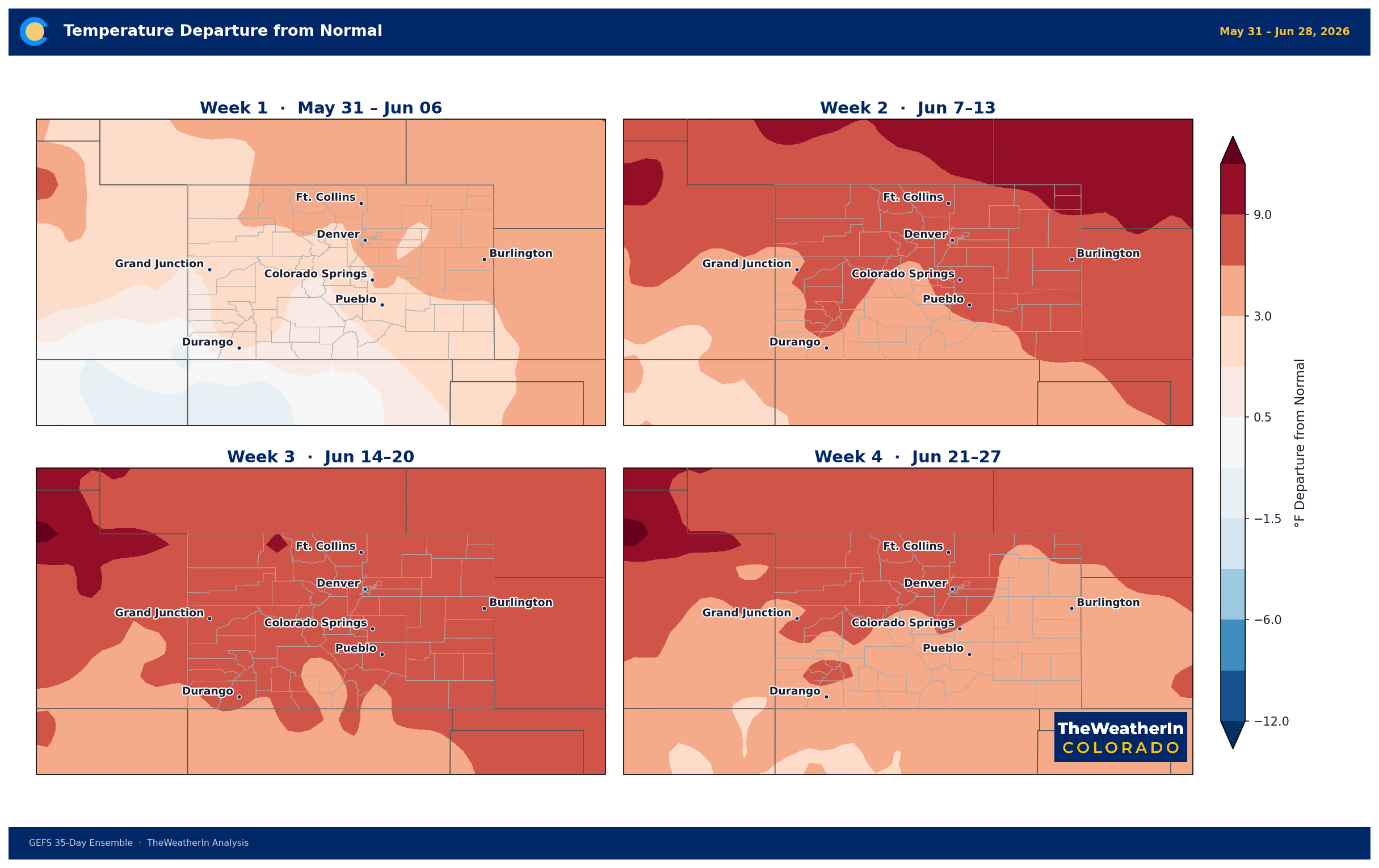
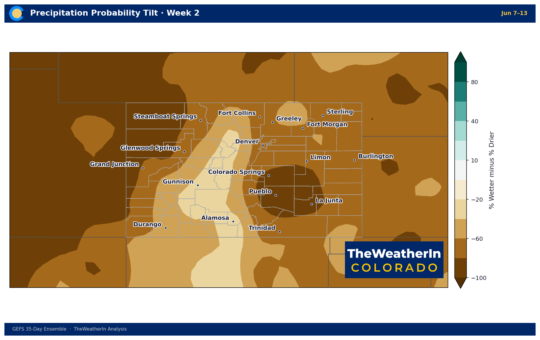
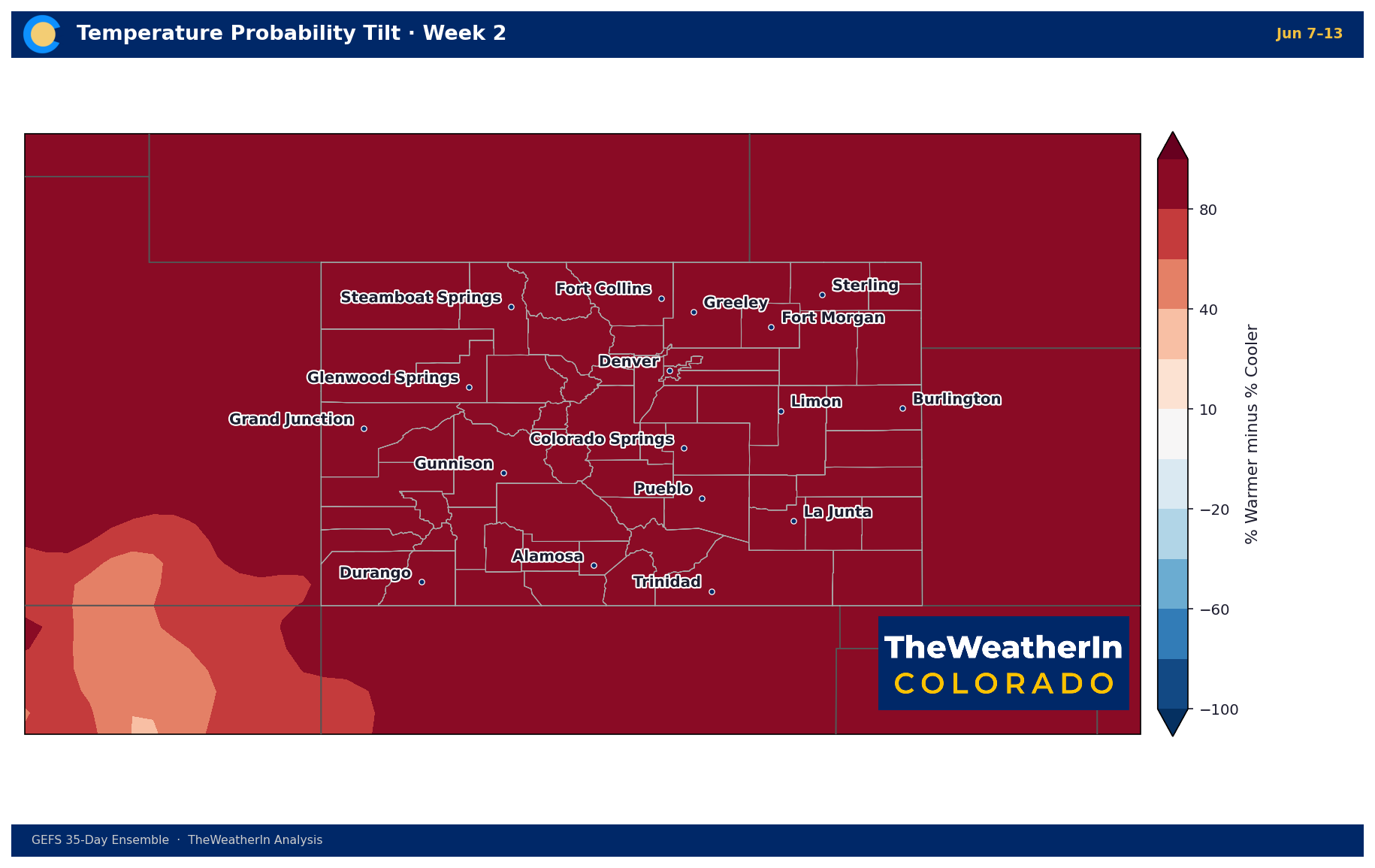
The signal beyond this week points toward a warm, drier-than-normal pattern settling in across Colorado through at least mid-to-late June. Week 2 (June 8–14) sees above-normal temperature probability statewide, with the best odds of below-normal precipitation across the south and west. Week 3 shifts to a more active pattern signal — isolated moisture return is possible, but the base state remains drier than normal. The Western Slope, which has already seen critical fire weather conditions this week, faces an increasing concern late this weekend and into next week as a trough deepens and a southwest pressure gradient tightens. That setup warrants close monitoring for more widespread fire weather potential. The forward-looking headline: the brief wet reprieve of early June gives way to a summer pattern that is unlikely to deliver the sustained precipitation Colorado needs.
Regional Breakdown — Week of June 1
| Region | Temperature | Precipitation | Highlights |
|---|---|---|---|
| Front Range / Foothills | Near to slightly above normal; 80s–low 90s Wed–Fri | Active Mon–Wed; drier Thu–Sun | Severe storm threat Mon–Tue afternoons (hail, wind, isolated tornado); heavy rain possible Wed; fire weather watch possible Mon |
| Mountains / High Country | Near normal; 50s–60s at elevation | Isolated–scattered storms Mon–Thu; drier Fri–Sun | Best storm coverage Wed along Continental Divide; high-elevation storms less efficient rain producers; drier westerlies return by weekend |
| Western Slope | +5–10°F above normal Mon–Fri; +10°F+ Thu–Sun | Mostly dry; isolated high-divide storms only | Critical fire weather conditions Mon (single-digit humidity, gusty winds SW Colorado); fire weather concern resurfaces late Sat–Sun as trough deepens and SW gradient tightens |
| Eastern Plains | Near 90°F Mon–Tue; cooler Wed (clouds/rain); 80s–90s Thu–Sun | Significant storm activity Mon–Wed; flash flooding possible Wed | Mon: large hail and damaging winds likely; brief tornado risk. Tue: higher rainfall potential, training possible overnight. Wed: widespread showers, flash flooding primary concern. Drying Thu–Sun. |
| Southern CO / San Luis Valley | 90°F plains Mon; cooler Wed; 90s by Fri–Sun; valleys 70s–80s | Increasing storm coverage Tue–Wed; drying Thu–Sun | Mon: marginal severe risk along I-25 corridor; elevated fire weather W. mountains (single-digit humidity). Tue–Wed: widespread storms, heavy rain and flash flooding primary concern. Thu–Sun: warm and mostly dry. |
Drought & Water
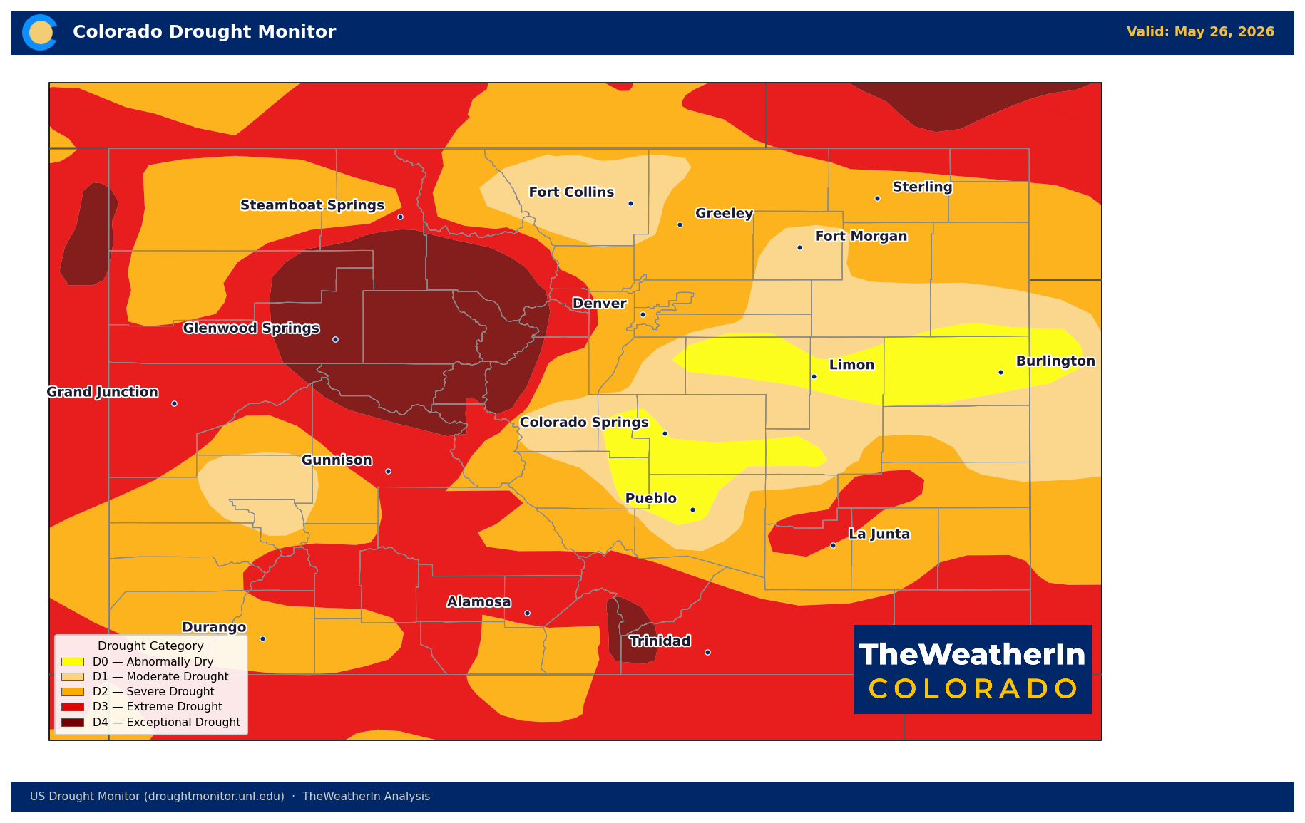
As of May 27, 2026, 100% of Colorado remains in some level of drought — and the numbers have barely budged. Severe drought (D2) or worse covers 78% of the state; extreme drought (D3) covers 40%; exceptional drought (D4) — the most severe category — covers nearly 10%. The Drought Severity and Coverage Index (DSCI), a single number that combines both coverage and intensity, stands at 321 out of a maximum of 500. For context, that index was 127 at the start of the year and 175 just three months ago. Colorado's drought has not stopped expanding; it has accelerated.
The storms this week will provide localized soil moisture relief in areas that receive meaningful rainfall — particularly the Eastern Plains on Wednesday. But basin-scale drought cannot be meaningfully addressed by convective rainfall events, which are inherently patchy. The underlying driver of this drought is the snowpack that was never there: statewide snowpack peaked at just 20% of the long-term median on May 1 — still the lowest on record for that date — and the May–July streamflow forecast statewide sits at just 24% of normal. That water supply gap is locked in for the 2026 irrigation season regardless of what June brings. Forty-eight of 86 streamflow forecast points are tracking toward record or near-record low flows. The Colorado River near the Utah border is forecast to deliver just 23% of a normal year's volume — a shortfall of roughly 2.5 million acre-feet.
Reservoir storage has cushioned the blow so far — statewide storage sat at 85% of median as of May 1 — but that number is declining as mountain inflows fail to materialize and operators draw down carryover supplies. The Eastern Arkansas basin is the most stressed at 56% of median and falling. The critical question for late summer is not whether drought persists, but how rapidly reservoir storage declines once runoff is gone.
Agricultural Implications
- Irrigation water supply remains critically short. The Arkansas, South Platte, and Colorado Headwaters basins are running 21–37% of normal May–July flow. Producers relying on surface water rights face a difficult season; allocations are reduced and senior-right delivery is the priority across most of the state.
- This week's storms carry dual risk for crops. Hail is the primary concern Monday and Tuesday on the Eastern Plains — large hail is possible, particularly along the Palmer Divide and in far-eastern counties. Gusty downdraft winds during strong storms Monday through Wednesday could cause mechanical damage to young crops. Wednesday's heavy rainfall potential is more welcome, but training storms that dump 1–3 inches on the same field in an hour are not the same as a slow, soaking rain — watch for runoff on dry, compacted soils with reduced infiltration capacity.
- Western Slope producers and ranchers: fire weather returns by late weekend. Monday's critical fire weather conditions (single-digit humidity, gusty winds in SW Colorado) are localized and brief, but a second, potentially more widespread fire weather event is taking shape for late Saturday into Sunday as a trough deepens and southwest winds strengthen. The long-range pattern through mid-June keeps the Western Slope drier and warmer than normal — forage conditions on native range remain stressed, and fire risk will stay elevated through the coming weeks.
The signal worth watching through the rest of June: whether the drying pattern on the Western Slope this weekend intensifies into more widespread critical fire weather conditions — and whether the emerging El Niño can begin to shift the summer pattern toward more moisture by mid-to-late summer. Neither answer arrives this week.



