
Fire Weather, Triple-Digit Heat, and a Drought That Isn't Done
Critical fire weather arrives Saturday and doesn't let up. Here's what the next week looks like — and why the pattern behind it matters all summer long.

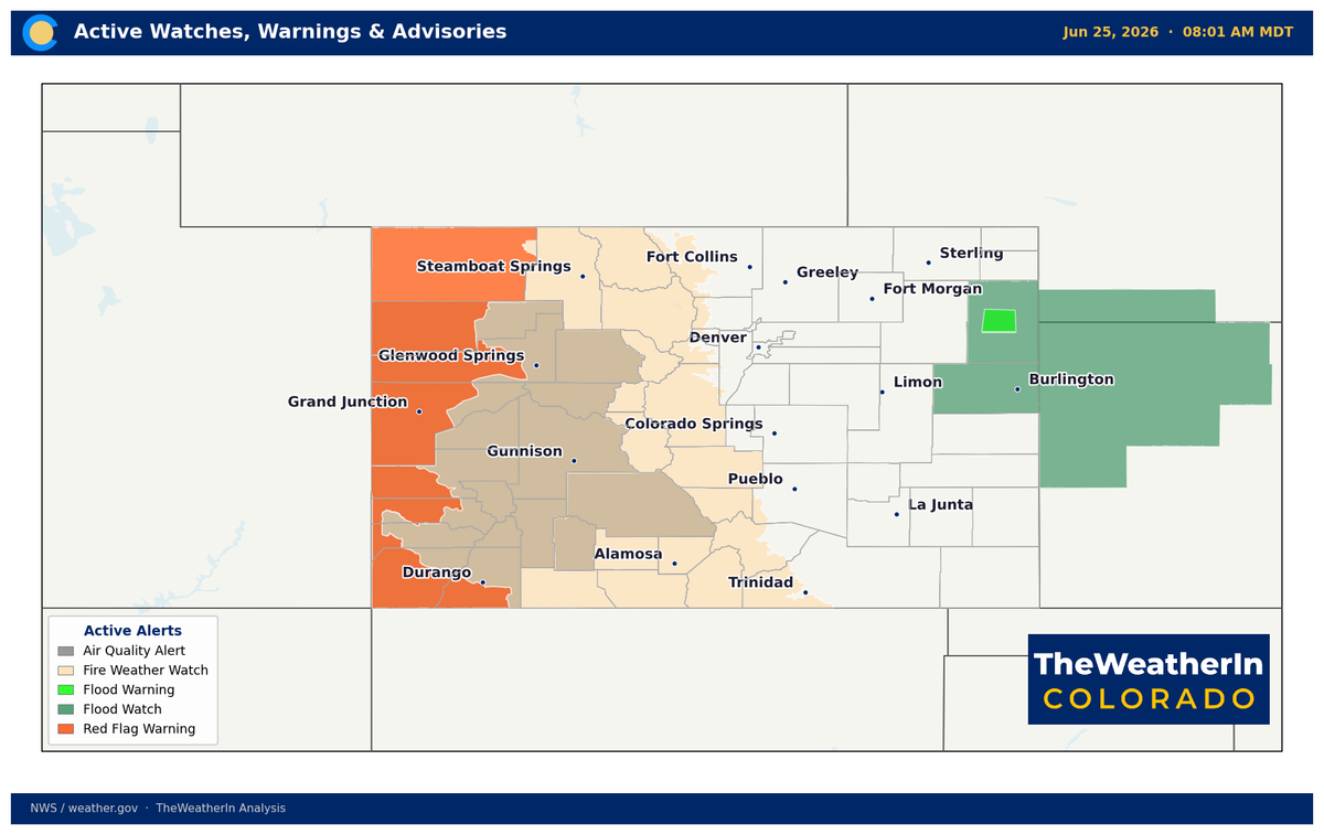
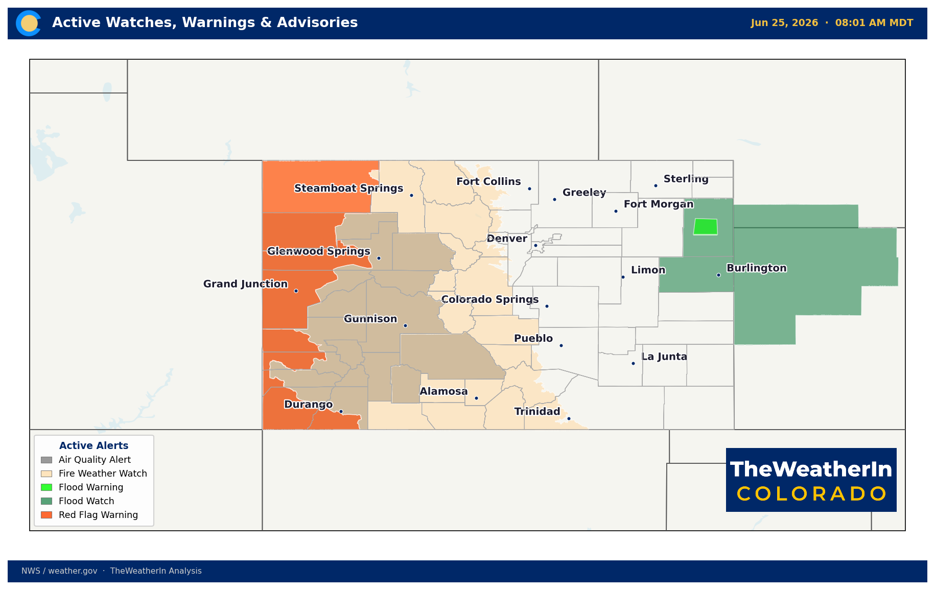
The brief moisture window is closing fast. By Friday afternoon, a trough dropping south through the Rockies will flip the script — ushering in a stretch of hot, windy, critically dry conditions that will persist across Colorado through early next week and underscores exactly why this drought story is far from over.
Pattern Overview
A Pacific low digging into the Northwest is the immediate driver. As it pushes a trough southward through the Rockies, it squeezes out the lingering moisture that's been fueling this week's showers and thunderstorms — and replaces it with a hot, dry airmass and southwest winds that will gust 40 to 50-plus mph across most of the state. An upper-level ridge building over the eastern U.S. keeps the broad pattern warm and dry through at least the start of July, with no meaningful precipitation in sight for the plains, valleys, or Western Slope.
It's worth stepping back for a moment: Colorado has now spent most of 2026 operating under the same relentless warm, dry regime that produced the worst snowpack on record and a drought now covering 100% of the state. The La Niña that drove that pattern is fading, but the damage it left behind — in soils, in rivers, in fuel conditions — doesn't reverse with one weather system or even one wet month. Saturday's fire weather setup isn't a one-off event. It's the predictable outcome of a landscape that is historically dry, with fuels cured well ahead of schedule and soils that have been stressed since last fall.
The broader signal worth tracking: El Niño conditions are now confirmed in the tropical Pacific, and the latest outlook favors a moderate-to-strong event — with a 63% chance of a very strong El Niño this winter, which would rank among the strongest on record. Historically, that kind of event delivers above-normal precipitation to the southern Rockies. But that is a November-through-March story. Between now and then, Colorado's fire and drought situation is governed by the summer monsoon — which historically reaches southern Colorado in mid-July at the earliest and remains inconsistent north of the Arkansas River drainage. There is no near-term cavalry coming.
Weeks Ahead: 2–4 Week Outlook
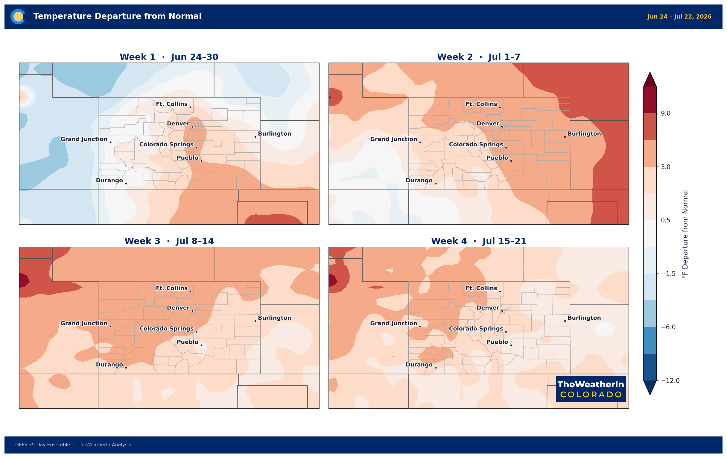
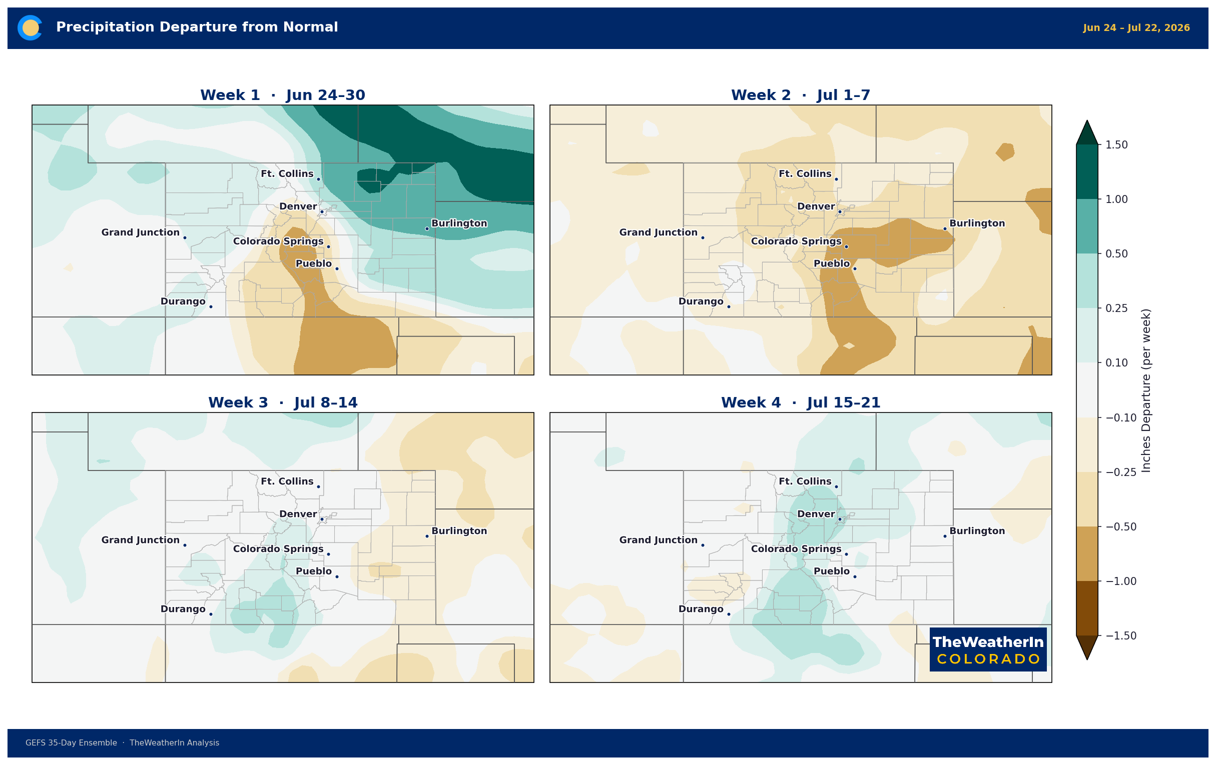
The warm, dry pattern that's defined Colorado's 2026 shows no signs of a meaningful break in the two- to four-week window. Temperature probabilities favor above-normal conditions statewide through mid-July, with the greatest anomalies likely to persist across the Eastern Plains and San Luis Valley where the drought footprint is deepest. Precipitation probabilities tilt below normal across most of the state through at least the third week of July — the critical window when the summer monsoon would need to begin establishing itself to provide any fire or drought relief to southern Colorado. Forecast data do suggest a gradual increase in monsoon moisture reaching the San Juans and southern mountains in the latter half of July, but confidence is low and any northward extent remains uncertain. The central and northern portions of the state — Front Range, Eastern Plains north of the Arkansas drainage, and the Yampa basin — should not count on meaningful monsoon precipitation at any point this summer.
Regional Breakdown: June 26 – July 1
| Region | Temperature | Precipitation | Highlights |
|---|---|---|---|
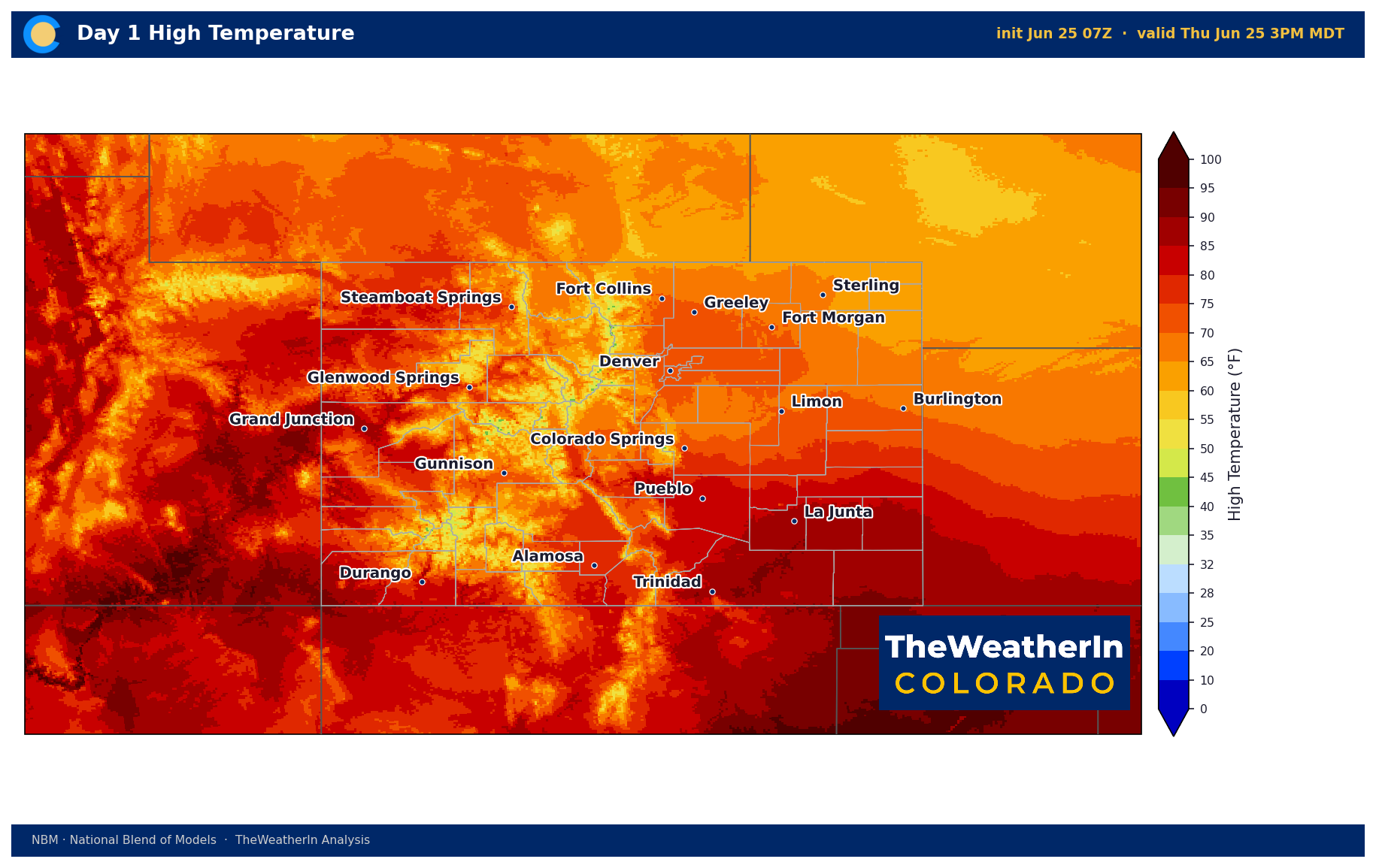
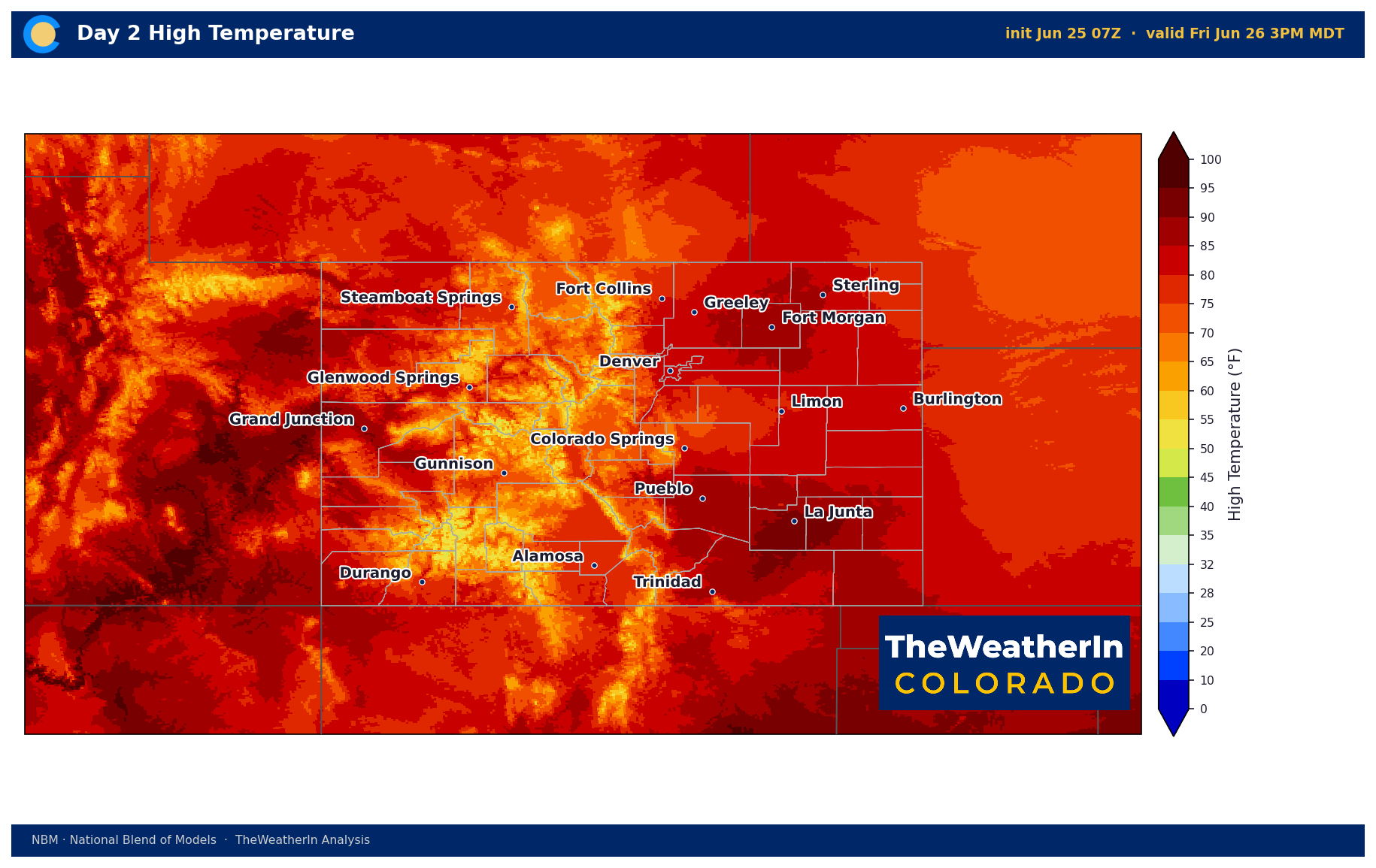
| Front Range / Foothills | +6–8°F above normal by weekend | Scattered to isolated through July 1 | Highs near 75°F Thursday; rebounding to low-to-mid 90s by Saturday. Winds gusting 40–50 mph Sat–Mon; critical fire weather conditions; humidity drops to single digits in highest terrain. |
| Mountains / High Country | +4–6°F above normal Sat–Mon | Isolated showers Thursday only | Fire Weather Watches in effect for mountains through weekend. Sustained SW winds 20–30 mph, gusts 40–50 mph. Humidity in low teens. Any new fire start will spread rapidly. |
| Western Slope | +5–7°F above normal by weekend | Near zero after Thursday evening | Red Flag Warning Friday noon–9 PM for zones below 8,000 ft. Fire Weather Watch all of Western Slope through weekend. Winds 40–50+ mph; humidity near 10%. Smoke from Utah wildfires continues. |
| Eastern Plains | +8–10°F above normal Sat–Mon | Minimal; severe storm chance Fri | Strong to severe storms possible Friday afternoon (hail, gusty winds). Then clear, windy, and critically hot Sat–Mon — triple digits (100–103°F) expected. Critical fire weather; single-digit humidity possible. |
| Southern CO / San Luis Valley | +7–10°F above normal by weekend | Isolated severe storms Thursday–Friday; then dry | Critical fire weather watch/warning in effect through early week. SW winds 40+ mph, single-digit humidity in valleys and mountains. Dry lightning threat extends into Tuesday–Wednesday. Highs 80s–low 100s. |
Drought & Water
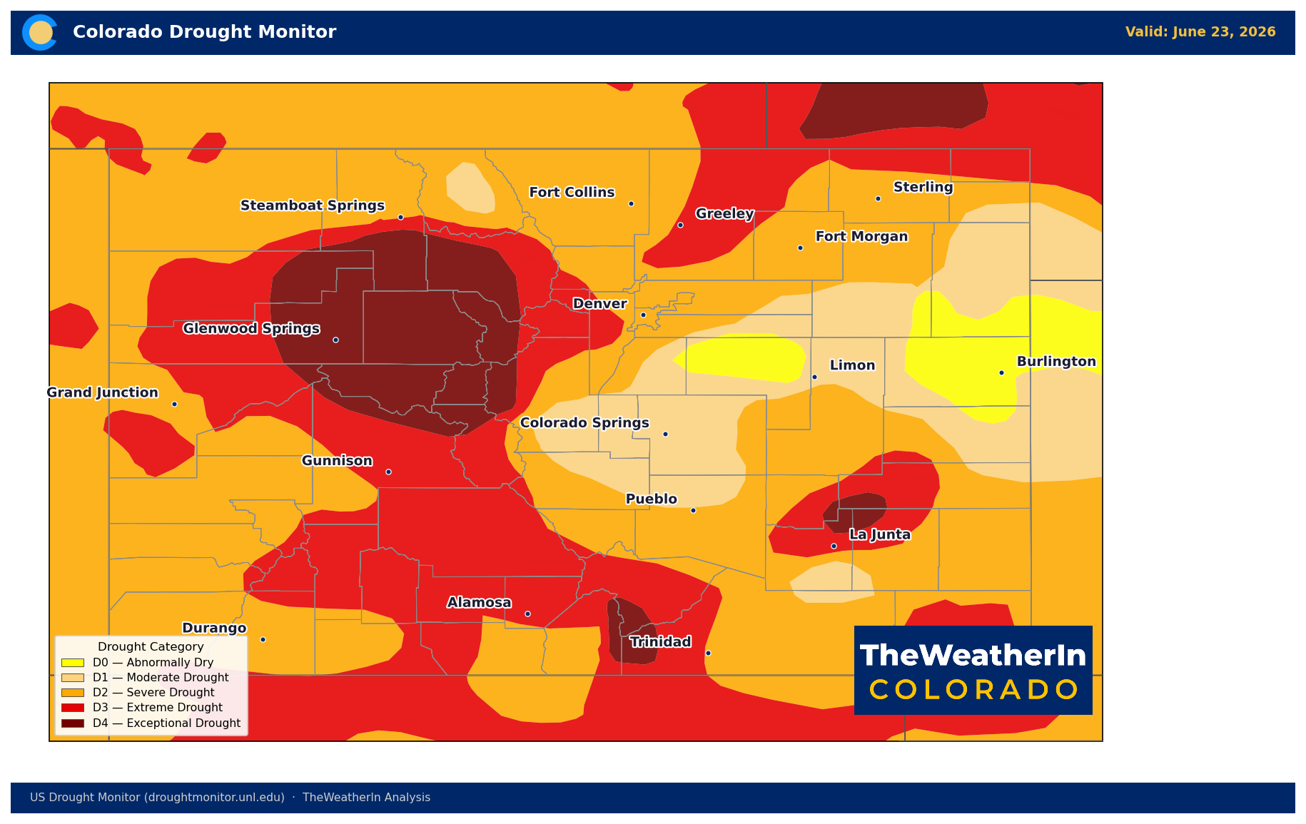
As of the June 23 U.S. Drought Monitor update, 100% of Colorado remains in at least abnormal dryness — unchanged from the prior week and from the start of the year. Moderate drought or worse (D1–D4) now covers 96.6% of the state, up from 97.6% last week but still in a narrow range of near-total coverage that has persisted for months. The most significant shift in the latest update is the continued expansion of extreme-to-exceptional drought: D3–D4 coverage now stands at 37.9% — up from 34.6% the prior week — and exceptional drought (D4) alone covers 9.3% of the state, concentrated in the north-central mountains and Sangre de Cristos.
The Drought Severity and Coverage Index (DSCI) — a single number that captures both how much of the state is in drought and how intense that drought is — currently stands at 329. That is more than double the DSCI reading at the start of 2026 (127) and more than double where things stood one year ago (133). The trajectory has been nearly unbroken since last fall.
The water supply situation underneath this drought is the more sobering number. Statewide May–July runoff is forecast at just 24% of normal. Half of all Colorado streamflow forecast points are on track for record or near-record low flows. The Colorado River near the Utah border is forecast at just 23% of a normal year — a shortfall of roughly 2.5 million acre-feet. Reservoir carryover from 2025 is providing a buffer, but it is being drawn down with no meaningful mountain runoff replenishment coming. The snowpack that would normally feed rivers through July is already gone — it peaked in mid-March at roughly half the typical amount, then melted out weeks ahead of schedule. That water supply gap is locked in for the entire 2026 season.
Fire risk is the direct near-term consequence. The fuel complex is historically dry statewide, and the upcoming fire weather pattern is arriving into conditions that have no modern parallel — a landscape that has been hot and dry since last fall, with fuels cured weeks ahead of normal and soils that carry almost no residual moisture.
Agricultural Implications
- Heat stress is the immediate concern Saturday through Monday. Triple-digit temperatures on the Eastern Plains (100–103°F) and 90s-to-low 100s across the San Luis Valley and southern slopes arrive with a dry airmass — heat index won't add much, but overnight lows staying in the 60s–70s will provide minimal recovery time for livestock. Water availability and shade access should be the priority through the weekend and into next week.
- Extreme wind Saturday–Monday creates its own hazard layer. Sustained winds of 40–50 mph with gusts to 50–60 mph across all regions carry significant risk of crop damage, soil erosion on bare or drought-stressed fields, and structure damage. Dryland forage fields already stressed by soil moisture deficits are particularly vulnerable to wind desiccation during this event.
- No freeze risk through early July, but soil moisture continues to decline. The scattered showers Thursday–Friday provide minor, localized relief to dryland producers — insufficient to offset the long-term deficit. The two-to-four week outlook offers no meaningful precipitation relief for dryland operations on the Eastern Plains or in the San Luis Valley. Irrigation water supplies remain severely limited statewide; the season's water allocation picture — already historically poor — will not improve.
The forward-looking signal that matters most: the confirmed El Niño now forming in the tropical Pacific is expected to strengthen into a moderate-to-strong event by winter — and that is the scenario that historically shifts Colorado's precipitation odds favorably, particularly for the southern Rockies. Watch for the next major pattern update in mid-July, when the monsoon's southward reach — or lack of it — will start to define how the back half of summer unfolds for drought-stressed producers across the state.
 The Weather In Colorado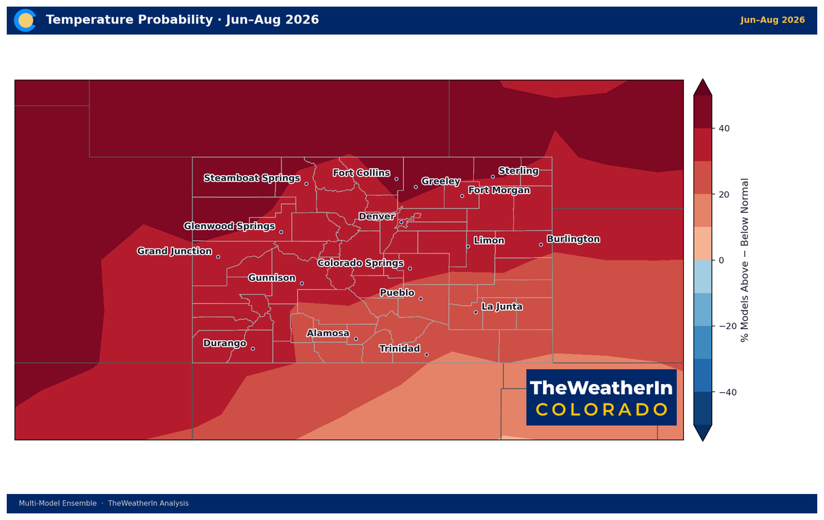
For the fuller picture of how that pattern shift fits into the months ahead, the Colorado Summer Outlook 2026 article breaks down what El Niño means for temperature and monsoon timing through the rest of summer — worth a read alongside this update.



